Category:Three Choirs Way
Jump to navigation
Jump to search
English: A long distance footpath between the cities of Gloucester, Hereford, and Worcester, with a theme of poetry and music linking the walk with the Music Festival celebrated at the three cathedrals.[1]

Media in category "Three Choirs Way"
The following 37 files are in this category, out of 37 total.
-
 Arable field at Broad Green - geograph.org.uk - 1690774.jpg 640 × 426; 72 KB
-
 Bridleway across Malvern Link Common - geograph.org.uk - 1459693.jpg 640 × 427; 228 KB
-
 Farm Road to Upper Venn Farm - geograph.org.uk - 106963.jpg 640 × 479; 103 KB
-
 Farm track at Hampton Bishop - geograph.org.uk - 447978.jpg 640 × 426; 112 KB
-
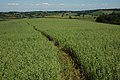 Field of oats, Munderfield Row - geograph.org.uk - 457483.jpg 640 × 426; 142 KB
-

-

-
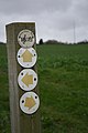
 Footpath sign on North End Road - geograph.org.uk - 1738139.jpg 640 × 480; 111 KB
-
 Fox near Broad Green - geograph.org.uk - 1690782.jpg 640 × 423; 109 KB
-
 Fungus in the hedgerow - geograph.org.uk - 1618734.jpg 640 × 426; 71 KB
-
 Hedgerow near Broad Green - geograph.org.uk - 1691048.jpg 426 × 640; 145 KB
-
 Hill Farm, Taynton - geograph.org.uk - 435938.jpg 640 × 426; 110 KB
-
 Lugwardine Bridge - geograph.org.uk - 144622.jpg 640 × 426; 134 KB
-
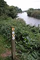
 River side footpath, Maisemore - geograph.org.uk - 931247.jpg 640 × 426; 116 KB
-
 Summit of Black Hill - geograph.org.uk - 685273.jpg 640 × 401; 201 KB
-
 The Three Choirs Way - geograph.org.uk - 1618731.jpg 640 × 426; 131 KB
-
 The Three Choirs Way - geograph.org.uk - 723650.jpg 427 × 640; 196 KB
-

-
 The Wysis Way and Three Choirs Way - geograph.org.uk - 1611262.jpg 640 × 480; 237 KB
-
 Three Choirs Way - geograph.org.uk - 49236.jpg 640 × 426; 151 KB
-
 Three Choirs Way near Broadwas - geograph.org.uk - 1701503.jpg 640 × 426; 121 KB
-
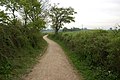
 Track near Chase End Street - geograph.org.uk - 733317.jpg 640 × 480; 132 KB
-
 Track near Over Farm - geograph.org.uk - 435515.jpg 640 × 426; 129 KB
-
 Wood pile, near Broadwas - geograph.org.uk - 1701502.jpg 640 × 426; 95 KB
-
 Entrance to Ladywell Coppice - geograph.org.uk - 733288.jpg 640 × 480; 120 KB
-

-
 Footpath through a paddock - geograph.org.uk - 669412.jpg 482 × 640; 186 KB
-
 Footpath to Lower House - geograph.org.uk - 458208.jpg 640 × 426; 128 KB
-

-
 Oil Seed Rape at Taynton - geograph.org.uk - 435941.jpg 640 × 426; 159 KB
-
-
 Riverbank footpath near Hereford - geograph.org.uk - 447874.jpg 640 × 426; 117 KB
-
 The Three Choirs Way, Much Cowarne - geograph.org.uk - 455380.jpg 640 × 426; 108 KB
-
 Three Choirs Way - geograph.org.uk - 106953.jpg 640 × 479; 99 KB
-
 Three Choirs Way to Cowarne Court - geograph.org.uk - 97998.jpg 640 × 479; 87 KB
-
 Three Choirs Way to Upper Venn Farm - geograph.org.uk - 109559.jpg 640 × 479; 55 KB
-


