Category:Thurstaston - Heswall footpath
Jump to navigation
Jump to search
| Object location | | View all coordinates using: OpenStreetMap |
|---|
This footpath runs between Church Lane, Thurstaston and Oldfield Drive, Heswall. Along it are The Dungeon and Oldfield Farm

Media in category "Thurstaston - Heswall footpath"
The following 17 files are in this category, out of 17 total.
-
 Start of Thurstaston to Heswall path at Church Lane.jpg 4,984 × 3,144; 11.43 MB
-
 Thurstaston to Heswall path at Church Farm.jpg 4,988 × 3,172; 10.85 MB
-
 Fingerpost at Church Farm, Thurstaston.jpg 3,084 × 4,908; 10.31 MB
-
 Thurstaston to Heswall path heading to The Dungeon.jpg 5,040 × 3,320; 11.34 MB
-
 View across the Dee from Thurstaston - Heswall path.jpg 5,163 × 3,442; 8.84 MB
-
 Gate on the Thurstaston to Heswall path.jpg 5,184 × 3,456; 9.54 MB
-
 Gate at path to The Dungeon.jpg 5,184 × 3,456; 11.16 MB
-
 Pathway from The Dungeon to Thurstaston.jpg 3,456 × 5,184; 12.58 MB
-
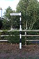
 Signpost to The Dungeon! - geograph.org.uk - 645629.jpg 640 × 480; 61 KB
-
 Pathway from The Dungeon to Heswall.jpg 3,456 × 5,184; 14.66 MB
-
 Footpath from Thurstaston to Oldfield - geograph.org.uk - 645617.jpg 640 × 480; 60 KB
-
 Footpath to Oldfield Farm - geograph.org.uk - 645636.jpg 640 × 480; 60 KB
-
 Lifting gate on the pathway to Heswall.jpg 5,184 × 3,456; 9.62 MB
-
 Pathway to Heswall.jpg 3,228 × 5,040; 7.85 MB
-
 Signpost at Oldfield Road.jpg 3,456 × 5,184; 12.79 MB
-
 Stone stile at Oldfield Farm.jpg 5,184 × 3,456; 8.73 MB
-
 The Dungeon from footpath to Heswall.jpg 5,184 × 3,456; 8.98 MB


