Category:Tile Hill
Jump to navigation
Jump to search
suburb in Coventry, West Midlands, England, UK  | |||||
| Upload media | |||||
| Instance of | |||||
|---|---|---|---|---|---|
| Location | Coventry, West Midlands, England | ||||
 | |||||
Media in category "Tile Hill"
The following 44 files are in this category, out of 44 total.
-
 "The Ponderosa", Tile Hill North - geograph.org.uk - 230495.jpg 640 × 397; 142 KB
-
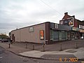
 Bell Inn -Station Rd - Tile Hill -Coventry.jpg 640 × 480; 76 KB
-
 Bungalow at Tile Hill by Jones and Armstrong.png 978 × 689; 1.02 MB
-
 Casino 26g07.JPG 2,592 × 1,944; 727 KB
-
 Cattle judging - geograph.org.uk - 454265.jpg 640 × 470; 96 KB
-
-
 Driveway, Westwood Heath Road - geograph.org.uk - 583220.jpg 640 × 427; 156 KB
-
 Edge of Plants Hill Wood.JPG 3,264 × 2,448; 2.25 MB
-
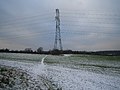
 Farmland Near Upper Eastern Green - geograph.org.uk - 96774.jpg 640 × 480; 106 KB
-
-
 Gravel Hill.jpeg 800 × 600; 191 KB
-
 House at Tile Hill by Jones and Hobbiss.png 900 × 583; 828 KB
-
 House, Westwood Heath Road - geograph.org.uk - 583215.jpg 640 × 427; 157 KB
-
 HST Tile Hill 1992 (32099108943).jpg 2,055 × 1,310; 1.04 MB
-
 Jardine Crescent 26a07.jpg 2,592 × 1,944; 1.04 MB
-
 Maxims Casino -Coventry -29j08.jpg 2,592 × 1,944; 2.45 MB
-
 Maxims Casino and shops -Coventry -29j08crp.jpg 2,532 × 1,864; 3.28 MB
-

-
 Tile Hill College - geograph.org.uk - 48236.jpg 640 × 480; 82 KB
-
 Tile hill shops 26a07.JPG 2,592 × 1,944; 825 KB
-
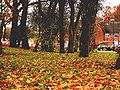
 Typical Warwickshire countryside - geograph.org.uk - 740730.jpg 640 × 428; 174 KB
-

-
 Blue verge, Crackley Lane - geograph.org.uk - 414967.jpg 480 × 640; 96 KB
-
 Bockendon Grange - geograph.org.uk - 44103.jpg 640 × 480; 72 KB
-
 Burton Green - geograph.org.uk - 44088.jpg 640 × 480; 94 KB
-
 Burton Green - geograph.org.uk - 46183.jpg 640 × 480; 123 KB
-
 Burton Green Primary School - geograph.org.uk - 46186.jpg 640 × 480; 162 KB
-
 Cryfield Grange Road - geograph.org.uk - 601851.jpg 640 × 480; 96 KB
-
 New housing, Westwood Heath Road - geograph.org.uk - 44091.jpg 640 × 480; 71 KB
-
 Pathway, Westwood - geograph.org.uk - 534261.jpg 640 × 427; 103 KB
-
 Pathway, Westwood Heath - geograph.org.uk - 583205.jpg 640 × 427; 160 KB
-
 Red Lane - geograph.org.uk - 46190.jpg 640 × 480; 98 KB
-
 Red Lane - geograph.org.uk - 46194.jpg 640 × 480; 89 KB
-
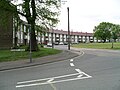
 Scarborough Way, Canley, Coventry - geograph.org.uk - 45939.jpg 640 × 480; 69 KB
-
 Scarman House, main reception - geograph.org.uk - 345177.jpg 640 × 480; 105 KB
-

-

-
 Showground, Crackley Lane - geograph.org.uk - 44105.jpg 640 × 480; 87 KB
-
 Tile Hill Lane - geograph.org.uk - 48238.jpg 640 × 480; 116 KB
-
 Tile Hill Sports Centre - geograph.org.uk - 611238.jpg 640 × 480; 57 KB
-
 Tile Hill Station and new bridge - geograph.org.uk - 45935.jpg 640 × 480; 106 KB
-
 Tile Hill, Coventry - geograph.org.uk - 48264.jpg 640 × 480; 72 KB
-

-


.jpg)


