Category:Tombeau Smith, Saint-Étienne
Jump to navigation
Jump to search
| Object location | | View all coordinates using: OpenStreetMap |
|---|
|
This building is inscrit au titre des monuments historiques de la France. It is indexed in the base Mérimée, a database of architectural heritage maintained by the French Ministry of Culture, under the reference PA42000040
|
 | |||||
| Upload media | |||||
| Instance of | |||||
|---|---|---|---|---|---|
| Location | Saint-Étienne, Loire, Auvergne-Rhône-Alpes, Metropolitan France, France | ||||
| Street address |
| ||||
| Owned by |
| ||||
| Heritage designation |
| ||||
 | |||||
Tombeau Smith, dit Pyramide Smith[edit]
Media in category "Tombeau Smith, Saint-Étienne"
The following 7 files are in this category, out of 7 total.
-
 Cimetière Cret Roc Smith Detail Clous.jpg 5,472 × 3,648; 14.17 MB
-
 Cimetière Cret Roc Smith Detail Ouest.jpg 3,567 × 5,351; 10.47 MB
-
 Cimetière Cret Roc Smith Nord.jpg 5,386 × 3,355; 10.23 MB
-
 Cimetière Cret Roc Smith Sud.jpg 3,648 × 5,472; 10.97 MB
-
 Saint Étienne-Cimetière du Crêt de Roc-Pyramide Smith-20140108.jpg 3,648 × 5,472; 6.74 MB
-
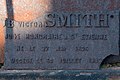 Saint Étienne-Plaque Victor Smith-20140108.jpg 4,500 × 3,000; 2.05 MB
-
 Saint-Étienne tombeau Smith.JPG 3,056 × 2,296; 1.82 MB


