Category:Topographic maps of German Länder
Jump to navigation
Jump to search
This is a category for maps showing the topography of one German bundesland (state) as a whole.
Media in category "Topographic maps of German Länder"
The following 28 files are in this category, out of 28 total.
-
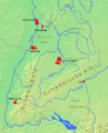 BWphysisch.png 1,222 × 1,496; 743 KB
-
 Bavaria relief location map.jpg 1,695 × 1,672; 1.14 MB
-
 Bavaria relief location map.png 1,695 × 1,672; 4.45 MB
-
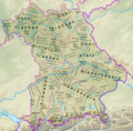 Bayern Relief Grenzen Namen.png 1,695 × 1,672; 4.57 MB
-
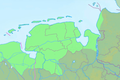
 Bremen Groningen blank.png 843 × 559; 105 KB
-
 Bremen Groningen Friesen.png 843 × 559; 205 KB
-
 Hessen phys Karte.gif 566 × 692; 310 KB
-
 Hessen topografisch Relief Karte.png 1,500 × 2,097; 5.39 MB
-
 Lower Saxony relief location map.jpg 1,786 × 1,509; 961 KB
-
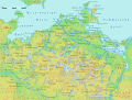 Mecklenburg-Vorpommern.gif 1,562 × 1,190; 360 KB
-
 Niedersachsen Relief Friesen.png 1,786 × 1,509; 3.29 MB
-
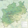
 North Rhine-Westphalia topographic map 01.jpg 2,500 × 2,455; 1,011 KB
-
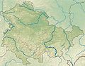
 North Rhine-Westphalia topographic map 01V.svg 560 × 550; 10.09 MB
-
 North Rhine-Westphalia Topography 01.png 2,268 × 1,880; 7.07 MB
-
 North Rhine-Westphalia Topography 05.png 2,500 × 2,500; 6.98 MB
-
 NRW Landsch Fluesse.png 1,432 × 1,354; 896 KB
-
 Rhineland-Palatinate relief location map.svg 930 × 1,234; 3.64 MB
-
 Saarland relief location map.svg 1,060 × 882; 5.23 MB
-
 Sachsen.gif 1,249 × 1,068; 657 KB
-
 Sachsen2.gif 1,249 × 1,068; 657 KB
-
 Sachsen3.png 1,249 × 1,068; 594 KB
-
 Sachsen topo 2.PNG 742 × 599; 605 KB
-
 Sachsen topo.png 2,598 × 2,098; 7.67 MB
-
 Sachsen-Anhalt.gif 1,163 × 1,373; 512 KB
-
 Schleswig-Holstein relief loc.png 882 × 775; 1,000 KB
-
 Schleswig-Holstein relief location map.jpg 968 × 775; 202 KB
-
 Schleswig-Holstein.png 1,123 × 1,133; 165 KB
-
 Thuringia relief location map.jpg 1,492 × 1,171; 798 KB


