Category:Topographic maps of Savoie
Jump to navigation
Jump to search
Departments of Metropolitan France: Ain [01] · Aisne [02] · Allier [03] · Alpes-de-Haute-Provence [04] · Hautes-Alpes [05] · Alpes-Maritimes [06] · Ardèche [07] · Ardennes [08] · Ariège [09] · Aube [10] · Aude [11] · Aveyron [12] · Bouches-du-Rhône [13] · Calvados [14] · Cantal [15] · Charente [16] · Charente-Maritime [17] · Cher [18] · Corrèze [19] · Corse-du-Sud [2A]† · Haute-Corse [2B]† · Côte-d’Or [21] · Côtes-d'Armor [22] · Creuse [23] · Dordogne [24] · Doubs [25] · Drôme [26] · Eure [27] · Eure-et-Loir [28] · Finistère [29] · Gard [30] · Haute-Garonne [31] · Gers [32] · Gironde [33] · Hérault [34] · Ille-et-Vilaine [35] · Indre [36] · Indre-et-Loire [37] · Isère [38] · Jura [39] · Landes [40] · Loir-et-Cher [41] · Loire [42] · Haute-Loire [43] · Loire-Atlantique [44] · Loiret [45] · Lot [46] · Lot-et-Garonne [47] · Lozère [48] · Maine-et-Loire [49] · Manche [50] · Marne [51] · Haute-Marne [52] · Mayenne [53] · Meurthe-et-Moselle [54] · Meuse [55] · Morbihan [56] · Moselle [57] · Nièvre [58] · Nord [59] · Oise [60] · Orne [61] · Pas-de-Calais [62] · Puy-de-Dôme [63] · Pyrénées-Atlantiques [64] · Hautes-Pyrénées [65] · Pyrénées-Orientales [66] · Bas-Rhin [67] · Haut-Rhin [68] · departmental district of the Rhône [69] · Haute-Saône [70] · Saône-et-Loire [71] · Sarthe [72] · Savoie [73] · Haute-Savoie [74] · Paris [75] · Seine-Maritime [76] · Seine-et-Marne [77] · Yvelines [78] · Deux-Sèvres [79] · Somme [80] · Tarn [81] · Tarn-et-Garonne [82] · Var [83] · Vaucluse [84] · Vendée [85] · Vienne [86] · Haute-Vienne [87] · Vosges [88] · Yonne [89] · Territoire de Belfort [90] · Essonne [91] · Hauts-de-Seine [92] · Seine-Saint-Denis [93] · Val-de-Marne [94] · Val-d'Oise [95]
Overseas departments and regions: Guadeloupe [971] · Martinique [972] · French Guiana [973] · Réunion [974] · Mayotte [976]
Overseas collectivities: Saint Pierre and Miquelon [975] · Saint Barthélemy [977] · Saint-Martin [978] · Wallis and Futuna [986] · French Polynesia [987]
Sui generis territories: New Caledonia [988]
Subcategories
This category has the following 2 subcategories, out of 2 total.
1
O
- Orthophotos of Savoie (1 F)
Media in category "Topographic maps of Savoie"
The following 30 files are in this category, out of 30 total.
-
 Agglomération-Grand-Chambéry-Topographie.png 437 × 353; 298 KB
-
 Albertville OSM 02.png 666 × 505; 472 KB
-
 Aménagement de Roselend - La Bâthie.png 5,526 × 2,988; 3.19 MB
-
 Carte 73 Savoie Reliefs lacs rivieres.png 440 × 358; 159 KB
-
 Carte Albanne - Savoie.jpg 1,104 × 927; 423 KB
-
 Carte Arc - Savoie.jpg 1,104 × 927; 413 KB
-
 Carte Arly - Savoie (et Haute-Savoie).jpg 1,104 × 927; 413 KB
-
 Carte Avant-pays savoyard.png 1,104 × 927; 2.37 MB
-
 Carte France 73 relief.png 645 × 525; 155 KB
-
 Carte Gelon - Savoie.jpg 1,104 × 927; 420 KB
-
 Carte Hyères - Savoie.jpg 1,104 × 927; 417 KB
-
 Carte Leysse - Savoie.jpg 1,104 × 927; 416 KB
-
 Carte Savoie Open Street Map.png 4,704 × 3,792; 14.4 MB
-
 Carte Sierroz - Savoie.jpg 1,104 × 927; 417 KB
-
 Carte Tillet - Savoie.jpg 1,104 × 927; 417 KB
-
 CC-Cœur des Bauges-Topographie.png 505 × 466; 483 KB
-
 Challes-les-Eaux OSM 02.png 380 × 504; 221 KB
-
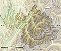
 Chambéry métropole-Topographie.png 472 × 555; 494 KB
-
 Cluse de Chambéry - Carte du relief.svg 1,898 × 2,050; 7.48 MB
-
 Col du Galibier OSM.png 746 × 619; 885 KB
-
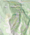 Courchevel ski resort map.svg 641 × 743; 3.07 MB
-
 Departement Savoie relief.jpg 428 × 382; 100 KB
-
 Géoloc D 73 Reliefs La Motte-Servolex.PNG 301 × 253; 180 KB
-
 Pays de Savoie relief location map.jpg 903 × 1,200; 664 KB
-
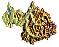
 Provinces géologiques Savoie (73).png 440 × 358; 196 KB
-
 Relief Savoie.GIF 500 × 692; 122 KB
-
 Savoie 1814-de.svg 620 × 674; 1.69 MB
-
 Savoie 1814-fr.svg 620 × 674; 1.69 MB
-
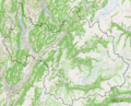
 Savoie department relief location map.jpg 1,104 × 927; 372 KB
-
 Savoie relief.jpg 326 × 258; 40 KB


.jpg)


.png)


