Category:Torphichen
Jump to navigation
Jump to search
Gàidhlig: Tha Tòrr Fhitheachan (Beurla: Torphichen) ann an Lodainn an Iar. 'S e seo na co-chomharran aige: 55° 56′ 0″ Tuath agus 3° 39′ 0″ Iar.
village in West Lothian, Scotland, UK  | |||||
| Upload media | |||||
| Instance of | |||||
|---|---|---|---|---|---|
| Location |
| ||||
| Population |
| ||||
 | |||||
Subcategories
This category has the following 7 subcategories, out of 7 total.
G
- Gormyre Hill (3 F)
J
- Jubilee Well, Torphichen (2 F)
K
L
S
T
- Torphichen Preceptory (152 F)
W
- Witchcraig Hill (7 F)
Media in category "Torphichen"
The following 22 files are in this category, out of 22 total.
-
 After a shower - geograph.org.uk - 1062171.jpg 640 × 480; 49 KB
-
 Another bath, in a field. - geograph.org.uk - 112711.jpg 640 × 384; 52 KB
-
-
 Building site near Torphichen - geograph.org.uk - 1197110.jpg 640 × 480; 109 KB
-

-
 Craigpark - geograph.org.uk - 1197834.jpg 640 × 480; 147 KB
-
 Field boundary - geograph.org.uk - 176574.jpg 480 × 640; 175 KB
-
 Fields by The Craigs - geograph.org.uk - 176572.jpg 640 × 480; 141 KB
-
 Fields, Broompark - geograph.org.uk - 1233474.jpg 640 × 359; 67 KB
-
 Grassland, Wallhouse - geograph.org.uk - 1233479.jpg 640 × 359; 66 KB
-
 North Couston Sand Quarry - geograph.org.uk - 21619.jpg 640 × 480; 61 KB
-
 Oaks, Wester Woodside. - geograph.org.uk - 112709.jpg 640 × 451; 57 KB
-
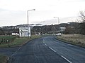
 Road to Nowhere, West Lothian - geograph.org.uk - 100020.jpg 640 × 480; 79 KB
-
 Rough ground, Couston - geograph.org.uk - 1150652.jpg 640 × 359; 89 KB
-
 Rough ground, Torphichen - geograph.org.uk - 1197830.jpg 640 × 480; 121 KB
-
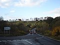
 Roundabout on the road to nowhere - geograph.org.uk - 1186878.jpg 640 × 480; 71 KB
-
 Strip wood above the Avon - geograph.org.uk - 1186891.jpg 640 × 480; 122 KB
-
 Torphichen Hills.jpg 640 × 480; 53 KB
-
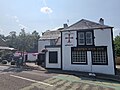 Torphichen Inn Front.jpg 4,032 × 3,024; 2.82 MB
-
 Torphichen Inn.jpg 3,088 × 2,056; 978 KB
-
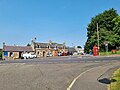 Torphichen Village Square.jpg 4,032 × 3,024; 4.15 MB
-
 View south from The Craigs - geograph.org.uk - 176570.jpg 640 × 480; 143 KB


