Category:Totternhoe
Vai alla navigazione
Vai alla ricerca
village and civil parish in Bedfordshire, UK  | |||||
| Carica un file multimediale | |||||
| Istanza di | |||||
|---|---|---|---|---|---|
| Luogo | Central Bedfordshire, Bedfordshire, Est dell'Inghilterra, Inghilterra | ||||
| sito web ufficiale | |||||
 | |||||
Sottocategorie
Questa categoria contiene le 7 sottocategorie indicate di seguito, su un totale di 7.
C
- Dunstable Town Cricket Club (3 F)
- The Cross Keys, Totternhoe (2 F)
G
- St Giles' church, Totternhoe (4 F)
T
- Totternhoe Castle (18 F)
- Totternhoe Chalk Quarry (12 F)
File nella categoria "Totternhoe"
Questa categoria contiene 143 file, indicati di seguito, su un totale di 143.
-
 B489-B4540 Junction nr. Whipsnade - geograph.org.uk - 161343.jpg 640 × 480; 68 KB
-
 Bluebells in St Giles' churchyard - geograph.org.uk - 5761004.jpg 1 600 × 1 066; 702 KB
-
 Bridleway to Well Head - geograph.org.uk - 5760998.jpg 1 600 × 1 066; 675 KB
-
 Byway from the Dunstable Road - geograph.org.uk - 3299994.jpg 1 600 × 1 067; 345 KB
-
 Byway track into Dunstable - geograph.org.uk - 3300003.jpg 1 200 × 1 600; 415 KB
-
 Byway, Castle Hill, Totternhoe - geograph.org.uk - 4666724.jpg 640 × 480; 144 KB
-
 Byway, Totternhoe - geograph.org.uk - 2434246.jpg 2 272 × 1 704; 1,64 MB
-
 Car Park on Whipsnade Road - geograph.org.uk - 4916834.jpg 1 964 × 1 418; 676 KB
-
 Castle Close, Totternhoe - geograph.org.uk - 4915752.jpg 2 048 × 1 536; 1,5 MB
-
 Castle Hill Road, Totternhoe - geograph.org.uk - 324048.jpg 640 × 480; 59 KB
-
 Castle Hill Road, Totternhoe. - geograph.org.uk - 323970.jpg 640 × 480; 93 KB
-
 Castle Hill Road, Totternhoe. - geograph.org.uk - 323979.jpg 640 × 480; 113 KB
-
 Central Bedfordshire , Dunstable Downs - geograph.org.uk - 5726572.jpg 5 972 × 3 981; 7,81 MB
-
 Central Bedfordshire , Dunstable Downs - geograph.org.uk - 5726573.jpg 6 000 × 4 000; 5,6 MB
-
 Central Bedfordshire , Dunstable Downs - geograph.org.uk - 5726574.jpg 6 000 × 4 000; 7,03 MB
-
 Central Bedfordshire , Dunstable Downs - geograph.org.uk - 5726576.jpg 6 000 × 4 000; 6,85 MB
-
 Central Bedfordshire , Dunstable Downs Car Park - geograph.org.uk - 5726575.jpg 6 000 × 4 000; 6,22 MB
-
 Church Road at the junction of Dunstable Road - geograph.org.uk - 4915647.jpg 2 048 × 1 536; 1,53 MB
-
 Church Road at the junction of Furlong Lane - geograph.org.uk - 4917421.jpg 1 960 × 1 412; 752 KB
-
 Driveway at Lower End - geograph.org.uk - 3859204.jpg 2 592 × 1 936; 2,17 MB
-
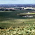
 Dunstable Downs - geograph.org.uk - 1982374.jpg 1 280 × 853; 310 KB
-
 Dunstable Downs - geograph.org.uk - 2365315.jpg 2 592 × 1 944; 1,62 MB
-
 Dunstable Downs - geograph.org.uk - 4101394.jpg 800 × 600; 145 KB
-
 Dunstable Downs - geograph.org.uk - 4915951.jpg 2 048 × 1 536; 1,49 MB
-
 Dunstable Downs - geograph.org.uk - 4916837.jpg 2 010 × 1 486; 793 KB
-
 Dunstable Downs - geograph.org.uk - 5061581.jpg 2 000 × 1 333; 2,51 MB
-
 Dunstable Downs - geograph.org.uk - 5065611.jpg 2 000 × 1 333; 2,96 MB
-
 Dunstable Downs - geograph.org.uk - 5065621.jpg 639 × 426; 166 KB
-
 Dunstable Downs - geograph.org.uk - 5284228.jpg 2 304 × 1 728; 864 KB
-
 Dunstable Town Cricket Club - geograph.org.uk - 2433918.jpg 2 272 × 1 704; 1,53 MB
-
 Electricity wires across a snowy field - geograph.org.uk - 3299997.jpg 1 600 × 1 073; 430 KB
-
 Entrance to Public Footpath - Totternhoe Knolls - geograph.org.uk - 2434152.jpg 1 704 × 2 272; 1,48 MB
-
 Entrance to Totternhoe Lower School - geograph.org.uk - 1567249.jpg 640 × 480; 87 KB
-
 Exposed rock face at Totternhoe Knolls - geograph.org.uk - 4508981.jpg 2 848 × 1 602; 4,4 MB
-
 Farm on Church Road, Totternhoe - geograph.org.uk - 4915854.jpg 2 048 × 1 536; 1,51 MB
-
 Farmland by the Stanbridge Road - geograph.org.uk - 4940671.jpg 1 600 × 1 066; 605 KB
-
 Farmland Track - geograph.org.uk - 2434100.jpg 1 704 × 2 272; 993 KB
-
 Field by Church Road, Totternhoe - geograph.org.uk - 4915845.jpg 2 048 × 1 536; 1,48 MB
-
 Field by Dunstable Road, Beecroft - geograph.org.uk - 4915860.jpg 1 990 × 1 454; 788 KB
-
 Field by Well Head Road near Totternhoe - geograph.org.uk - 4917416.jpg 2 048 × 1 536; 1,48 MB
-
 Field by Well Head Road near Totternhoe - geograph.org.uk - 4917417.jpg 1 996 × 1 464; 862 KB
-
 Field entrance north of Eaton Green - geograph.org.uk - 4666793.jpg 640 × 480; 94 KB
-
 Five Knolls Hill - geograph.org.uk - 1567159.jpg 640 × 480; 74 KB
-
 Footbridge over a stream - geograph.org.uk - 5761001.jpg 1 066 × 1 600; 635 KB
-
 Footpath to Dolittle Mill - geograph.org.uk - 5761009.jpg 1 600 × 1 066; 525 KB
-
 Footpath to Doolittle Mill - geograph.org.uk - 1567277.jpg 640 × 480; 77 KB
-
 Footpath to the Toternhoe Knolls - geograph.org.uk - 4940621.jpg 1 600 × 1 067; 901 KB
-
 Footpath up Castle Hill, Totternhoe - geograph.org.uk - 4666775.jpg 640 × 480; 205 KB
-
 Former chalk quarry, Totternhoe - geograph.org.uk - 4666698.jpg 640 × 480; 105 KB
-
 Former Chapel, Totternhoe - geograph.org.uk - 2434181.jpg 2 272 × 1 704; 1,66 MB
-
 Gated Byway - geograph.org.uk - 1567205.jpg 640 × 480; 77 KB
-
 GOC Dunstable Downs 034 Dunstable Downs (24695317971).jpg 4 288 × 3 216; 4,73 MB
-
 GOC Dunstable Downs 036 Dunstable Downs (24181950603).jpg 4 288 × 3 216; 4,22 MB
-
 GOC Dunstable Downs 037 Dunstable Downs (24782557136).jpg 4 288 × 3 216; 3,71 MB
-
 GOC Dunstable Downs 038 Dunstable Downs (24808823905).jpg 4 288 × 3 216; 3,6 MB
-
 GOC Dunstable Downs 039 Dunstable Downs (24441160159).jpg 4 288 × 3 216; 3,8 MB
-
 GOC Dunstable Downs 041 Dunstable Downs (24181960163).jpg 4 288 × 3 216; 4,4 MB
-
 GOC Dunstable Downs 054 Welcome to Totternhoe (24802476706).jpg 3 463 × 2 598; 2,85 MB
-
 GOC Dunstable Downs 056 28 Wellhead Road, Totternhoe (24802483816).jpg 3 904 × 2 932; 3,1 MB
-
 GOC Dunstable Downs 063 Totternhoe (24828747665).jpg 2 959 × 2 213; 2,13 MB
-
 GOC Dunstable Downs 075 Disused quarry workings, Totternhoe (24802490306).jpg 4 288 × 3 216; 3,58 MB
-
 GOC Dunstable Downs 077 Disused quarry workings, Totternhoe (24735292621).jpg 4 288 × 3 216; 4,06 MB
-
 GOC Dunstable Downs 118 Dunstable Downs (24817515141).jpg 4 288 × 3 216; 3,51 MB
-
 GOC Dunstable Downs 122 Ivinghoe Beacon from Dunstable Downs (24884580796).jpg 4 288 × 3 216; 3,43 MB
-
 GOC Dunstable Downs 123 London Gliding Club, Totternhoe (24565811429).jpg 2 367 × 1 778; 1,43 MB
-
 GOC Dunstable Downs 124 Totternhoe (24637955530).jpg 4 280 × 2 411; 2,84 MB
-
 Green Lane at Toternhoe - geograph.org.uk - 4940614.jpg 1 600 × 1 066; 663 KB
-
 Hanging around - geograph.org.uk - 2741032.jpg 1 024 × 768; 236 KB
-
 Houses on Stanbridge Road, Lower End - geograph.org.uk - 4915742.jpg 1 968 × 1 422; 996 KB
-
 Ivinghoe Beacon from Dunstable Downs - geograph.org.uk - 3823056.jpg 1 600 × 1 200; 238 KB
-
 Kensworth Chalk Quarry - geograph.org.uk - 4547119.jpg 3 264 × 2 448; 3,37 MB
-
 Kite flying on Dunstable Downs - geograph.org.uk - 72418.jpg 640 × 425; 76 KB
-
 Lancotbury Close, Totternhoe - geograph.org.uk - 4666685.jpg 640 × 428; 78 KB
-
 London Gliding Club - geograph.org.uk - 2828319.jpg 3 456 × 2 304; 3,04 MB
-
 London Gliding Club from Dunstable Downs - geograph.org.uk - 5307325.jpg 2 288 × 1 712; 688 KB
-
 London Gliding Club, Dunstable - geograph.org.uk - 4101148.jpg 800 × 600; 137 KB
-
 On the Dunstable Downs - geograph.org.uk - 5056472.jpg 480 × 640; 61 KB
-
 Paraglider, Dunstable Downs - geograph.org.uk - 3849596.jpg 4 320 × 3 240; 4,05 MB
-
 Path down to the gliding club - geograph.org.uk - 2828316.jpg 2 304 × 3 456; 3,82 MB
-
 Ploughed field south of A505 - geograph.org.uk - 4666806.jpg 640 × 480; 104 KB
-
 Poplar Farm Park mobile home park - geograph.org.uk - 4940665.jpg 1 600 × 1 066; 474 KB
-
 Public Footpath - geograph.org.uk - 2434407.jpg 1 704 × 2 272; 1,46 MB
-

-
 Road Entrance to Stone Quarry - geograph.org.uk - 2434205.jpg 2 272 × 1 704; 1,63 MB
-
 Road, Totternhoe Lower End - geograph.org.uk - 2434571.jpg 1 704 × 2 272; 769 KB
-
 Scrub clearance on Dunstable Downs - geograph.org.uk - 5307316.jpg 2 157 × 1 618; 579 KB
-
 Site of Totternhoe Roman Villa.JPG 6 016 × 4 000; 13,22 MB
-

-
 St Giles Totternhoe - geograph.org.uk - 5761006.jpg 1 600 × 1 066; 447 KB
-
 St Giles' church hall - geograph.org.uk - 5761007.jpg 1 600 × 1 065; 406 KB
-
 St Giles, Totternhoe - Chancel - geograph.org.uk - 5001881.jpg 1 000 × 736; 273 KB
-
 St Giles, Totternhoe - East end - geograph.org.uk - 5001878.jpg 1 000 × 683; 282 KB
-
 St Giles, Totternhoe - East end - geograph.org.uk - 5001880.jpg 1 000 × 718; 304 KB
-
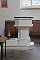 St Giles, Totternhoe - Font - geograph.org.uk - 5001887.jpg 667 × 1 000; 204 KB
-
 St Giles, Totternhoe - geograph.org.uk - 5001874.jpg 1 000 × 667; 349 KB
-
 St Giles, Totternhoe - geograph.org.uk - 5001877.jpg 1 000 × 641; 293 KB
-
 St Giles, Totternhoe - Organ - geograph.org.uk - 5001891.jpg 667 × 1 000; 207 KB
-
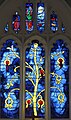 St Giles, Totternhoe - Stained glass window - geograph.org.uk - 5001883.jpg 594 × 1 000; 371 KB
-
 St Giles, Totternhoe - Stained glass window - geograph.org.uk - 5001884.jpg 510 × 1 000; 358 KB
-
 St Giles, Totternhoe - West end - geograph.org.uk - 5001890.jpg 1 000 × 652; 235 KB
-
 Stanbridge Road at the junction of the A505 - geograph.org.uk - 4915695.jpg 1 960 × 1 412; 874 KB
-
 Stanbridge Road, Lower End - geograph.org.uk - 4915774.jpg 2 048 × 1 536; 1,52 MB
-
 Stanbridgeford and Stanbridge - geograph.org.uk - 5463169.jpg 3 264 × 2 448; 3,42 MB
-
 Stream by Dolittle Mill - geograph.org.uk - 5760993.jpg 1 600 × 1 066; 686 KB
-
 Stream by Stanbridge Road - geograph.org.uk - 4940669.jpg 1 600 × 1 066; 648 KB
-
 Summit of Castle Hill, Totternhoe - geograph.org.uk - 4666761.jpg 640 × 480; 103 KB
-
 The A505, Stanbridgeford - geograph.org.uk - 5279840.jpg 2 304 × 1 728; 861 KB
-
 The A505, Totternhoe - geograph.org.uk - 5279398.jpg 2 304 × 1 728; 814 KB
-
 The Cross keys pub, Totternhoe - geograph.org.uk - 3849668.jpg 4 320 × 3 240; 2,95 MB
-
 The entrance to Chilterns Gateway Centre, Dunstable - geograph.org.uk - 5284229.jpg 2 304 × 1 728; 862 KB
-
 The foot of the Dunstable Downs - geograph.org.uk - 5066825.jpg 2 000 × 1 333; 3,4 MB
-
 The Icknield Way in Spring - geograph.org.uk - 72414.jpg 640 × 425; 144 KB
-
 The London Gliding Club, Dunstable - geograph.org.uk - 5062933.jpg 2 000 × 1 333; 2,42 MB
-
 The road to Eaton Bray in the snow - geograph.org.uk - 3300016.jpg 1 600 × 1 066; 215 KB
-
 Totternhoe Memorial Hall - geograph.org.uk - 3849660.jpg 4 320 × 3 240; 4,14 MB
-
 Totternhoe Quarry - geograph.org.uk - 324022.jpg 640 × 480; 125 KB
-
 Track along the field edge towards the Sewage works - geograph.org.uk - 3300012.jpg 1 600 × 1 068; 410 KB
-

-
 View from Dunstable Downs - geograph.org.uk - 4666652.jpg 640 × 480; 107 KB
-
 View west from Dunstable Downs, 1973 - geograph.org.uk - 4283270.jpg 640 × 640; 152 KB
-
 Well Head Road - geograph.org.uk - 4666675.jpg 640 × 480; 96 KB
-
 Whipsnade Road on Dunstable Downs - geograph.org.uk - 4915952.jpg 2 048 × 1 536; 1,48 MB
-
 Barley and Knapweed flowers - geograph.org.uk - 193385.jpg 640 × 480; 101 KB
-
 Barley Field, Wellhead Road - geograph.org.uk - 197116.jpg 640 × 480; 102 KB
-
 Castle Close, Totternhoe - geograph.org.uk - 324029.jpg 640 × 480; 110 KB
-
 Castle Hill Road, Totternhoe - geograph.org.uk - 193752.jpg 640 × 346; 57 KB
-
 Dog Gate - geograph.org.uk - 147354.jpg 480 × 640; 195 KB
-
 Dunstable Downs Gliding Club - geograph.org.uk - 147363.jpg 640 × 480; 78 KB
-
 Dunstable, Track to Totternhoe - geograph.org.uk - 145552.jpg 640 × 480; 104 KB
-
 Houses on Castle Hill Road - geograph.org.uk - 324054.jpg 640 × 480; 79 KB
-
 Kensworth chalk quarry - geograph.org.uk - 138293.jpg 640 × 482; 118 KB
-
 Knapweed - geograph.org.uk - 193819.jpg 640 × 480; 94 KB
-
 Lockington Farm, Totternhoe - geograph.org.uk - 193749.jpg 640 × 580; 96 KB
-
 London Gliding Club, Dunstable Downs - geograph.org.uk - 222505.jpg 640 × 480; 56 KB
-
 Prominent Pylon - geograph.org.uk - 325774.jpg 640 × 447; 58 KB
-
 Pylons, Dunstable Downs - geograph.org.uk - 84771.jpg 480 × 640; 16 KB
-

-
 Totternhoe Memorial Hall - geograph.org.uk - 324060.jpg 640 × 480; 60 KB
-
 Tree Cathedral - geograph.org.uk - 16755.jpg 480 × 640; 197 KB
-
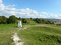
 Trig point on Dunstable Downs - geograph.org.uk - 224184.jpg 550 × 380; 25 KB
-
 Unknown Structure - geograph.org.uk - 324033.jpg 640 × 480; 125 KB
-
 View from Totternhoe Castle - geograph.org.uk - 324021.jpg 640 × 480; 69 KB
-
 Wellhead Road - geograph.org.uk - 193750.jpg 640 × 480; 75 KB


.jpg)
.jpg)
.jpg)
.jpg)
.jpg)
.jpg)
.jpg)
.jpg)
.jpg)
.jpg)
.jpg)
.jpg)
.jpg)
.jpg)


_-_geograph.org.uk_-_4291523.jpg)


.jpg)