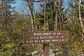
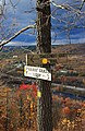
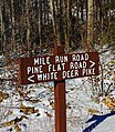
Category:Trail signs in Pennsylvania
Jump to navigation
Jump to search
States of the United States: Arizona · California · Colorado · Connecticut · Florida · Georgia · Hawaii · Indiana · Kentucky · Louisiana · Maryland · Minnesota · Mississippi · Montana · Nevada · New Jersey · New Mexico · New York · Ohio · Pennsylvania · Tennessee · Texas · Utah · Vermont · Virginia · Washington · Wyoming
English: Hiking trail and junction signs in Pennsylvania.
Subcategories
This category has only the following subcategory.
- Trail blazes in Pennsylvania (13 F)
Media in category "Trail signs in Pennsylvania"
The following 83 files are in this category, out of 83 total.
-
 2012-366-85 Hero's Hike (7016456575).jpg 4,752 × 3,168; 4.42 MB
-
 3 Ponds Trail (1) (15452728190).jpg 3,456 × 5,184; 11.67 MB
-
 Allegheny Front Trail (Revisited) (1) (9000968235).jpg 3,147 × 4,304; 8.33 MB
-
 Appalachian Trail sign in Pennsylvania.JPG 2,560 × 1,920; 1.21 MB
-
 Appalachian Trail Sign.jpg 2,520 × 3,776; 4.17 MB
-
 Bark Cabin Natural Area (1) (14417765155).jpg 5,184 × 3,456; 17.01 MB
-
 Beartown Woods Natural Area (1) (8132859805).jpg 3,135 × 3,059; 11.26 MB
-
 Black Forest Trail (Revisited) (24) (21011524638).jpg 3,243 × 3,456; 8.93 MB
-
 Brush Hollow (8333679323).jpg 4,872 × 3,456; 9.45 MB
-
 Cobbs Creek RecPath Sign 61st Street Phil-Del Co Border.JPG 4,000 × 3,000; 2.22 MB
-
 Crandall Town Trail (9346236681).jpg 5,184 × 3,456; 14.15 MB
-
 Crossroads (14291973111).jpg 4,710 × 3,456; 9.38 MB
-
 Cynwyd Heritage Trail shield, Aug 2022.jpg 3,648 × 2,736; 2.26 MB
-
 Darlington Signs.jpg 458 × 402; 138 KB
-
 Delps Trail (4) (10792037303).jpg 3,456 × 5,184; 15.15 MB
-
 Delps Trail (5) (10792005143).jpg 3,456 × 4,711; 11.14 MB
-
 Delps Trail (6) (10791730456).jpg 3,456 × 4,582; 14.65 MB
-
 Delps Trail (7) (10791734005).jpg 3,456 × 5,184; 14.72 MB
-
 Delps Trail (8) (10791668025).jpg 2,941 × 4,429; 10.76 MB
-
 Dennison Run - panoramio (1).jpg 2,048 × 1,536; 739 KB
-
 Destinations (1) (8484191144).jpg 3,456 × 5,184; 10.42 MB
-
 Destinations (2) (8484187308).jpg 3,144 × 5,184; 12.59 MB
-
 Destinations (3) (8484182348).jpg 3,456 × 5,184; 14.2 MB
-
 Detweiler Run Natural Area (7) (8107739497).jpg 3,645 × 3,101; 11.67 MB
-
 Detweiler Run Natural Area (Revisited) (16) (10545001003).jpg 5,184 × 3,456; 12.41 MB
-
 Elizabeth Township, PA, USA - panoramio (1).jpg 1,536 × 2,048; 2.13 MB
-
 Elizabeth Township, PA, USA - panoramio - Bobby17543 (3).jpg 640 × 480; 244 KB
-
 Elizabeth Township, PA, USA - panoramio - Bobby17543 (6).jpg 640 × 480; 194 KB
-
 Falling Spring (1) (9528386740).jpg 3,456 × 4,703; 8.81 MB
-
 Flickr - Nicholas T - Hook Natural Area (2).jpg 3,456 × 4,608; 10.36 MB
-
 Flickr - Nicholas T - Joyce Kilmer Natural Area (1).jpg 3,240 × 4,320; 12.53 MB
-
 Flickr - Nicholas T - Montour Preserve (1).jpg 3,456 × 4,608; 7.43 MB
-
 Flickr - Nicholas T - Outdoor Café.jpg 2,112 × 2,558; 4.95 MB
-
 Flickr - Nicholas T - Reprieve.jpg 3,240 × 4,320; 11.81 MB
-
 Flickr - Nicholas T - Signage.jpg 3,456 × 4,608; 13.5 MB
-
 Flickr - Nicholas T - Sullivan Mountain Hike (1).jpg 4,608 × 3,456; 16.86 MB
-
 Flickr - Nicholas T - To and From.jpg 3,240 × 4,320; 11.18 MB
-
 Gas Line Trail (1) (8546270540).jpg 5,184 × 3,456; 11.88 MB
-
 Gas Line Trail (3) (8546257320).jpg 5,184 × 3,456; 12.05 MB
-
 Golden Eagle Trail (Full Hike) (1) (11142543824).jpg 5,184 × 3,456; 10.9 MB
-
 Golden Eagle Trail (Full Hike) (9) (11142211304).jpg 5,184 × 3,456; 9.52 MB
-
 Golden Eagle Trail (Revisited) (3) (8303017506).jpg 5,184 × 3,456; 16.04 MB
-
 Grand View Trail (2).jpg 3,240 × 4,320; 9.95 MB
-
 Half Dome Trail (1) (13962560034).jpg 3,456 × 4,274; 13.36 MB
-
 Hammersly Wild Area Opinion.jpg 3,648 × 2,736; 7.53 MB
-
 Hawk Falls - Hickory Run State Park - Pennsylvania (7067297769).jpg 2,816 × 2,112; 1.31 MB
-
 Kettle Creek Vista (1) (9228626458).jpg 3,456 × 5,184; 13.41 MB
-
 Kunes Camp Trail (1) (10127503313).jpg 2,839 × 4,511; 13.46 MB
-
 Kunes Camp Trail (11) (10126952024).jpg 2,891 × 4,845; 10.77 MB
-
 Kunes Camp Trail (9) (10127035434).jpg 5,184 × 3,456; 22.24 MB
-
 Lehigh Gap Nature Center (Revisited) (5) (22320816760).jpg 3,358 × 5,184; 12.77 MB
-
 Lewis Falls Trailhead (31862135126).jpg 3,661 × 3,068; 10.28 MB
-
 Liberty Bell Trail Sign.jpg 3,008 × 2,000; 1.81 MB
-
 Loyalsock Trail (2) (8194496177).jpg 3,960 × 3,325; 11.75 MB
-
 Matson's Woods (Revisited) (1) (10636128706).jpg 4,558 × 3,456; 12.43 MB
-
 Mile Run Road (2) (24422370153).jpg 3,005 × 3,456; 12.95 MB
-
 Montour Trail 3.jpg 2,953 × 1,835; 2.32 MB
-
 NCT PA kiosk1.jpg 791 × 1,001; 448 KB
-
 Oil Creek State Park Trail Sign.jpg 2,805 × 1,863; 2.54 MB
-
 Perimeter Trail (11) (16850709259).jpg 3,456 × 5,184; 16.26 MB
-
 Pine Trail (1) (13939101646).jpg 3,456 × 5,184; 14.86 MB
-
 Pitch Pine Loop Trail (7) (21035124418).jpg 2,733 × 3,230; 7.02 MB
-
 Prairie Grass Trail (11) (15614579046).jpg 5,184 × 3,456; 17.41 MB
-
 Prairie Grass Trail (3) (15635570381).jpg 3,456 × 4,728; 11.93 MB
-
 R B Winter State Trail SIgns.jpg 1,536 × 2,048; 882 KB
-
 Round Top (Revisited) (11) (10261693025).jpg 3,456 × 5,184; 16.11 MB
-
 Schuylkill River Trail EB at Spring Mill.jpeg 4,032 × 3,024; 3.76 MB
-
 Schuylkill River Trail in Montgomery County, Pennsylvania.jpg 4,272 × 2,848; 6.79 MB
-
 Side Trail (9224135427).jpg 3,456 × 5,184; 15.54 MB
-
 Sproul State Forest Unappetizing.jpg 1,587 × 2,103; 2.52 MB
-
 Thickhead Mountain Wild Area (4) (10585064505).jpg 3,456 × 5,184; 12.28 MB
-
 This Way 'n' That (8836460893).jpg 5,184 × 3,456; 13.48 MB
-
 Thousand Step Trail (10) (30042927774).jpg 4,308 × 3,456; 13.55 MB
-
 Thunder Swamp Trail (Revisited) (1) (8755091477).jpg 4,400 × 2,876; 7.54 MB
-
 Top Mountain Trail (1) (14957276774).jpg 3,384 × 3,456; 10.6 MB
-
 Twin Falls Trailhead (31861871666).jpg 4,265 × 2,790; 13.36 MB
-
 Twin Sisters Trail (1) (14277434502).jpg 3,456 × 4,602; 12.76 MB
-
 Twin Sisters Trail (2) (14278898564).jpg 5,184 × 3,456; 14.17 MB
-
 Twin Sisters Trail (3) (14092688498).jpg 4,697 × 3,171; 12.48 MB
-
 US 202 Parkway trail end sign at PA 63, Oct. 2023.jpg 3,872 × 2,564; 3.13 MB
-
 West Branch Research and Demonstration Forest (4) (28093128905).jpg 3,456 × 5,184; 9.81 MB
-
 Winter Trail (8630663610).jpg 5,184 × 3,456; 11.42 MB
-
 Worlds End State Park Trail 1.jpg 1,536 × 2,048; 1.11 MB
.jpg)
_(15452728190).jpg)
_(1)_(9000968235).jpg)


_(14417765155).jpg)
_(8132859805).jpg)
_(24)_(21011524638).jpg)
.jpg)

.jpg)
.jpg)


_(10792037303).jpg)
_(10792005143).jpg)
_(10791730456).jpg)
_(10791734005).jpg)
_(10791668025).jpg)
.jpg)
_(8484191144).jpg)
_(8484187308).jpg)
_(8484182348).jpg)
_(8107739497).jpg)
_(16)_(10545001003).jpg)
.jpg)
.jpg)
.jpg)
_(9528386740).jpg)
.jpg)
.jpg)
.jpg)


.jpg)

_(8546270540).jpg)
_(8546257320).jpg)
_(1)_(11142543824).jpg)
_(9)_(11142211304).jpg)
_(3)_(8303017506).jpg)
.jpg)
_(13962560034).jpg)

.jpg)
_(9228626458).jpg)
_(10127503313).jpg)
_(10126952024).jpg)
_(10127035434).jpg)
_(5)_(22320816760).jpg)
.jpg)

_(8194496177).jpg)
_(1)_(10636128706).jpg)
_(24422370153).jpg)


_(16850709259).jpg)
_(13939101646).jpg)
_(21035124418).jpg)
_(15614579046).jpg)
_(15635570381).jpg)

_(11)_(10261693025).jpg)


.jpg)

_(10585064505).jpg)
.jpg)
_(30042927774).jpg)
_(1)_(8755091477).jpg)
_(14957276774).jpg)
.jpg)
_(14277434502).jpg)
_(14278898564).jpg)
_(14092688498).jpg)

_(28093128905).jpg)
.jpg)
