Category:Travel maps of South Africa
Jump to navigation
Jump to search
Subcategories
This category has the following 7 subcategories, out of 7 total.
D
E
- Travel maps of Eastern Cape (4 F)
T
- Travel maps of Mpumalanga (2 F)
- Travel maps of Northern Cape (1 F)
V
- Visa maps of South Africa (8 F)
W
Media in category "Travel maps of South Africa"
The following 39 files are in this category, out of 39 total.
-
 (de)Map-South Africa-Eastern Cape01.png 1,024 × 713; 131 KB
-
 (de)Map-South Africa-Eastern Cape02.png 1,024 × 757; 194 KB
-
 (de)Map-South Africa-Free-State01.png 1,024 × 704; 130 KB
-
 (de)Map-South Africa-Free-State02.png 1,024 × 906; 264 KB
-
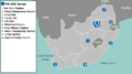
 (de)Map-South Africa-Gauteng01.png 1,024 × 700; 132 KB
-
 (de)Map-South Africa-Gauteng02.png 944 × 704; 157 KB
-
 (de)Map-South Africa-Kruger Park01.png 640 × 1,024; 237 KB
-
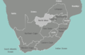
 (de)Map-South Africa-KwaZulu-Natal01.png 1,024 × 700; 130 KB
-
 (de)Map-South Africa-KwaZulu-Natal02.png 1,024 × 809; 181 KB
-
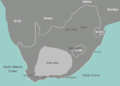
 (de)Map-South Africa-Limpopo01.png 1,024 × 693; 130 KB
-
 (de)Map-South Africa-Limpopo02.png 1,024 × 587; 136 KB
-
 (de)Map-South Africa-Parks01.png 1,024 × 707; 168 KB
-
 (de)Map-South Africa.svg 744 × 1,052; 474 KB
-
 (de)Map-South Africa01.png 1,024 × 685; 120 KB
-
 (de)Map-South Africa02.png 1,024 × 718; 223 KB
-

-
 Bioregions of SA EEZ.png 3,000 × 2,549; 644 KB
-
 Cape Town dive sites route map.png 1,200 × 1,402; 58 KB
-
 KwaZulu-Natal regions map.png 4,688 × 3,906; 1.86 MB
-
 KwaZulu-Natal regions map.svg 750 × 625; 1.7 MB
-
 Map-South Africa-fifa-2010.png 800 × 444; 89 KB
-
 Map-South Africa-Free State01.png 950 × 600; 107 KB
-
 Map-South Africa-Gauteng01.png 908 × 600; 108 KB
-
 Map-South Africa-Johannesburg-fifa-2010.svg 744 × 1,052; 212 KB
-
 Map-South Africa-Karoo01.png 800 × 571; 75 KB
-
 Map-South Africa-KwaZulu Natal01.png 959 × 600; 106 KB
-
 Map-South Africa-Limpopo01.png 934 × 600; 109 KB
-
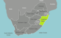
 Map-South Africa-Mpumalanga01.png 929 × 600; 110 KB
-
 Map-South Africa-North West01.png 927 × 600; 109 KB
-
 Map-South Africa-Northern Cape01.png 941 × 600; 109 KB
-
 Map-South Africa-Parks01.png 1,024 × 748; 2.2 MB
-
 Map-South Africa.svg 744 × 1,052; 494 KB
-
 Map-South Africa01.png 800 × 573; 179 KB
-
 Photog Reef.jpg 1,654 × 2,339; 428 KB
-
 South Africa regions map (cs).png 1,875 × 1,407; 747 KB
-
 South Africa-Regions map NL.png 4,010 × 3,010; 1.55 MB
-
 South Africa-Regions map ru.png 3,564 × 2,676; 1.65 MB
-
 South Africa-Regions map.png 2,000 × 1,501; 811 KB
-
 South Africa-Regions map.svg 4,010 × 3,010; 611 KB
Map-South_Africa-Eastern_Cape01.png)
Map-South_Africa-Eastern_Cape02.png)
Map-South_Africa-Free-State01.png)
Map-South_Africa-Free-State02.png)
Map-South_Africa-Gauteng01.png)
Map-South_Africa-Gauteng02.png)
Map-South_Africa-Kruger_Park01.png)
Map-South_Africa-KwaZulu-Natal01.png)
Map-South_Africa-KwaZulu-Natal02.png)
Map-South_Africa-Limpopo01.png)
Map-South_Africa-Limpopo02.png)
Map-South_Africa-Parks01.png)
Map-South_Africa.svg)
Map-South_Africa01.png)
Map-South_Africa02.png)


.png)


.jpg)