Category:Truck-related road signs in the United States
Jump to navigation
Jump to search
Subcategories
This category has the following 8 subcategories, out of 8 total.
Media in category "Truck-related road signs in the United States"
The following 180 files are in this category, out of 180 total.
-
 02-SB I-95 Carson, VA Weight Station.jpg 3,648 × 2,736; 2.09 MB
-
 03-NB I-95 Carson, VA Weight Station.jpg 3,648 × 2,736; 2.1 MB
-

-

-

-

-
-

-

-
 A1AnRoadSign-LeftOntoWorthAvenue (32302387990).jpg 2,400 × 1,600; 2.58 MB
-
 AR-66 Nimrod Bridge (Wallace Bridge)(15371).jpg 640 × 462; 227 KB
-
 BP Gas Station, S&S Food Store, Branford.JPG 4,320 × 3,240; 4.48 MB
-
 Branford city limits, US129sb.JPG 4,320 × 3,240; 4.44 MB
-
 California Route 44 & 89 Intersection.jpg 4,320 × 3,240; 5.43 MB
-
 Coffee County border, GA64EB.JPG 5,152 × 3,864; 7.95 MB
-
 Cross Bay Bl 149th Av td 12.jpg 5,472 × 3,648; 5 MB
-
 Cross City town limit, Florida SR351sb.JPG 4,320 × 3,240; 4.5 MB
-
 Cross City town limit, Florida US19nb.JPG 4,320 × 3,240; 4.53 MB
-
 Down the west side of Wauconda Pass (4937404438).jpg 1,024 × 768; 263 KB
-
 Downtown Connector sb Exit 244 1 mile.jpg 5,184 × 3,456; 4.38 MB
-
 EB I-10 Suwanee Co Rest Area; Tandem Truck Parking Sign-1.jpg 4,608 × 3,456; 3.97 MB
-
 EB I-10 Suwanee Co Rest Area; Tandem Truck Parking Sign-2.jpg 4,608 × 3,456; 4.43 MB
-
 Exit 72 EB on I-40 3.jpg 5,999 × 2,368; 2.55 MB
-
 Exit 72 EB on I-40.jpg 5,999 × 2,211; 3.78 MB
-
 Florida I75nb Bellville Rd Overpass.JPG 5,184 × 3,456; 4.34 MB
-
 Florida I75nb County Rd 132 Overpass.JPG 5,184 × 3,456; 4.36 MB
-
 Florida I75nb County Rd 141 Overpass.JPG 5,184 × 3,456; 4.62 MB
-
 Florida I75nb County Rd 152 Overpass.JPG 5,184 × 3,456; 4.54 MB
-
 Florida I75nb Exit 435 2021.jpg 5,184 × 3,456; 4.75 MB
-
 Florida I75nb Exit 435.JPG 4,608 × 3,456; 4.65 MB
-
 Florida I75nb King Hill Rd Overpass.JPG 4,608 × 3,456; 4.26 MB
-
 Florida I75nb Springville Rd Overpass.JPG 5,184 × 3,456; 4.16 MB
-
 Florida I75sb CR132 Overpass.JPG 4,608 × 3,456; 3.51 MB
-
 Florida I75sb CR152 Overpass 2019.jpg 5,184 × 3,456; 4.27 MB
-
 Florida I75sb CR18 Overpass.jpg 5,184 × 3,456; 4.7 MB
-
 Florida I75sb CR235A Overpass.jpg 5,184 × 3,456; 4.17 MB
-
 Florida I75sb FLA 247 Overpass.jpg 5,184 × 3,456; 5.1 MB
-
 Florida I75sb King Hill Rd Overpass close.jpg 5,184 × 3,456; 4.23 MB
-
 Florida I75sb King Hill Rd Overpass.JPG 4,608 × 3,456; 3.48 MB
-
 Florida I75sb NW 143st Overpass.jpg 5,184 × 3,456; 4.73 MB
-
 Florida I75sb Springville Rd Overpass.jpg 5,184 × 3,456; 4.46 MB
-

-
 Georgia I285nb Bouldercrest Rd Overpass.jpg 5,184 × 3,456; 5.25 MB
-
 Georgia I285nb Clarkston city limit.jpg 5,184 × 3,456; 4.75 MB
-
 Georgia I285nb Clifton Springs Rd Overpass.jpg 5,184 × 3,456; 4.81 MB
-
 Georgia I285nb Columbia Dr Overpass.jpg 5,184 × 3,456; 5.13 MB
-
 Georgia I285nb Exit 42.jpg 5,184 × 3,456; 4.73 MB
-
 Georgia I285nb Exit 43 1 mile.jpg 5,184 × 3,456; 4.62 MB
-
 Georgia I285nb Exit 44 1 mile.jpg 5,184 × 3,456; 4.62 MB
-
 Georgia I285nb Lavista Rd GA 236 Overpass.jpg 5,184 × 3,456; 4.48 MB
-
 Georgia I285nb Panthersville Rd Overpass.jpg 5,184 × 3,456; 4.75 MB
-
 Georgia I285nb Redwing Cir Overpass.jpg 5,184 × 3,456; 4.83 MB
-
 Georgia I475sb Columbus Rd Overpass.jpg 5,184 × 3,456; 4.72 MB
-
 Georgia I475sb Estes Rd Overpass close.jpg 5,184 × 3,456; 4.52 MB
-
 Georgia I475sb GA74 Overpass close.jpg 5,184 × 3,456; 4.11 MB
-
 Georgia I475sb Peake Rd Overpass.jpg 5,184 × 3,456; 4.89 MB
-
 Georgia I75nb Colwell Road Overpass.jpg 5,184 × 3,456; 4.35 MB
-
 Georgia I75nb exit 187 1 mile.jpg 5,184 × 3,456; 4.35 MB
-
 Georgia I75nb Exit 2 2024.jpg 5,184 × 3,456; 4.05 MB
-
 Georgia I75nb Exit 22 N Valdosta Rd Overpass.JPG 5,184 × 3,456; 4.92 MB
-
 Georgia I75nb Exit 37.JPG 4,320 × 3,240; 4.44 MB
-
 Georgia I75nb Exit 49.JPG 4,320 × 3,240; 4.46 MB
-
 Georgia I75nb Exit 80.JPG 4,320 × 3,240; 4.4 MB
-
 Georgia I75nb Exit 99.JPG 4,608 × 3,456; 4.32 MB
-
 Georgia I75nb Loch Laurel Rd Overpass.JPG 5,184 × 3,456; 4.33 MB
-
 Georgia I75nb N Perry Parkway Overpass, 2016.jpg 5,184 × 3,456; 4.41 MB
-
 Georgia I75nb Old Clyattville Rd Overpass 2024.jpg 5,184 × 3,456; 4.34 MB
-
 Georgia I75nb Rest Stop 5 Exit.JPG 4,320 × 3,240; 4.45 MB
-
 Georgia I75nb SR376 Lakes Blvd Overpass.JPG 5,184 × 3,456; 4.77 MB
-
 Georgia I75sb Aviation Blvd Overpass.jpg 5,184 × 3,456; 4.34 MB
-
 Georgia I75sb Bethlehem Rd overpass.jpg 5,184 × 3,456; 4.31 MB
-
 Georgia I75sb Bowen Rd Overpass close.jpg 5,184 × 3,456; 4.36 MB
-
 Georgia I75sb Colwell Rd overpass.jpg 5,184 × 3,456; 4.57 MB
-
 Georgia I75sb Exit 138 1 mile 2020.jpg 5,184 × 3,456; 3.96 MB
-
 Georgia I75sb Exit 22 Overpass - N. Valdosta Rd.JPG 4,320 × 3,240; 4.41 MB
-
 Georgia I75sb Exit 237 Forest Parkway Overpass.jpg 5,184 × 3,456; 4.13 MB
-
 Georgia I75sb Exit 238A.jpg 5,184 × 3,456; 4.25 MB
-
 Georgia I75sb Exit 238B .5 mile.jpg 5,184 × 3,456; 4.24 MB
-
 Georgia I75sb Exit 239 1.75 miles.jpg 5,184 × 3,456; 4.24 MB
-
 Georgia I75sb Exit 29 Overpass - GA122.JPG 5,184 × 3,456; 4.56 MB
-
 Georgia I75sb Exit 32.JPG 5,184 × 3,456; 4.67 MB
-
 Georgia I75sb Exit 37.JPG 5,184 × 3,456; 4.65 MB
-
 Georgia I75sb Exit 39.JPG 4,320 × 3,240; 4.35 MB
-
 Georgia I75sb Exit 41.JPG 4,320 × 3,240; 4.45 MB
-
 Georgia I75sb exit 41.jpg 5,184 × 3,456; 4.29 MB
-
 Georgia I75sb Exit 45.JPG 4,320 × 3,240; 4.39 MB
-
 Georgia I75sb exit 45.jpg 5,184 × 3,456; 4.32 MB
-
 Georgia I75sb exit 55.jpg 5,184 × 3,456; 4.69 MB
-
 Georgia I75sb Exit 78.jpg 5,184 × 3,456; 4.44 MB
-
 Georgia I75sb Exit 80.jpg 5,184 × 3,456; 4.46 MB
-
 Georgia I75sb Exit 82.jpg 5,184 × 3,456; 4.15 MB
-
 Georgia I75sb Exit49.JPG 4,320 × 3,240; 4.47 MB
-
 Georgia I75sb Farmers Market Rd Overpass.jpg 5,184 × 3,456; 3.94 MB
-
 Georgia I75sb Firetower Rd Overpass close.jpg 5,184 × 3,456; 4.34 MB
-
 Georgia I75sb GA230 Overpass, Unadilla.JPG 5,184 × 3,456; 4.21 MB
-
 Georgia I75sb GA26 Overpass, Perry close.jpg 5,184 × 3,456; 4.69 MB
-
 Georgia I75sb Hampton-McDonough Rd overpass.jpg 5,184 × 3,456; 4.52 MB
-
 Georgia I75sb High Falls Rd Overpass.jpg 5,184 × 3,456; 5.11 MB
-
 Georgia I75sb Indian Creek Rd overpass.jpg 5,184 × 3,456; 4.49 MB
-
 Georgia I75sb Jenkinsburg Rd Overpass.jpg 5,184 × 3,456; 4.24 MB
-
 Georgia I75sb Johnstonville Rd overpass.jpg 5,184 × 3,456; 4.93 MB
-
 Georgia I75sb Musslewhite Rd Overpass 2020.jpg 5,184 × 3,456; 4.37 MB
-
 Georgia I75sb Old Hatley Rd Overpass.JPG 5,184 × 3,456; 4.2 MB
-
 Georgia I75sb Rest Stop 6 Exit.JPG 4,320 × 3,240; 4.41 MB
-
 Georgia I75sb Rockhouse Rd E Overpass.jpg 5,184 × 3,456; 4.68 MB
-
 Georgia I75sb Shiloh Rd Overpass close.jpg 5,184 × 3,456; 4.12 MB
-
 Georgia I85sb Beaver Ruin Rd overpass.jpg 5,184 × 3,456; 4.47 MB
-
 Georgia I85sb Exit 107 exit only.jpg 5,184 × 3,456; 4.43 MB
-
 Georgia I85sb Exit 89 .75 mile.jpg 5,184 × 3,456; 4.9 MB
-
 Georgia I85sb Exit 91 .75 mile.jpg 5,184 × 3,456; 4.56 MB
-
 Georgia I85sb Exit 94 exit only.jpg 5,184 × 3,456; 4.89 MB
-
 Georgia I85sb Exit 96 .5 mile.jpg 5,184 × 3,456; 5.13 MB
-
 Georgia I85sb GA317 Lawrenceville-Suwannee Rd Overpass.jpg 5,184 × 3,456; 5.03 MB
-
 Georgia I85sb Shallowford Rd overpass.jpg 5,184 × 3,456; 5.23 MB
-
 Georgia I95nb Exit 102 1 mile, Pine Barren Rd Overpass.jpg 5,184 × 3,456; 4.46 MB
-
 Georgia I95nb Exit 104 Overpass.jpg 5,184 × 3,456; 4.86 MB
-
 Georgia I95nb Exit 106 2019.jpg 5,184 × 3,456; 4.18 MB
-
 Georgia I95nb Exit 106.jpg 5,184 × 3,456; 5.01 MB
-
 Georgia I95nb Exit 109 .5 mile.jpg 5,184 × 3,456; 4.34 MB
-
 Georgia I95nb Exit 109 1 mile.jpg 5,184 × 3,456; 4.18 MB
-
 Georgia I95nb Exit 109.jpg 5,184 × 3,456; 4.39 MB
-
 Georgia I95nb Exit 38.jpg 5,184 × 3,456; 4.2 MB
-
 Georgia I95nb Exit 42.jpg 5,184 × 3,456; 4.52 MB
-
 Georgia I95nb Exit 99A-B 2 miles.jpg 5,184 × 3,456; 4.95 MB
-
 Georgia I95nb Islands Hwy Overpass.jpg 5,184 × 3,456; 5.38 MB
-
 Georgia I95sb Colonals Island Road Overpass.jpg 5,184 × 3,456; 4.94 MB
-
 Georgia I95sb Exit 49.jpg 5,184 × 3,456; 4.47 MB
-
 Georgia I95sb Exit 67 2017.jpg 5,184 × 3,456; 4.09 MB
-
 Georgia Interstate 75 NB Exit 160 .5 mile.jpg 5,184 × 3,456; 4.67 MB
-
 Gold Mine Road nb at Cold Spring-Rush Township, PA border, Dec. 2023.jpg 3,648 × 2,736; 3.93 MB
-
 HAER War Eagle Bridge and Mill.jpg 971 × 766; 173 KB
-
 I-40 US 70 in McDowell County 2.jpg 5,999 × 2,249; 3.28 MB
-
 I-40 US 70 in McDowell County 7.jpg 6,000 × 2,388; 2 MB
-
 I-80 WB parking area, MM307, Albany Co., WY.jpg 2,560 × 1,157; 509 KB
-
 Int285eRoad-Exit26-Glenridge-GA400US19n (30929834520).jpg 2,400 × 1,600; 1.88 MB
-
 Int285eRoad-Exit30-Chamblee-DunwoodyRoad (30929835670).jpg 2,400 × 1,600; 1.95 MB
-
 Int285s-Exit52-Int675sOneMile (32908204945).jpg 2,400 × 1,600; 1.73 MB
-
 Int75nInt85nRoad-Exit239-US19US41 (34317445562).jpg 2,400 × 1,600; 1.23 MB
-
 Int75sRoad-Exit271-ChastainRoadToInt575n (30929829890).jpg 2,400 × 1,600; 1.76 MB
-
 Int75sRoad-Exit277-GA92 (30929828680).jpg 2,400 × 1,600; 1.75 MB
-
 Int75sRoad-Exit288-GA113w (30929827720).jpg 2,400 × 1,600; 1.91 MB
-
 Int77sRoad-Exit34-SC34 (29505996335).jpg 1,200 × 800; 470 KB
-
 Int85nRoad-Exit71-GA139-HalfMile (33745347040).jpg 2,400 × 1,600; 1.89 MB
-
 Int85nRoad-MM71-CampCreek-LandingMD88overhead (33999699521).jpg 2,400 × 1,600; 1.65 MB
-
 Interstate 35E - St Paul, MN - panoramio (15).jpg 2,777 × 1,981; 1.58 MB
-
 Interstate 35E - St Paul, MN - panoramio (17).jpg 3,062 × 2,191; 2.09 MB
-

-
 Langley Covered Bridge MI.jpg 1,024 × 683; 405 KB
-

-
 Looking East at US27 129 intersection, Branford.jpg 4,320 × 3,240; 4.47 MB
-
 Monticello City Limit, CR 146 WB.JPG 4,320 × 3,240; 4.54 MB
-
 NB FL 655 near S End FL 559-02.jpg 3,648 × 2,736; 2.03 MB
-
 NB I-684 Brewster Rest Area; Trucks Exit When Flashing.jpg 3,648 × 2,736; 1.64 MB
-
 NB I-95 GA Exit 82; Off-Ramp (Close-Up).jpg 3,648 × 2,736; 1.97 MB
-
 NB I-95 NC OHV Detector near Godwin.jpg 3,648 × 2,736; 2.07 MB
-
 NB I-95 St George Scale; Weigh in Motion Left Sign.jpg 3,648 × 2,736; 2.06 MB
-
 NB I-95 St George Scale; Weigh in Motion Right Sign.jpg 3,648 × 2,736; 2.09 MB
-
 NB I-95; Truck Parking Area south of Exit 18.JPG 4,000 × 3,000; 2.39 MB
-
 NB SE 3rd Ave Palatka-Lake Butler State Trail; Lake Butler, FL-1.jpg 3,648 × 2,736; 2.05 MB
-
 NB US 1-23-301 Weigh Station; All Trucks, Trailers Pickups and Vans Exit.jpg 3,648 × 2,736; 2.09 MB
-
 NC 194 Truck Warning (Banner Elk).jpg 5,520 × 3,684; 7.79 MB
-
 No Big Rigs, Low Clearance sign, RTD The Ride P-n-R Ward Rd & I-70.jpg 3,264 × 1,836; 916 KB
-
 No trucks sign in Pasco, Washington.jpg 3,264 × 2,448; 1.63 MB
-
 Northbound I-95; Truck Prohibitions for Emporia, Virginia exits.jpg 640 × 480; 39 KB
-
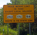 NY 284-17A-94 truck restriction sign.jpg 580 × 549; 143 KB
-
 Ohio (7695533362).jpg 2,400 × 1,600; 2.79 MB
-
 SB I-684 Bedford Rest Area; Trucks Exit When Flashing.jpg 3,648 × 2,736; 1.8 MB
-
 SB I-95 NC OHV Detector near Dunn-1.jpg 3,648 × 2,736; 2.06 MB
-
 SB I-95 NC OHV Detector near Dunn-2.jpg 3,648 × 2,736; 2.07 MB
-
 SB US 1-23-301 Weigh Station; All Trucks, Trailers Pickups and Vans Exit.jpg 3,648 × 2,736; 1.99 MB
-
 Sunken Meadow State Park; New Toll Booth.jpg 3,648 × 2,736; 2.05 MB
-
 Truckersuseexpwysnotpkwys.jpg 1,240 × 1,048; 390 KB
-
 TruckGradeWarning.jpg 1,280 × 960; 349 KB
-
 US 1 Bus sb at Tollgate Road, Bel Air, MD, May 2023.jpg 3,200 × 2,271; 1.58 MB
-
 US19nGA400nRoadSigns-MM4 (42118271701).jpg 2,400 × 1,600; 1.58 MB
-
-
 Waltmire Bridge (Mackinaw River) from SW 1.jpg 1,867 × 1,647; 1.14 MB
-
 Waltmire Bridge (Mackinaw River) from SW 2.jpg 1,790 × 1,680; 1.3 MB
-
 WB I-10 Columbia Co Rest Area; Tandem Truck Parking Sign-1.jpg 4,608 × 3,456; 3.63 MB
-
 WB I-10 Columbia Co Rest Area; Tandem Truck Parking Sign-2.jpg 4,608 × 3,456; 3.75 MB


_near_Exit_247_(Interstate_20)_in_Atlanta,_Georgia.jpg)
_east_of_Exit_34_(Maryland_State_Route_355)_in_Bethesda,_Montgomery_County,_Maryland.jpg)
_just_north_of_the_interchange_with_the_Garden_State_Parkway_and_U.S._Route_9_in_Woodbridge_Township,_Middlesex_County,_New_Jersey.jpg)
_between_Exit_2_and_Exit_4_in_Edison_Township,_Middlesex_County,_New_Jersey.jpg)
_between_Exit_8A_and_Exit_7_in_West_Orange_Township,_Essex_County,_New_Jersey.jpg)
_at_Exit_1B_(Maryland_State_Route_170_SOUTH,_Odenton,_Rental_Car_Return)_in_Stony_Run,_Anne_Arundel_County,_Maryland.jpg)
_at_Exit_2_(Potomac_Park,_U.S._Park_Police)_in_Washington,_D.C..jpg)
.jpg)
(15371).jpg)


.jpg)


.jpg)
.jpg)
.jpg)
.jpg)
.jpg)
.jpg)
.jpg)
.jpg)
.jpg)
.jpg)
.jpg)
.jpg)


.jpg)


.jpg)


.jpg)


.jpg)
_from_SW_1.jpg)
_from_SW_2.jpg)

