Category:Truro
Vai alla navigazione
Vai alla ricerca
English: Truro is a city and civil parish in Cornwall, England, United Kingdom
città dell'Inghilterra  | |||||
| Carica un file multimediale | |||||
| Istanza di |
| ||||
|---|---|---|---|---|---|
| Luogo | Cornwall, Cornovaglia, Sud Ovest dell'Inghilterra, Inghilterra | ||||
| Situato sul mare / lago / fiume |
| ||||
| Popolazione |
| ||||
| Superficie |
| ||||
| Distinto da | |||||
| sito web ufficiale | |||||
 | |||||
- NOTE: Truro may also refer to: Truro, Iowa United States, Truro, Massachusetts United States, Truro, Nova Scotia Canada, Truro, South Australia Australia
Sottocategorie
Questa categoria contiene le 28 sottocategorie indicate di seguito, su un totale di 28.
B
- Benchmarks in Truro (27 F)
- Bosvigo gardens (28 F)
C
- Callestick, Cornwall (3 F)
- Coosebean Greenway (3 F)
- Countryside around Truro (21 F)
E
F
- Flowers in Truro (9 F)
G
- Graffiti in Truro (9 F)
H
K
N
- New Mill Fords (4 F)
P
R
S
T
- Teagle (7 F)
- The Truro Milestones (96 F)
- Truro harbour (21 F)
V
- Views of Truro (17 F)
Pagine nella categoria "Truro"
Questa categoria contiene un'unica pagina, indicata di seguito.
File nella categoria "Truro"
Questa categoria contiene 200 file, indicati di seguito, su un totale di 247.
(pagina precedente) (pagina successiva)-
 Across to Tesco from Currys store - geograph.org.uk - 4037708.jpg 640 × 480; 63 KB
-
 Adverts below Coronation Terrace, Truro - geograph.org.uk - 4703588.jpg 800 × 624; 135 KB
-
 Agar Road, Truro - geograph.org.uk - 4055274.jpg 3 872 × 2 592; 5,7 MB
-
 All the fun of the fair^ - geograph.org.uk - 2704559.jpg 640 × 480; 107 KB
-

-
 Arboreal Arch - geograph.org.uk - 4688656.jpg 424 × 640; 110 KB
-
 Arch Hill, south of Truro - geograph.org.uk - 3386534.jpg 1 024 × 768; 119 KB
-
 Beached boats in the Malpas Estuary - geograph.org.uk - 4055420.jpg 3 872 × 2 592; 4,65 MB
-
 Beached boats in Truro - geograph.org.uk - 4055304.jpg 3 872 × 2 592; 5,64 MB
-
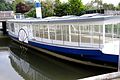
 Boarding the Falmouth ferry at Truro - geograph.org.uk - 4076873.jpg 1 024 × 575; 144 KB
-
 Boat for sale - geograph.org.uk - 4055403.jpg 3 872 × 2 592; 4,67 MB
-
 Boats moored at Sunny Corner - geograph.org.uk - 5837784.jpg 640 × 480; 101 KB
-
 Bridge Over Arch Hill - geograph.org.uk - 4688626.jpg 424 × 640; 103 KB
-
 Bushes by the Cornish Main line - geograph.org.uk - 5104529.jpg 640 × 426; 86 KB
-
 Bushes by the Cornish Main line - geograph.org.uk - 5104534.jpg 640 × 426; 76 KB
-

-
 Car park, Cornish Crescent, Truro - geograph.org.uk - 2462681.jpg 640 × 480; 68 KB
-
 Car park, Truro - geograph.org.uk - 5896207.jpg 640 × 480; 52 KB
-
 Cattle at Highertown, Truro - geograph.org.uk - 4913805.jpg 2 985 × 2 237; 3,53 MB
-
 Cattle on Treyew Farm, Highertown, Truro - geograph.org.uk - 4913992.jpg 3 648 × 2 736; 3,69 MB
-
 CBM on Arch Hill Milestone - geograph.org.uk - 4905698.jpg 360 × 640; 87 KB
-
 Celtic Rebellion sticker, Truro, June 2021.jpg 3 024 × 4 032; 2,58 MB
-
 Cement Works next to Lighterage Quay, Truro - geograph.org.uk - 2036739.jpg 3 888 × 2 592; 4,09 MB
-
 Chapel Road Truro.jpg 2 048 × 1 536; 843 KB
-
 Clifton Villa Veterinary Surgery, Truro - geograph.org.uk - 4703578.jpg 800 × 794; 176 KB
-
 Colourful reflections (328414633).jpg 2 592 × 1 944; 2,25 MB
-
 Compton Castle being renovated (geograph 2096648).jpg 1 600 × 1 072; 388 KB
-
 Copes Gardens - geograph.org.uk - 5149142.jpg 640 × 426; 65 KB
-
 Cornwall , Grassy Field - geograph.org.uk - 5384802.jpg 5 531 × 3 687; 6,89 MB
-

-
 Cutting, Cornish Main Line - geograph.org.uk - 5104525.jpg 640 × 426; 93 KB
-

-
 Cycling near Newham - geograph.org.uk - 43580.jpg 640 × 427; 139 KB
-
 Dobbs Lane - geograph.org.uk - 2692985.jpg 1 024 × 683; 282 KB
-
 Edhen Park, Truro - geograph.org.uk - 4055344.jpg 3 872 × 2 592; 4,83 MB
-
 End of The Line - geograph.org.uk - 4688676.jpg 640 × 424; 112 KB
-
 Flag of Truro.png 4 795 × 2 868; 1,68 MB
-
 Flowerpot men at the Farmers Market, Truro - geograph.org.uk - 4413355.jpg 1 600 × 1 062; 654 KB
-
 Footpath by the Truro River - geograph.org.uk - 4638606.jpg 3 264 × 2 448; 3,13 MB
-
 Footpath Near County Hall - geograph.org.uk - 4688244.jpg 424 × 640; 105 KB
-
 Former mill pond north of Truro Cathedral - geograph.org.uk - 3320935.jpg 1 024 × 768; 685 KB
-
 Frances St - geograph.org.uk - 5104466.jpg 640 × 291; 56 KB
-
 George St - geograph.org.uk - 5104488.jpg 640 × 426; 72 KB
-
 Gloweth From the Air - geograph.org.uk - 588745.jpg 640 × 480; 129 KB
-

-
 Grazing near Highertown - geograph.org.uk - 5650018.jpg 640 × 480; 85 KB
-
 Hedgehogs on Trafalgar Roundabout - geograph.org.uk - 6251677.jpg 3 035 × 1 833; 672 KB
-
 Hendra Rd - geograph.org.uk - 5149074.jpg 640 × 426; 74 KB
-
 Hendra Road, Truro - geograph.org.uk - 4238432.jpg 480 × 640; 53 KB
-
 High tide on the Truro River - geograph.org.uk - 4076882.jpg 1 024 × 575; 135 KB
-
 Highertown (in a rain storm) - geograph.org.uk - 5149039.jpg 640 × 426; 41 KB
-
 Hillside east of Newmills Farm - geograph.org.uk - 89408.jpg 640 × 454; 96 KB
-
 Houses at Pencarrick - geograph.org.uk - 3649268.jpg 640 × 414; 73 KB
-
 Houses in Highertown, Truro - geograph.org.uk - 4913815.jpg 3 648 × 2 736; 3,31 MB
-
 Housing estate, Truro - geograph.org.uk - 5889756.jpg 1 024 × 681; 141 KB
-
 Kenwyn - geograph.org.uk - 5149146.jpg 640 × 426; 65 KB
-
 Kenwyn Bridge - geograph.org.uk - 2009743.jpg 800 × 600; 265 KB
-

-
 Lane descends - geograph.org.uk - 3649274.jpg 427 × 640; 125 KB
-
 Lock on the Truro River - geograph.org.uk - 4688335.jpg 640 × 424; 78 KB
-
 Looking upriver to Truro - geograph.org.uk - 3268628.jpg 1 600 × 1 066; 195 KB
-
 Lychgate and Schoolroom Kenwyn Church - geograph.org.uk - 3155039.jpg 960 × 1 280; 344 KB
-
 Maritime Line - geograph.org.uk - 6021649.jpg 1 024 × 681; 187 KB
-
 Meadow Beside Caleneck Creek - geograph.org.uk - 4688659.jpg 640 × 424; 69 KB
-
 Meadow to the North of Trennick Lane - geograph.org.uk - 2633192.jpg 2 304 × 3 456; 3,79 MB
-
 Moorings on the Truro River - geograph.org.uk - 4688345.jpg 640 × 424; 54 KB
-

-
 Muddy creek by Tesco - geograph.org.uk - 4055323.jpg 3 872 × 2 592; 1,7 MB
-
 Muddy estuary in Truro - geograph.org.uk - 4055309.jpg 3 872 × 2 592; 4,65 MB
-
 October sunset - geograph.org.uk - 5561937.jpg 2 592 × 1 944; 1,68 MB
-

-

-

-
 Old Line to Truro - geograph.org.uk - 4688618.jpg 424 × 640; 84 KB
-

-

-

-
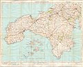
 Ordnance Survey One-Inch Sheet 143 Truro & St Austell, Published 1918r.jpg 13 983 × 10 219; 13,81 MB
-
 Ordnance Survey One-Inch Sheet 143 Truro, Published 1918.jpg 13 991 × 10 267; 13,97 MB
-
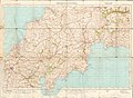
 Ordnance Survey One-Inch Sheet 146 Land's End & Lizard, Published 1919.jpg 13 990 × 11 254; 13,96 MB
-
 Ordnance Survey One-Inch Sheet 190 Truro & Falmouth, Published 1961.jpg 8 198 × 9 967; 8,49 MB
-
 Ordnance Survey One-Inch Sheet 190 Truro & Falmouth, Published 1972.jpg 11 099 × 13 145; 39,33 MB
-
 Ordnance Survey One-Inch Sheet 190 Truro and Falmouth, Published 1946.jpg 8 186 × 9 581; 8,52 MB
-
 Park towards Hendra Road - geograph.org.uk - 4238444.jpg 640 × 480; 102 KB
-
 Park, St George's Road, Truro - geograph.org.uk - 990429.jpg 603 × 640; 149 KB
-

-
 Penhaligon Court - geograph.org.uk - 5538774.jpg 2 592 × 1 944; 1,6 MB
-
 Penventinnie Lane - geograph.org.uk - 2010180.jpg 800 × 600; 257 KB
-
 Penwithers Junction, Highertown, Truro - geograph.org.uk - 4913965.jpg 3 648 × 2 736; 3,03 MB
-
 Postal delivery office, Truro - geograph.org.uk - 4055351.jpg 3 872 × 2 592; 4,02 MB
-
 Railway Bridge over a Country Lane - geograph.org.uk - 229126.jpg 640 × 427; 121 KB
-
 Railway Viaduct, Truro - geograph.org.uk - 2009499.jpg 800 × 600; 362 KB
-
 Rainbow over Kenwyn - geograph.org.uk - 2095343.jpg 480 × 640; 46 KB
-
 Ringroad junction, A39, A390, Falmouth Road - geograph.org.uk - 2695657.jpg 1 024 × 683; 115 KB
-

-
 River Allen Lock, low tide, Truro, Cornwall.jpg 4 896 × 2 752; 4,85 MB
-
 River Allen, Truro - geograph.org.uk - 2009823.jpg 800 × 600; 401 KB
-
 River Kenwyn - geograph.org.uk - 5104459.jpg 640 × 426; 90 KB
-
 River Kenwyn, Truro - geograph.org.uk - 4238484.jpg 640 × 480; 131 KB
-

-
 Road and Railway - geograph.org.uk - 227613.jpg 640 × 427; 124 KB
-
 Road cutting on St Clement's Hill, Truro - geograph.org.uk - 3321169.jpg 1 024 × 768; 701 KB
-
 Road junction near Tregerrick - geograph.org.uk - 349814.jpg 640 × 427; 51 KB
-
 Roofscape, Kenwyn - geograph.org.uk - 5889757.jpg 1 024 × 681; 156 KB
-
 Roofscape, Kenwyn - geograph.org.uk - 5889761.jpg 1 024 × 681; 151 KB
-
 Rooftops, Truro - geograph.org.uk - 5104432.jpg 640 × 426; 72 KB
-
 Rooftops, Truro - geograph.org.uk - 5104493.jpg 640 × 426; 77 KB
-
 Rosewin Hill - geograph.org.uk - 5134041.jpg 640 × 428; 95 KB
-
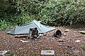 Rough Sleeper's Campsite - geograph.org.uk - 2036773.jpg 3 888 × 2 592; 1,52 MB
-

-
 Scene in front of Truro Cathedral - geograph.org.uk - 2096689.jpg 4 525 × 3 072; 5,4 MB
-

-
 Silver seal, Truro, Cornwall.jpg 642 × 676; 188 KB
-
 Six gulls on a fence (29297953455).jpg 3 872 × 2 178; 8,43 MB
-

-
 Speed hump, Campfield Hill - geograph.org.uk - 959787.jpg 427 × 640; 99 KB
-
 St George's Church, Truro - geograph.org.uk - 5748533.jpg 1 024 × 738; 154 KB
-
 St George's Rd - geograph.org.uk - 5889764.jpg 1 024 × 681; 147 KB
-
 St George's Street - geograph.org.uk - 5149069.jpg 640 × 426; 71 KB
-
 St Mary's St Truro - geograph.org.uk - 4688296.jpg 424 × 640; 53 KB
-
 Stile at the end of the Footpath - geograph.org.uk - 506341.jpg 640 × 480; 190 KB
-
 Stream at rear of St Clement Street - geograph.org.uk - 4040576.jpg 640 × 480; 105 KB
-
 Stream with swans in Truro - geograph.org.uk - 605504.jpg 640 × 583; 111 KB
-
 Street Market in Lemon Quay, Truro - geograph.org.uk - 2098297.jpg 4 605 × 3 104; 5,8 MB
-
 Street Market in Lemon Quay, Truro - geograph.org.uk - 2098331.jpg 4 410 × 3 022; 5,46 MB
-
 Street Market in Lemon Quay, Truro - geograph.org.uk - 2098347.jpg 4 583 × 2 967; 5,4 MB
-
 Street Market in Lemon Quay, Truro - geograph.org.uk - 2098362.jpg 4 439 × 2 900; 3,21 MB
-
 Telephone Kiosks on Lemon Street Truro - geograph.org.uk - 4429089.jpg 1 492 × 1 490; 970 KB
-
 The Beynon Way - geograph.org.uk - 215842.jpg 640 × 427; 107 KB
-
 The City Inn on Pydar Street - geograph.org.uk - 4055252.jpg 3 872 × 2 592; 4,63 MB
-
 The edge of Truro - geograph.org.uk - 5104389.jpg 640 × 426; 62 KB
-
 The edge of Truro - geograph.org.uk - 5894852.jpg 1 024 × 681; 158 KB
-
 The Entrance to Kenwyn Church - geograph.org.uk - 3155035.jpg 1 280 × 960; 483 KB
-
 The grate pyramid by the pond (328413052).jpg 2 592 × 1 944; 2,29 MB
-
 The lower part of Kenwyn - geograph.org.uk - 5748655.jpg 1 024 × 768; 179 KB
-
 The Maritime Line - geograph.org.uk - 5104542.jpg 640 × 426; 78 KB
-
 The Maritime Line - geograph.org.uk - 5104545.jpg 640 × 426; 77 KB
-
 The old oak tree (49913844047).jpg 3 570 × 2 873; 4,39 MB
-

-
 The River Kenwyn in Truro - geograph.org.uk - 4055446.jpg 3 872 × 2 592; 4,89 MB
-

-
 The Truro River - geograph.org.uk - 4688365.jpg 640 × 424; 53 KB
-
 The Watchers - geograph.org.uk - 346376.jpg 640 × 479; 112 KB
-
 To Un-loading For Your Boat (26120815050).jpg 3 489 × 2 565; 5,67 MB
-
 Trafalgar Way - first post-horse change - geograph.org.uk - 1183760.jpg 480 × 640; 251 KB
-
 Trafalgar Way plaque in Truro - geograph.org.uk - 2996356.jpg 480 × 640; 88 KB
-
 Trenerry Tollhouse by Bodmin Road, Truro (geograph 6096315).jpg 640 × 441; 118 KB
-
 Truro (25538545133).jpg 2 855 × 2 258; 5,91 MB
-
 Truro (26300492482).jpg 2 542 × 2 574; 4,69 MB
-
 Truro (26333504965).jpg 3 480 × 2 320; 7,55 MB
-
 Truro , A39 Roadworks - geograph.org.uk - 4612111.jpg 4 288 × 2 848; 6,29 MB
-
 Truro , Blossom on Tregolls Road - geograph.org.uk - 2817567.jpg 2 848 × 4 288; 6,66 MB
-
 Truro , Bodmin Road - geograph.org.uk - 2817559.jpg 4 052 × 2 428; 2,96 MB
-
 Truro , City Scenery - geograph.org.uk - 5384813.jpg 6 000 × 4 000; 6,2 MB
-
 Truro , City Sign on Tregolls Road - geograph.org.uk - 2817566.jpg 4 288 × 2 848; 5,66 MB
-
 Truro , Footpath - geograph.org.uk - 5385773.jpg 5 777 × 3 852; 5,8 MB
-
 Truro , Furniss Island - geograph.org.uk - 5385742.jpg 5 300 × 3 534; 6,54 MB
-
 Truro , Garras Wharf Car Park - geograph.org.uk - 2817574.jpg 4 288 × 2 848; 5,62 MB
-
 Truro , Green Lane A390 - geograph.org.uk - 5384804.jpg 5 834 × 3 890; 6 MB
-
 Truro , House on the A39 - geograph.org.uk - 4612102.jpg 3 898 × 2 589; 5,5 MB
-
 Truro , Lloyds TSB - geograph.org.uk - 2817579.jpg 4 288 × 2 848; 5,42 MB
-
 Truro , National Tyres and Autocare - geograph.org.uk - 4611960.jpg 4 156 × 2 759; 6,51 MB
-
 Truro , Newquay Road - geograph.org.uk - 5385763.jpg 6 000 × 4 000; 6,58 MB
-
 Truro , Pedestrian Underpass - geograph.org.uk - 2817575.jpg 4 288 × 2 848; 6,23 MB
-
 Truro , Shell Petrol Station - geograph.org.uk - 2817569.jpg 4 288 × 2 848; 4,78 MB
-
 Truro , Shell Petrol Station - geograph.org.uk - 5385755.jpg 5 543 × 3 696; 6,15 MB
-
 Truro , St Austell Street B3284 - geograph.org.uk - 5385753.jpg 5 783 × 3 856; 5,9 MB
-
 Truro , St Clement Street - geograph.org.uk - 4611935.jpg 4 288 × 2 848; 5,1 MB
-
 Truro , The Alverton Entrance - geograph.org.uk - 4612076.jpg 4 096 × 2 720; 7,18 MB
-
 Truro , Tregurra Lane - geograph.org.uk - 4612114.jpg 4 288 × 2 848; 5,88 MB
-
 Truro , Tregurra Lane - geograph.org.uk - 5385771.jpg 5 575 × 3 717; 5,49 MB
-
 Truro , Trevithick Lane - geograph.org.uk - 5385759.jpg 6 000 × 4 000; 6,76 MB
-
 Truro , Truro River - geograph.org.uk - 5384817.jpg 6 000 × 4 000; 7,09 MB
-
 Truro - Cornwall dot.png 417 × 599; 122 KB
-
 Truro - geograph.org.uk - 1834242.jpg 640 × 426; 308 KB
-
 Truro - geograph.org.uk - 5104436.jpg 640 × 426; 71 KB
-
 Truro - UK city.jpg 3 394 × 1 873; 686 KB
-
 Truro City Centre - geograph.org.uk - 6021668.jpg 1 024 × 681; 141 KB
-
 Truro City Council, 2021.svg 360 × 185; 2 KB
-

-
 Truro from Lemon Quay (NBY 443253).jpg 3 600 × 2 338; 2,05 MB
-
 Truro Harbour Office Workshop - geograph.org.uk - 2036744.jpg 3 888 × 2 592; 698 KB
-
 Truro Kea Tower (NBY 441939).jpg 3 600 × 2 359; 2,17 MB
-
 Truro leats.jpg 640 × 427; 142 KB
-
 Truro Malpas (NBY 444015).jpg 3 600 × 2 338; 2,09 MB
-
 Truro River - Approaching Truro - geograph.org.uk - 2009737.jpg 800 × 600; 266 KB
-
 Truro River - geograph.org.uk - 1885398.jpg 3 635 × 2 419; 3,15 MB
-
 Truro River - geograph.org.uk - 4688352.jpg 640 × 424; 45 KB
-
 Truro Roofscape - geograph.org.uk - 5894836.jpg 1 024 × 681; 118 KB
-
 Truro St. Clements (NBY 441504).jpg 2 330 × 3 600; 2,06 MB
-
 Truro St. Clements (NBY 442992).jpg 2 366 × 3 600; 2,11 MB
-
 Truro Viaduct - geograph.org.uk - 4238440.jpg 478 × 640; 81 KB
-
 Truro Viaduct - geograph.org.uk - 6257886.jpg 1 024 × 576; 132 KB
-
 Truro, general view, Cornwall, England-LCCN2002696621.jpg 3 679 × 2 738; 2,81 MB
-
 Truro, general view, Cornwall, England-LCCN2002696621.tif 3 679 × 2 738; 28,82 MB
-
 TruroBandstand.jpg 3 587 × 5 381; 10,1 MB
-
 Two railway speed limit signs, Truro - geograph.org.uk - 4703772.jpg 800 × 800; 155 KB
-
 Valley of the River Allen and Kenwyn - geograph.org.uk - 5149151.jpg 640 × 426; 59 KB
-
 Victorial Postbox, Truro Station - geograph.org.uk - 5889800.jpg 681 × 1 024; 143 KB
-
 Victorian Postbox, Truro Station - geograph.org.uk - 6021665.jpg 1 024 × 681; 114 KB


.jpg)
.jpg)


_EXPLORE_-_Flickr_-_Mr_B%27s_Photography.jpg)


_-_geograph.org.uk_-_5149039.jpg)


.jpg)


.jpg)


.jpg)


.jpg)


.jpg)


.jpg)


.jpg)
.jpg)
.jpg)
.jpg)


.jpg)

.jpg)

.jpg)


.jpg)
.jpg)


