Category:Tulliemet
Jump to navigation
Jump to search
English: Tulliemet (historically often Tullymet and translating as Hill of Justice) is a small Scottish village some 35 kms NNW of the city of Perth and approximately midway between Dunkeld and Pitlochry. It comprises a loosely-spread collection of 47 dwellings encompassed by the four postcodes PH9 0PA (or 0PB or 0NY or 0NZ). Although it has some notable history, the village is perhaps most familiar through the popularity of the eponymous strathspey "The Braes of Tulliemet".
Media in category "Tulliemet"
The following 21 files are in this category, out of 21 total.
-
 Achnahosher across the Tulliemet Burn - geograph.org.uk - 810583.jpg 640 × 480; 93 KB
-

-
 Driveway to Tulliemet House - geograph.org.uk - 300497.jpg 640 × 480; 146 KB
-
 Frosty Scene at Tulliemet - geograph.org.uk - 300279.jpg 640 × 480; 94 KB
-

-
 Milton Cottage, Tulliemet - geograph.org.uk - 1087971.jpg 640 × 532; 124 KB
-
 Milton Farm, Tulliemet - geograph.org.uk - 1087988.jpg 640 × 425; 50 KB
-
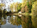
 Pond among the Trees - geograph.org.uk - 751415.jpg 640 × 480; 143 KB
-
 Pond at Tulliemet Lodge - geograph.org.uk - 1087996.jpg 640 × 623; 120 KB
-
 Postbox at Wester Tulliemet - geograph.org.uk - 1087978.jpg 372 × 640; 84 KB
-
 Roads from Tulliemet House - geograph.org.uk - 1087865.jpg 640 × 450; 82 KB
-
 Smithy House, Tulliemet - geograph.org.uk - 1087905.jpg 640 × 480; 76 KB
-
 The Braes of Tulliemet - geograph.org.uk - 1004267.jpg 640 × 480; 85 KB
-
 The Curling Pond, Tulliemet - geograph.org.uk - 1474753.jpg 640 × 479; 128 KB
-
 The Old Smiddy, Tulliemet - geograph.org.uk - 1474763.jpg 640 × 474; 107 KB
-

-
 Tulliemet - geograph.org.uk - 31248.jpg 640 × 445; 67 KB
-
 Tulliemet Burn - geograph.org.uk - 1087872.jpg 480 × 640; 118 KB
-
 Tulliemet Burn - geograph.org.uk - 1599325.jpg 640 × 480; 147 KB
-
 Tulliemet Burn - geograph.org.uk - 810535.jpg 640 × 480; 85 KB
-
 West Side of Tulliemet Wood - geograph.org.uk - 300269.jpg 640 × 480; 80 KB


