Category:Twijnstraat 32, Utrecht
Jump to navigation
Jump to search
| Object location | | View all coordinates using: OpenStreetMap |
|---|
 | |||||
| Upload media | |||||
| Instance of |
| ||||
|---|---|---|---|---|---|
| Location | Utrecht, Netherlands | ||||
| Street address |
| ||||
| Heritage designation |
| ||||
 | |||||
|
This is a category about rijksmonument number 450391
|
| Address |
|
Media in category "Twijnstraat 32, Utrecht"
This category contains only the following file.
-
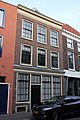 Twijnstraat 32.JPG 3,456 × 5,184; 6.99 MB