Category:U.S. Route 67 in Illinois
Jump to navigation
Jump to search
section of United States Numbered Highway in Illinois, United States  _map.svg) | |||||
| Upload media | |||||
| Instance of | |||||
|---|---|---|---|---|---|
| Location | Illinois | ||||
| Transport network |
| ||||
| Owned by | |||||
| Maintained by | |||||
| Inception |
| ||||
| Length |
| ||||
 | |||||
Subcategories
This category has the following 7 subcategories, out of 7 total.
C
- Clark Bridge (U.S. Route 67) (36 F)
G
I
- Illinois Route 267 (3 F)
M
- McKinley Bridge (11 F)
O
- Old Clark Bridge (5 F)
R
Media in category "U.S. Route 67 in Illinois"
The following 20 files are in this category, out of 20 total.
-
 1940s US 67 Shield (27918163255).jpg 1,200 × 1,800; 862 KB
-
 Beardstown, Illinois (7235193870).jpg 4,000 × 3,000; 2.21 MB
-
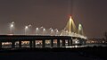 Clark Bridge at night.jpg 5,184 × 2,916; 2.16 MB
-
 Eastern end of Illinois Route 103.jpg 6,000 × 3,576; 3.02 MB
-
 U.S. Route 67 Business in Roseville, Illinois.jpg 4,608 × 3,456; 7.46 MB
-
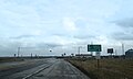
 U.S. Route 67 in Roseville, Illinois.jpg 4,608 × 3,456; 7.22 MB
-
 US 67 (IL) map.png 184 × 292; 6 KB
-
 US 67 (IL) map.svg 1,180 × 688; 196 KB
-
 US 67 Illinois 1926.svg 1,485 × 1,440; 31 KB
-
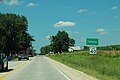
 US 67 north in Good Hope IL.jpg 4,608 × 3,456; 7.49 MB
-
 US 67 south of US 136.jpg 4,608 × 3,456; 7.77 MB
-
 US67 North - Jct IL94 to IL192 Signs (42512720590).jpg 2,400 × 1,600; 2.22 MB
-
 US67 Sign 1940s-Spec Rock Island (42512677340).jpg 2,400 × 1,600; 1.41 MB
-
 US67 South - Jct IL94 to IL192 Signs (44320562101).jpg 2,400 × 1,600; 1.72 MB
-
 US67 South - Preemption IL Sign (30453197088).jpg 2,400 × 1,600; 2.19 MB
-
 US67 South - Road Curve (44272469572).jpg 2,400 × 1,600; 1.84 MB
-
 US67 South - Rock Island County Sign (30453202858).jpg 2,400 × 1,600; 1.71 MB
-
 US67nIL110ckcSigns-AtIL116 (38701223684).jpg 2,400 × 1,600; 2.12 MB
-
 US67sIL110wCKC-IL9ewSigns (38701225114).jpg 2,400 × 1,600; 1.55 MB
-
 US67sIL110wCKC-RoadSigns (38531282135).jpg 2,400 × 1,600; 1.24 MB
.jpg)
.jpg)


_map.png)


.jpg)
.jpg)
.jpg)
.jpg)
.jpg)
.jpg)
.jpg)
.jpg)
.jpg)