Category:Ufton
Jump to navigation
Jump to search
village and civil parish in Warwickshire, United Kingdom  | |||||
| Upload media | |||||
| Instance of | |||||
|---|---|---|---|---|---|
| Location | Stratford-on-Avon, Warwickshire, West Midlands, England | ||||
| Population |
| ||||
| Area |
| ||||
 | |||||
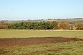
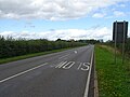
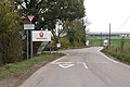
English: Ufton is a small village located in the Stratford District of Warwickshire, England. It located 8km south east of Leamington Spa and 3km west of Southam on the A425 road. It sits on top of a glacial escarpment 121 metres above sea level which was formed during the last ice age. Ufton Fields, a 77 acre Site of Special Scientific Interest, is located to the south east of the village and the parish church is dedicated to St. Michael which dates back to at least the start of the 13th century. The Grand Union Canal is within walking distance of the village to the north.
Subcategories
This category has the following 4 subcategories, out of 4 total.
T
- The White Hart, Ufton (7 F)
U
- St Michael and All Angels, Ufton (15 F)
- Ufton Fields nature reserve (25 F)
Media in category "Ufton"
The following 200 files are in this category, out of 230 total.
(previous page) (next page)-
 'The Old School', White Hart Lane, Ufton - geograph.org.uk - 1418612.jpg 640 × 419; 100 KB
-
 A bend in the Ridgeway unclassified road - geograph.org.uk - 1481561.jpg 640 × 413; 112 KB
-
 A jump (for horses) near Ufton Wood - geograph.org.uk - 1556439.jpg 640 × 426; 129 KB
-
 A marshy pool west of Ufton Hill Farm - geograph.org.uk - 1570025.jpg 640 × 426; 169 KB
-
 A newly-dredged ditch near Island Farm - geograph.org.uk - 1571694.jpg 640 × 420; 126 KB
-
 A rough farm track west of Ufton - geograph.org.uk - 1571717.jpg 640 × 419; 77 KB
-
 A sharp bend on Welsh Road - geograph.org.uk - 1410648.jpg 640 × 426; 129 KB
-
 A stand of trees west of Ufton - geograph.org.uk - 1571711.jpg 640 × 426; 88 KB
-
-
 A425 approaching Ufton - geograph.org.uk - 1509205.jpg 640 × 449; 128 KB
-
 A425 enters Ufton - geograph.org.uk - 2656444.jpg 2,000 × 1,508; 518 KB
-
 A425 near Ufton - geograph.org.uk - 2656315.jpg 2,000 × 1,501; 380 KB
-
 A425 towards Royal Leamington Spa - geograph.org.uk - 6240902.jpg 800 × 600; 95 KB
-
 Abandoned quarry wagon - geograph.org.uk - 1199675.jpg 640 × 429; 175 KB
-
 Allotments east of Ufton - geograph.org.uk - 1556466.jpg 640 × 426; 113 KB
-

-

-
 Approach road to Ufton landfill site - geograph.org.uk - 1561883.jpg 640 × 426; 109 KB
-
 Approaching Bascote Heath from the north - geograph.org.uk - 1410657.jpg 640 × 426; 102 KB
-
 Approaching Bascote Heath from the south - geograph.org.uk - 1556459.jpg 640 × 426; 121 KB
-
 Approaching Longhole Bridge - geograph.org.uk - 1509305.jpg 640 × 428; 131 KB
-
-

-
 Approaching Ufton from the south - geograph.org.uk - 1550551.jpg 640 × 426; 159 KB
-

-
-
 Autumn gold at the edge of Ufton Wood - geograph.org.uk - 1556447.jpg 640 × 426; 143 KB
-

-
 B4452 to Harbury - geograph.org.uk - 2336960.jpg 640 × 480; 73 KB
-
 Back along Ufton Fields towards Ufton - geograph.org.uk - 1199653.jpg 640 × 429; 151 KB
-
 Backlit sheep posing near Ufton - geograph.org.uk - 1556426.jpg 640 × 418; 157 KB
-
 Barn by the Ridgeway - geograph.org.uk - 3081012.jpg 640 × 480; 86 KB
-
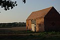 Barn near Ufton - geograph.org.uk - 1509896.jpg 640 × 428; 53 KB
-
 Barn on bridleway from Ufton - geograph.org.uk - 4541408.jpg 480 × 640; 72 KB
-
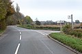
 Bascote heath crossroads - geograph.org.uk - 1403443.jpg 640 × 426; 113 KB
-
 Bascote Heath house (1) - geograph.org.uk - 1410652.jpg 640 × 411; 122 KB
-
 Bascote Heath house (2) - geograph.org.uk - 1410654.jpg 640 × 432; 140 KB
-

-
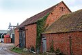 Brick-built barns at Posher Farm, Ufton - geograph.org.uk - 1569849.jpg 640 × 426; 111 KB
-
 Building on White Hart Lane, Ufton - geograph.org.uk - 3072343.jpg 640 × 480; 93 KB
-

-
 Cattle Barn at Ufton Hill Farm - geograph.org.uk - 3255312.jpg 640 × 480; 69 KB
-
 Cereal crop, Ufton Hill - geograph.org.uk - 6240906.jpg 800 × 600; 118 KB
-
 Churchyard and Old Forge Cottage, Ufton - geograph.org.uk - 1418586.jpg 640 × 469; 119 KB
-

-

-

-
 Disused barns west of Ufton Hill Farm - geograph.org.uk - 1570012.jpg 640 × 426; 106 KB
-

-

-

-
 Disused farm building - geograph.org.uk - 2663748.jpg 2,000 × 1,497; 583 KB
-
 Downhill on the A425 northwest of Ufton - geograph.org.uk - 1418583.jpg 541 × 640; 202 KB
-

-
 Electricity pylon at Ufton Fields - geograph.org.uk - 1550582.jpg 610 × 640; 119 KB
-
 Entrance drive to Greystone kennels - geograph.org.uk - 2663841.jpg 2,000 × 1,502; 685 KB
-

-

-
-

-
 Farm buildings south of Welsh Road - geograph.org.uk - 1403444.jpg 640 × 426; 92 KB
-

-
 Farm track off Southam Road (A425) - geograph.org.uk - 6240940.jpg 800 × 600; 119 KB
-
 Farm track south of the A425 road - geograph.org.uk - 1571698.jpg 640 × 433; 83 KB
-

-
 Farmland near Ufton - geograph.org.uk - 1508839.jpg 640 × 428; 114 KB
-
 Farmland near Ufton - geograph.org.uk - 1509186.jpg 640 × 428; 96 KB
-
 Farmland near Ufton - geograph.org.uk - 1512074.jpg 640 × 429; 90 KB
-
 Farmland near Ufton - geograph.org.uk - 1512077.jpg 640 × 428; 95 KB
-
 Farmland near Ufton - geograph.org.uk - 1513261.jpg 640 × 427; 81 KB
-
 Farmland off Welsh Road - geograph.org.uk - 3906807.jpg 640 × 480; 71 KB
-
 Farmland south of Ufton village - geograph.org.uk - 1550584.jpg 640 × 426; 84 KB
-
 Farmyard at Posher Farm, Ufton - geograph.org.uk - 1569847.jpg 640 × 426; 80 KB
-
 Farmyard at Ufton Wood - geograph.org.uk - 3263403.jpg 640 × 480; 93 KB
-
 Field of barley - geograph.org.uk - 5440123.jpg 640 × 480; 141 KB
-
 Fields near Ufton - geograph.org.uk - 3940457.jpg 2,592 × 1,944; 2.01 MB
-

-
 Footpath from Harbury to Southam - geograph.org.uk - 2663761.jpg 2,000 × 1,495; 565 KB
-
 Footpath heads out to the road, Ufton - geograph.org.uk - 3072326.jpg 640 × 480; 132 KB
-
 Footpath signs at Ufton - geograph.org.uk - 1511955.jpg 428 × 640; 79 KB
-

-
 Footpath to Harbury near Ufton Hill Farm - geograph.org.uk - 2660655.jpg 2,000 × 1,503; 637 KB
-
 Footpath to Southam from Harbury - geograph.org.uk - 2659149.jpg 2,000 × 1,498; 457 KB
-
 Footpath to Ufton Fields Nature Reserve - geograph.org.uk - 2656426.jpg 2,000 × 1,498; 210 KB
-

-

-
 Gated farm track off the A425 - geograph.org.uk - 6240911.jpg 800 × 540; 108 KB
-
 Gateway and old barns, Welsh Road - geograph.org.uk - 1410634.jpg 640 × 446; 103 KB
-

-
 Grassland off Southam Road (A425) - geograph.org.uk - 6240942.jpg 640 × 480; 80 KB
-

-
 Herd of cows on Ufton Hill Farm - geograph.org.uk - 1570000.jpg 640 × 404; 85 KB
-

-
 Hereford bull in a field by the B4452 (cropped).jpg 436 × 327; 82 KB
-
 Hereford bull on Ufton Hill Farm - geograph.org.uk - 1570019.jpg 640 × 424; 86 KB
-
 Hereford calf on Ufton Hill Farm - geograph.org.uk - 1570020.jpg 640 × 426; 166 KB
-

-

-
 Hereford cow and calf on Ufton Hill Farm - geograph.org.uk - 1570022.jpg 640 × 426; 100 KB
-

-

-

-
 Horses at Ufton Hill Farm - geograph.org.uk - 3067323.jpg 640 × 480; 77 KB
-
 Horses on Ufton Hill Farm - geograph.org.uk - 1570001.jpg 600 × 399; 82 KB
-
 House on Ufton Fields, Ufton - geograph.org.uk - 6240925.jpg 800 × 600; 105 KB
-
 Houses in Ufton - geograph.org.uk - 3255295.jpg 640 × 480; 68 KB
-
 Houses in Ufton - geograph.org.uk - 3255302.jpg 640 × 480; 72 KB
-

-

-
-

-
 Lake at Ufton Fields Nature Reserve - geograph.org.uk - 2656392.jpg 2,000 × 1,504; 366 KB
-

-
 Late afternoon sky south of Ufton - geograph.org.uk - 1561891.jpg 630 × 419; 92 KB
-

-
 Livestock sheds at Ufton Hill Farm - geograph.org.uk - 1569989.jpg 640 × 410; 76 KB
-

-

-

-

-

-

-

-

-

-

-

-

-

-

-

-

-
 Machinery dealership, Ufton - geograph.org.uk - 6240932.jpg 800 × 600; 90 KB
-

-
 Midway Bunglaow, Bascote Heath - geograph.org.uk - 1556463.jpg 640 × 468; 146 KB
-
 Minor road leaving Ufton - geograph.org.uk - 4541375.jpg 480 × 640; 89 KB
-
 Minor road out of Ufton - geograph.org.uk - 4541404.jpg 480 × 640; 79 KB
-
 Muck Heap near Posher Farm - geograph.org.uk - 3471700.jpg 640 × 480; 74 KB
-
 Newly mown field near Ufton Hill - geograph.org.uk - 3067339.jpg 640 × 480; 89 KB
-

-

-
 Old Landfill Operations sign - geograph.org.uk - 2663734.jpg 2,000 × 1,495; 602 KB
-
 Path past the allotments, Ufton - geograph.org.uk - 3072317.jpg 640 × 480; 102 KB
-
 Path, Ufton Fields nature reserve - geograph.org.uk - 5440166.jpg 640 × 480; 217 KB
-
 Phonebox beside A425, Ufton - geograph.org.uk - 1418591.jpg 640 × 448; 138 KB
-
 Ploughed Field on Flax Hill - geograph.org.uk - 3255309.jpg 640 × 480; 88 KB
-
 Pond near Ufton Fields - geograph.org.uk - 3067357.jpg 640 × 480; 64 KB
-
 Pond near Ufton Fields - geograph.org.uk - 3940471.jpg 2,592 × 1,944; 1.68 MB
-

-
 Posher Farm - geograph.org.uk - 3471688.jpg 640 × 480; 56 KB
-

-
 Postbox and busstop at Ufton - geograph.org.uk - 1418579.jpg 640 × 437; 135 KB
-

-
 Pylons near Ufton Hill Farm - geograph.org.uk - 2660619.jpg 2,000 × 1,495; 502 KB
-
 Pylons north of Harbury - geograph.org.uk - 1570006.jpg 640 × 434; 81 KB
-
 Remains of a muck-heap west of Ufton - geograph.org.uk - 1571713.jpg 640 × 426; 85 KB
-
 Ridgeway junction with A425, Ufton - geograph.org.uk - 1418595.jpg 640 × 403; 122 KB
-

-

-
 Sheep grazing near Island Farm - geograph.org.uk - 1571695.jpg 640 × 428; 145 KB
-
 Sign for Ufton crossroads - geograph.org.uk - 2663870.jpg 2,000 × 1,494; 854 KB
-
 Silos at Posher Farm, Ufton - geograph.org.uk - 1569851.jpg 640 × 581; 113 KB
-
 Southam Road (A425) - geograph.org.uk - 6240943.jpg 800 × 600; 143 KB
-
 Southam Road (A425), Ufton - geograph.org.uk - 6240934.jpg 800 × 600; 197 KB
-
 Start of a footpath - geograph.org.uk - 1199648.jpg 480 × 640; 133 KB
-
 Stile south of Ufton Hill Farm - geograph.org.uk - 1569992.jpg 640 × 426; 113 KB
-
 Stone-built barn at Posher Farm, Ufton - geograph.org.uk - 1569848.jpg 640 × 426; 124 KB
-
 Sunlight and shade in Ufton Wood - geograph.org.uk - 1556445.jpg 640 × 426; 209 KB
-

-
 The edge of Ufton village - geograph.org.uk - 1199614.jpg 640 × 429; 157 KB
-

-
 The well at Ufton - geograph.org.uk - 1199633.jpg 429 × 640; 168 KB
-
 The Well, White Hart Lane, Ufton - geograph.org.uk - 3072339.jpg 640 × 480; 130 KB
-
 Towards the Grand Union Canal - geograph.org.uk - 4541580.jpg 480 × 640; 66 KB
-
 Track north of Ufton - geograph.org.uk - 1513392.jpg 640 × 428; 109 KB
-
 Track to Posher Farm - geograph.org.uk - 6240909.jpg 800 × 600; 90 KB
-
 Track to Ufton - geograph.org.uk - 1510177.jpg 640 × 428; 77 KB
-
 Track to Wood Farm - geograph.org.uk - 1509872.jpg 640 × 428; 44 KB
-

-
 Transformer near Island Farm - geograph.org.uk - 1571701.jpg 389 × 640; 82 KB
-
 Transformer near Ufton Crossroads - geograph.org.uk - 1556476.jpg 448 × 640; 185 KB
-

-
 Transformer supplying Posher Farm, Ufton - geograph.org.uk - 1569852.jpg 617 × 640; 114 KB
-
 Trees across a pasture west of Ufton - geograph.org.uk - 1571721.jpg 640 × 426; 96 KB
-
 Ufton Crossroads - geograph.org.uk - 1860596.jpg 640 × 480; 64 KB
-
 Ufton crossroads A425 - geograph.org.uk - 2663881.jpg 2,000 × 1,509; 602 KB
-
 Ufton crossroads on the A425 - geograph.org.uk - 1556473.jpg 640 × 426; 85 KB
-
 Ufton Fields lane - geograph.org.uk - 1199637.jpg 640 × 429; 119 KB
-
 Ufton Fields Nature Reserve - geograph.org.uk - 12374.jpg 640 × 480; 151 KB
-
 Ufton Fields, Ufton - geograph.org.uk - 6240926.jpg 800 × 600; 114 KB
-

-

-
 Ufton landfill site - geograph.org.uk - 2659155.jpg 2,000 × 1,512; 595 KB
-
 Ufton Village Hall - geograph.org.uk - 1199690.jpg 640 × 429; 111 KB
-
 Ufton Wood - geograph.org.uk - 1513282.jpg 640 × 428; 81 KB
-
 Ufton, sheep grazing - geograph.org.uk - 2672559.jpg 1,024 × 768; 120 KB
-
 Ufton-Business Premises - geograph.org.uk - 6316337.jpg 1,600 × 1,092; 284 KB
-
 Ufton-Town Farm - geograph.org.uk - 6316319.jpg 1,600 × 1,055; 403 KB
-
 Undulating hillside north of Ufton - geograph.org.uk - 1481539.jpg 640 × 426; 117 KB
-
 Used car sales forecourt, Ufton - geograph.org.uk - 1418581.jpg 640 × 419; 95 KB


_near_Ufton_Wood_-_geograph.org.uk_-_1556439.jpg)


_-_geograph.org.uk_-_1570041.jpg)
_-_geograph.org.uk_-_1570042.jpg)


_-_geograph.org.uk_-_1410652.jpg)
_-_geograph.org.uk_-_1410654.jpg)


_-_geograph.org.uk_-_1570013.jpg)
_-_geograph.org.uk_-_1570015.jpg)


_-_geograph.org.uk_-_6240940.jpg)


,_Ufton_-_geograph.org.uk_-_6240938.jpg)
_-_geograph.org.uk_-_6240942.jpg)


.jpg)


_-_geograph.org.uk_-_1561884.jpg)
_-_geograph.org.uk_-_1561886.jpg)


_-_geograph.org.uk_-_1570004.jpg)


_-_geograph.org.uk_-_6240943.jpg)
,_Ufton_-_geograph.org.uk_-_6240934.jpg)


_-_geograph.org.uk_-_1570034.jpg)
_-_geograph.org.uk_-_1570035.jpg)