Category:Ugthorpe
Jump to navigation
Jump to search
village in the United Kingdom Jan2006.jpg) | |||||
| Upload media | |||||
| Instance of | |||||
|---|---|---|---|---|---|
| Location | Scarborough, North Yorkshire, Yorkshire and the Humber, England | ||||
| Said to be the same as | Ugthorpe (Wikimedia duplicated page, civil parish) | ||||
 | |||||
Subcategories
This category has the following 7 subcategories, out of 7 total.
A
- St Anne's Church, Ugthorpe (1 F)
B
- The Black Bull, Ugthorpe (2 F)
C
- Christ Church, Ugthorpe (4 F)
L
- Ugthorpe Lodge Hotel (3 F)
N
- Newton Mulgrave Moor (7 F)
S
- Michael Stonehouse (1 F)
W
- Ugthorpe Windmill (4 F)
Media in category "Ugthorpe"
The following 77 files are in this category, out of 77 total.
-
 A171 towards Guisborough - geograph.org.uk - 2482017.jpg 1,600 × 1,200; 340 KB
-
 A171 towards Guisborough - geograph.org.uk - 2482020.jpg 1,600 × 1,200; 247 KB
-
 Approaching the ford - geograph.org.uk - 5381656.jpg 2,048 × 1,536; 1.72 MB
-
 Barry Bank - geograph.org.uk - 5381624.jpg 2,560 × 1,440; 1.79 MB
-
 Bridleway and track on Ugthorpe Moor - geograph.org.uk - 3422462.jpg 4,000 × 3,000; 2.5 MB
-
 Bridleway over Ugthorpe Moor - geograph.org.uk - 3422476.jpg 4,000 × 3,000; 2.84 MB
-
 Broom House Lane - geograph.org.uk - 5381620.jpg 2,048 × 1,536; 1.09 MB
-
 Broom House Lane heading east - geograph.org.uk - 2482027.jpg 1,600 × 1,200; 369 KB
-
 Broom House Lane heading east - geograph.org.uk - 2482032.jpg 1,600 × 1,200; 303 KB
-
 Building that housed Catholic school in Ugthorpe.jpg 1,007 × 997; 409 KB
-
 Cattle grid on road to Stonegate - geograph.org.uk - 6289851.jpg 480 × 640; 116 KB
-
 Climbing up from Mickleby Beck - geograph.org.uk - 3422381.jpg 4,000 × 3,000; 3.03 MB
-
 Cresting a hill near Woodhall Farm - geograph.org.uk - 4588418.jpg 640 × 386; 27 KB
-
 Farm Ford at Ugthorpe - geograph.org.uk - 4659462.jpg 600 × 400; 477 KB
-
 Farm track ford at Mickleby Beck - geograph.org.uk - 3422366.jpg 4,000 × 3,000; 4.45 MB
-
 Farmland near Broom House - geograph.org.uk - 2482030.jpg 1,600 × 1,200; 442 KB
-
 Farmland near Primrose House - geograph.org.uk - 2482026.jpg 1,600 × 1,200; 405 KB
-
 Farmland near Ugthorpe - geograph.org.uk - 2482015.jpg 1,600 × 1,200; 524 KB
-
 Field footpath to Ugthorpe - geograph.org.uk - 3422395.jpg 4,000 × 3,000; 2.7 MB
-
 Field Near Barry Bank Farm - geograph.org.uk - 220181.jpg 640 × 384; 66 KB
-
 Footpath near Ugthorpe Grange - geograph.org.uk - 5381640.jpg 2,560 × 1,440; 1.4 MB
-
 Ford at Biggin House Farm - geograph.org.uk - 4659464.jpg 600 × 400; 567 KB
-
 Ford at Ugthorpe - geograph.org.uk - 3805141.jpg 3,872 × 2,592; 4.85 MB
-
 Gate on bridleway, Sheffield Moor - geograph.org.uk - 622275.jpg 640 × 480; 114 KB
-
 Grazing east of Woodhall Farm - geograph.org.uk - 4588414.jpg 640 × 480; 75 KB
-
 High Park farm - geograph.org.uk - 114493.jpg 640 × 427; 59 KB
-
 High Park Farm - geograph.org.uk - 2482016.jpg 1,600 × 950; 197 KB
-
 High Park Farm - geograph.org.uk - 317748.jpg 640 × 427; 62 KB
-
 High Park Farm - geograph.org.uk - 4845321.jpg 1,500 × 990; 308 KB
-
 Looking out of Ugthorpe Lodge Caravan and Camping Park - geograph.org.uk - 3153931.jpg 2,017 × 1,313; 740 KB
-
 Minor road towards the A171 - geograph.org.uk - 4588423.jpg 640 × 480; 54 KB
-

-
 Moorland off the A171 - geograph.org.uk - 2482005.jpg 1,600 × 1,200; 411 KB
-
 Near Ugthorpe Grange - geograph.org.uk - 5381633.jpg 2,560 × 1,440; 1.33 MB
-
 Outbuilding at Daywell House - geograph.org.uk - 622274.jpg 640 × 480; 116 KB
-
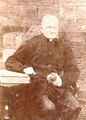 Rev Nicholas Rigby.png 563 × 788; 1.02 MB
-
 Sheep above Woodhill House - geograph.org.uk - 317757.jpg 427 × 640; 43 KB
-
 Sheep on rough grazing - geograph.org.uk - 114501.jpg 640 × 427; 57 KB
-

-
 Three priests from The Missionaries of The Sacred Heart..jpg 296 × 422; 12 KB
-
 Track to Ugthorpe - geograph.org.uk - 2482013.jpg 1,600 × 1,200; 643 KB
-
 Ugthorpe - geograph.org.uk - 220196.jpg 640 × 384; 68 KB
-
 Ugthorpe Entry, Yorkshire, UK.jpeg 946 × 688; 364 KB
-
 Ugthorpe Moor - geograph.org.uk - 5069216.jpg 2,592 × 1,936; 1.82 MB
-
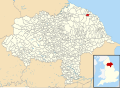 Ugthorpe UK parish locator map.svg 1,425 × 1,037; 4.3 MB
-
 Barton Rigg trig - geograph.org.uk - 100534.jpg 640 × 427; 65 KB
-
 Biggin House - geograph.org.uk - 291669.jpg 640 × 427; 74 KB
-
 Briscoe Farm - geograph.org.uk - 291673.jpg 640 × 427; 62 KB
-
 Briscoe Farm - geograph.org.uk - 291677.jpg 640 × 427; 47 KB
-
 Broom House Lane - geograph.org.uk - 622287.jpg 640 × 480; 85 KB
-
 Broom House Lane - geograph.org.uk - 622293.jpg 640 × 480; 147 KB
-
 Crossroads and ford - geograph.org.uk - 622299.jpg 640 × 480; 93 KB
-
 Egton - junction with A171 - geograph.org.uk - 291681.jpg 640 × 427; 37 KB
-
 Hardale - geograph.org.uk - 359222.jpg 640 × 480; 149 KB
-
 Hardale Beck Ford - geograph.org.uk - 359204.jpg 640 × 480; 128 KB
-
 High Tranmire farm - geograph.org.uk - 123602.jpg 640 × 480; 50 KB
-
 High Tranmire Farm - geograph.org.uk - 700072.jpg 640 × 480; 107 KB
-
 Junction on the A171 - geograph.org.uk - 126804.jpg 640 × 427; 65 KB
-
 Low Whims - geograph.org.uk - 359186.jpg 640 × 480; 116 KB
-
 Low Whims and High Whims - geograph.org.uk - 114498.jpg 640 × 427; 50 KB
-
 Man-made pond - geograph.org.uk - 291679.jpg 640 × 414; 55 KB
-
 Minor road past The Hermitage - geograph.org.uk - 291664.jpg 640 × 427; 38 KB
-
 Moorgate Farm from the East - geograph.org.uk - 189436.jpg 640 × 427; 62 KB
-
 Moorhouse Farm - geograph.org.uk - 291662.jpg 640 × 415; 53 KB
-
 Moorside Farm. - geograph.org.uk - 329107.jpg 640 × 479; 99 KB
-
 Mulgrave Farm - geograph.org.uk - 220188.jpg 640 × 384; 90 KB
-
 Primrose House - geograph.org.uk - 220183.jpg 640 × 384; 82 KB
-
 Road to Ugthorpe - geograph.org.uk - 224970.jpg 640 × 480; 40 KB
-
 Rough Track to Ugthorpe - geograph.org.uk - 291665.jpg 640 × 427; 38 KB
-
 Southgate Cottage - geograph.org.uk - 292093.jpg 640 × 480; 72 KB
-
 Track to Mulgrave Farm - geograph.org.uk - 291670.jpg 640 × 427; 87 KB
-
 Tranmire Moor - geograph.org.uk - 224950.jpg 640 × 383; 46 KB
-
 Travellers Rest Farm - geograph.org.uk - 291671.jpg 640 × 427; 30 KB
-
 Ugthorpe Grange - geograph.org.uk - 291667.jpg 640 × 374; 27 KB
-
 Unclassified Road to Egton Banks - geograph.org.uk - 120476.jpg 640 × 480; 72 KB
-

-
 View down Hardale valley - geograph.org.uk - 699966.jpg 640 × 480; 131 KB


