Category:United Kingdom photographs taken on 2005-04-24
Jump to navigation
Jump to search
Countries of Europe: Belgium · Croatia · Czech Republic · Denmark · France‡ · Germany · Greece · Italy · Netherlands‡ · Poland · Portugal‡ · Romania · Russia‡ · Slovakia · Spain‡ · Sweden · United Kingdom
Specific status: Isle of Man
‡: partly located in Europe
Specific status: Isle of Man
‡: partly located in Europe
| ← | 24 April 2005 | → | ||
| ← | April 2005 | → | ||

United Kingdom photographs taken on 24 April 2005.
Image files should be categorized here automatically using {{taken on}} template. Direct categorisation is also possible, if automatic is impossible.
Media in category "United Kingdom photographs taken on 2005-04-24"
The following 200 files are in this category, out of 342 total.
(previous page) (next page)-
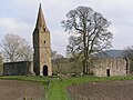
 "New" Church at Edvin Loach - geograph.org.uk - 5667.jpg 640 × 480; 94 KB
-
 319376Brighton.jpg 800 × 600; 224 KB
-
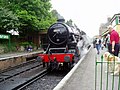 A 'Black Five' at Alresford - geograph.org.uk - 859080.jpg 640 × 480; 112 KB
-
 Abandoned Churchyard - geograph.org.uk - 5546.jpg 640 × 458; 122 KB
-
 Abandoned Cottage - geograph.org.uk - 36599.jpg 480 × 640; 134 KB
-
 Ainsdale - geograph.org.uk - 6086.jpg 640 × 480; 54 KB
-
 Anglers Rest in Bamford - geograph.org.uk - 5583.jpg 640 × 354; 59 KB
-
 At the Sign of the Angel - geograph.org.uk - 379142.jpg 435 × 640; 104 KB
-
 Bagwood Lake - geograph.org.uk - 950155.jpg 640 × 483; 63 KB
-
 Bapton - geograph.org.uk - 5485.jpg 640 × 427; 206 KB
-
 Bapton - geograph.org.uk - 5486.jpg 640 × 427; 51 KB
-
 Barley fields - geograph.org.uk - 23838.jpg 640 × 480; 29 KB
-
 Barnwood - geograph.org.uk - 5523.jpg 640 × 480; 82 KB
-
 Barnwood - geograph.org.uk - 5525.jpg 640 × 480; 81 KB
-
 Long Row - geograph.org.uk - 1211910.jpg 640 × 480; 102 KB
-
 Belper River Gardens - geograph.org.uk - 1211900.jpg 640 × 480; 105 KB
-
 St John's Chapel - geograph.org.uk - 1286316.jpg 640 × 480; 98 KB
-
 Bewdley Station, Severn Valley Railway - geograph.org.uk - 5566.jpg 640 × 480; 90 KB
-
 Bishopthorpe Palace - geograph.org.uk - 11570.jpg 446 × 640; 111 KB
-
 Bit of a climb - geograph.org.uk - 892098.jpg 640 × 427; 62 KB
-
 Black Poplar and Isfield Church - geograph.org.uk - 1528119.jpg 640 × 480; 101 KB
-
 Bluebells in Parkwood - geograph.org.uk - 5615.jpg 640 × 480; 621 KB
-
 Boardhouse Plantation in Spring - geograph.org.uk - 5628.jpg 640 × 480; 597 KB
-
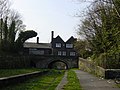
 Borwick Hall Bridge, Lancaster Canal - geograph.org.uk - 6435.jpg 640 × 480; 79 KB
-
 Bridleway in Ettington, Warwickshire.jpg 640 × 480; 99 KB
-
 British Camp Hotel - geograph.org.uk - 5487.jpg 640 × 479; 66 KB
-
 Broughall House - geograph.org.uk - 5447.jpg 640 × 409; 54 KB
-
 Busy A6 Through Belper - geograph.org.uk - 1211909.jpg 640 × 480; 78 KB
-
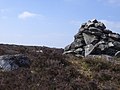
 Cairn above Gordale Scar.jpg 889 × 479; 122 KB
-
 Calverhall - geograph.org.uk - 5456.jpg 640 × 480; 48 KB
-
 Cherry Trees Helensburgh - geograph.org.uk - 363621.jpg 640 × 427; 98 KB
-
 China Shop, Market Place, Belper - geograph.org.uk - 1286301.jpg 480 × 640; 85 KB
-
 Church at East Ilsley - geograph.org.uk - 5601.jpg 640 × 480; 307 KB
-
 Clam Bridge Wycoller - geograph.org.uk - 643571.jpg 640 × 479; 129 KB
-
 Clodock Church - geograph.org.uk - 88190.jpg 640 × 480; 150 KB
-
 Codford St Mary - geograph.org.uk - 5496.jpg 640 × 427; 260 KB
-
 The Clock Tower, Colwall - geograph.org.uk - 6045.jpg 640 × 479; 108 KB
-
 Colwall Green from the south - geograph.org.uk - 6055.jpg 640 × 485; 112 KB
-
 Corra Common Farm - geograph.org.uk - 5458.jpg 640 × 480; 87 KB
-
 Country Park Halt - geograph.org.uk - 5558.jpg 640 × 480; 79 KB
-
 Cullen Beach and Golf Course - geograph.org.uk - 101416.jpg 640 × 480; 83 KB
-

-
 Dogs wanting to work - geograph.org.uk - 892102.jpg 640 × 427; 70 KB
-
 East Ilsley Village Centre - geograph.org.uk - 5602.jpg 640 × 480; 374 KB
-
 East Ilsley, Berkshire.jpg 640 × 480; 468 KB
-
 Entrance to Golitha Woods - geograph.org.uk - 6061.jpg 474 × 544; 87 KB
-
 Falls Foot Ingleborough - geograph.org.uk - 21176.jpg 640 × 480; 129 KB
-
 All Saints, Farnborough - geograph.org.uk - 5631.jpg 640 × 480; 494 KB
-
 Farnborough Village Pond - geograph.org.uk - 5633.jpg 640 × 480; 526 KB
-
 Farnham - geograph.org.uk - 5407.jpg 640 × 397; 52 KB
-
 Field next to Woodacre Great wood - geograph.org.uk - 5515.jpg 640 × 480; 97 KB
-
 Fields near Ingleby Greenhow - geograph.org.uk - 19205.jpg 640 × 480; 76 KB
-
 Fishing boats at Ullapool - geograph.org.uk - 241934.jpg 640 × 425; 109 KB
-
 Fishing Lake at Dormston - geograph.org.uk - 5630.jpg 640 × 480; 110 KB
-
 Fleet Pond from the north east - geograph.org.uk - 11455.jpg 640 × 480; 75 KB
-
 Footbridge over the road, Barton Court - geograph.org.uk - 6056.jpg 640 × 479; 103 KB
-
 Footpath at Parkwood - geograph.org.uk - 5614.jpg 640 × 480; 471 KB
-
 Footpath near Kingsbridge picnic area. - geograph.org.uk - 5619.jpg 640 × 426; 106 KB
-
 Footpath through Benton Woods - geograph.org.uk - 845027.jpg 640 × 424; 137 KB
-
 Footpath through Boardhouse Plantation - geograph.org.uk - 5629.jpg 640 × 480; 583 KB
-
 Ford across Guilsfield Brook - geograph.org.uk - 755461.jpg 640 × 480; 118 KB
-
 Frensham - geograph.org.uk - 5408.jpg 640 × 381; 36 KB
-
 Ghyll Manor Hotel, Rusper, West Sussex - geograph.org.uk - 24531.jpg 640 × 426; 37 KB
-
 Gordale Beck.jpg 2,048 × 1,536; 1.85 MB
-
 Gordale Scar from above.jpg 2,048 × 1,536; 765 KB
-
 Gordale Scar silhouette 2.jpg 1,536 × 2,048; 1.02 MB
-
 Gordale Scar silhouette.jpg 1,536 × 2,048; 785 KB
-
 Grindleford Sir William Hotel 005579 75384d5d 213x160.jpg 640 × 413; 55 KB
-
 Grizedale Brook - geograph.org.uk - 786244.jpg 640 × 480; 153 KB
-
 Grouse on Moorland Above Rosedale - geograph.org.uk - 985432.jpg 640 × 512; 104 KB
-

-
 Halton Weir, River Lune - geograph.org.uk - 6449.jpg 640 × 480; 93 KB
-
 Hampton Loade Ferry.jpg 640 × 480; 72 KB
-
 Hampton Loade Station - geograph.org.uk - 5764.jpg 640 × 480; 69 KB
-
 Helmdon churchyard from the church tower - geograph.org.uk - 342671.jpg 640 × 640; 139 KB
-
 Holme Wood - geograph.org.uk - 786245.jpg 640 × 480; 148 KB
-
 Ightfield Church - geograph.org.uk - 5454.jpg 640 × 480; 81 KB
-
 Ingleborough.jpg 640 × 480; 77 KB
-
 Inside Gordale Scar.jpg 2,048 × 1,536; 1.72 MB
-
 Jubilee scout hut at Guilsfield - geograph.org.uk - 755454.jpg 640 × 480; 77 KB
-
 St Mary's Church, Kington, Herefordshire - geograph.org.uk - 10954.jpg 640 × 480; 152 KB
-
 Kington.jpg 640 × 480; 128 KB
-
 Kinver Lock Cottage - panoramio.jpg 2,048 × 1,536; 1.22 MB
-
 Lacock Abbey - geograph.org.uk - 379161.jpg 480 × 640; 160 KB
-
 Lady Howard de Walden's Mansion. - geograph.org.uk - 5516.jpg 640 × 479; 67 KB
-
 Liathach - Stùc a' Choire Dhuibh Bhig - geograph.org.uk - 987556.jpg 640 × 427; 198 KB
-
 Limestone pavement at Malham Cove.jpg 2,048 × 1,536; 2.01 MB
-
 Loch an Athain - geograph.org.uk - 103545.jpg 640 × 480; 76 KB
-

-
 Long Cairn - geograph.org.uk - 280440.jpg 640 × 480; 138 KB
-

-
 Looking down Malham Cove.jpg 2,048 × 1,536; 2.07 MB
-
-
 M62, Irlam, Salford - geograph.org.uk - 6161.jpg 640 × 480; 105 KB
-
 Malham Beck from Malham Cove.jpg 671 × 1,171; 240 KB
-
 Malham countryside.jpg 2,048 × 1,536; 1.42 MB
-
 Malham Cove 2.jpg 2,048 × 1,536; 1.65 MB
-
 Malham Cove 3.jpg 2,048 × 1,536; 1.24 MB
-
 Malham Cove.jpg 2,048 × 1,536; 1.62 MB
-
 Malham Tarn 2.jpg 1,864 × 673; 557 KB
-
 Malham Tarn 3.jpg 2,048 × 601; 464 KB
-
 Malham Tarn.jpg 1,600 × 1,002; 781 KB
-
 Mere - geograph.org.uk - 5481.jpg 640 × 427; 231 KB
-
 Mere - geograph.org.uk - 5483.jpg 619 × 404; 213 KB
-
 Midway Truck stop - geograph.org.uk - 5440.jpg 640 × 480; 52 KB
-
 Nether Kellet Village Green - geograph.org.uk - 5513.jpg 640 × 480; 86 KB
-
 Newbury, New Vodafone Headquarters - geograph.org.uk - 5590.jpg 640 × 480; 350 KB
-
 Northwood Halt - geograph.org.uk - 5533.jpg 640 × 480; 82 KB
-
 Old cottages, Cove Bay - geograph.org.uk - 11460.jpg 640 × 480; 58 KB
-
 On the SW ridge of Bla Bheinn - geograph.org.uk - 103543.jpg 640 × 480; 84 KB
-

-
 Path towards Blaven - geograph.org.uk - 103540.jpg 640 × 480; 65 KB
-

-
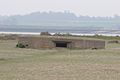 Pill Box on Mersea Island - geograph.org.uk - 5347.jpg 640 × 426; 40 KB
-

-
 Pillerton Hersey ford - geograph.org.uk - 18384.jpg 640 × 480; 179 KB
-
-
 Red deer stags on Cruinn a'Bheinn - geograph.org.uk - 5702.jpg 640 × 457; 42 KB
-
 Restenneth Priory (geograph 13755).jpg 640 × 480; 154 KB
-
 Ridge and Furrow Field with Sheep - geograph.org.uk - 5542.jpg 640 × 480; 68 KB
-
 River Keer, near Capernwray - geograph.org.uk - 6442.jpg 640 × 480; 114 KB
-
 Roundabout - geograph.org.uk - 5445.jpg 640 × 440; 67 KB
-
 Running Track, Valley Road, Worksop - geograph.org.uk - 175451.jpg 640 × 480; 72 KB
-
 Sblondon-elecgraffiti05.jpg 974 × 1,290; 430 KB
-
 St Peter's Church, Scorton.jpg 640 × 480; 92 KB
-
 Severn Centre, Highley.jpg 640 × 480; 35 KB
-
 Shavington Park Lodge. - geograph.org.uk - 5461.jpg 640 × 441; 87 KB
-
 Shoreline at Crombie Point - geograph.org.uk - 37307.jpg 640 × 480; 94 KB
-
 Site of Sheep Market, East Ilsley - geograph.org.uk - 5603.jpg 640 × 480; 538 KB
-
 Smithy Clough - geograph.org.uk - 657056.jpg 640 × 479; 70 KB
-
 Smithy Clough - geograph.org.uk - 657077.jpg 640 × 479; 82 KB
-
 Bridge over Sonning Cutting - geograph.org.uk - 5429.jpg 640 × 487; 94 KB
-
 Spring Tavern in Glossop - geograph.org.uk - 5587.jpg 640 × 530; 70 KB
-
 Sprotbrough Bridge and Lock - geograph.org.uk - 583843.jpg 640 × 427; 108 KB
-
 Sprotbrough Lock - geograph.org.uk - 583836.jpg 640 × 427; 88 KB
-
 St Cuthbert's Church, Over Kellet - geograph.org.uk - 6444.jpg 640 × 480; 104 KB
-
 St Michael's Coxwold - geograph.org.uk - 8392.jpg 474 × 640; 119 KB
-
 Standard 'Class 5' at Alton - geograph.org.uk - 859066.jpg 640 × 480; 91 KB
-
 Stockton - geograph.org.uk - 5488.jpg 640 × 427; 316 KB
-
 Stockton - geograph.org.uk - 5491.jpg 640 × 427; 297 KB
-
 Sugar Loaf Tunnel.jpg 640 × 480; 186 KB
-
 Tatham Wife Hole - geograph.org.uk - 21172.jpg 640 × 480; 146 KB
-

-
 The bridge at Sprotbrough - geograph.org.uk - 583839.jpg 640 × 427; 87 KB
-
 The Carrs, Pity Me, Durham UK - geograph.org.uk - 62188.jpg 640 × 480; 129 KB
-
 The Castle - geograph.org.uk - 5433.jpg 640 × 480; 78 KB
-
 The Harrow, West Ilsley - geograph.org.uk - 5648.jpg 640 × 480; 441 KB
-
 The Lodge and Gates to Blackmore House - geograph.org.uk - 5450.jpg 640 × 479; 95 KB
-
 The Mains, Torridon - geograph.org.uk - 987545.jpg 640 × 427; 183 KB
-
 The Old Grammar School - geograph.org.uk - 5443.jpg 640 × 480; 65 KB
-
 The Old Methodist School Rosemary Lane - geograph.org.uk - 1030112.jpg 640 × 480; 145 KB
-
 The Old School, Hanley Castle - geograph.org.uk - 5465.jpg 640 × 479; 66 KB
-

-
 The Pump House, Hanley Castle - geograph.org.uk - 5468.jpg 640 × 479; 61 KB
-
 The Ridge, Bury Down - geograph.org.uk - 5611.jpg 640 × 480; 407 KB
-
 The Staffordshire and Worcestershire Canal Kinver - panoramio.jpg 2,048 × 1,536; 1.21 MB
-
 The SW ridge of Bla Bheinn - geograph.org.uk - 103542.jpg 640 × 480; 61 KB
-
 The Vine Kinver - panoramio.jpg 2,048 × 1,536; 1.23 MB
-
 The White Cottage - geograph.org.uk - 5435.jpg 640 × 480; 72 KB
-
 Thingwall hall.jpg 640 × 480; 60 KB
-
 Toirbheartan 957694.jpg 640 × 390; 70 KB
-
 Top of Malham Cove.jpg 2,048 × 1,536; 1.5 MB
-
 Towards Ardgeith - geograph.org.uk - 9783.jpg 640 × 313; 165 KB
-
 Transport Museum - geograph.org.uk - 153404.jpg 640 × 480; 97 KB
-
 Trellwyn-fach maenhir - geograph.org.uk - 200600.jpg 640 × 480; 88 KB
-
 Trig Point of Bla Bheinn - geograph.org.uk - 103544.jpg 640 × 635; 136 KB
-
 Vintage coach at Alresford - geograph.org.uk - 859075.jpg 640 × 480; 109 KB
-
 Walkers Arms - geograph.org.uk - 313403.jpg 640 × 480; 112 KB
-
 Wantisden - Church of St John the Baptist.jpg 640 × 480; 65 KB
-
 War Memorial - geograph.org.uk - 5451.jpg 640 × 480; 79 KB
-
 Weir on River Derwent near Kirkham Abbey - geograph.org.uk - 986456.jpg 640 × 617; 122 KB
-
 West Derby railway station in 2005.jpg 640 × 480; 61 KB
-
 West Highland Way and oak woods - geograph.org.uk - 5697.jpg 640 × 480; 122 KB
-
 All Saints , West Ilsley - geograph.org.uk - 5594.jpg 640 × 480; 493 KB
-
 West Ilsley Stables - geograph.org.uk - 5610.jpg 640 × 480; 376 KB
-
 West Ilsley, Berkshire.jpg 640 × 480; 522 KB
-
 West Malvern Church - geograph.org.uk - 5514.jpg 640 × 479; 96 KB
-
 West Malvern School - geograph.org.uk - 5518.jpg 640 × 479; 123 KB
-
 Whitchurch Entrance - geograph.org.uk - 5442.jpg 640 × 435; 70 KB
-
 White Craig cairn - geograph.org.uk - 64237.jpg 640 × 480; 123 KB
-
 Wilkesley - geograph.org.uk - 5471.jpg 640 × 480; 89 KB
-
 Windmill Hill nr East Ilsley - geograph.org.uk - 5605.jpg 640 × 480; 484 KB
-
 WW2 Control Tower - geograph.org.uk - 5438.jpg 640 × 335; 38 KB
-
 Wych Elm in Bloom - geograph.org.uk - 1277831.jpg 640 × 480; 96 KB
-
 Wycoller - geograph.org.uk - 655740.jpg 640 × 479; 116 KB
-
 Wycoller Beck - geograph.org.uk - 659075.jpg 640 × 479; 134 KB
-
 Wycoller Beck - geograph.org.uk - 659100.jpg 640 × 479; 92 KB
-
 Wycoller Clam Bridge - geograph.org.uk - 1180010.jpg 640 × 479; 138 KB
-
 Wycoller Hall - geograph.org.uk - 640757.jpg 640 × 479; 112 KB
-
 Wycoller village - geograph.org.uk - 659109.jpg 640 × 461; 114 KB
-
 Yellow Rape Field, Whitewater Common - geograph.org.uk - 299167.jpg 640 × 480; 111 KB
-
 Aldby Farm Yard - geograph.org.uk - 301873.jpg 640 × 480; 139 KB
-
 Another Cottage - geograph.org.uk - 5473.jpg 640 × 480; 95 KB
-
 At play in Sutton Park - geograph.org.uk - 14352.jpg 640 × 426; 129 KB
-
 Avenue to Folly Farm - geograph.org.uk - 5635.jpg 640 × 480; 97 KB
-
 Blaen-waun, Cotoneaster-covered ruin - geograph.org.uk - 200631.jpg 640 × 480; 90 KB
-

-
 Button Oak - geograph.org.uk - 5529.jpg 640 × 480; 39 KB
-
 Button Oak - geograph.org.uk - 5531.jpg 640 × 480; 48 KB
-
 Cailness basin - geograph.org.uk - 5700.jpg 640 × 480; 47 KB


.jpg)


