Category:United Kingdom photographs taken on 2007-06-12
Jump to navigation
Jump to search
Countries of Europe: Belgium · Bosnia and Herzegovina · Czech Republic · Finland · France‡ · Germany · Hungary · Republic of Ireland · Italy · Kazakhstan‡ · Latvia · Netherlands‡ · Norway · Poland · Portugal‡ · Russia‡ · Slovakia · Spain‡ · Sweden · Switzerland · Turkey‡ · Ukraine · United Kingdom
‡: partly located in Europe
‡: partly located in Europe
| ← | 12 June 2007 | → | ||
| ← | June 2007 | → | ||

United Kingdom photographs taken on 12 June 2007.
Image files should be categorized here automatically using {{taken on}} template. Direct categorisation is also possible, if automatic is impossible.
Subcategories
This category has the following 3 subcategories, out of 3 total.
Media in category "United Kingdom photographs taken on 2007-06-12"
The following 200 files are in this category, out of 527 total.
(previous page) (next page)-
 "Fox and Hounds" Aspatria - geograph.org.uk - 524791.jpg 640 × 480; 117 KB
-
 "Letters Inn" Aspatria - geograph.org.uk - 524797.jpg 640 × 480; 102 KB
-
 "Sun Inn" Aspatria - geograph.org.uk - 524803.jpg 640 × 480; 102 KB
-
 "The Grapes Hotel" Aspatria - geograph.org.uk - 524799.jpg 640 × 480; 107 KB
-
 A bridge into the shipyard at Whitby - geograph.org.uk - 467873.jpg 640 × 480; 94 KB
-

-
 Aberdeen Harbour - geograph.org.uk - 608133.jpg 640 × 426; 75 KB
-
 All Saints Square. - geograph.org.uk - 464209.jpg 640 × 480; 82 KB
-
 All Saints. Rotherham - geograph.org.uk - 464202.jpg 640 × 480; 71 KB
-
 Ansells End, Whiteway Bottom - geograph.org.uk - 465948.jpg 640 × 480; 91 KB
-
 At Chattafin - geograph.org.uk - 471522.jpg 640 × 480; 126 KB
-
 B3217 - geograph.org.uk - 465244.jpg 640 × 480; 99 KB
-
 Bark Barn - geograph.org.uk - 467233.jpg 640 × 480; 102 KB
-
 Barn at Winder - geograph.org.uk - 467264.jpg 640 × 480; 158 KB
-
 Beinn Liath Mhor - geograph.org.uk - 1006743.jpg 640 × 471; 79 KB
-
 Beinn Liath Mhor - geograph.org.uk - 1127987.jpg 640 × 461; 71 KB
-
 Belfast Opera - panoramio.jpg 2,592 × 1,944; 2.86 MB
-
 Belfast stadhuis - panoramio.jpg 2,592 × 1,944; 2.6 MB
-
 Benbecula Loch Dubh Mor.jpg 640 × 480; 66 KB
-
 Benbecula Loch na Craoibhe Bige 1.jpg 640 × 480; 116 KB
-
 Bendish, Public Highway - geograph.org.uk - 464550.jpg 640 × 480; 91 KB
-
 Bendish, Public Highway - geograph.org.uk - 464767.jpg 640 × 480; 87 KB
-
 BF Stn sign.jpg 2,848 × 2,132; 1.06 MB
-
-
 Blackmore End, Kimpton Road - geograph.org.uk - 466030.jpg 640 × 480; 108 KB
-
 Bondwood Farm - geograph.org.uk - 468220.jpg 640 × 443; 78 KB
-
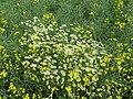
 Bramble (Rubus fruticosus) - geograph.org.uk - 479475.jpg 640 × 480; 77 KB
-
 Bridge 168, Grand Union Canal, Watford - geograph.org.uk - 464942.jpg 640 × 427; 110 KB
-
 Bridge, Kennet & Avon Canal. - panoramio.jpg 2,816 × 2,112; 3.8 MB
-
 Bridgegate - geograph.org.uk - 464212.jpg 640 × 480; 88 KB
-
 Brook near Moat Farm Godington - geograph.org.uk - 816151.jpg 640 × 425; 96 KB
-
 Cottages, Mill Road, Buckden - geograph.org.uk - 466286.jpg 640 × 480; 84 KB
-
 Bursledon Brickworks Museum - geograph.org.uk - 464782.jpg 640 × 427; 205 KB
-
 Callender 13352688824 o.jpg 1,600 × 1,180; 1,003 KB
-
 Carradoo Glebe - geograph.org.uk - 466868.jpg 640 × 479; 70 KB
-
 Cattle Grid at Honey Hill Farm - geograph.org.uk - 466261.jpg 640 × 480; 76 KB
-
 Chamomile amidst the rape - geograph.org.uk - 465356.jpg 640 × 530; 188 KB
-
 Channing Way - Fountain - geograph.org.uk - 465288.jpg 493 × 640; 86 KB
-
 Chantry of the Holy Cross. - geograph.org.uk - 464220.jpg 640 × 480; 75 KB
-
 Chapel Farm - geograph.org.uk - 464462.jpg 640 × 480; 72 KB
-
 Chattafin - geograph.org.uk - 465030.jpg 640 × 480; 93 KB
-
 Church and church yard, Whitby - geograph.org.uk - 758919.jpg 640 × 427; 46 KB
-
 Clathrina lacunosa 111198021.jpg 2,000 × 1,339; 845 KB
-
 Cliffs, Sgòrr Reidh - geograph.org.uk - 761786.jpg 640 × 480; 89 KB
-
 Coal Park Lane, Swanwick - geograph.org.uk - 464753.jpg 427 × 640; 126 KB
-
 Cobbled Path towards Bank Farm - geograph.org.uk - 464515.jpg 480 × 640; 139 KB
-
 Common Poppies (Papaver rhoeas) - geograph.org.uk - 466273.jpg 640 × 480; 157 KB
-

-
 Constitution hill1.jpg 600 × 800; 522 KB
-
 Cooks Cottage, Henrietta Street - geograph.org.uk - 467894.jpg 640 × 480; 105 KB
-
 Cross in Iddesleigh churchyard - geograph.org.uk - 469290.jpg 640 × 478; 95 KB
-
 Croxley station, Metropolitan line - geograph.org.uk - 465077.jpg 640 × 427; 84 KB
-
 Cublington Motte - The Beacon - geograph.org.uk - 465384.jpg 640 × 475; 185 KB
-
 Cunningham Brook - geograph.org.uk - 464507.jpg 480 × 640; 148 KB
-
 Dismantled Railway - geograph.org.uk - 1717490.jpg 2,048 × 1,360; 2.49 MB
-
 Disused Warehouse - geograph.org.uk - 464140.jpg 640 × 480; 70 KB
-
 Dolesden Lane - geograph.org.uk - 470629.jpg 640 × 480; 155 KB
-
 Drive to Creeds Farm. - geograph.org.uk - 466081.jpg 640 × 480; 70 KB
-
 Drumbroarty - geograph.org.uk - 466896.jpg 640 × 479; 82 KB
-
 Dun Grugaig - geograph.org.uk - 487759.jpg 640 × 480; 132 KB
-
 Dundee Ice Arena - geograph.org.uk - 608076.jpg 640 × 426; 76 KB
-
 St Michael and All Angels - geograph.org.uk - 816141.jpg 640 × 425; 96 KB
-
 Effingham Street - geograph.org.uk - 464188.jpg 640 × 480; 102 KB
-
 Entrance - geograph.org.uk - 467247.jpg 640 × 480; 93 KB
-
 Entrance to Shalstone Grounds Farm - geograph.org.uk - 465162.jpg 640 × 532; 124 KB
-
 Evening sun at Pixton - geograph.org.uk - 469447.jpg 640 × 480; 100 KB
-
 Exbourne Methodist Church - geograph.org.uk - 467039.jpg 640 × 480; 79 KB
-
 Exmoor, Woolcombe Farm - geograph.org.uk - 464897.jpg 640 × 427; 232 KB
-
 Fairview Farm - geograph.org.uk - 468265.jpg 640 × 474; 109 KB
-
-
 Farm Road off A96 - geograph.org.uk - 470251.jpg 640 × 480; 116 KB
-
 Farming, Turville - geograph.org.uk - 470533.jpg 640 × 480; 165 KB
-
 Farmland, Turville Park - geograph.org.uk - 470738.jpg 640 × 480; 127 KB
-
 Farmland, Turville Park - geograph.org.uk - 470752.jpg 640 × 480; 152 KB
-
 Farringdon station - geograph.org.uk - 464726.jpg 640 × 427; 93 KB
-
 Field beside Exbourne Footpath 4 - geograph.org.uk - 466128.jpg 640 × 480; 115 KB
-
 Field beside the Okement - geograph.org.uk - 465246.jpg 640 × 480; 105 KB
-
 Field by lane to Pixton - geograph.org.uk - 469429.jpg 640 × 480; 122 KB
-
 Field of barley near Barwick - geograph.org.uk - 465934.jpg 640 × 480; 99 KB
-
 Fields near Barwick - geograph.org.uk - 469723.jpg 640 × 480; 76 KB
-
 Fishing boats at Foremark.jpg 640 × 480; 93 KB
-
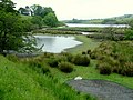
 Fishing on Foremark Reservoir - geograph.org.uk - 468203.jpg 640 × 324; 75 KB
-
 Footbridge in Swanwick Wood - geograph.org.uk - 464688.jpg 427 × 640; 224 KB
-
 Footdee - geograph.org.uk - 465877.jpg 640 × 409; 53 KB
-

-
-
 Footpath through Swanwick Wood - geograph.org.uk - 464674.jpg 427 × 640; 259 KB
-
 Footpath, rape and chamomile - geograph.org.uk - 465353.jpg 640 × 480; 186 KB
-
 Foremark outfall.jpg 640 × 480; 78 KB
-
 Foremark pumping station.jpg 640 × 454; 111 KB
-
 Foremark Reservoir dam and outfall - geograph.org.uk - 466029.jpg 640 × 480; 80 KB
-
 Foremark Reservoir dam from below - geograph.org.uk - 468272.jpg 640 × 400; 90 KB
-

-
 From Iddesleigh Bridge - geograph.org.uk - 469230.jpg 640 × 480; 96 KB
-
 Furnishing Store - geograph.org.uk - 1115526.jpg 640 × 404; 79 KB
-

-
 Gateway to field near Exbourne - geograph.org.uk - 469049.jpg 640 × 480; 88 KB
-

-
-
 Gone to earth - geograph.org.uk - 465399.jpg 640 × 480; 197 KB
-

-
 Gun emplacement, Savernake - geograph.org.uk - 464537.jpg 640 × 480; 201 KB
-

-
 Interior of St Mary, Harrington - geograph.org.uk - 465125.jpg 480 × 640; 49 KB
-
 Hedges and Cottage - geograph.org.uk - 464534.jpg 640 × 480; 87 KB
-
 Heli-pad Lancaster Infirmary - geograph.org.uk - 467064.jpg 640 × 480; 102 KB
-
 Honey Hill Farm. - geograph.org.uk - 466242.jpg 640 × 480; 83 KB
-
 Horse Sculpture-Eden Project - geograph.org.uk - 718320.jpg 640 × 405; 70 KB
-
 Horses grazing near Fawley - geograph.org.uk - 464962.jpg 640 × 480; 49 KB
-
 Hot Property - geograph.org.uk - 476260.jpg 640 × 480; 87 KB
-
 Houses in Coal Park Lane, Swanwick - geograph.org.uk - 464761.jpg 640 × 427; 186 KB
-
 Houses in Swanwick Wood - geograph.org.uk - 464666.jpg 640 × 427; 205 KB
-
 Hyde Seals - geograph.org.uk - 1011318.jpg 481 × 640; 127 KB
-
 Hyde Seals - geograph.org.uk - 1011336.jpg 640 × 481; 144 KB
-
 Hyde Seals Information - geograph.org.uk - 1078833.jpg 640 × 542; 156 KB
-
 Iddesleigh church - geograph.org.uk - 469322.jpg 480 × 640; 95 KB
-
 Iddesleigh Cross - geograph.org.uk - 469355.jpg 640 × 480; 107 KB
-
 Iddesleigh Footpath 10 - geograph.org.uk - 465267.jpg 480 × 640; 149 KB
-
 Iddesleigh Waste Water Treatment Works - geograph.org.uk - 465260.jpg 640 × 480; 116 KB
-
-

-
 Intake Bridge over Sleightholme Beck - geograph.org.uk - 623661.jpg 640 × 480; 129 KB
-
 Interior of St Mary, Harrington - geograph.org.uk - 465122.jpg 640 × 480; 69 KB
-
 Jewish Chapel - Scholemoor Cemetery - geograph.org.uk - 465283.jpg 611 × 640; 108 KB
-
 Jewish Chapel - Scholemoor Cemetery - geograph.org.uk - 465284.jpg 560 × 640; 69 KB
-
 Jurassic Way enters the Rape. - geograph.org.uk - 466256.jpg 640 × 480; 88 KB
-
 Kennett & Avon Canal - panoramio.jpg 2,816 × 2,112; 2.38 MB
-
 Kimpton, Claggy Bottom - geograph.org.uk - 465973.jpg 640 × 480; 94 KB
-
 Kimpton, High Street - geograph.org.uk - 465997.jpg 640 × 480; 79 KB
-
 Kimpton, The White Horse Public House - geograph.org.uk - 465988.jpg 640 × 480; 89 KB
-

-
 Lane approaching Chattafin - geograph.org.uk - 465007.jpg 640 × 480; 137 KB
-
 Lane at Oak Dene - geograph.org.uk - 465250.jpg 640 × 480; 125 KB
-
 Lane between Hedges - geograph.org.uk - 464554.jpg 640 × 480; 100 KB
-
 Lane from New Bridge - geograph.org.uk - 469211.jpg 640 × 487; 87 KB
-
 Lane to Exbourne - geograph.org.uk - 466177.jpg 480 × 640; 89 KB
-
 Lane to Woodhall - geograph.org.uk - 469058.jpg 480 × 640; 97 KB
-
 Let's get ready to rumble - geograph.org.uk - 465317.jpg 640 × 480; 93 KB
-
 St James's church, Little Paxton - geograph.org.uk - 466215.jpg 640 × 480; 123 KB
-
 Old Church House - geograph.org.uk - 467249.jpg 640 × 480; 101 KB
-
 Llandudno Promenade Bandstand - geograph.org.uk - 474228.jpg 640 × 480; 43 KB
-
 Loch a' Mhuirt - geograph.org.uk - 472781.jpg 640 × 480; 65 KB
-
 Locomotive arriving at Whitby Station - geograph.org.uk - 758887.jpg 640 × 427; 55 KB
-
 Loosedon Cross - geograph.org.uk - 465953.jpg 640 × 480; 98 KB
-
 Lye Valley Nature Reserve - geograph.org.uk - 573132.jpg 640 × 480; 143 KB
-

-
 M6 - geograph.org.uk - 467071.jpg 640 × 480; 103 KB
-

-
 Mayweed in the Rape. - geograph.org.uk - 466236.jpg 640 × 480; 200 KB
-
 More cows at Oghill - geograph.org.uk - 466903.jpg 640 × 479; 77 KB
-
 NATS London Area Control Centre, Swanwick - geograph.org.uk - 464744.jpg 640 × 414; 156 KB
-
-
 New Plantation - geograph.org.uk - 464293.jpg 640 × 480; 60 KB
-
 New runway, Colonsay airport.jpg 640 × 430; 96 KB
-
 Nice pub at Charlestown - geograph.org.uk - 691703.jpg 640 × 401; 71 KB
-
 North Breakwater - geograph.org.uk - 608128.jpg 640 × 426; 90 KB
-
 North Met Pit, Cheshunt Gravel Pits - geograph.org.uk - 465961.jpg 640 × 480; 65 KB
-
 North Molton, above Coombeshead - geograph.org.uk - 464846.jpg 640 × 427; 202 KB
-
 North Molton, below Coombeshead - geograph.org.uk - 464842.jpg 640 × 427; 174 KB
-
 North Molton, by Darlick Corner - geograph.org.uk - 464894.jpg 640 × 427; 198 KB
-
 North Molton, by High Bullen Cross - geograph.org.uk - 464839.jpg 640 × 427; 211 KB
-
 North Molton, by Longstone Wells - geograph.org.uk - 464872.jpg 640 × 427; 141 KB
-
 North Molton, gated lane - geograph.org.uk - 464877.jpg 640 × 427; 201 KB
-
 North Molton, Higher South Radway - geograph.org.uk - 464859.jpg 640 × 427; 196 KB
-
 North Molton, lane near Coombeshead - geograph.org.uk - 464847.jpg 640 × 427; 292 KB
-
 North Molton, moorland lane - geograph.org.uk - 464880.jpg 640 × 427; 146 KB
-
 North Molton, near Radworthy Down - geograph.org.uk - 464856.jpg 640 × 427; 186 KB
-
 North Molton, on North Molton Ridge - geograph.org.uk - 464889.jpg 640 × 427; 229 KB
-
 North Molton, South Wood - geograph.org.uk - 464851.jpg 427 × 640; 339 KB
-
 North Molton, towards Longstone Wells - geograph.org.uk - 464885.jpg 640 × 427; 160 KB
-

-
 North Molton, towards Tabor Hill - geograph.org.uk - 464866.jpg 640 × 427; 173 KB
-
 Oakengrove - geograph.org.uk - 464228.jpg 640 × 480; 186 KB
-
 Obelisk war memorial, Euston Square - geograph.org.uk - 1548696.jpg 512 × 640; 128 KB
-

-
 Okement valley - geograph.org.uk - 464930.jpg 640 × 480; 103 KB
-
 Okement valley at Shilstone - geograph.org.uk - 464960.jpg 640 × 480; 136 KB
-
 Old railway track heading to Chetwode - geograph.org.uk - 716277.jpg 640 × 425; 70 KB
-
 Old traffic sign near Hele Mill. - geograph.org.uk - 468545.jpg 640 × 480; 135 KB
-
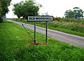 Old Woodhall - geograph.org.uk - 464495.jpg 640 × 464; 86 KB
-
-
 Open Bridge at Whitby - geograph.org.uk - 467674.jpg 640 × 480; 62 KB
-
 Opening of the Jurassic Way. - geograph.org.uk - 465705.jpg 480 × 640; 91 KB
-

-
 Pair of Eurasian siskins (Carduelis pinus) - Flickr - S. Rae.jpg 2,185 × 2,019; 1.76 MB
-
 Palm Trees and KwikSave - geograph.org.uk - 1011327.jpg 640 × 481; 120 KB
-
 Papadil Pinnacle - geograph.org.uk - 761811.jpg 640 × 480; 54 KB
-
 Pasture and mown hay, Turville Court - geograph.org.uk - 470582.jpg 640 × 480; 137 KB
-
 Path to Honey Hill Farm. - geograph.org.uk - 466222.jpg 640 × 480; 93 KB
-
-
 Pixton - geograph.org.uk - 469670.jpg 640 × 472; 104 KB
-
 Plaque - geograph.org.uk - 479049.jpg 640 × 480; 83 KB
-
 Poppies in the field - geograph.org.uk - 716273.jpg 640 × 425; 84 KB
-
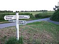
 Precise Directions - geograph.org.uk - 464517.jpg 640 × 480; 115 KB
-
 Pynda - geograph.org.uk - 465253.jpg 640 × 480; 91 KB
-

-
 St Peter's Church, Quernmore.jpg 594 × 446; 150 KB
-
 The Parish Church of St Peter, Quernmore - geograph.org.uk - 467271.jpg 630 × 472; 138 KB
-
 Raised beach at Uragaig - geograph.org.uk - 466455.jpg 640 × 430; 96 KB
-
 Rape field without flowers - geograph.org.uk - 465350.jpg 640 × 480; 191 KB


_-_geograph.org.uk_-_479475.jpg)


_-_geograph.org.uk_-_466273.jpg)


_-_Flickr_-_S._Rae.jpg)


