Category:United Kingdom photographs taken on 2007-09-15
Jump to navigation
Jump to search
Countries of Europe: Belgium · Bulgaria · Croatia · Czech Republic · Denmark · Estonia · Finland · France‡ · Germany · Greece · Hungary · Republic of Ireland · Italy · Netherlands‡ · Norway · Poland · Portugal‡ · Russia‡ · Serbia · Spain‡ · Sweden · Switzerland · Ukraine · United Kingdom
‡: partly located in Europe
‡: partly located in Europe
| ← | 15 September 2007 | → | ||
| ← | September 2007 | → | ||

United Kingdom photographs taken on 15 September 2007.
Image files should be categorized here automatically using {{taken on}} template. Direct categorisation is also possible, if automatic is impossible.
Subcategories
This category has the following 3 subcategories, out of 3 total.
L
S
Media in category "United Kingdom photographs taken on 2007-09-15"
The following 200 files are in this category, out of 1,469 total.
(previous page) (next page)-
 "Blackpool" - geograph.org.uk - 557902.jpg 640 × 480; 104 KB
-
 "Howards End" - geograph.org.uk - 558062.jpg 640 × 477; 114 KB
-
 'Property with potential....', Willersley - geograph.org.uk - 560898.jpg 640 × 426; 116 KB
-
 'Sortalight R' - Flickr - exfordy.jpg 2,949 × 1,948; 4.32 MB
-
 1960 Lotus 7 - Flickr - exfordy.jpg 3,150 × 2,109; 4.39 MB
-
 1978 Caterham 7 Twin Cam - Flickr - exfordy.jpg 3,084 × 2,107; 4.19 MB
-
 1982 Caterham 7 Silver Jubilee edition - Flickr - exfordy (1).jpg 2,991 × 1,705; 3.46 MB
-
 1982 Caterham 7 Silver Jubilee edition - Flickr - exfordy.jpg 2,820 × 2,152; 4.29 MB
-
 1985 Caterham De Dion Super Sprint - Flickr - exfordy.jpg 2,913 × 2,064; 3.79 MB
-
 1986 Caterham 1700 Super Sprint De Dion (Exfordy), front.jpg 2,109 × 2,014; 3.1 MB
-
 19th Century Cardiff Castle - geograph.org.uk - 558500.jpg 640 × 480; 113 KB
-
 2007 at Reading station - The Three Guineas.jpg 1,366 × 1,024; 358 KB
-
 33rd Avenue - geograph.org.uk - 555823.jpg 640 × 452; 190 KB
-
 A 2 litre Vauxhall engine presumably - Flickr - exfordy.jpg 3,504 × 2,336; 3.82 MB
-
 A beautiful Viper Blue Roadsport SV - Flickr - exfordy.jpg 3,504 × 2,336; 4 MB
-
 A cistern - geograph.org.uk - 965136.jpg 640 × 480; 167 KB
-
 A crop of maize ready to be harvested - geograph.org.uk - 556143.jpg 640 × 480; 83 KB
-
 A decorative panel in the railings - geograph.org.uk - 573486.jpg 640 × 481; 121 KB
-
 A decorative panel in the railings - geograph.org.uk - 573488.jpg 640 × 481; 108 KB
-

-
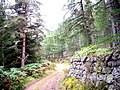
 A forest track, Birsemore - geograph.org.uk - 964169.jpg 480 × 640; 153 KB
-
 A grass track on Sole Hill - geograph.org.uk - 556645.jpg 640 × 480; 103 KB
-

-

-
 A Parish Boundary - geograph.org.uk - 557067.jpg 640 × 480; 86 KB
-
 A passing steam train - geograph.org.uk - 557045.jpg 640 × 558; 120 KB
-
 A pile of stakes - geograph.org.uk - 578464.jpg 640 × 483; 153 KB
-
 A rain pool in the forest - geograph.org.uk - 965227.jpg 640 × 480; 144 KB
-
 A Remote Dwelling - geograph.org.uk - 557075.jpg 640 × 480; 128 KB
-
 A small burn on Stake Hill - geograph.org.uk - 558729.jpg 480 × 640; 140 KB
-
 A track at Swingill - geograph.org.uk - 556654.jpg 640 × 480; 97 KB
-
 A view across Great Easton - geograph.org.uk - 566099.jpg 640 × 408; 101 KB
-

-
 A180 westbound near Ulceby - geograph.org.uk - 1049012.jpg 640 × 480; 76 KB
-
 Access track and walking route - geograph.org.uk - 556607.jpg 480 × 640; 127 KB
-
 Aggregate depot - geograph.org.uk - 563211.jpg 561 × 421; 203 KB
-
 Ah, there she is^ - geograph.org.uk - 555775.jpg 640 × 465; 102 KB
-
 Airbles railway station in 2007.jpg 1,600 × 1,200; 712 KB
-
 Alba Tyres - Leeds Road - geograph.org.uk - 556162.jpg 640 × 359; 34 KB
-
 Alconbury church tower.jpg 2,000 × 3,008; 742 KB
-
 All Aboard^ - geograph.org.uk - 556577.jpg 640 × 480; 92 KB
-
 All Saints, Bloxwich - geograph.org.uk - 557030.jpg 640 × 480; 69 KB
-
 All Saints, Bloxwich - geograph.org.uk - 557031.jpg 640 × 480; 105 KB
-
 Allotments - Derby Road - geograph.org.uk - 556178.jpg 640 × 421; 46 KB
-
 Allt Dhruidh - geograph.org.uk - 578581.jpg 480 × 640; 81 KB
-
 American Buick Car. - geograph.org.uk - 555923.jpg 640 × 480; 105 KB
-
 American Jeep. - geograph.org.uk - 555926.jpg 640 × 480; 95 KB
-
 An access to Birsebeg - geograph.org.uk - 965042.jpg 640 × 480; 150 KB
-
 An electric fence on Faw Side - geograph.org.uk - 556635.jpg 640 × 480; 111 KB
-
 An orange capped fungus - geograph.org.uk - 965284.jpg 640 × 480; 109 KB
-
 Antermony Loch - geograph.org.uk - 1569697.jpg 640 × 452; 111 KB
-

-
 Approach to Drumneachie - geograph.org.uk - 965309.jpg 640 × 480; 91 KB
-
 Armadale Pier - geograph.org.uk - 575256.jpg 640 × 480; 122 KB
-
 Armadale Pier - Passenger Footbridge - geograph.org.uk - 575258.jpg 640 × 480; 97 KB
-
 Autumn fields - geograph.org.uk - 966334.jpg 640 × 480; 69 KB
-
 Autumn Greens and Golds - geograph.org.uk - 556233.jpg 480 × 640; 125 KB
-
 Avenue of young oaks - geograph.org.uk - 556612.jpg 640 × 477; 158 KB
-
 Baddesley Clinton - geograph.org.uk - 558072.jpg 640 × 480; 103 KB
-
 Baddesley Clinton - geograph.org.uk - 558087.jpg 640 × 480; 67 KB
-
 Barbers at Station - geograph.org.uk - 645209.jpg 640 × 480; 52 KB
-
 Barn at Kirwaugh Farm - geograph.org.uk - 555907.jpg 640 × 480; 136 KB
-
 Barn, Near Capon Hall - geograph.org.uk - 557807.jpg 640 × 427; 70 KB
-
 Barrachan Home Farm Road - geograph.org.uk - 555856.jpg 640 × 480; 171 KB
-
 Barrachan Village - geograph.org.uk - 555858.jpg 640 × 480; 119 KB
-
 Battle windmill.jpg 640 × 480; 74 KB
-
 Battle, High Street - geograph.org.uk - 560754.jpg 640 × 480; 72 KB
-
 Beautiful wire wheeled 7 - Flickr - exfordy (1).jpg 3,504 × 2,336; 4.84 MB
-
 Beautiful wire wheeled 7 - Flickr - exfordy (2).jpg 3,504 × 2,336; 4.22 MB
-
 Beautiful wire wheeled 7 - Flickr - exfordy.jpg 3,213 × 1,780; 4.25 MB
-
 Below the weir - geograph.org.uk - 557900.jpg 640 × 430; 179 KB
-
 Bend in the river Derwent - geograph.org.uk - 557485.jpg 514 × 640; 237 KB
-
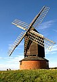
 Berkswell Windmill - geograph.org.uk - 558106.jpg 640 × 480; 65 KB
-
 Bespoke tailor's workshop - geograph.org.uk - 556586.jpg 640 × 478; 161 KB
-
 Birmingham Community Gospel Choir (1392842081).jpg 1,280 × 668; 173 KB
-
 The Cottage, Bix - geograph.org.uk - 557647.jpg 640 × 477; 95 KB
-
 Blanchland buildings - geograph.org.uk - 1003909.jpg 640 × 223; 64 KB
-
 Blanchland Roofs - geograph.org.uk - 1003930.jpg 640 × 349; 107 KB
-
 Blast From the Past - geograph.org.uk - 558245.jpg 640 × 427; 127 KB
-
 St. Giles's chapel, Blaston - geograph.org.uk - 566641.jpg 640 × 434; 136 KB
-
 Blaston Hill - geograph.org.uk - 566644.jpg 640 × 423; 122 KB
-
 Bluemans, near Sedlescombe - geograph.org.uk - 558619.jpg 640 × 480; 83 KB
-
 Boats moored on the River Usk - geograph.org.uk - 977824.jpg 640 × 480; 139 KB
-
 Boats on the Kennet and Avon Canal - geograph.org.uk - 556922.jpg 640 × 426; 104 KB
-
 Bodiam, castle footbridge - geograph.org.uk - 560770.jpg 640 × 480; 65 KB
-
 Bodiam, the castle - geograph.org.uk - 560765.jpg 640 × 480; 87 KB
-
 Borough Hall, Stratton Strawless - geograph.org.uk - 556362.jpg 640 × 480; 57 KB
-
 Bosham Railway Station - geograph.org.uk - 597077.jpg 640 × 480; 77 KB
-
 Boulder Field, Kirkby Fell - geograph.org.uk - 557817.jpg 640 × 480; 94 KB
-
 Boulders, Windlestraw Law - geograph.org.uk - 557925.jpg 640 × 480; 129 KB
-
 Boundary wall - geograph.org.uk - 965132.jpg 640 × 480; 159 KB
-
 Bowmans Park - geograph.org.uk - 565347.jpg 640 × 480; 86 KB
-
 Bradford Lane - geograph.org.uk - 556151.jpg 640 × 438; 37 KB
-
 Brains Brewery Clock - geograph.org.uk - 558464.jpg 640 × 480; 91 KB
-
 Brewery Quarter Steps - geograph.org.uk - 558456.jpg 640 × 480; 147 KB
-
 Bridge over the Derwent - geograph.org.uk - 557974.jpg 430 × 640; 106 KB
-

-
 Bridleway beside Brycheiniog Wood - geograph.org.uk - 559209.jpg 640 × 426; 129 KB
-
 Brill Windmill - geograph.org.uk - 1577266 (cropped).jpg 628 × 236; 39 KB
-
 Brill Windmill - geograph.org.uk - 1577266.jpg 628 × 430; 84 KB
-
 Brill Windmill - geograph.org.uk - 1604058.jpg 447 × 640; 73 KB
-
 Brill Windmill - geograph.org.uk - 1604061.jpg 447 × 640; 45 KB
-
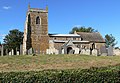 St. Nicholas Church, Bringhurst - geograph.org.uk - 564627.jpg 640 × 442; 117 KB
-
 Bringhurst, Leicestershire - geograph.org.uk - 564600.jpg 640 × 391; 121 KB
-
 Bruntsfield Evangelical Church - geograph.org.uk - 558484.jpg 453 × 617; 94 KB
-
 Bull and Royal, Longridge - geograph.org.uk - 557693.jpg 640 × 480; 108 KB
-
 Bulls Cross Wood - geograph.org.uk - 951783.jpg 640 × 426; 49 KB
-
 Burns Club, Irvine - geograph.org.uk - 557403.jpg 640 × 480; 65 KB
-
 Bus at Walton-on-the-Hill - geograph.org.uk - 1888677.jpg 640 × 480; 108 KB
-
 Bus reflection - geograph.org.uk - 1724629.jpg 640 × 480; 403 KB
-
 Bus Shelter on the Fowey Road - geograph.org.uk - 558717.jpg 640 × 427; 81 KB
-
 Busk Moss - geograph.org.uk - 557276.jpg 640 × 333; 84 KB
-
 Café Café, Irvine - geograph.org.uk - 557414.jpg 640 × 480; 63 KB
-
 Cairn beside Brycheiniog Wood - geograph.org.uk - 559703.jpg 640 × 426; 143 KB
-
 St John the Evangelist, Caldecott - geograph.org.uk - 561728.jpg 472 × 640; 114 KB
-
 The Old Vicarage, north of Caldecott - geograph.org.uk - 561732.jpg 640 × 367; 87 KB
-
 The Welland Valley - geograph.org.uk - 564093.jpg 640 × 499; 108 KB
-
 Caldicot Station - geograph.org.uk - 556569.jpg 640 × 480; 66 KB
-
 Calf Hey Reservoir from Musbury Heights - geograph.org.uk - 558406.jpg 640 × 480; 122 KB
-
 Calver cafe - geograph.org.uk - 557714.jpg 640 × 430; 173 KB
-
 Calver Mill - geograph.org.uk - 556598.jpg 640 × 430; 186 KB
-
 Canal Bridge at Waring Bottom - geograph.org.uk - 556723.jpg 640 × 480; 106 KB
-
 Capoeira Conviver I (1393733870).jpg 1,280 × 853; 261 KB
-
 Capoeira Conviver II (1392841297).jpg 1,280 × 906; 253 KB
-
 Car parked Sevens - Flickr - exfordy.jpg 3,504 × 550; 1.3 MB
-
 Caravan Club site - Burford - geograph.org.uk - 952075.jpg 640 × 480; 106 KB
-
 Carbon Bits' 3 piece luggage set - Flickr - exfordy.jpg 2,817 × 2,095; 3.61 MB
-
 Carbon dash, Stack instruments - Flickr - exfordy.jpg 3,504 × 2,336; 3.41 MB
-
 Cardiff Pride - geograph.org.uk - 557591.jpg 640 × 480; 128 KB
-
 Cardiff Bus Station - geograph.org.uk - 557859.jpg 640 × 480; 115 KB
-
 Cardiff Bus Station.jpg 594 × 419; 71 KB
-
 Cardiff Castle Gateway - geograph.org.uk - 557783.jpg 480 × 640; 139 KB
-
 Cardiff Castle Grounds - geograph.org.uk - 558516.jpg 480 × 640; 133 KB
-
 Cardiff Castle Keep - geograph.org.uk - 558490.jpg 640 × 480; 122 KB
-
 Cardiff Castle North Gate - geograph.org.uk - 558526.jpg 640 × 480; 142 KB
-
 Cardiff Castle Tower - geograph.org.uk - 557544.jpg 480 × 640; 95 KB
-
 Cardiff Central bus station.jpg 422 × 331; 45 KB
-
 Cardiff City Hall - geograph.org.uk - 557554.jpg 480 × 640; 119 KB
-
 Cardiff City Hall.jpg 640 × 480; 108 KB
-
 Cardiff Civic Centre - geograph.org.uk - 557770.jpg 640 × 480; 122 KB
-
 Cardiff Rugby Ground.jpg 640 × 480; 99 KB
-
 Cardiff University - geograph.org.uk - 557477.jpg 640 × 480; 107 KB
-
 Carlside Tarn - geograph.org.uk - 653604.jpg 640 × 480; 50 KB
-
 Carn a' Mhaim - geograph.org.uk - 783422.jpg 640 × 360; 63 KB
-
 Castle Arcade - geograph.org.uk - 557792.jpg 480 × 640; 127 KB
-
 Castle Arcade, Cardiff - geograph.org.uk - 557800.jpg 480 × 640; 125 KB
-
 St. Nicholas' Church, Castle Hedingham - geograph.org.uk - 562798.jpg 640 × 480; 111 KB
-

-

-
 Castle Lane, Castle Hedingham - geograph.org.uk - 565361.jpg 640 × 480; 58 KB
-
 Caterham 7 R500 Evo - Flickr - exfordy.jpg 1,948 × 2,030; 2.8 MB
-
 Caterham 7 Roadster 02.jpg 3,504 × 2,336; 3.39 MB
-
 Caterham 7 Roadster Blue.jpg 2,925 × 2,100; 4.02 MB
-
 Caterham 7 Roadster Gathering.jpg 3,303 × 1,998; 4.53 MB
-
 Caterham 7 Roadster in Aluminum.jpg 2,945 × 2,043; 3.79 MB
-
 Caterham 7 Roadster Orange.jpg 2,286 × 2,034; 3.09 MB
-
 Caterham 7 Roadster Rear.jpg 3,504 × 2,336; 4.56 MB
-
 Caterham 7 Roadster With Roll Cage.jpg 3,504 × 2,336; 4.29 MB
-
 Caterham 7 Roadster.jpg 3,105 × 2,193; 5.1 MB
-
 Caterham 7 Roadsters On Display.jpg 2,928 × 1,743; 2.7 MB
-
 Caterham 7 Roadsters Parked On Grass.jpg 2,739 × 2,017; 3.59 MB
-
 Caterham 7 Roadsters Parked.jpg 3,504 × 2,336; 4.02 MB
-
 Caterham 7 With a Stripe -exfordy.jpg 2,965 × 2,268; 5.94 MB
-
 Caterham 7 With Carbon Fibre Parts.jpg 3,375 × 1,891; 5.01 MB
-
 Caterham Super 7 - exfordy.jpg 3,504 × 2,336; 4.39 MB
-
 Caterham Superlight R300 - Flickr - exfordy.jpg 3,120 × 1,795; 3.86 MB
-
 Caterham X330 - Flickr - exfordy (1).jpg 3,504 × 2,336; 3.7 MB
-
 Caterham X330 - Flickr - exfordy (2).jpg 2,796 × 1,807; 3.48 MB
-
 Caterham X330 - Flickr - exfordy.jpg 2,935 × 1,599; 4.46 MB
-
 Cathays railway station.jpg 640 × 480; 157 KB
-
 Cathays Terrace - geograph.org.uk - 558866.jpg 640 × 480; 99 KB
-
 Cattle at Bix Manor Farm - geograph.org.uk - 557633.jpg 640 × 477; 109 KB
-
 Cattle at Bix Manor Farm - geograph.org.uk - 557636.jpg 640 × 477; 99 KB
-
 Cattle from Barlae Farm - geograph.org.uk - 555898.jpg 640 × 480; 115 KB
-
 Cattle grid - geograph.org.uk - 965334.jpg 640 × 480; 122 KB
-
 Cattle resting - geograph.org.uk - 966327.jpg 640 × 480; 106 KB
-
 Cefn Brân - geograph.org.uk - 559341.jpg 640 × 480; 112 KB
-
 Cellars Clough Mill - geograph.org.uk - 556686.jpg 491 × 640; 78 KB
-
 Cellars Lock 34E 2007 - geograph.org.uk - 561900.jpg 640 × 421; 98 KB
-
 Celtic Cross in Tregaminion Chapel Yard - geograph.org.uk - 558694.jpg 427 × 640; 142 KB
-
 Central Indoor market - geograph.org.uk - 557808.jpg 480 × 640; 139 KB
-
 Ceunant Farm - geograph.org.uk - 559249.jpg 640 × 480; 89 KB
-
 Chapel at Rhyd-y-Llechau - geograph.org.uk - 559261.jpg 640 × 480; 125 KB
-
 Chrome roll over bar and extra storage - Flickr - exfordy.jpg 3,504 × 2,336; 4.15 MB
-
 Church Bank, Great Easton - geograph.org.uk - 561704.jpg 640 × 491; 118 KB
-
 Churchponds, Castle Hedingham - geograph.org.uk - 563976.jpg 640 × 480; 88 KB
-
-
 City Bridge, Newport - geograph.org.uk - 557828 (cropped).jpg 447 × 335; 58 KB
-
 City Bridge, Newport - geograph.org.uk - 557828.jpg 640 × 480; 98 KB
-
 City Hall Clock Tower - geograph.org.uk - 557579.jpg 640 × 480; 108 KB
-
 Clauchrie Farm Road - geograph.org.uk - 555911.jpg 640 × 480; 101 KB
-
 Claunch Farm Road - geograph.org.uk - 555889.jpg 640 × 480; 103 KB
-
 Clear Felling - geograph.org.uk - 557076.jpg 640 × 480; 125 KB
-
 Cliff Top At Danes Dyke - geograph.org.uk - 557877.jpg 640 × 480; 81 KB
-
 Clifton- Vicarage Hill - geograph.org.uk - 556377.jpg 640 × 480; 129 KB
-
-
 Come on Ye Reds^ - geograph.org.uk - 557847.jpg 480 × 640; 123 KB
-
 Commondyke railway station - geograph.org.uk - 957800.jpg 640 × 480; 94 KB
-
 Concours cars - Flickr - exfordy.jpg 3,366 × 1,908; 4.36 MB
-


.jpg)


,_front.jpg)


_sustainable_development._-_geograph.org.uk_-_557334.jpg)


.jpg)
.jpg)


.jpg)


.jpg)
.jpg)


.jpg)
.jpg)


.jpg)


.jpg)