Category:United Kingdom photographs taken on 2008-12-12
Jump to navigation
Jump to search
Countries of Europe: Belgium · Czech Republic · Estonia · France‡ · Germany · Hungary · Italy · Malta · Netherlands‡ · Poland · Portugal‡ · Romania · Russia‡ · Spain‡ · Switzerland · Turkey‡ · Ukraine · United Kingdom
‡: partly located in Europe
‡: partly located in Europe
| ← | 12 December 2008 | → | ||
| ← | December 2008 | → | ||

United Kingdom photographs taken on 12 December 2008.
Image files should be categorized here automatically using {{taken on}} template. Direct categorisation is also possible, if automatic is impossible.
Subcategories
This category has the following 2 subcategories, out of 2 total.
Media in category "United Kingdom photographs taken on 2008-12-12"
The following 200 files are in this category, out of 509 total.
(previous page) (next page)-
 'Exportation' on Commerce House - geograph.org.uk - 1078805.jpg 640 × 460; 29 KB
-
 A Cardiff to Bristol train passes Rogiet - geograph.org.uk - 1078197.jpg 640 × 480; 101 KB
-

-
 A converted Wesleyan Chapel - plaque - geograph.org.uk - 1077720.jpg 480 × 640; 106 KB
-
 A former Wesleyan Chapel - geograph.org.uk - 1077715.jpg 640 × 480; 83 KB
-
 A frosty track - geograph.org.uk - 1077702.jpg 480 × 640; 165 KB
-
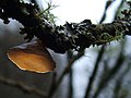 A fungus - Exidia recisa - geograph.org.uk - 1552334.jpg 640 × 480; 57 KB
-
 A thatched house - geograph.org.uk - 1078262.jpg 640 × 429; 55 KB
-
 A thatched notice board - geograph.org.uk - 1078249.jpg 640 × 429; 88 KB
-
 Abandoned railway - geograph.org.uk - 1084231.jpg 640 × 481; 70 KB
-
 Abbey Bridge End, Jedburgh - geograph.org.uk - 1079301.jpg 640 × 480; 99 KB
-
 Abbey Bridge, Jedburgh - geograph.org.uk - 1079300.jpg 640 × 480; 72 KB
-
 Abergavenny - Buddha - panoramio.jpg 2,112 × 2,816; 2.3 MB
-
 Abergavenny - Clocks - panoramio.jpg 2,816 × 2,112; 2.22 MB
-
 Abergavenny - Dragon - panoramio.jpg 2,816 × 2,112; 2.53 MB
-
 Abergavenny - Market Place - panoramio.jpg 2,816 × 2,112; 2.7 MB
-
 Abergavenny Market Place - panoramio.jpg 2,112 × 2,816; 2.47 MB
-
 Abergavenny War Memorial - panoramio.jpg 2,112 × 2,816; 2.22 MB
-
 All Saints Thorpe Abbotts - geograph.org.uk - 1089607.jpg 640 × 480; 122 KB
-
 Any land in SZ5997^ - geograph.org.uk - 1144999.jpg 640 × 427; 74 KB
-
 Approaching Tuttington Road - geograph.org.uk - 1077690.jpg 640 × 480; 144 KB
-
-

-
 B3056 by Pig Bush car park - geograph.org.uk - 1123647.jpg 640 × 425; 42 KB
-
 B3056 heading over Shepton Bridge - geograph.org.uk - 1123619.jpg 640 × 425; 69 KB
-
 B3056 junction - geograph.org.uk - 1123678.jpg 640 × 425; 41 KB
-
 B3056 passing Penerley Farm - geograph.org.uk - 1123611.jpg 640 × 425; 71 KB
-
 B3056 passing Stephill Bottom - geograph.org.uk - 1123669.jpg 640 × 425; 47 KB
-
 Back Lane Langtoft - geograph.org.uk - 1078000.jpg 640 × 480; 52 KB
-
 Backward Clock - geograph.org.uk - 1077661.jpg 480 × 640; 66 KB
-
 Bacup Road - geograph.org.uk - 1078903.jpg 640 × 424; 56 KB
-
 Bacup Road, Cloughfold - geograph.org.uk - 1079008.jpg 640 × 352; 55 KB
-
 Bakery and café, Somerled Square - geograph.org.uk - 1077885.jpg 640 × 486; 82 KB
-
 Bandstand within Ham Hill Park - geograph.org.uk - 1084286.jpg 640 × 481; 66 KB
-
 Barn at Brownwich Farm - geograph.org.uk - 1145147.jpg 640 × 427; 53 KB
-
 Baron Street, Cloughfold - geograph.org.uk - 1078922.jpg 480 × 640; 81 KB
-
 Beach chalets at Hill Head - geograph.org.uk - 1145057.jpg 640 × 427; 62 KB
-
 Beached and falling apart - geograph.org.uk - 1078210.jpg 640 × 429; 73 KB
-
 Beaulieu River - geograph.org.uk - 1123531.jpg 640 × 425; 100 KB
-
 Beaulieu Road - geograph.org.uk - 1123505.jpg 640 × 425; 67 KB
-
 Beaulieu Road - geograph.org.uk - 1123710.jpg 640 × 425; 83 KB
-
 Beccles Town Hall - geograph.org.uk - 1089552.jpg 480 × 640; 74 KB
-
 Bedwin Sands, Severn Estuary - geograph.org.uk - 1078441.jpg 640 × 480; 45 KB
-

-

-

-

-
 Belfast Castle - geograph.org.uk - 1601289.jpg 640 × 428; 70 KB
-
 Belle Vue House, Redwick - geograph.org.uk - 1078172.jpg 640 × 480; 88 KB
-
 Beneath Austin's Bridge - geograph.org.uk - 1081068.jpg 640 × 480; 132 KB
-
 Birch woodland - geograph.org.uk - 1077743.jpg 640 × 480; 73 KB
-
 Bishopsteignton footpath - geograph.org.uk - 1078084.jpg 640 × 429; 104 KB
-
 Black Lion, Surbiton - geograph.org.uk - 1077758.jpg 640 × 480; 71 KB
-
 Blue plaque on Victoria Place - geograph.org.uk - 1082335.jpg 640 × 453; 72 KB
-
 Bracket fungi near the Dart (2) - geograph.org.uk - 1080862.jpg 640 × 480; 114 KB
-
 Bracket fungi near the Dart - geograph.org.uk - 1080855.jpg 480 × 640; 125 KB
-
 Breakwater, Portland Grounds - geograph.org.uk - 1078109.jpg 640 × 480; 80 KB
-
 Bridge over the Lòn an Eireannaich - geograph.org.uk - 1077713.jpg 640 × 480; 95 KB
-
 Bridleway and footpath Spilt - geograph.org.uk - 1082746.jpg 640 × 481; 113 KB
-
 Bristol Channel from Penarth cliffs - geograph.org.uk - 1167276.jpg 640 × 480; 48 KB
-
 Brownwich Farm - geograph.org.uk - 1145152.jpg 640 × 427; 71 KB
-
 Brownwich fish pond - geograph.org.uk - 1145157.jpg 640 × 426; 74 KB
-
 Brownwich fish pond - geograph.org.uk - 1145160.jpg 640 × 427; 108 KB
-
 Buckshaw Hall - geograph.org.uk - 1097081.jpg 640 × 480; 98 KB
-
 Buckshaw Hall - geograph.org.uk - 1097090.jpg 480 × 640; 66 KB
-
 Buckshaw Hall - geograph.org.uk - 1097091.jpg 640 × 480; 66 KB
-
 Buckshaw Hall - geograph.org.uk - 1097101.jpg 640 × 480; 69 KB
-
 Buckshaw Hall, Chimney - geograph.org.uk - 1097094.jpg 480 × 640; 53 KB
-
 Buckshaw Hall, Detail - geograph.org.uk - 1097088.jpg 480 × 640; 67 KB
-
 Buckshaw Hall, Doorway - geograph.org.uk - 1097087.jpg 480 × 640; 76 KB
-
 Buckshaw Hall, Rear view - geograph.org.uk - 1097099.jpg 640 × 480; 70 KB
-
 Builders' merchant, Portree - geograph.org.uk - 1077764.jpg 640 × 480; 60 KB
-

-
 Buildings at Buckshaw Hall - geograph.org.uk - 1097103.jpg 640 × 480; 64 KB
-
 But is it art^ - geograph.org.uk - 1147224.jpg 640 × 426; 38 KB
-
 Bwlch y Dwr - geograph.org.uk - 1083223.jpg 640 × 480; 192 KB
-
 Bwlch y Dwr - geograph.org.uk - 1083226.jpg 640 × 480; 185 KB
-
 Bwlch y Dwr View looking East - geograph.org.uk - 1083221.jpg 640 × 480; 190 KB
-
 Caldicot Level - geograph.org.uk - 1078138.jpg 640 × 480; 112 KB
-
 Canal Brook - geograph.org.uk - 1079164.jpg 640 × 480; 95 KB
-
 Car park near Hill Head - geograph.org.uk - 1145035.jpg 640 × 427; 62 KB
-

-
 Cave Hill - geograph.org.uk - 1601315.jpg 640 × 428; 49 KB
-
 Caversham weir - geograph.org.uk - 1110761.jpg 640 × 480; 103 KB
-
 Cawl Terrace, Bacup Road - geograph.org.uk - 1078906.jpg 640 × 403; 63 KB
-
 Central Surbiton - geograph.org.uk - 1077777.jpg 640 × 480; 89 KB
-
 Chalk Quarry Langtoft - geograph.org.uk - 1078009.jpg 640 × 480; 109 KB
-
 Chase Side pre-Worboys sign - geograph.org.uk - 1078768.jpg 640 × 480; 81 KB
-
 Chilling substation - geograph.org.uk - 1147180.jpg 640 × 427; 72 KB
-
 China Inn, Dromore Road, Omagh - geograph.org.uk - 1077618.jpg 640 × 480; 54 KB
-

-
-
 Chuley Bridge - geograph.org.uk - 1081276.jpg 640 × 480; 95 KB
-
 Church Farm, Redwick - geograph.org.uk - 1078161.jpg 640 × 480; 87 KB
-
 Church Path, Ashburton - geograph.org.uk - 1081996.jpg 480 × 640; 121 KB
-
 City Hall, Belfast - geograph.org.uk - 1601138.jpg 640 × 428; 64 KB
-
 Claremont Road - geograph.org.uk - 1077810.jpg 640 × 480; 66 KB
-
 Claremont Road, Surbiton - geograph.org.uk - 1077814.jpg 640 × 423; 64 KB
-
 Clayhill Heath - geograph.org.uk - 1124722.jpg 640 × 425; 61 KB
-
 Cliff top path - geograph.org.uk - 1145086.jpg 640 × 427; 56 KB
-
 Cliff top path - geograph.org.uk - 1145101.jpg 640 × 427; 101 KB
-

-

-
 Cockwood Harbour - geograph.org.uk - 1078251.jpg 640 × 429; 61 KB
-
 Cockwood Harbour - geograph.org.uk - 1078252.jpg 640 × 429; 73 KB
-
 Cockwood village pond - geograph.org.uk - 1078258.jpg 640 × 429; 95 KB
-
 Competition^ - geograph.org.uk - 1077788.jpg 640 × 480; 77 KB
-
 Converted Church, Bacup Road - geograph.org.uk - 1078969.jpg 640 × 408; 81 KB
-
 Converted Methodist Church, Snodland - geograph.org.uk - 1084274.jpg 640 × 481; 64 KB
-

-
 Copse near Row Hill - geograph.org.uk - 1124660.jpg 640 × 425; 67 KB
-
 Cottage Grove - geograph.org.uk - 1077763.jpg 640 × 480; 65 KB
-
 Crake Dale Langtoft - geograph.org.uk - 1078029.jpg 640 × 480; 74 KB
-
 Crake Dale western end - geograph.org.uk - 1078036.jpg 640 × 480; 111 KB
-
 Crooked Dale side valley fox covert - geograph.org.uk - 1078061.jpg 640 × 480; 80 KB
-
 Cuxton Community Church - geograph.org.uk - 1080480.jpg 640 × 481; 87 KB
-
 Cuxton Library - geograph.org.uk - 1080486.jpg 640 × 481; 63 KB
-
 Cuxton Marina - geograph.org.uk - 1080506.jpg 640 × 481; 80 KB
-
 Dart near Austin's Bridge - geograph.org.uk - 1080969.jpg 640 × 480; 133 KB
-
 St.Agatha's Catholic Church, Dawlish - geograph.org.uk - 1078260.jpg 640 × 429; 58 KB
-
 Dean Farm - geograph.org.uk - 1080511.jpg 640 × 481; 62 KB
-
 Dear Row - geograph.org.uk - 1089590.jpg 640 × 480; 78 KB
-
 Dear Row road sign - geograph.org.uk - 1089598.jpg 640 × 480; 87 KB
-
 Dear Santa ... - geograph.org.uk - 1082171.jpg 480 × 640; 62 KB
-
 Deepmore Farm Lane - geograph.org.uk - 1079119.jpg 640 × 480; 90 KB
-
 Deer caught on a fence - geograph.org.uk - 1516980.jpg 480 × 640; 104 KB
-
 Denny Wood Campsite - geograph.org.uk - 1123722.jpg 640 × 425; 91 KB
-
 Down the Line - geograph.org.uk - 1080502.jpg 640 × 481; 99 KB
-
 Drainage channel, near Redwick - geograph.org.uk - 1078053.jpg 640 × 480; 91 KB
-
 Dramatic sunrise near Ranby Farm - geograph.org.uk - 1079380.jpg 640 × 480; 78 KB
-
 Drive by Ladycross Lodge - geograph.org.uk - 1124757.jpg 640 × 425; 88 KB
-
 Drive to New Park Manor Hotel - geograph.org.uk - 1124676.jpg 640 × 425; 71 KB
-
 Dunvegan Road, Portree - geograph.org.uk - 1077801.jpg 640 × 480; 58 KB
-
 Ely Museum - geograph.org.uk - 1092138.jpg 480 × 640; 85 KB
-

-
-
 Entrance to Holborough Marshes - geograph.org.uk - 1084250.jpg 640 × 481; 132 KB
-

-
 Entrance to New Park - geograph.org.uk - 1124687.jpg 640 × 425; 59 KB
-
 Entrance to Pondhead Farm - geograph.org.uk - 1124651.jpg 640 × 425; 43 KB
-
 Entrance to Snodland Cemetery - geograph.org.uk - 1084278.jpg 640 × 481; 81 KB
-

-

-
 Ewell Road, Surbiton - geograph.org.uk - 1077835.jpg 640 × 480; 77 KB
-
 Exe estuary and station footbridge - geograph.org.uk - 1078247.jpg 640 × 429; 54 KB
-
 Farm buildings, Redwick - geograph.org.uk - 1078164.jpg 640 × 480; 70 KB
-
 Farm Track from Lower Laches Farm - geograph.org.uk - 1079097.jpg 640 × 480; 130 KB
-
 Farmland at Chilling - geograph.org.uk - 1145183.jpg 640 × 427; 80 KB
-
 Fenced Footpath - geograph.org.uk - 1084220.jpg 640 × 481; 78 KB
-
 Field at Huxham's Cross (2) - geograph.org.uk - 1080802.jpg 640 × 360; 80 KB
-
 Field at Huxham's Cross - geograph.org.uk - 1080788.jpg 640 × 480; 121 KB
-
 Field Barn Langtoft - geograph.org.uk - 1078015.jpg 640 × 480; 66 KB
-
 Field by Muttonsnow Farm - geograph.org.uk - 1123430.jpg 640 × 425; 52 KB
-

-
 Fields behind Big Green, Warmington - geograph.org.uk - 1127576.jpg 480 × 640; 63 KB
-
 Fisher Jessie statue, Peterhead - geograph.org.uk - 1077905.jpg 427 × 640; 60 KB
-
 Fishing for eels - geograph.org.uk - 1147395.jpg 640 × 427; 49 KB
-
 Flood Plaque Langtoft - geograph.org.uk - 1078006.jpg 640 × 480; 87 KB
-
 Flooded Pottern Ford - geograph.org.uk - 1123470.jpg 640 × 425; 99 KB
-
 Flotsam - geograph.org.uk - 1077915.jpg 640 × 427; 81 KB
-
 Foales Court, Ashburton - geograph.org.uk - 1082189.jpg 480 × 640; 72 KB
-
 Footbridge across Beaulieu River - geograph.org.uk - 1123562.jpg 640 × 425; 102 KB
-
 Footbridge across Beaulieu River - geograph.org.uk - 1123578.jpg 640 × 425; 104 KB
-

-
 Footbridge in Quarry - geograph.org.uk - 1083580.jpg 481 × 640; 124 KB
-
 Footbridge over A228 - geograph.org.uk - 1084295.jpg 640 × 481; 83 KB
-
 Footbridge over A228 Halling By-Pass - geograph.org.uk - 1083604.jpg 640 × 481; 79 KB
-

-
 Footpath across A228 Halling By-pass - geograph.org.uk - 1084205.jpg 640 × 481; 94 KB
-

-
 Footpath junction in Wingate Wood - geograph.org.uk - 1083552.jpg 481 × 640; 130 KB
-
 Footpath on Meadow Crescent - geograph.org.uk - 1084211.jpg 640 × 481; 108 KB
-
 Footpath to Beaulieu - geograph.org.uk - 1124852.jpg 640 × 425; 75 KB
-
 Footpath to East Boldre - geograph.org.uk - 1124863.jpg 640 × 425; 81 KB
-
 Footpath to Rawtenstall - geograph.org.uk - 1079004.jpg 640 × 480; 121 KB
-
 Foreshore near Solent Breezes - geograph.org.uk - 1147221.jpg 640 × 427; 53 KB
-
 Foreshore near Solent Breezes - geograph.org.uk - 1147230.jpg 640 × 427; 70 KB
-
 Former pipeline - geograph.org.uk - 1147191.jpg 640 × 427; 68 KB
-
 Former pipeline - geograph.org.uk - 1147205.jpg 640 × 427; 80 KB
-
 Former Pub, Ely - geograph.org.uk - 1092175.jpg 640 × 480; 102 KB
-
 Former Quarry now farmers field - geograph.org.uk - 1084214.jpg 640 × 481; 49 KB
-
 Frost on the Union Chain Bridge - geograph.org.uk - 1079303.jpg 640 × 480; 91 KB
-
 Frosty hedgerow - geograph.org.uk - 1077705.jpg 480 × 640; 153 KB
-
 Frosty morning across the grass - geograph.org.uk - 1078034.jpg 640 × 470; 191 KB
-
 Frozen Weed in Dean Farm Valley - geograph.org.uk - 1082782.jpg 640 × 481; 88 KB
-
 Fruit and Vegetable stall, Dock Street - geograph.org.uk - 1136091.jpg 640 × 480; 143 KB
-

-
 Garage on Saddleworth Road - geograph.org.uk - 1097138.jpg 640 × 480; 57 KB
-
 Gasometer at Cloughfold - geograph.org.uk - 1078914.jpg 640 × 480; 76 KB
-
 Georgian building, Magor - geograph.org.uk - 1078188.jpg 640 × 480; 74 KB
-
 Globular lights in Castle Park - geograph.org.uk - 1085890.jpg 3,008 × 2,000; 2.69 MB
-
 Gravestone by the path, Ashburton - geograph.org.uk - 1082080.jpg 462 × 640; 86 KB
-
 Graveyard, Ashburton (2) - geograph.org.uk - 1081861.jpg 640 × 480; 139 KB
-
 Graveyard, Ashburton (3) - geograph.org.uk - 1081929.jpg 640 × 480; 137 KB
-
 Graveyard, Ashburton - geograph.org.uk - 1081847.jpg 640 × 501; 134 KB
-
 Green Doors - geograph.org.uk - 1078861.jpg 640 × 424; 66 KB
-

-
 Gurnetfields Furzebrake - geograph.org.uk - 1123661.jpg 640 × 425; 73 KB
-
 Halling Baptist Chapel - geograph.org.uk - 1083609.jpg 640 × 481; 110 KB
-


_-_geograph.org.uk_-_1080862.jpg)


_-_geograph.org.uk_-_1080802.jpg)


_-_geograph.org.uk_-_1081861.jpg)
_-_geograph.org.uk_-_1081929.jpg)


