Category:United Kingdom photographs taken on 2009-01-16
Jump to navigation
Jump to search
Countries of Europe: Austria · Belgium · Bulgaria · Cyprus‡ · Czech Republic · Denmark · Finland · France‡ · Germany · Greece · Republic of Ireland · Italy · Netherlands‡ · Poland · Portugal‡ · Russia‡ · Serbia · Spain‡ · Sweden · Switzerland · Ukraine · United Kingdom
‡: partly located in Europe
‡: partly located in Europe
| ← | 16 January 2009 | → | ||
| ← | January 2009 | → | ||

United Kingdom photographs taken on 16 January 2009.
Image files should be categorized here automatically using {{taken on}} template. Direct categorisation is also possible, if automatic is impossible.
Subcategories
This category has only the following subcategory.
L
Media in category "United Kingdom photographs taken on 2009-01-16"
The following 200 files are in this category, out of 616 total.
(previous page) (next page)-

-

-
 19th-century building at location where Adam Smith lived, 1767-1776.jpg 3,264 × 2,448; 3.14 MB
-
 A carbolic ride, East Benhar - geograph.org.uk - 1121958.jpg 640 × 480; 100 KB
-

-
 A glimpse of sunlight - geograph.org.uk - 1126971.jpg 640 × 480; 48 KB
-
 A house on Craigour Road - geograph.org.uk - 1121818.jpg 640 × 480; 64 KB
-

-

-
 A Study in Scarlet - geograph.org.uk - 1121669.jpg 640 × 480; 107 KB
-
 A14 looking east - geograph.org.uk - 1122024.jpg 640 × 477; 32 KB
-
 Abandoned factory - detail - geograph.org.uk - 1126400.jpg 640 × 480; 262 KB
-
 Abbey Gateway, Romsey - geograph.org.uk - 1141274.jpg 480 × 640; 155 KB
-
 Abbotswell House, Buckfastleigh - geograph.org.uk - 1125636.jpg 640 × 480; 87 KB
-
 Access to Annesley Grove - geograph.org.uk - 1121614.jpg 640 × 468; 124 KB
-
 Access to Balvenie Road - geograph.org.uk - 1121667.jpg 640 × 480; 76 KB
-
 Access to Craigour Avenue - geograph.org.uk - 1121859.jpg 640 × 468; 62 KB
-
 Advertising hoarding, Belfast - geograph.org.uk - 1125414.jpg 1,162 × 748; 671 KB
-
 Alders. Greenrig - geograph.org.uk - 1122120.jpg 640 × 480; 137 KB
-

-
 Ambassador House Dornoch - geograph.org.uk - 1123451.jpg 640 × 480; 46 KB
-

-
 An older house on Craigour Road - geograph.org.uk - 1121637.jpg 640 × 480; 88 KB
-
 An unexpected visitor - geograph.org.uk - 1121873.jpg 640 × 480; 108 KB
-
 Annesley Grove - geograph.org.uk - 1121623.jpg 640 × 480; 78 KB
-
 Annesley Park estate - geograph.org.uk - 1121627.jpg 640 × 480; 104 KB
-
 Appleby Street - geograph.org.uk - 1122376.jpg 640 × 480; 72 KB
-
 Archery Club in Frid Wood - geograph.org.uk - 1126374.jpg 640 × 481; 120 KB
-
-
 Ashby building, Belfast - geograph.org.uk - 1125364.jpg 640 × 543; 249 KB
-
 Ashton's indoor market - geograph.org.uk - 1121809.jpg 640 × 480; 125 KB
-
 Auld Mannies Seat - geograph.org.uk - 1121631.jpg 640 × 480; 119 KB
-
 B709 passing Heriot Mill. - geograph.org.uk - 1122016.jpg 640 × 480; 111 KB
-
 Back Lane, Bradninch - geograph.org.uk - 1124294.jpg 640 × 480; 96 KB
-
 Back street - geograph.org.uk - 1122381.jpg 640 × 480; 73 KB
-
 Back street opposite blackburn museum - panoramio.jpg 2,048 × 1,536; 141 KB
-
 Balvenie Road - geograph.org.uk - 1121660.jpg 640 × 480; 83 KB
-
 Barn above Dean - geograph.org.uk - 1126516.jpg 640 × 480; 95 KB
-
 Barnsley House and garden - geograph.org.uk - 1122565.jpg 640 × 480; 106 KB
-
 Barnsley House near Cirencester - geograph.org.uk - 1122526.jpg 640 × 480; 103 KB
-
 Battery Park - geograph.org.uk - 1164709.jpg 640 × 480; 71 KB
-
 Bays Leap Farm, Heddon on the Wall - geograph.org.uk - 1125029.jpg 640 × 360; 56 KB
-
 Beech clearing - geograph.org.uk - 1121929.jpg 480 × 640; 117 KB
-
 Beeches - geograph.org.uk - 1122078.jpg 480 × 640; 103 KB
-
 Beeching's Way, Thorverton - geograph.org.uk - 1125623.jpg 640 × 480; 65 KB
-
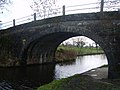 Bell's Bridge - geograph.org.uk - 1121865.jpg 640 × 480; 81 KB
-
 BETFRED coming soon^ - geograph.org.uk - 1121971.jpg 640 × 480; 93 KB
-
 Bidwell Cross - geograph.org.uk - 1126411.jpg 640 × 480; 87 KB
-
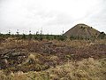 Bing, Benhar - geograph.org.uk - 1121946.jpg 640 × 480; 101 KB
-
 Black Helvella. Helvella lacunosa - Flickr - gailhampshire (1).jpg 936 × 788; 430 KB
-
 Black Helvella. Helvella lacunosa - Flickr - gailhampshire.jpg 892 × 920; 443 KB
-
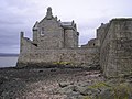 Blackness Castle sea wall - geograph.org.uk - 1122493.jpg 640 × 480; 86 KB
-
 Blakeley Plantation - geograph.org.uk - 1123055.jpg 640 × 360; 66 KB
-
 Blyth Road lay-by - geograph.org.uk - 1122116.jpg 640 × 438; 63 KB
-
 Borden Parish Hall - geograph.org.uk - 1128821.jpg 640 × 481; 57 KB
-
 Borve 1121785.jpg 640 × 480; 84 KB
-
 Boughton North Industrial estate - geograph.org.uk - 1122109.jpg 640 × 570; 103 KB
-
 Bowhill Farm, Bradninch - geograph.org.uk - 1123809.jpg 640 × 480; 100 KB
-
 Bradbeers, Romsey - geograph.org.uk - 1141369.jpg 480 × 640; 111 KB
-
 Bridge at Kiln Trees Farm - geograph.org.uk - 1122053.jpg 640 × 480; 86 KB
-
 Bridge detail, near Snowford Hill - geograph.org.uk - 1122215.jpg 640 × 537; 138 KB
-
 Bridge Near Snape Wood Farm - geograph.org.uk - 1122023.jpg 640 × 480; 79 KB
-

-
 Bridge Street, Buckfastleigh - geograph.org.uk - 1124253.jpg 486 × 640; 75 KB
-
 Bridging the Corsehope Burn - geograph.org.uk - 1122057.jpg 640 × 394; 86 KB
-
 Bridleway near Eathorpe - geograph.org.uk - 1122199.jpg 640 × 486; 153 KB
-
 Bridleway to Colebrook - geograph.org.uk - 1123790.jpg 640 × 457; 93 KB
-
 Bridleway, to Greenslinch - geograph.org.uk - 1124976.jpg 480 × 640; 129 KB
-
 Buckfastleigh from Church Steps - geograph.org.uk - 1124090.jpg 640 × 480; 83 KB
-

-
 Cabus Nook Bridge - geograph.org.uk - 1122058.jpg 640 × 480; 69 KB
-
 Cafe culture, Yeovil High Street - geograph.org.uk - 1126371.jpg 640 × 480; 212 KB
-
 Calder's Bakery, Torphins - geograph.org.uk - 1121710.jpg 640 × 480; 71 KB
-
 Callander Drive, Forfar - geograph.org.uk - 1122495.jpg 640 × 427; 74 KB
-
 Canal overflow. - geograph.org.uk - 1259998.jpg 640 × 480; 130 KB
-
 Carbost Wee Free - geograph.org.uk - 1141539.jpg 640 × 427; 34 KB
-
 Carpark at Center Parcs - geograph.org.uk - 1125358.jpg 640 × 480; 83 KB
-
 Carry Bridge - geograph.org.uk - 1123920.jpg 640 × 480; 129 KB
-
 Carry Bridge - geograph.org.uk - 1123935.jpg 640 × 480; 90 KB
-
 Carry Lane - geograph.org.uk - 1123926.jpg 640 × 480; 66 KB
-

-
 Cattle near Wallaford Cross - geograph.org.uk - 1126635.jpg 640 × 378; 87 KB
-
 Cattle stance marker (number three) - geograph.org.uk - 1126063.jpg 640 × 480; 88 KB
-
 CCTV camera. East Benhar - geograph.org.uk - 1122020.jpg 480 × 640; 82 KB
-
 Chapel street church from Wainwright bridge - panoramio.jpg 2,048 × 1,536; 122 KB
-
 Chapelhales - geograph.org.uk - 1124592.jpg 640 × 480; 77 KB
-
 Chapelhales Farm - geograph.org.uk - 1124571.jpg 640 × 480; 70 KB
-
 Chimney pots - geograph.org.uk - 1121814.jpg 640 × 480; 52 KB
-
 Church Lane, Bradninch - geograph.org.uk - 1123818.jpg 640 × 480; 69 KB
-
-
 Church Steps, Buckfastleigh - geograph.org.uk - 1124085.jpg 480 × 640; 106 KB
-
 Church Street, Buckfastleigh - geograph.org.uk - 1124176.jpg 640 × 472; 85 KB
-
 Church Street, Lenton - geograph.org.uk - 1122312.jpg 640 × 426; 111 KB
-
 Church Street, Wootton Bassett - geograph.org.uk - 1122050.jpg 640 × 442; 80 KB
-
-
 Cloreen Park, Belfast - geograph.org.uk - 1125350.jpg 480 × 640; 203 KB
-
 Close House Lodge and Gateway - geograph.org.uk - 1121981.jpg 640 × 480; 111 KB
-
 Cluanie Inn - geograph.org.uk - 1141492.jpg 640 × 427; 41 KB
-
 Colliery ruins, East Benhar - geograph.org.uk - 1121949.jpg 640 × 480; 96 KB
-
 Colne Water - geograph.org.uk - 1123937.jpg 640 × 480; 97 KB
-
 Concrete Blocks - geograph.org.uk - 1122082.jpg 640 × 480; 77 KB
-

-
 Cottage by Cowie Wynd access - geograph.org.uk - 1121642.jpg 640 × 482; 72 KB
-
 Cottage garden - geograph.org.uk - 1121850.jpg 640 × 480; 60 KB
-
 Cottage on Craigour Road - geograph.org.uk - 1121640.jpg 640 × 480; 67 KB
-
 Cottages and pasture at Haltree Farm - geograph.org.uk - 1122064.jpg 640 × 480; 67 KB
-
 Cottages in Inchley Place - geograph.org.uk - 1121829.jpg 640 × 480; 92 KB
-
 Cottages, Hunningham Lane - geograph.org.uk - 1122397.jpg 640 × 463; 126 KB
-
 Cottages, New House Lane - geograph.org.uk - 1121903.jpg 640 × 480; 60 KB
-
 Court Barton Farm, Thorverton - geograph.org.uk - 1125639.jpg 640 × 480; 54 KB
-

-
 Cow near Wallaford Cross - geograph.org.uk - 1126679.jpg 640 × 480; 68 KB
-
 Cowie Wynd - geograph.org.uk - 1121644.jpg 640 × 459; 68 KB
-
 Cowie Wynd - geograph.org.uk - 1121821.jpg 640 × 480; 86 KB
-
 Coxhill Cross - geograph.org.uk - 1125852.jpg 640 × 361; 54 KB
-
 Coxhill Cross - geograph.org.uk - 1125853.jpg 480 × 640; 85 KB
-
 Craigour Road (A980) - geograph.org.uk - 1121616.jpg 640 × 480; 86 KB
-
 Crossing a burn on the way to Heriot - geograph.org.uk - 1121998.jpg 640 × 480; 107 KB
-
 Crossroads in Priory Road, Snape - geograph.org.uk - 1121715.jpg 3,072 × 2,304; 1.33 MB
-
 Crossroads north of Wylam - geograph.org.uk - 1123122.jpg 640 × 360; 67 KB
-
 Crossroads, near Tedbridge - geograph.org.uk - 1124322.jpg 640 × 480; 95 KB
-
 Culver Close, Bradninch - geograph.org.uk - 1124309.jpg 640 × 480; 64 KB
-
 Davis Bridge - geograph.org.uk - 1122029.jpg 640 × 480; 84 KB
-
 Dean's Hill Reservoir - geograph.org.uk - 1126333.jpg 640 × 481; 94 KB
-
 Dismantled railway line - geograph.org.uk - 1121784.jpg 640 × 480; 97 KB
-
 Distant railway bridge - geograph.org.uk - 1122018.jpg 640 × 480; 53 KB
-
 Doggie weather vane - geograph.org.uk - 1121621.jpg 429 × 640; 54 KB
-
 Driveway near Long Itchington - geograph.org.uk - 1122180.jpg 640 × 450; 81 KB
-
 Duck and Cottages, Buckfastleigh - geograph.org.uk - 1123745.jpg 640 × 480; 92 KB
-

-
 DUNAID cottage - geograph.org.uk - 1121705.jpg 640 × 480; 103 KB
-
 Dundreggan Dam - geograph.org.uk - 1141484.jpg 640 × 427; 78 KB
-
 Early Morning at Newmill - geograph.org.uk - 1144488.jpg 640 × 481; 62 KB
-

-
 Early snowdrops - Barnsley House - geograph.org.uk - 1122805.jpg 640 × 480; 139 KB
-
 East Street, Bridgtown, Cannock - geograph.org.uk - 1124510.jpg 640 × 480; 58 KB
-
 Eathorpe Park, driveway - geograph.org.uk - 1122396.jpg 640 × 498; 163 KB
-
 Edinburgh - Glasgow Central railway - geograph.org.uk - 1121935.jpg 640 × 480; 111 KB
-
 Edinggight Wynd - geograph.org.uk - 1121656.jpg 640 × 454; 75 KB
-
 Edinggight Wynd - geograph.org.uk - 1121663.jpg 640 × 480; 76 KB
-
 Eilean Donan Castle - geograph.org.uk - 1141520.jpg 640 × 427; 42 KB
-

-

-
 Elizabeth II Postbox, Litton - geograph.org.uk - 1124021.jpg 683 × 1,024; 126 KB
-
 Elliot Plain, Buckfastleigh - geograph.org.uk - 1123732.jpg 640 × 480; 70 KB
-
 Entrance to Combensatchfield - geograph.org.uk - 1125048.jpg 640 × 480; 97 KB
-
 Entrance to Dewar - geograph.org.uk - 1121911.jpg 640 × 480; 92 KB
-
-

-
 Extreme window cleaning^ - geograph.org.uk - 1121898.jpg 640 × 480; 80 KB
-
 Farm buildings, Tedbridge - geograph.org.uk - 1124326.jpg 640 × 480; 69 KB
-
 Farm cottages at Colqhuar - geograph.org.uk - 1121768.jpg 640 × 480; 69 KB
-
 Farm cottages, Tedbridge - geograph.org.uk - 1124332.jpg 640 × 480; 66 KB
-
 Farm road near Heddon Steads - geograph.org.uk - 1124317.jpg 640 × 360; 55 KB
-
 Farm road, Chapelhales - geograph.org.uk - 1124629.jpg 640 × 480; 87 KB
-
 Farm track at West Heddon - geograph.org.uk - 1124328.jpg 640 × 480; 102 KB
-
 Farm track near Bays Leap Farm - geograph.org.uk - 1124878.jpg 640 × 480; 98 KB
-
 Farmland and Lownie Hill - geograph.org.uk - 1122079.jpg 640 × 427; 56 KB
-
 Farmland, A435, near Bagendon - geograph.org.uk - 1122134.jpg 640 × 480; 177 KB
-
 Fauldhouse Moor - geograph.org.uk - 1122017.jpg 640 × 480; 102 KB
-
 Field above Wallaford - geograph.org.uk - 1126693.jpg 640 × 480; 105 KB
-
 Field by Harthill - geograph.org.uk - 1122124.jpg 640 × 359; 75 KB
-
 Field east of Prestbury - geograph.org.uk - 1122077.jpg 640 × 480; 167 KB
-
 Field of stubble, near Christ Cross - geograph.org.uk - 1124941.jpg 640 × 480; 105 KB
-
 Figure of three locks. - geograph.org.uk - 1259991.jpg 640 × 480; 92 KB
-

-
 Figure of Three Top Lock Sign - geograph.org.uk - 1259982.jpg 640 × 480; 130 KB
-
 Fire station in Blackburn - panoramio.jpg 2,048 × 1,536; 167 KB
-
 Footbridge - geograph.org.uk - 1121749.jpg 640 × 480; 88 KB
-
 Footbridge over Howdene Burn - geograph.org.uk - 1123380.jpg 640 × 480; 135 KB
-
 Footbridge over River Lavant - geograph.org.uk - 1122878.jpg 640 × 480; 156 KB
-
 Footbridge over the Kinloch River - geograph.org.uk - 1126499.jpg 640 × 480; 95 KB
-
 Footpath - geograph.org.uk - 1123922.jpg 640 × 480; 125 KB
-
 Footpath - geograph.org.uk - 1123924.jpg 640 × 480; 105 KB
-
 Footpath - geograph.org.uk - 1123928.jpg 480 × 640; 80 KB
-
 Footpath 176 - geograph.org.uk - 1122847.jpg 640 × 480; 86 KB
-
 Footpath above Buckfastleigh - geograph.org.uk - 1124093.jpg 640 × 480; 93 KB
-
 Footpath and railway, Snowford Hill - geograph.org.uk - 1122209.jpg 640 × 437; 135 KB
-
 Footpath east of Horsley - geograph.org.uk - 1123435.jpg 640 × 360; 59 KB
-
 Footpath junction near Pond Farm - geograph.org.uk - 1128809.jpg 640 × 481; 109 KB
-
 Footpath near Oakwood Cottages - geograph.org.uk - 1125994.jpg 640 × 481; 95 KB
-
 Footpath near Snape Warren - geograph.org.uk - 1121655.jpg 2,304 × 3,072; 2.34 MB
-
 Footpath on Pond Farm Road - geograph.org.uk - 1128813.jpg 481 × 640; 48 KB
-

-
 Footpath through Vinson Farm - geograph.org.uk - 1128774.jpg 640 × 481; 104 KB
-
 Footpath to Apuldram - geograph.org.uk - 1122909.jpg 640 × 480; 95 KB
-
 Footpath toward Grove End Farm - geograph.org.uk - 1125987.jpg 640 × 481; 89 KB
-
 For valour - geograph.org.uk - 1121849.jpg 640 × 480; 119 KB
-
 Ford Green - geograph.org.uk - 1122074.jpg 640 × 480; 52 KB
-
 Ford Green Bridge - geograph.org.uk - 1122068.jpg 640 × 480; 120 KB
-
 Ford Green Bridge - geograph.org.uk - 1122070.jpg 640 × 480; 71 KB
-
 Fore Street, Bradninch - geograph.org.uk - 1123825.jpg 640 × 480; 85 KB
-
 Fore Street, Buckfastleigh (2) - geograph.org.uk - 1123705.jpg 463 × 640; 65 KB
-
 Fore Street, Buckfastleigh - geograph.org.uk - 1123671.jpg 549 × 640; 75 KB
-
 Fore Street, Silverton - geograph.org.uk - 1125329.jpg 640 × 480; 71 KB
-
 Former Morlands factory, Glastonbury - geograph.org.uk - 1126397.jpg 640 × 480; 203 KB
-
 Former United Free Church, Torphins - geograph.org.uk - 1121702.jpg 534 × 640; 80 KB
-
 Former Water Office - geograph.org.uk - 1122373.jpg 640 × 480; 66 KB
-
 Frid Wood and stile - geograph.org.uk - 1126345.jpg 640 × 481; 132 KB
-


.jpg)


_-_geograph.org.uk_-_1126063.jpg)


_-_geograph.org.uk_-_1121616.jpg)


_-_geograph.org.uk_-_1123705.jpg)


