Category:United Kingdom photographs taken on 2009-03-03
Jump to navigation
Jump to search
Countries of Europe: Austria · Belgium · Czech Republic · Denmark · Estonia · France‡ · Germany · Greece · Republic of Ireland · Italy · Malta · Netherlands‡ · Norway · Poland · Romania · Russia‡ · Spain‡ · Sweden · Switzerland · Turkey‡ · Ukraine · United Kingdom
‡: partly located in Europe
‡: partly located in Europe
| ← | 3 March 2009 | → | ||
| ← | March 2009 | → | ||

United Kingdom photographs taken on 3 March 2009.
Image files should be categorized here automatically using {{taken on}} template. Direct categorisation is also possible, if automatic is impossible.
Subcategories
This category has only the following subcategory.
Media in category "United Kingdom photographs taken on 2009-03-03"
The following 200 files are in this category, out of 357 total.
(previous page) (next page)-
 1120 to Stansted Airport - geograph.org.uk - 1188770.jpg 640 × 480; 82 KB
-
 57314 Crewe (1).jpg 2,048 × 1,536; 829 KB
-

-
 A20 goes over Hockenden Lane. - geograph.org.uk - 1187885.jpg 640 × 481; 47 KB
-
 A75 Underpass - geograph.org.uk - 1190051.jpg 640 × 427; 90 KB
-
 Agonopteric heracliana (3324507531).jpg 956 × 707; 196 KB
-

-
 All Saints, Biddenden, Kent - Doorway - geograph.org.uk - 1194226.jpg 640 × 427; 115 KB
-

-
 All Saints, Biddenden, Kent - geograph.org.uk - 1194220.jpg 640 × 400; 61 KB
-
 All Saints, Biddenden, Kent - geograph.org.uk - 1194223.jpg 640 × 444; 85 KB
-
 All Saints, Biddenden, Kent - geograph.org.uk - 1194227.jpg 640 × 432; 58 KB
-
 All Saints, Biddenden, Kent - geograph.org.uk - 1194482.jpg 640 × 400; 75 KB
-
 All Saints, Biddenden, Kent - geograph.org.uk - 1194485.jpg 640 × 403; 75 KB
-
 All Saints, Biddenden, Kent - geograph.org.uk - 1194487.jpg 557 × 640; 100 KB
-

-

-

-
 All Saints, Biddenden, Kent - West door - geograph.org.uk - 1194224.jpg 427 × 640; 124 KB
-

-
 Alley, Campsie Crescent - geograph.org.uk - 1187727.jpg 640 × 480; 39 KB
-
 Approaching Low Hauxley - geograph.org.uk - 1198127.jpg 640 × 480; 81 KB
-
 Ayton - geograph.org.uk - 1188795.jpg 640 × 480; 49 KB
-
 Ayton and Burnmouth Parish Church - geograph.org.uk - 1188789.jpg 480 × 640; 121 KB
-

-
 Beach Chalet at Hauxley - geograph.org.uk - 1198179.jpg 640 × 480; 80 KB
-
 Beach on Druridge Bay and The Scars - geograph.org.uk - 1189823.jpg 640 × 480; 54 KB
-
 Beechen wood, March 2009 - geograph.org.uk - 1189039.jpg 618 × 404; 190 KB
-
 Bell Street - geograph.org.uk - 1188561.jpg 480 × 640; 101 KB
-
 Bending towards Ladyflat - geograph.org.uk - 1188190.jpg 640 × 480; 81 KB
-

-
 All Saints, Biddenden, Kent - Roof - geograph.org.uk - 1194476.jpg 640 × 425; 91 KB
-
 Blackadder Bank Farm - geograph.org.uk - 1188540.jpg 640 × 480; 61 KB
-
 Blackpool tram lines 1 (3325084357).jpg 3,168 × 4,752; 7.25 MB
-
 Blackpool tram lines 2 (3325925052).jpg 2,584 × 3,952; 4.64 MB
-
 Blocks above Lynemouth Bay - geograph.org.uk - 1192409.jpg 640 × 480; 78 KB
-
 Bournemouth North Cemetery - geograph.org.uk - 1187681.jpg 640 × 480; 83 KB
-
 Bournemouth North Cemetery, chapel - geograph.org.uk - 1188013.jpg 640 × 480; 65 KB
-
 Bridge over the Allt Àirigh na Suirghe - geograph.org.uk - 1187854.jpg 640 × 470; 162 KB
-
 Bridging the Blackadder - geograph.org.uk - 1188227.jpg 640 × 480; 96 KB
-
 Bridging the burn - geograph.org.uk - 1187989.jpg 640 × 480; 81 KB
-

-
-
 Burn near Learable - geograph.org.uk - 1187290.jpg 640 × 480; 192 KB
-
 Burnage lane end junction - geograph.org.uk - 1187951.jpg 600 × 450; 19 KB
-
 Cairn's Mill - geograph.org.uk - 1188295.jpg 640 × 480; 96 KB
-
 Campsie Crescent, Omagh - geograph.org.uk - 1187725.jpg 640 × 480; 56 KB
-
 Cap - or Gap - Law - geograph.org.uk - 1187840.jpg 640 × 360; 57 KB
-
 Capercaillie Conservation notice - geograph.org.uk - 1188458.jpg 640 × 480; 66 KB
-
-

-
 Car park at Morrisons in Berwick - geograph.org.uk - 1188773.jpg 640 × 480; 50 KB
-
 Charminster, Strouden Avenue - geograph.org.uk - 1188040.jpg 640 × 480; 77 KB
-
 Church Street - geograph.org.uk - 1188604.jpg 640 × 480; 73 KB
-
 Church Street, Haslingden - geograph.org.uk - 1188577.jpg 640 × 437; 73 KB
-
 Coast Path approaching Amble - geograph.org.uk - 1198227.jpg 640 × 480; 90 KB
-
 Coast Path South of Amble - geograph.org.uk - 1198214.jpg 640 × 480; 79 KB
-

-
 Cottages at Fairlaw Farm - geograph.org.uk - 1188838.jpg 640 × 480; 49 KB
-
 Cottages at Mayfield - geograph.org.uk - 1188848.jpg 640 × 480; 43 KB
-
-
 Cottages at the side of the B6461 - geograph.org.uk - 1188768.jpg 640 × 480; 48 KB
-
 Cottages below Gallows Law - geograph.org.uk - 1188850.jpg 640 × 480; 71 KB
-
 Cottages near Kimmerghame Mains - geograph.org.uk - 1188415.jpg 640 × 480; 56 KB
-
 Cottages on the bend - geograph.org.uk - 1188083.jpg 640 × 480; 95 KB
-
 Cottages, Bell Street - geograph.org.uk - 1188570.jpg 480 × 640; 80 KB
-

-
 Country road in Berwickshire - geograph.org.uk - 1188786.jpg 640 × 480; 51 KB
-
 Country road in the Borders - geograph.org.uk - 1188161.jpg 636 × 640; 78 KB
-
 Country road near Blackadder Mains - geograph.org.uk - 1188524.jpg 640 × 480; 55 KB
-
 Country road near Middlestots - geograph.org.uk - 1188497.jpg 640 × 480; 87 KB
-
 Countryside near Ayton - geograph.org.uk - 1188784.jpg 640 × 480; 44 KB
-
 Coxon's Tower at low tide - geograph.org.uk - 1209763.jpg 640 × 509; 82 KB
-
 Crawlaw Gill - geograph.org.uk - 1257729.jpg 480 × 640; 110 KB
-
 Cresswell Boat Club - geograph.org.uk - 1193611.jpg 640 × 480; 62 KB
-
 Cresswell from Druridge Bay - geograph.org.uk - 1193626.jpg 640 × 480; 35 KB
-
 Cycle Path by Park Road - geograph.org.uk - 1191060.jpg 640 × 480; 71 KB
-
 Damaged roadside post - geograph.org.uk - 1188032.jpg 640 × 418; 60 KB
-
 Dawn Treader - geograph.org.uk - 1323480.jpg 640 × 428; 105 KB
-
 DMU at Fishguard Harbour - geograph.org.uk - 1203933.jpg 640 × 480; 105 KB
-
 DMU at Milford Haven - geograph.org.uk - 1203931.jpg 640 × 480; 95 KB
-
 Dunes South of Amble - geograph.org.uk - 1198199.jpg 640 × 480; 97 KB
-
 Duxford Chapel - geograph.org.uk - 1188821.jpg 640 × 480; 78 KB
-
 East Lea Estate, Newbiggin - geograph.org.uk - 1191011.jpg 640 × 480; 64 KB
-
 Elim Christian Centre - geograph.org.uk - 1187857.jpg 640 × 481; 63 KB
-
 En route to Bogend - geograph.org.uk - 1188326.jpg 640 × 480; 85 KB
-
 Entering Cresswell - geograph.org.uk - 1192454.jpg 640 × 480; 69 KB
-
 Entrance to Cragganmore Wood - geograph.org.uk - 1188377.jpg 640 × 480; 417 KB
-
 Entrance to Lynemouth Power Station - geograph.org.uk - 1191048.jpg 640 × 480; 77 KB
-
 Eyeing the Manger - geograph.org.uk - 1226117.jpg 640 × 480; 107 KB
-
 Farm building at Cothill - geograph.org.uk - 1188148.jpg 640 × 480; 67 KB
-

-

-
 Farm cottages at Middlestots - geograph.org.uk - 1188428.jpg 640 × 480; 49 KB
-
 Farm Cottages at Spital Mains - geograph.org.uk - 1188751.jpg 640 × 480; 71 KB
-
 First, or last, house in Scotland - geograph.org.uk - 1188764.jpg 640 × 480; 49 KB
-
 Fisher's Fort at low tide - geograph.org.uk - 1210047.jpg 640 × 547; 78 KB
-
 Fogo Kirk - geograph.org.uk - 1188284.jpg 640 × 480; 102 KB
-
 Font Stone above Nine Mile Burn - geograph.org.uk - 1187833.jpg 640 × 360; 58 KB
-
 Font Stone on Monks Rigg - geograph.org.uk - 1187823.jpg 640 × 480; 133 KB
-
 Footbridge in Anagach Wood - geograph.org.uk - 1188432.jpg 640 × 480; 414 KB
-
 Footpath on Newbiggin Moor - geograph.org.uk - 1191022.jpg 640 × 480; 62 KB
-
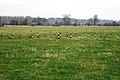 Geese grazing on flood meadows - geograph.org.uk - 1206753.jpg 640 × 428; 69 KB
-
 Glen Lyn Gorge - geograph.org.uk - 1200904.jpg 640 × 427; 120 KB
-
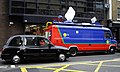 GMTV Outside Broadcast Van - geograph.org.uk - 1188014.jpg 640 × 386; 59 KB
-
 Grave slab, Kilninian church - geograph.org.uk - 1611119.jpg 480 × 640; 68 KB
-

-

-
 Halesworth - Church of St Mary the Virgin.jpg 3,072 × 2,304; 1.47 MB
-
 Halesworth banner Town Sign.jpg 3,072 × 439; 224 KB
-
 Halesworth Town Sign - geograph.org.uk - 1188840.jpg 3,072 × 2,304; 1.68 MB
-
 Halesworth Town Sign - geograph.org.uk - 1188843.jpg 3,072 × 2,304; 1.52 MB
-
 Halesworth War Memorial - geograph.org.uk - 1188836.jpg 3,072 × 2,304; 1.56 MB
-
 Hardwell Camp - panoramio - ian freeman (1).jpg 2,304 × 3,072; 3.39 MB
-
 Hardwell Camp - panoramio - ian freeman (2).jpg 3,072 × 2,304; 2.97 MB
-
 Hardwell Camp - panoramio - ian freeman (3).jpg 3,072 × 2,304; 3.46 MB
-
 Hardwell Camp - panoramio - ian freeman.jpg 3,072 × 2,304; 3.11 MB
-
 Hardwell Camp - panoramio.jpg 3,072 × 2,304; 3.81 MB
-
 Headcorn Station - Bridge over line - geograph.org.uk - 1190164.jpg 640 × 426; 59 KB
-
 Headcorn Station - geograph.org.uk - 1190166.jpg 640 × 414; 65 KB
-
 Headcorn Station - geograph.org.uk - 1190168.jpg 640 × 426; 67 KB
-
 Headcorn Station Platform - geograph.org.uk - 1190159.jpg 640 × 434; 59 KB
-
 Headcorn Station Platform - geograph.org.uk - 1190162.jpg 640 × 373; 62 KB
-
 Headcorn Station Platform - geograph.org.uk - 1190163.jpg 640 × 426; 59 KB
-
 Heading for Duns - geograph.org.uk - 1190042.jpg 640 × 433; 95 KB
-
 Heaste - geograph.org.uk - 1187891.jpg 640 × 480; 168 KB
-
 High Lovelady Shield Bastle House - geograph.org.uk - 1332426.jpg 640 × 480; 131 KB
-
 High Street - geograph.org.uk - 1187512.jpg 640 × 480; 87 KB
-
 Higher Lane - geograph.org.uk - 1188608.jpg 640 × 287; 36 KB
-
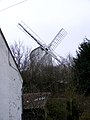 Holton Windmill - geograph.org.uk - 1188849.jpg 2,304 × 3,072; 1.7 MB
-
 Horse above Lynemouth Bay - geograph.org.uk - 1192390.jpg 640 × 480; 78 KB
-
 Housing at Lamberton - geograph.org.uk - 1188777.jpg 640 × 480; 53 KB
-
 In Low Hauxley - geograph.org.uk - 1198141.jpg 640 × 480; 66 KB
-
 Information Centre - geograph.org.uk - 1190059.jpg 640 × 427; 124 KB
-
 Jumble Sale sign - geograph.org.uk - 1187762.jpg 640 × 480; 238 KB
-
 Junction near Auchencrow - geograph.org.uk - 1188844.jpg 640 × 509; 51 KB
-

-
 Kildavie cleared village - geograph.org.uk - 1611097.jpg 640 × 480; 93 KB
-
 King George V Playing Field, Omagh - geograph.org.uk - 1187723.jpg 640 × 480; 84 KB
-

-
 Ladbroke Grove - geograph.org.uk - 1193406.jpg 640 × 480; 90 KB
-
 Ladyburn Lake - geograph.org.uk - 1194473.jpg 640 × 480; 56 KB
-
 Land prepared for the new season - geograph.org.uk - 1188510.jpg 640 × 480; 64 KB
-

-

-

-
 Light 1 (3330909027).jpg 4,752 × 2,364; 6.81 MB
-
 Light 1a bw (3331723252).jpg 4,752 × 2,364; 5.18 MB
-
 Light 2 (3330917541).jpg 4,752 × 3,168; 7.6 MB
-
 Light 3 (3330858623).jpg 4,752 × 3,168; 7.02 MB
-
 Limestone exposure below Druim Bhàin - geograph.org.uk - 1187970.jpg 640 × 480; 202 KB
-
 Limestone outcrop by the Heaste road - geograph.org.uk - 1187871.jpg 640 × 480; 168 KB
-
 Loch Cloich - geograph.org.uk - 1426875.jpg 640 × 480; 43 KB
-
 Lodge and entrance to Ayton Castle - geograph.org.uk - 1188798.jpg 640 × 401; 62 KB
-
 Lodge and entrance to Bonkyl Lodge - geograph.org.uk - 1188885.jpg 640 × 400; 93 KB
-
 London Bridge Station - geograph.org.uk - 1190170.jpg 640 × 326; 52 KB
-
 London Bridge Station - geograph.org.uk - 1190171.jpg 640 × 426; 71 KB
-

-
 London Road, Halesworth - geograph.org.uk - 1188831.jpg 3,072 × 2,304; 1.42 MB
-
 Lonely cottage near Lamberton - geograph.org.uk - 1188778.jpg 640 × 480; 43 KB
-
-
 Looking back to Scotland - geograph.org.uk - 1188762.jpg 640 × 480; 48 KB
-
 Looking back to the A1 road - geograph.org.uk - 1188781.jpg 640 × 480; 62 KB
-

-
 Looking over freshly planted fields - geograph.org.uk - 1188908.jpg 640 × 480; 54 KB
-

-

-
 Looking towards Hutton Mains Farm - geograph.org.uk - 1188610.jpg 640 × 480; 66 KB
-
 Lynemouth Bay - geograph.org.uk - 1192398.jpg 640 × 480; 64 KB
-
 M50 in the rain 1 - geograph.org.uk - 1187752.jpg 640 × 480; 194 KB
-
 M50 in the rain 2 - geograph.org.uk - 1187755.jpg 640 × 480; 192 KB
-
 Magnificent Marchmont House - geograph.org.uk - 1188104.jpg 640 × 480; 73 KB
-
 Manor Street, Forfar - geograph.org.uk - 1195144.jpg 640 × 428; 83 KB
-
 Market Place Halesworth - geograph.org.uk - 1188824.jpg 2,304 × 3,072; 1.42 MB
-
 Marooned - geograph.org.uk - 1187672.jpg 640 × 428; 109 KB
-

-

-
 Minor road in Berwickshire - geograph.org.uk - 1188504.jpg 640 × 480; 42 KB
-
 Minor road junction near Caldra - geograph.org.uk - 1188203.jpg 640 × 480; 76 KB
-
 Minor road through Lamberton - geograph.org.uk - 1188779.jpg 640 × 480; 59 KB
-
 Monks Path - geograph.org.uk - 1187803.jpg 640 × 360; 51 KB
-
 Monks Road - geograph.org.uk - 1187819.jpg 640 × 360; 58 KB
-
 Moorland above Broadford - geograph.org.uk - 1187920.jpg 640 × 427; 150 KB
-
 Moorland above Learable - geograph.org.uk - 1187319.jpg 640 × 480; 201 KB
-
 Moorland east of the A851 - geograph.org.uk - 1187953.jpg 640 × 480; 163 KB
-
 Newmills in Northumberland - geograph.org.uk - 1188766.jpg 640 × 480; 56 KB
-
 Nine Mile Burn - geograph.org.uk - 1187856.jpg 640 × 360; 51 KB
-
 North promenade (3325928658).jpg 4,656 × 2,706; 6.32 MB
-
 Northumberland Coast Path Logo - geograph.org.uk - 1193686.jpg 640 × 480; 88 KB
-
 Notice, Chapel Hill Pleasure Grounds - geograph.org.uk - 1190311.jpg 480 × 640; 124 KB
-
 Oil Mill Lane, Berwick - geograph.org.uk - 1209739.jpg 640 × 480; 87 KB
-
 Old bothy at Learable - geograph.org.uk - 1187289.jpg 640 × 480; 206 KB
-

-
 Old sheep fanks - geograph.org.uk - 1187901.jpg 640 × 480; 183 KB
-
 On Newbiggin Golf Course - geograph.org.uk - 1191036.jpg 640 × 480; 33 KB
-
 On the Road to Cresswell - geograph.org.uk - 1192416.jpg 640 × 480; 54 KB
-
 On the South Jetty - geograph.org.uk - 1198269.jpg 640 × 480; 63 KB
-
 Part of stone circle, at Learable - geograph.org.uk - 1187312.jpg 640 × 480; 236 KB
-

-
 Paxton in Berwickshire - geograph.org.uk - 1188757.jpg 640 × 480; 70 KB

.jpg)


.jpg)


.jpg)
.jpg)


.jpg)
.jpg)
.jpg)


_-_geograph.org.uk_-_1187921.jpg)
.jpg)
.jpg)
.jpg)
.jpg)


.jpg)


