Category:United Kingdom photographs taken on 2009-09-12
Jump to navigation
Jump to search
Countries of Europe: Albania · Austria · Belarus · Belgium · Croatia · Czech Republic · Denmark · Estonia · Finland · France‡ · Germany · Greece · Hungary · Italy · Latvia · Montenegro · Netherlands‡ · Norway · Poland · Portugal‡ · Romania · Russia‡ · Serbia · Slovakia · Spain‡ · Sweden · Switzerland · Ukraine · United Kingdom
‡: partly located in Europe
‡: partly located in Europe
| ← | 12 September 2009 | → | ||
| ← | September 2009 | → | ||

United Kingdom photographs taken on 12 September 2009.
Image files should be categorized here automatically using {{taken on}} template. Direct categorisation is also possible, if automatic is impossible.
Subcategories
This category has the following 16 subcategories, out of 16 total.
D
H
K
L
N
S
W
Media in category "United Kingdom photographs taken on 2009-09-12"
The following 200 files are in this category, out of 981 total.
(previous page) (next page)-
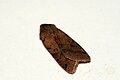
 (2266) Brown-spot Pinion (Agrochola litura) (3913044285).jpg 1,500 × 1,004; 1.28 MB
-
 (2266) Brown-spot Pinion (Agrochola litura) (3913832154).jpg 1,500 × 1,004; 865 KB
-
 -2009-09-12 Boiler room, Lydia Eva Steam Drifter, South Quay, Great Yarmouth.JPG 2,560 × 1,920; 1,022 KB
-
 -2009-09-12 Looking along the Britannia Pier, Great Yarmouth (1).JPG 2,560 × 1,920; 735 KB
-
 -2009-09-12 Lydia Eva Steam Drifter, South Quay, Great Yarmouth (1).JPG 2,560 × 1,920; 1.1 MB
-
 -2009-09-12 Lydia Eva Steam Drifter, South Quay, Great Yarmouth (2).JPG 2,560 × 1,920; 1.12 MB
-
 -2009-09-12 Lydia Eva Steam Drifter, South Quay, Great Yarmouth (3).JPG 1,920 × 2,560; 1.11 MB
-
 -2009-09-12 Lydia Eva Steam Drifter, South Quay, Great Yarmouth (4).JPG 1,920 × 2,560; 1.1 MB
-
 -2009-09-12 Lydia Eva Steam Drifter, South Quay, Great Yarmouth (5).JPG 1,920 × 2,560; 1.06 MB
-
 -2009-09-12 Lydia Eva Steam Drifter, South Quay, Great Yarmouth (6).JPG 2,560 × 1,920; 1.12 MB
-
 -2009-09-12 Lydia Eva Steam Drifter, South Quay, Great Yarmouth (7).jpg 2,560 × 1,920; 1.23 MB
-

-
 -2009-09-12 Wheel house, Lydia Eva Steam Drifter, South Quay, Great Yarmouth (1).JPG 1,920 × 2,560; 1.04 MB
-
 -2009-09-12 Wheel house, Lydia Eva Steam Drifter, South Quay, Great Yarmouth (2).JPG 2,560 × 1,920; 735 KB
-
 -2009-09-12 Wheel house, Lydia Eva Steam Drifter, South Quay, Great Yarmouth (3).JPG 1,920 × 2,560; 676 KB
-
 2009-09-12 Yare Haven bridge, Great Yarmouth.JPG 2,560 × 1,920; 1.07 MB
-
 A buoy on St Mary's Loch - geograph.org.uk - 1491444.jpg 434 × 640; 117 KB
-
 A House at Datchet - panoramio.jpg 3,035 × 2,244; 1.36 MB
-
 A303, Popham - geograph.org.uk - 1506570.jpg 640 × 480; 66 KB
-
 A515 - geograph.org.uk - 1518850.jpg 640 × 480; 54 KB
-
 A515 - geograph.org.uk - 1518867.jpg 640 × 480; 57 KB
-
 Abbot Hall - geograph.org.uk - 1492221.jpg 640 × 427; 63 KB
-
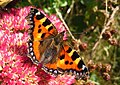 Aglais urticae - geograph.org.uk - 1502268.jpg 640 × 453; 103 KB
-
 Air Ambulance leaving Croft race circuit - geograph.org.uk - 1564092.jpg 640 × 480; 107 KB
-

-
 Asda, Rugby - geograph.org.uk - 1498672.jpg 640 × 480; 61 KB
-
 AutoGyro MTOsport at Leuchars 80.jpg 3,456 × 2,304; 1.1 MB
-
 Banking on Hawthorn Bend - geograph.org.uk - 1564083.jpg 640 × 480; 117 KB
-
 Bargain Stone - geograph.org.uk - 1490819.jpg 480 × 640; 125 KB
-
 Barlow Moor Road, Chorlton - panoramio - WythenshaweMike.jpg 3,072 × 2,304; 1.83 MB
-
 Barn Owl near Gemsbrook - geograph.org.uk - 1492461.jpg 640 × 480; 125 KB
-
 Barns at Gemsbrook - geograph.org.uk - 1492530.jpg 640 × 480; 66 KB
-
 Basking seals - geograph.org.uk - 1494204.jpg 640 × 480; 45 KB
-
 Bedfordshire Walking Festival - geograph.org.uk - 1490578.jpg 640 × 462; 134 KB
-
 Bend in Crasswell Street - geograph.org.uk - 1484656.jpg 640 × 480; 74 KB
-
 Bicycles, Brasenose Lane, Oxford. - panoramio.jpg 2,816 × 2,112; 2.95 MB
-
 Black Burn - geograph.org.uk - 1495781.jpg 640 × 329; 75 KB
-
 Boat in locks - geograph.org.uk - 1484703.jpg 640 × 480; 81 KB
-
 Bridge over Holcombe Brook - geograph.org.uk - 1588538.jpg 640 × 428; 124 KB
-
 Bridge over River Winster - geograph.org.uk - 1500461.jpg 640 × 480; 179 KB
-
 Bridge over the Afon Gwaun - geograph.org.uk - 1511160.jpg 640 × 480; 143 KB
-
 Bridge over the Witney bypass - geograph.org.uk - 1484907.jpg 640 × 480; 51 KB
-
 Bridge Street, Lower Town-Y Cwm - geograph.org.uk - 1510700.jpg 640 × 458; 101 KB
-
 Bridge, Barravourich - geograph.org.uk - 1491241.jpg 640 × 480; 134 KB
-
 Bridges, Mytholmroyd - geograph.org.uk - 1490374.jpg 640 × 480; 119 KB
-
 Bridleway to Little Lawford - geograph.org.uk - 1491117.jpg 640 × 428; 91 KB
-
 Bridleway to Long Lawford - geograph.org.uk - 1491110.jpg 640 × 428; 101 KB
-
 Brunels Royal Albert Bridge tide recorder.jpg 2,736 × 2,736; 1.93 MB
-
 Building on Hilbre Island 7.JPG 3,648 × 2,736; 3.58 MB
-
 Burial Mounds At Sutton - geograph.org.uk - 1484449.jpg 640 × 480; 101 KB
-
 Burn at Ford - geograph.org.uk - 1516456.jpg 480 × 640; 129 KB
-
 Burnfoot - geograph.org.uk - 1518066.jpg 640 × 428; 138 KB
-
 Bus Station Arrival - geograph.org.uk - 1783413.jpg 1,600 × 1,200; 381 KB
-
-
 Camasunary in autumn - geograph.org.uk - 1712410.jpg 800 × 600; 98 KB
-
 Canopy, Swansea West Services - geograph.org.uk - 1496667.jpg 442 × 640; 140 KB
-
 Car park at Moneypool Burn - geograph.org.uk - 1534606.jpg 640 × 475; 124 KB
-
 Carl Wark entrance 20090912.jpg 2,008 × 3,008; 2.02 MB
-
 Cattle at Haroldswick - geograph.org.uk - 1484392.jpg 640 × 426; 72 KB
-
 Cattle grid - geograph.org.uk - 1535054.jpg 640 × 480; 105 KB
-
 Cattle grid near Gatehouse Station - geograph.org.uk - 1535153.jpg 640 × 480; 95 KB
-
-
-
 Chapel-le-dale church - geograph.org.uk - 1485304.jpg 425 × 640; 138 KB
-
 Cheviot lamb on Millennium Hill - geograph.org.uk - 1484942.jpg 640 × 427; 288 KB
-

-
 Cleugh Head - geograph.org.uk - 1485464.jpg 640 × 314; 63 KB
-
 Clock Tower, Morpeth - geograph.org.uk - 1543664.jpg 640 × 480; 87 KB
-
 Clough Head and Clough Head Hill - geograph.org.uk - 1491134.jpg 640 × 480; 102 KB
-
 Coire dà Leathaid - geograph.org.uk - 1492818.jpg 640 × 480; 125 KB
-
 Coire Maol Chaluim - geograph.org.uk - 1492834.jpg 640 × 480; 121 KB
-

-
 Colston Avenue, Bristol.jpg 3,488 × 2,616; 1.77 MB
-
 Comber Road at Ballykeel Edengonnell - geograph.org.uk - 1484745.jpg 640 × 480; 69 KB
-
 Complex corner - Croft Circuit - geograph.org.uk - 1564110.jpg 640 × 480; 134 KB
-
 Concrete bridge on a forestry track - geograph.org.uk - 1534611.jpg 640 × 480; 125 KB
-

-

-

-

-
 Corn Street, Witney - geograph.org.uk - 1484896.jpg 640 × 480; 57 KB
-
 Cors yr Hwch - geograph.org.uk - 1484859.jpg 640 × 480; 69 KB
-
 Cottages, Main Rd, Crockham Hill - geograph.org.uk - 1501201.jpg 640 × 430; 155 KB
-
 Cottages, Main Rd, Crookham Hill - geograph.org.uk - 1501617.jpg 640 × 430; 120 KB
-
 Country lane above Clatter - geograph.org.uk - 1590729.jpg 640 × 426; 83 KB
-
 Country road to Trawscoed - geograph.org.uk - 1588877.jpg 426 × 640; 69 KB
-
 Covered Reservoir, Puddledock Lane - geograph.org.uk - 1499884.jpg 640 × 430; 91 KB
-
 Covered Reservoir, Puddledock Lane - geograph.org.uk - 1499894.jpg 640 × 430; 122 KB
-
 Crags, Silver Cove - geograph.org.uk - 1495213.jpg 640 × 480; 77 KB
-
 Craigie Linn - geograph.org.uk - 1517907.jpg 428 × 640; 123 KB
-
 Cribarth.jpg 3,872 × 2,592; 2.33 MB
-
 Croft circuit banking - geograph.org.uk - 1564137.jpg 640 × 480; 130 KB
-
 Crossroads at Magheraconluce - geograph.org.uk - 1484544.jpg 640 × 480; 113 KB
-
 Culvert, Water of Tulla road - geograph.org.uk - 1491571.jpg 640 × 480; 109 KB
-
 Cut silage drying in a field near Burton - geograph.org.uk - 1486213.jpg 640 × 480; 102 KB
-
 Danebury Ring, Iron Age Hill Fort - geograph.org.uk - 1506378.jpg 640 × 480; 67 KB
-
 Decisions, decisions - geograph.org.uk - 1511098.jpg 640 × 480; 90 KB
-
 Decorative brickwork on disused building - geograph.org.uk - 1492644.jpg 640 × 480; 135 KB
-
-
 Deep Gill - geograph.org.uk - 1491235.jpg 480 × 640; 123 KB
-
 Deep Gill - geograph.org.uk - 1491238.jpg 640 × 480; 121 KB
-
 Deep Gill - geograph.org.uk - 1492838.jpg 480 × 640; 120 KB
-
 Deep Gill - geograph.org.uk - 1492843.jpg 480 × 640; 142 KB
-
 Deep Gill - geograph.org.uk - 1495240.jpg 640 × 480; 86 KB
-
 Deep Gill - geograph.org.uk - 1495256.jpg 480 × 640; 96 KB
-
 Deep Gill - geograph.org.uk - 1495265.jpg 640 × 480; 101 KB
-
 Deep Gill - geograph.org.uk - 1495273.jpg 640 × 480; 88 KB
-
 Deep Gill - geograph.org.uk - 1495299.jpg 640 × 480; 124 KB
-
 Delivery lorry beside footpath - geograph.org.uk - 1491053.jpg 640 × 480; 104 KB
-
 Derelict barn at Holmbush Manor Farm - geograph.org.uk - 1492674.jpg 640 × 480; 117 KB
-
 Derelict barns near Waterland Farm - geograph.org.uk - 1494135.jpg 640 × 480; 71 KB
-
-
 Derelict house, Chartwell - geograph.org.uk - 1500053.jpg 640 × 430; 152 KB
-
-
 Dick Brook looking east from footbridge - geograph.org.uk - 1490159.jpg 480 × 640; 155 KB
-
 Dick Brook looking west from footbridge - geograph.org.uk - 1490148.jpg 480 × 640; 161 KB
-
-
 Dinmont House - geograph.org.uk - 1495789.jpg 640 × 409; 75 KB
-
 Discount Tyres - geograph.org.uk - 1494351.jpg 640 × 412; 185 KB
-
 Disused mine workings - geograph.org.uk - 1506663.jpg 640 × 480; 96 KB
-
 Disused silos at Holmbush Manor Farm - geograph.org.uk - 1492688.jpg 640 × 480; 70 KB
-
 Dollar Academy entrance - geograph.org.uk - 1484779.jpg 640 × 481; 104 KB
-
 Double stile at Warhams - geograph.org.uk - 1490800.jpg 640 × 480; 120 KB
-
 Down the steps ... to the Law Courts - geograph.org.uk - 1530782.jpg 480 × 640; 57 KB
-
 Drive off Froghole Lane - geograph.org.uk - 1500959.jpg 640 × 430; 148 KB
-
 Drive to Warhams - geograph.org.uk - 1490809.jpg 640 × 480; 107 KB
-
 Dromara Road, Ballykeel - geograph.org.uk - 1484184.jpg 640 × 480; 58 KB
-
 Dromara Road, Drumlough - geograph.org.uk - 1484199.jpg 640 × 480; 84 KB
-
 Dromore farmhouse - geograph.org.uk - 1534997.jpg 640 × 459; 58 KB
-
 Drum Dargwylltion - geograph.org.uk - 1484803.jpg 640 × 480; 121 KB
-
 Drum Nantyrgorlan - geograph.org.uk - 1484784.jpg 640 × 480; 93 KB
-
 Drum yr Eira - geograph.org.uk - 1484740.jpg 640 × 480; 77 KB
-
 Drumlough Road, Hillsborough - geograph.org.uk - 1484209.jpg 640 × 480; 97 KB
-
 Drumlough Road, Magheraconluce - geograph.org.uk - 1484221.jpg 640 × 480; 71 KB
-
 Drumlough Townland - geograph.org.uk - 1484207.jpg 640 × 480; 59 KB
-

-
 Drystane dyke on Black Hill - geograph.org.uk - 1518136.jpg 640 × 428; 48 KB
-
 Ducks and pond at Warnham Manor - geograph.org.uk - 1493766.jpg 640 × 480; 113 KB
-
 Dunnswood Sewage Works - geograph.org.uk - 1514809.jpg 640 × 480; 98 KB
-
 Dyke, Achallader - geograph.org.uk - 1491224.jpg 640 × 480; 107 KB
-
 Eagle Court - geograph.org.uk - 1530456.jpg 640 × 480; 64 KB
-
-
 East Breakwater - geograph.org.uk - 1484769.jpg 640 × 480; 64 KB
-
 Eastfield, Froghole Lane - geograph.org.uk - 1500952.jpg 640 × 430; 157 KB
-
 Edge of the marsh - geograph.org.uk - 1494200.jpg 640 × 480; 39 KB
-
 Eilean na Cloiche - geograph.org.uk - 1485287.jpg 640 × 480; 54 KB
-
 Eilean nam Bridianach - geograph.org.uk - 1498867.jpg 640 × 480; 74 KB
-

-
 Enjoying the sunshine at Seaview - geograph.org.uk - 1484957.jpg 640 × 480; 94 KB
-
 Ennerdale - geograph.org.uk - 1491212.jpg 640 × 480; 71 KB
-
 Entrance to Cousins Farm - geograph.org.uk - 1491145.jpg 640 × 480; 83 KB
-

-
 Entrance, Bardogs Farm, Puddledock Lane - geograph.org.uk - 1499764.jpg 640 × 430; 137 KB
-
 Evening in West Street - geograph.org.uk - 1511084.jpg 640 × 480; 81 KB
-
 Exhibition Hall, Sutton Hoo - geograph.org.uk - 1484430.jpg 640 × 480; 106 KB
-
 Exiting the Pitt's Wood Enclosure - geograph.org.uk - 1638820.jpg 480 × 640; 109 KB
-
 Fanshawe Lane, nr Redes Mere - geograph.org.uk - 1484856.jpg 600 × 338; 68 KB
-
 Farm track at Little Saxham - geograph.org.uk - 1496954.jpg 640 × 427; 91 KB
-
 Farm track at Little Saxham - geograph.org.uk - 1496974.jpg 640 × 427; 102 KB
-
 Farmland At Sutton - geograph.org.uk - 1484600.jpg 640 × 480; 100 KB
-
 Farmland Overlooking Hebden Dale - geograph.org.uk - 1491147.jpg 640 × 480; 65 KB
-
 Featherstone Castle - geograph.org.uk - 1495761.jpg 640 × 410; 132 KB
-
 Featherstone Common - geograph.org.uk - 1485255.jpg 391 × 640; 53 KB
-
 Fence, Gorton - geograph.org.uk - 1491596.jpg 640 × 480; 112 KB
-
 Field and tree at Little Saxham - geograph.org.uk - 1496950.jpg 427 × 640; 96 KB
-
 Field at Higher Tregerest - geograph.org.uk - 1497489.jpg 640 × 480; 68 KB
-
 Field behind Lodge Farm - geograph.org.uk - 1496944.jpg 427 × 640; 95 KB
-
 Fields west of Long Lawford - geograph.org.uk - 1494075.jpg 640 × 428; 94 KB
-
 Fish farm on Loch Langabhat - geograph.org.uk - 1499003.jpg 640 × 480; 81 KB
-
 Fishguard Herrings - geograph.org.uk - 1510665.jpg 640 × 480; 75 KB
-
 Font, Merrow Church - geograph.org.uk - 1484391.jpg 480 × 640; 63 KB
-
 Footbridge and railway bridge, Hollinwood - panoramio.jpg 2,048 × 1,536; 1.09 MB
-

-
 Footbridge over Dick Brook - geograph.org.uk - 1490105.jpg 480 × 640; 139 KB
-

-
 Footpath At Foot Of Foul Hill - geograph.org.uk - 1490852.jpg 480 × 640; 158 KB
-
 Footpath crossing the Downs Link - geograph.org.uk - 1492698.jpg 640 × 480; 137 KB
-

-
 Ford at Little Lawford - geograph.org.uk - 1493978.jpg 640 × 428; 106 KB
-
 Forest Lodge, Mapleton Rd - geograph.org.uk - 1500115.jpg 640 × 430; 154 KB
-
 Forest Track - geograph.org.uk - 1491220.jpg 640 × 480; 134 KB
-
 Forest track at Knock Derry - geograph.org.uk - 1517884.jpg 640 × 428; 44 KB
-
 Forest track crossing Burnfoot Burn - geograph.org.uk - 1517897.jpg 640 × 428; 61 KB
-
-
 Forest track near Moneypool Burn - geograph.org.uk - 1534622.jpg 640 × 480; 111 KB
-

-

-
 Former Sunbeam Works - geograph.org.uk - 1485528.jpg 640 × 480; 216 KB
-
 Fort Works - Pelham Street - geograph.org.uk - 1485284.jpg 640 × 480; 195 KB
-
 Forton services, M6 - geograph.org.uk - 1531459.jpg 640 × 434; 38 KB
-
 Foul Scout Wood - geograph.org.uk - 1491023.jpg 640 × 480; 118 KB
-
 Freshes Creek - geograph.org.uk - 1495513.jpg 640 × 480; 202 KB
-
 From Tewit How - geograph.org.uk - 1494373.jpg 640 × 480; 82 KB
-
 Gardens at Lanhydrock House - geograph.org.uk - 1569399.jpg 640 × 480; 89 KB
-
 Gate and Stile on the Greensand Way - geograph.org.uk - 1499231.jpg 640 × 430; 167 KB
-
-
 Gate on the footpath to Chartwell - geograph.org.uk - 1499972.jpg 640 × 430; 189 KB
-

-
 Gate, Puddledock Lane - geograph.org.uk - 1499783.jpg 640 × 430; 174 KB
-

_Brown-spot_Pinion_(Agrochola_litura)_(3913044285).jpg)
_Brown-spot_Pinion_(Agrochola_litura)_(3913832154).jpg)

.JPG)
.JPG)
.JPG)
.JPG)
.JPG)
.JPG)
.JPG)
.jpg)

.JPG)
.JPG)
.JPG)


_-_geograph.org.uk_-_1502332.jpg)
_through_Nowhurst_Copse_-_geograph.org.uk_-_1493593.jpg)


)_-_geograph.org.uk_-_1502313.jpg)


