Category:United Kingdom photographs taken on 2009-09-22
Jump to navigation
Jump to search
Countries of Europe: Albania · Austria · Bulgaria · Denmark · Finland · France‡ · Germany · Greece · Italy · Latvia · Malta · Monaco · Montenegro · Netherlands‡ · Norway · Poland · Portugal‡ · Romania · Russia‡ · Serbia · Spain‡ · Switzerland · Turkey‡ · Ukraine · United Kingdom
‡: partly located in Europe
‡: partly located in Europe
| ← | 22 September 2009 | → | ||
| ← | September 2009 | → | ||

United Kingdom photographs taken on 22 September 2009.
Image files should be categorized here automatically using {{taken on}} template. Direct categorisation is also possible, if automatic is impossible.
Subcategories
This category has the following 2 subcategories, out of 2 total.
L
S
Media in category "United Kingdom photographs taken on 2009-09-22"
The following 200 files are in this category, out of 712 total.
(previous page) (next page)-
 "Round-house" at Yarrows. - geograph.org.uk - 1502701.jpg 640 × 480; 153 KB
-
 "Say cheese", sheep near Loch Sarclet. - geograph.org.uk - 1502670.jpg 640 × 481; 141 KB
-
 (2255) Feathered Ranunculus (Polymixis lichenea) (3952021662).jpg 1,500 × 1,004; 1.67 MB
-
 (2273) Pink-barred Sallow (Xanthia togata) (3951272029).jpg 1,500 × 1,004; 793 KB
-
 (2273) Pink-barred Sallow (Xanthia togata) (3951273137).jpg 1,500 × 1,004; 1.31 MB
-
 132 KV pylons cheek by jowl - geograph.org.uk - 1502587.jpg 557 × 640; 194 KB
-
 699 bus on Eversley Park Road, Winchmore Hill - geograph.org.uk - 2611588.jpg 1,594 × 1,116; 660 KB
-
 A brick wall enclosure - geograph.org.uk - 1501297.jpg 480 × 640; 154 KB
-
 A colourful crop of pumpkins - geograph.org.uk - 1587932.jpg 640 × 480; 67 KB
-
 A Former School at Lossiemouth - geograph.org.uk - 1511800.jpg 640 × 480; 89 KB
-
 A Rose at Station Park Lossiemouth - geograph.org.uk - 1511973.jpg 640 × 638; 110 KB
-
 A walk on the beach - geograph.org.uk - 1524415.jpg 640 × 480; 50 KB
-
 A46 roadworks dumper truck at work - geograph.org.uk - 1502956.jpg 640 × 460; 74 KB
-
 Abhainn a Loch Chragaich - geograph.org.uk - 1715455.jpg 2,592 × 1,944; 614 KB
-

-
 An Anchor on the Quayside at Lossiemouth - geograph.org.uk - 1511851.jpg 640 × 490; 136 KB
-
 An inlet coming from Caerfai Bay - geograph.org.uk - 1544501.jpg 640 × 480; 284 KB
-
 Anchor Inn Sidmouth - geograph.org.uk - 1505689.jpg 640 × 480; 72 KB
-
 Apple Box Trailer at Nickle Farm - geograph.org.uk - 1502212.jpg 640 × 320; 56 KB
-
 Apple Boxes at Nickle Farm - geograph.org.uk - 1501886.jpg 640 × 427; 107 KB
-
 Asda Living, Newport Retail Park - geograph.org.uk - 1720200.jpg 640 × 487; 73 KB
-
 Ash Road, Wickham Market - geograph.org.uk - 1501434.jpg 3,072 × 2,304; 1.54 MB
-
 Autumn is on hand - geograph.org.uk - 1501995.jpg 640 × 427; 81 KB
-
 Ayton Castle - geograph.org.uk - 1501644.jpg 640 × 480; 81 KB
-
 B1078 Lower Street, Wickham Market - geograph.org.uk - 1501429.jpg 3,072 × 2,304; 1.42 MB
-
 B1438 Snowdon Hill, Wickham Market - geograph.org.uk - 1501421.jpg 3,072 × 2,304; 1.45 MB
-
 Bandstand in Myatt's Fields - geograph.org.uk - 1502237.jpg 640 × 480; 373 KB
-
 Barn for sale - geograph.org.uk - 1501239.jpg 640 × 428; 69 KB
-
 Barrow Town Hall, Cumbria, NWE.jpg 640 × 449; 91 KB
-
 Nursery Close, Barton Upon Humber - geograph.org.uk - 1501881.jpg 640 × 480; 287 KB
-
 Beccles 1 - geograph.org.uk - 1502990.jpg 480 × 640; 124 KB
-

-
 Black Roof House, Knatchbull Road - geograph.org.uk - 1502219.jpg 480 × 640; 283 KB
-
 Blackpool Sands and beyond - geograph.org.uk - 1502050.jpg 640 × 480; 24 KB
-
-
 Boathouses by the River Thames - geograph.org.uk - 1501788.jpg 640 × 480; 99 KB
-
 Boots, Newport Retail Park - geograph.org.uk - 1719603.jpg 640 × 466; 70 KB
-
 Bothwell Street drying area - geograph.org.uk - 1522197.jpg 480 × 640; 108 KB
-
 Box Hill From Westhumble, Surrey - geograph.org.uk - 1504022.jpg 640 × 428; 64 KB
-
 Braddylls Arms at Ulverston - geograph.org.uk - 1513690.jpg 480 × 640; 114 KB
-
 Braddylls Arms at Ulverston - geograph.org.uk - 1513713.jpg 640 × 480; 121 KB
-
 Bridge Over the River Mole, Mickleham, Surrey - geograph.org.uk - 1504222.jpg 3,872 × 2,592; 2.94 MB
-
 British Telecom Inspection Cover - geograph.org.uk - 1503046.jpg 3,072 × 2,304; 1.65 MB
-
 Brixham breakwater lighthouse - geograph.org.uk - 1505755.jpg 640 × 503; 71 KB
-
 Broch at Loch of the Yarrows (detail). - geograph.org.uk - 1502778.jpg 640 × 480; 142 KB
-
 Broch at Loch of the Yarrows. - geograph.org.uk - 1502769.jpg 640 × 480; 137 KB
-
 Broch at Loch of the Yarrows. - geograph.org.uk - 1502774.jpg 640 × 480; 137 KB
-
 Building works on Blechynden Terrace - geograph.org.uk - 1502619.jpg 640 × 427; 222 KB
-
 Business studies, Coventry University - panoramio.jpg 3,008 × 2,000; 2.76 MB
-
 By Ringmore Road - geograph.org.uk - 1509364.jpg 640 × 482; 130 KB
-

-
 Cairn on hill above Bhomasdal - geograph.org.uk - 1524293.jpg 640 × 480; 36 KB
-
 Cardinal Place, Victoria Street - geograph.org.uk - 1500974.jpg 640 × 480; 84 KB
-
 Carreg Fran viewed from the coast path - geograph.org.uk - 1544551.jpg 640 × 480; 189 KB
-
 Carterton Town Hall - geograph.org.uk - 1501661.jpg 640 × 427; 77 KB
-
 Cattle in Postwick Marsh - geograph.org.uk - 1502001.jpg 600 × 546; 105 KB
-
 Cattle near Garrington - geograph.org.uk - 1543942.jpg 640 × 480; 177 KB
-
 Channel Tunnel Rail Link - geograph.org.uk - 1502047.jpg 640 × 427; 88 KB
-
 Chapel Lane, Belfast - geograph.org.uk - 1501453.jpg 640 × 480; 89 KB
-
 Chapel Lane, Wickham Market - geograph.org.uk - 1503811.jpg 3,072 × 2,304; 1.41 MB
-
 Chatsworth House Gardens - geograph.org.uk - 1503401.jpg 640 × 480; 70 KB
-
 Chewing the cud - geograph.org.uk - 1501912.jpg 640 × 446; 70 KB
-
 Chichester Road Pyracanthas - geograph.org.uk - 1502995.jpg 640 × 428; 163 KB
-

-
 Chimneys and Roofs in Souttergate - geograph.org.uk - 1503967.jpg 640 × 489; 77 KB
-
 Church at Sidmouth - geograph.org.uk - 1505681.jpg 480 × 640; 63 KB
-
 Church Gate - geograph.org.uk - 1508377.jpg 640 × 480; 83 KB
-

-
 Church Street - geograph.org.uk - 1502890.jpg 640 × 427; 77 KB
-

-
 Clachan Bridge - geograph.org.uk - 1509912.jpg 640 × 426; 366 KB
-

-

-

-

-

-

-

-
-

-

-
-
 Clarence Pier, Southsea - geograph.org.uk - 1606216.jpg 640 × 480; 59 KB
-
 Clearing in Wykeham Forest - geograph.org.uk - 1502421.jpg 640 × 480; 97 KB
-
 Cliffs of Dun Mor, Ellenabeich - geograph.org.uk - 1509254.jpg 640 × 426; 184 KB
-
 Clouds, surf and sand - geograph.org.uk - 1524330.jpg 640 × 480; 34 KB
-
 Clover Field - geograph.org.uk - 1502472.jpg 640 × 480; 100 KB
-

-
 Coast path by Ramsey Sound - geograph.org.uk - 1544578.jpg 640 × 480; 221 KB
-
 Coast path to Llech Cyllyll - geograph.org.uk - 1544535.jpg 480 × 640; 273 KB
-
 College Avenue, Belfast - geograph.org.uk - 1501357.jpg 640 × 480; 67 KB
-
 Colourful Display Denbies Wine Estate, near Dorking, Surrey, 2009.jpg 640 × 428; 117 KB
-
 Converted barns, Gaydon - geograph.org.uk - 1501259.jpg 640 × 428; 51 KB
-
 Cormont Road (1893) - geograph.org.uk - 1502213.jpg 640 × 480; 119 KB
-

-

-
 Cottage in Fox Lane - geograph.org.uk - 1501251.jpg 640 × 525; 138 KB
-
 Cottage in Fox Lane - geograph.org.uk - 1501255.jpg 640 × 480; 120 KB
-
 Cottage in Fox Road - geograph.org.uk - 1501364.jpg 640 × 480; 112 KB
-
 Cottage in Fox Road - geograph.org.uk - 1501368.jpg 640 × 490; 103 KB
-
 Cottage in Fox Road - geograph.org.uk - 1501371.jpg 640 × 480; 132 KB
-
 Cottage, Lingreabhagh Bay - geograph.org.uk - 1524455.jpg 640 × 480; 74 KB
-
 Cottages by the Wherryman's Way - geograph.org.uk - 1501916.jpg 640 × 480; 132 KB
-
 Cottages in Fox Road - geograph.org.uk - 1501355.jpg 640 × 480; 86 KB
-
 Cottages in Kinloch Rannoch - geograph.org.uk - 1504655.jpg 640 × 480; 88 KB
-

-
 Coulardbank Road at Lossiemouth - geograph.org.uk - 1511814.jpg 640 × 480; 58 KB
-
 Countess Wear - geograph.org.uk - 1504645.jpg 640 × 480; 63 KB
-
 Coventry Cathedral I - panoramio.jpg 3,008 × 2,000; 882 KB
-
 Crawford Bridge from Albion Terrace - geograph.org.uk - 1522192.jpg 640 × 480; 71 KB
-
 Crawford Bridge, Bothwell Street - geograph.org.uk - 1522191.jpg 640 × 480; 63 KB
-

-
 Crop Field off Wykeham Lane - geograph.org.uk - 1502398.jpg 640 × 480; 90 KB
-
-
 Cross the Road - geograph.org.uk - 1504764.jpg 640 × 428; 79 KB
-

-
 Dead Man's Hole, under Tower Bridge - geograph.org.uk - 1502545.jpg 640 × 431; 76 KB
-
 Decorative brick - a Tudor Swan - geograph.org.uk - 1501980.jpg 612 × 567; 163 KB
-
 Decorative bricks in wall - geograph.org.uk - 1501974.jpg 640 × 473; 135 KB
-
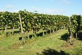 Denbies Vineyard, Dorking, Surrey - geograph.org.uk - 1503163.jpg 640 × 428; 118 KB
-
 Denbies Vineyard, Dorking, Surrey - geograph.org.uk - 1503658.jpg 640 × 428; 77 KB
-
 Denstead Lane - geograph.org.uk - 1502217.jpg 640 × 480; 86 KB
-

-
 Derelict buildings by Loch Brickigoe. - geograph.org.uk - 1502786.jpg 640 × 480; 144 KB
-
 Digge Court Cottages - geograph.org.uk - 1502049.jpg 640 × 427; 80 KB
-
 Discing at Burleigh Farm - geograph.org.uk - 1502014.jpg 640 × 427; 85 KB
-
 Distant view across the fields - geograph.org.uk - 1502097.jpg 640 × 427; 99 KB
-
 Disused Chapel, Main Street - geograph.org.uk - 1501584.jpg 640 × 480; 78 KB
-
 Disused Railway Track Bed, Wykeham - geograph.org.uk - 1501918.jpg 640 × 480; 111 KB
-
-
 Down the road to Lingreabhagh - geograph.org.uk - 1522841.jpg 640 × 480; 55 KB
-
 Downstream on the River Yare - geograph.org.uk - 1502019.jpg 640 × 480; 135 KB
-

-
 Dryobotodes eremita (3946325995).jpg 1,500 × 1,004; 922 KB
-
 Duke Street, Barrow-in-Furness.jpg 640 × 470; 110 KB
-
 Dumbleton drinking fountain - geograph.org.uk - 1502966.jpg 480 × 640; 232 KB
-
 Dunalastair Hotel, Kinloch Rannoch - geograph.org.uk - 1504637.jpg 640 × 480; 95 KB
-
 Dunes and beach - geograph.org.uk - 1524311.jpg 640 × 480; 39 KB
-
 Dunn Street - geograph.org.uk - 1502100.jpg 640 × 427; 91 KB
-
 Durlston Bay from Durlston Head - geograph.org.uk - 1626714.jpg 640 × 480; 89 KB
-
 East Field - geograph.org.uk - 1502453.jpg 640 × 480; 91 KB
-
 East Ilsley War Memorial - geograph.org.uk - 1659865.jpg 477 × 640; 66 KB
-
 Easy route to the monument - geograph.org.uk - 1565392.jpg 640 × 480; 107 KB
-
 Edina Works from the rear - geograph.org.uk - 1522334.jpg 640 × 480; 97 KB
-
 Edina Works, Edina Place - geograph.org.uk - 1522310.jpg 640 × 480; 133 KB
-
 Edina Works, Edina Place - geograph.org.uk - 1522316.jpg 640 × 480; 126 KB
-
 Edina Works, Edina Place - geograph.org.uk - 1522325.jpg 480 × 640; 87 KB
-
 Emirates Stadium 22-09-2009.JPG 6,098 × 2,302; 2.39 MB
-
 End of Seafront - geograph.org.uk - 1505704.jpg 640 × 480; 72 KB
-
 End of the road. - geograph.org.uk - 1502093.jpg 640 × 360; 67 KB
-
 Ennomos autumnaria (3947106554).jpg 1,500 × 1,004; 1.02 MB
-

-
 Entrance into a farmyard - geograph.org.uk - 1501561.jpg 640 × 480; 104 KB
-
 Entrance to "Long Cairn" at Yarrows. - geograph.org.uk - 1502693.jpg 640 × 480; 205 KB
-
 Entrance to Framingham Manor - geograph.org.uk - 1501305.jpg 520 × 640; 142 KB
-
 Ex-railway goods van in farmyard - geograph.org.uk - 1501563.jpg 476 × 640; 99 KB
-
 Exeter Cathedral - geograph.org.uk - 1504604.jpg 640 × 480; 62 KB
-
 Exeter Cathedral - geograph.org.uk - 1504612.jpg 640 × 480; 72 KB
-
 Exeter Quays - geograph.org.uk - 1504601.jpg 640 × 480; 59 KB
-
 Expensive fill-up - geograph.org.uk - 1504428.jpg 640 × 480; 93 KB
-
 Fairy Glen - geograph.org.uk - 1527409.jpg 428 × 640; 149 KB
-
 Far Lane to Hutton Bescel - geograph.org.uk - 1502443.jpg 640 × 480; 85 KB
-
 Far Lane to Hutton Bescel - geograph.org.uk - 1502449.jpg 640 × 480; 89 KB
-
 Farm Building, Far Lane - geograph.org.uk - 1502447.jpg 640 × 480; 60 KB
-
 Farm Building, Great Moor Road - geograph.org.uk - 1502431.jpg 640 × 480; 85 KB
-
 Farm Buildings, Ings Road - geograph.org.uk - 1501683.jpg 640 × 480; 68 KB
-
 Farmhouse, Gaydon - geograph.org.uk - 1501252.jpg 640 × 428; 82 KB
-

-
 Farmland South of Darrell's Low Farm - geograph.org.uk - 1501714.jpg 640 × 480; 75 KB
-
 Farmland west of Dumbleton - geograph.org.uk - 1502959.jpg 640 × 480; 211 KB
-
 Farmland, Darrell's Low Farm - geograph.org.uk - 1501698.jpg 640 × 480; 86 KB
-
 Farmland, Irton Moor - geograph.org.uk - 1502464.jpg 640 × 480; 38 KB
-
 Farmland, North Moor - geograph.org.uk - 1502403.jpg 640 × 480; 68 KB
-
 Field boundary near Garrington - geograph.org.uk - 1543908.jpg 640 × 480; 190 KB
-

-
 Field north of Fox Lane - geograph.org.uk - 1501318.jpg 640 × 450; 75 KB
-
 Fields by the Arch Brook - geograph.org.uk - 1508518.jpg 640 × 435; 82 KB
-
-
-
 Fionnsabhagh with sheep - geograph.org.uk - 1524449.jpg 640 × 480; 65 KB
-
 Fishermans Cottage, Penberth - geograph.org.uk - 1541624.jpg 640 × 423; 70 KB
-
 Fishing Boats, Penberth Cove - geograph.org.uk - 1564947.jpg 640 × 425; 86 KB
-
 Flies feasting on cow - geograph.org.uk - 1502016.jpg 591 × 640; 155 KB
-
 Follow the Trains - geograph.org.uk - 1504065.jpg 640 × 428; 68 KB
-
 Footbridge over Allt Mor - geograph.org.uk - 1504382.jpg 640 × 480; 187 KB
-
 Footbridge over the Cragg Brook - geograph.org.uk - 1504464.jpg 640 × 480; 120 KB
-
 Footbridge Over the Rive Mole, Westhumble, Surrey - geograph.org.uk - 1504058.jpg 2,592 × 3,872; 4.59 MB
-

-
-
 Footpath Next to Caravan Park - geograph.org.uk - 1501634.jpg 640 × 480; 113 KB
-
 Footpath to River Derwent - geograph.org.uk - 1501674.jpg 640 × 480; 126 KB
-
 Ford Prefect in Rectory Close - geograph.org.uk - 1501538.jpg 640 × 480; 79 KB
-
 Forest Road - geograph.org.uk - 1502415.jpg 640 × 480; 90 KB
-
 Forest Track - geograph.org.uk - 1502405.jpg 640 × 480; 145 KB
-
 Forest Track - geograph.org.uk - 1502419.jpg 640 × 480; 109 KB
-
 Forest Track - geograph.org.uk - 1502424.jpg 640 × 480; 105 KB
-
 Fort Blockhouse and the Fast Cat - geograph.org.uk - 1606227.jpg 640 × 480; 43 KB
-
 Fox Lane - geograph.org.uk - 1501314.jpg 480 × 640; 137 KB
-
 Fox Lane past Framingham Manor - geograph.org.uk - 1501330.jpg 640 × 533; 167 KB
-
 Fox Lane past Framingham Manor - geograph.org.uk - 1501335.jpg 620 × 558; 171 KB


_Feathered_Ranunculus_(Polymixis_lichenea)_(3952021662).jpg)
_Pink-barred_Sallow_(Xanthia_togata)_(3951272029).jpg)
_Pink-barred_Sallow_(Xanthia_togata)_(3951273137).jpg)


._-_geograph.org.uk_-_1502778.jpg)


_and_%22Round-house%22_at_Yarrows._-_geograph.org.uk_-_1502704.jpg)


_-_geograph.org.uk_-_1524503.jpg)
_-_geograph.org.uk_-_1524552.jpg)
_-_geograph.org.uk_-_1524559.jpg)
_-_geograph.org.uk_-_1524514.jpg)
_-_geograph.org.uk_-_1524518.jpg)
_-_geograph.org.uk_-_1524523.jpg)
_-_geograph.org.uk_-_1524526.jpg)
_-_geograph.org.uk_-_1524533.jpg)
_-_geograph.org.uk_-_1524535.jpg)
_-_geograph.org.uk_-_1524539.jpg)
_-_geograph.org.uk_-_1524543.jpg)


_-_geograph.org.uk_-_1502213.jpg)


.jpg)


.jpg)


_-_geograph.org.uk_-_1501645.jpg)
_-_geograph.org.uk_-_1501827.jpg)


