Category:United Kingdom photographs taken on 2009-10-25
Jump to navigation
Jump to search
Countries of Europe: Armenia‡ · Austria · Belarus · Belgium · Bosnia and Herzegovina · Croatia · Czech Republic · Denmark · Estonia · Finland · France‡ · Germany · Greece · Hungary · Italy · Latvia · Lithuania · Netherlands‡ · Norway · Poland · Portugal‡ · Romania · Russia‡ · Serbia · Slovakia · Slovenia · Spain‡ · Switzerland · Turkey‡ · Ukraine · United Kingdom
‡: partly located in Europe
‡: partly located in Europe
| ← | 25 October 2009 | → | ||
| ← | October 2009 | → | ||

United Kingdom photographs taken on 25 October 2009.
Image files should be categorized here automatically using {{taken on}} template. Direct categorisation is also possible, if automatic is impossible.
Subcategories
This category has the following 2 subcategories, out of 2 total.
Media in category "United Kingdom photographs taken on 2009-10-25"
The following 200 files are in this category, out of 1,404 total.
(previous page) (next page)-

-
 'Monks Cross' - geograph.org.uk - 1554524.jpg 640 × 480; 100 KB
-
 (1768) Grey Pine Carpet (Thera obeliscata) (4045252193).jpg 1,500 × 1,004; 1.53 MB
-
 2 in 1 Sandwich Bar and Grill - Westgate - geograph.org.uk - 1553974.jpg 640 × 484; 102 KB
-
-
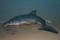
 A Basking Shark meets its fate - geograph.org.uk - 1553827.jpg 640 × 427; 29 KB
-

-
 A mighty beast - geograph.org.uk - 1554457.jpg 640 × 480; 74 KB
-

-
 A tunnel of colour - geograph.org.uk - 1555409.jpg 640 × 480; 129 KB
-

-

-
 A65, Long Preston - geograph.org.uk - 1554651.jpg 640 × 480; 70 KB
-
 A65, Long Preston - geograph.org.uk - 1554665.jpg 640 × 480; 88 KB
-
 Aberclawdd - geograph.org.uk - 1554470.jpg 640 × 427; 182 KB
-
 Above Glyn Feinion - geograph.org.uk - 1554519.jpg 640 × 426; 174 KB
-
 Above the Severn plain - geograph.org.uk - 1614413.jpg 640 × 426; 198 KB
-
 Access road to High Wood Lodge - geograph.org.uk - 1559173.jpg 640 × 427; 122 KB
-
 Access road to Oast Cottage - geograph.org.uk - 1558430.jpg 640 × 427; 83 KB
-
 Access road to Ream Hills Farm - geograph.org.uk - 1553622.jpg 640 × 440; 69 KB
-
 Access to South Sands, Bridlington - geograph.org.uk - 1556793.jpg 640 × 427; 286 KB
-
 Across the lake. - geograph.org.uk - 1557629.jpg 640 × 480; 94 KB
-
 Acupuncture Clinic, Mandela Street - geograph.org.uk - 1561196.jpg 640 × 480; 69 KB
-

-
 Agricultural Building - geograph.org.uk - 1554436.jpg 640 × 503; 73 KB
-
 Alcove in the church - geograph.org.uk - 1561500.jpg 480 × 640; 40 KB
-
 Algoa Interiors in Denbigh Street - geograph.org.uk - 1560297.jpg 480 × 640; 72 KB
-
 All aboard the Orient Express - geograph.org.uk - 1554397.jpg 640 × 480; 59 KB
-
 All part of the service - geograph.org.uk - 1554458.jpg 480 × 640; 73 KB
-
 All Saints Aston Upthorpe - geograph.org.uk - 1560548.jpg 640 × 427; 50 KB
-
 All Saints from the Bridleway - geograph.org.uk - 1562884.jpg 640 × 480; 76 KB
-
 All Up Hill - geograph.org.uk - 1560345.jpg 640 × 480; 91 KB
-

-
 Allotment's Farm - geograph.org.uk - 1560236.jpg 640 × 480; 132 KB
-
 Allotments at Avery Hill - geograph.org.uk - 1557671.jpg 640 × 480; 78 KB
-
 Allt a' Choire Ghreadaidh - geograph.org.uk - 1561628.jpg 640 × 480; 105 KB
-
 Alnwick Castle - geograph.org.uk - 1558930.jpg 640 × 426; 66 KB
-

-
 Altar at the end - geograph.org.uk - 1561574.jpg 640 × 480; 68 KB
-
 AMC (UK) Ltd - White Abbey Road - geograph.org.uk - 1554847.jpg 423 × 640; 64 KB
-

-
 An autumn Sunday at Leeds Castle - geograph.org.uk - 1556249.jpg 640 × 480; 71 KB
-
 An Dorus - geograph.org.uk - 1561645.jpg 480 × 640; 49 KB
-

-
 An old bridge across the creek^ - geograph.org.uk - 1564497.jpg 640 × 480; 81 KB
-
 Anchor Inn, Gargrave.jpg 640 × 480; 75 KB
-
 Ancient clock at Leeds Castle - geograph.org.uk - 1556218.jpg 480 × 640; 57 KB
-
 Ancient stone in Ynys churchyard - geograph.org.uk - 1564475.jpg 640 × 480; 139 KB
-
 Andover - A-Plan Insurance - geograph.org.uk - 1775592.jpg 640 × 480; 82 KB
-
 Andover - Adecco - geograph.org.uk - 1778467.jpg 640 × 480; 87 KB
-
 Andover - Blockbusters - geograph.org.uk - 1778503.jpg 640 × 480; 91 KB
-
 Andover - Bridge Street - geograph.org.uk - 1779640.jpg 640 × 480; 73 KB
-
 Andover - Charcoal Grill - geograph.org.uk - 1778736.jpg 640 × 480; 64 KB
-
 Andover - Dominos Pizza - geograph.org.uk - 1775290.jpg 640 × 480; 84 KB
-
 Andover - Former Betting Shop - geograph.org.uk - 1775570.jpg 640 × 480; 93 KB
-
 Andover - Golden Dragon - geograph.org.uk - 1775318.jpg 640 × 480; 92 KB
-
 Andover - Halcrow and Sons - geograph.org.uk - 1775755.jpg 640 × 480; 86 KB
-
 Andover - Hollywood Nails - geograph.org.uk - 1775691.jpg 640 × 480; 72 KB
-
 Andover - Icelands - geograph.org.uk - 1778509.jpg 640 × 480; 72 KB
-
 Andover - Ipiccoli - geograph.org.uk - 1775715.jpg 640 × 480; 77 KB
-
 Andover - Jade Cottage - geograph.org.uk - 1778514.jpg 640 × 480; 77 KB
-
 Andover - Kebab House - geograph.org.uk - 1775335.jpg 640 × 480; 92 KB
-
 Andover - Mimmo Hairdressers - geograph.org.uk - 1778891.jpg 640 × 480; 118 KB
-
 Andover - Nat West Bank - geograph.org.uk - 1775366.jpg 640 × 480; 83 KB
-
 Andover - P Squire Electrical - geograph.org.uk - 1775272.jpg 640 × 480; 91 KB
-

-
 Andover - Ranson Houghton - geograph.org.uk - 1775670.jpg 640 × 480; 100 KB
-
 Andover - Redbridge Public House - geograph.org.uk - 1775613.jpg 640 × 480; 97 KB
-
 Andover - Redwoods and Brooks - geograph.org.uk - 1778492.jpg 640 × 480; 71 KB
-
 Andover - Right 4 Staff - geograph.org.uk - 1778481.jpg 640 × 480; 90 KB
-
 Andover - Sainsbury's - geograph.org.uk - 1778842.jpg 640 × 480; 73 KB
-
 Andover - Sainsburys - geograph.org.uk - 1778820.jpg 640 × 480; 75 KB
-
 Andover - Sally Anns - geograph.org.uk - 1778764.jpg 640 × 480; 67 KB
-
 Andover - Shoecare - geograph.org.uk - 1778795.jpg 640 × 480; 82 KB
-
 Andover - Shoecare - geograph.org.uk - 1778881.jpg 640 × 480; 89 KB
-
 Andover - Stryx Bowling Alley - geograph.org.uk - 1778533.jpg 640 × 480; 89 KB
-
 Andover - The Cabin - geograph.org.uk - 1779622.jpg 640 × 480; 100 KB
-
 Andover - The Pie Shop - geograph.org.uk - 1775775.jpg 640 × 480; 87 KB
-
 Andover - The Thai Way - geograph.org.uk - 1779631.jpg 640 × 480; 70 KB
-
 Andover - Think Print - geograph.org.uk - 1775727.jpg 640 × 480; 74 KB
-
 Andover - White Hart - geograph.org.uk - 1774989.jpg 640 × 480; 78 KB
-
 Andover - White Hart - geograph.org.uk - 1775224.jpg 640 × 480; 103 KB
-
 Andover - White Hart - geograph.org.uk - 1775239.jpg 640 × 480; 97 KB
-
 Andover - White Hart - geograph.org.uk - 1775251.jpg 640 × 480; 73 KB
-
 Andover -Lucys Kitchen - geograph.org.uk - 1778450.jpg 640 × 480; 70 KB
-
 Apollo Drive - geograph.org.uk - 1556584.jpg 640 × 479; 141 KB
-
-
 Approaching Darragh Cross - geograph.org.uk - 1553945.jpg 640 × 480; 105 KB
-

-
 Approaching Stanton Harcourt - geograph.org.uk - 1589153.jpg 640 × 427; 55 KB
-

-

-
-
-
 Approaching Yelford - geograph.org.uk - 1588635.jpg 640 × 427; 66 KB
-
 Apsley Street, Belfast - geograph.org.uk - 1554412.jpg 640 × 396; 120 KB
-

-
 Ardmillan village - geograph.org.uk - 1554521.jpg 640 × 480; 87 KB
-
 Arichastlich Cottage Glen Orchy - geograph.org.uk - 1554094.jpg 640 × 480; 86 KB
-
 Armstrong Drive - geograph.org.uk - 1556590.jpg 640 × 479; 141 KB
-
 Army Careers - Westgate - geograph.org.uk - 1553946.jpg 640 × 480; 102 KB
-
 Arnold Health Centre - geograph.org.uk - 1557729.jpg 640 × 479; 79 KB
-
 Arnold Methodist Church - geograph.org.uk - 1557725.jpg 640 × 479; 122 KB
-
 Arnold Post Office - geograph.org.uk - 1557717.jpg 640 × 479; 81 KB
-
 Arnold, The Market Place - geograph.org.uk - 1557723.jpg 640 × 479; 134 KB
-

-
 Assarts Road, Nuthall - geograph.org.uk - 1556645.jpg 640 × 479; 66 KB
-
 Clock on the top - geograph.org.uk - 1560507.jpg 640 × 427; 86 KB
-
 Not that old then - geograph.org.uk - 1560529.jpg 640 × 427; 81 KB
-
 Act of Parliament - geograph.org.uk - 1562922.jpg 640 × 412; 61 KB
-
 Back past the church - geograph.org.uk - 1562895.jpg 426 × 640; 101 KB
-
 Bricked up door - geograph.org.uk - 1561435.jpg 426 × 640; 83 KB
-
 Ceiling at the end - geograph.org.uk - 1561573.jpg 480 × 640; 64 KB
-
 Door to the vestry - geograph.org.uk - 1561438.jpg 426 × 640; 90 KB
-
 East end of the church - geograph.org.uk - 1561440.jpg 426 × 640; 110 KB
-
 Graves under the yew - geograph.org.uk - 1560554.jpg 640 × 427; 112 KB
-
 Graves under the yew - geograph.org.uk - 1561453.jpg 640 × 427; 121 KB
-
 Hall across the fencing - geograph.org.uk - 1562958.jpg 640 × 427; 117 KB
-
 Hall over the carpark - geograph.org.uk - 1562912.jpg 640 × 427; 109 KB
-
 Headstop in the church - geograph.org.uk - 1561457.jpg 640 × 480; 31 KB
-
 Headstop over the alcove - geograph.org.uk - 1561504.jpg 480 × 640; 35 KB
-

-
 House on the corner - geograph.org.uk - 1563004.jpg 640 × 427; 79 KB
-
 Luke the well loved - geograph.org.uk - 1561482.jpg 480 × 640; 54 KB
-
 Mark on the buttress - geograph.org.uk - 1561442.jpg 426 × 640; 123 KB
-
 Plaque on the box - geograph.org.uk - 1561592.jpg 640 × 480; 62 KB
-
 Porch on the church - geograph.org.uk - 1561394.jpg 426 × 640; 90 KB
-
 Porch on the hall - geograph.org.uk - 1562920.jpg 438 × 640; 59 KB
-
 Seat by the porch - geograph.org.uk - 1562948.jpg 640 × 427; 112 KB
-
 St Birinus in the window - geograph.org.uk - 1561474.jpg 480 × 640; 65 KB
-
 The Astons Village hall - geograph.org.uk - 1562909.jpg 640 × 427; 91 KB
-
 Up where the bell is - geograph.org.uk - 1561586.jpg 480 × 640; 57 KB
-
 View of the east end - geograph.org.uk - 1561447.jpg 426 × 640; 87 KB
-
 Atique Textiles - White Abbey Road - geograph.org.uk - 1554849.jpg 640 × 423; 70 KB
-

-
 Autumn at Leeds Castle - geograph.org.uk - 1555792.jpg 640 × 480; 75 KB
-

-
 Autumn Bowls - geograph.org.uk - 1555579.jpg 640 × 480; 60 KB
-
-
 Autumn colour in Standlake - geograph.org.uk - 1589778.jpg 640 × 427; 111 KB
-
 Autumn colours at Stourhead - geograph.org.uk - 1557593.jpg 480 × 640; 163 KB
-
 Autumn in Low Wood - geograph.org.uk - 1556615.jpg 479 × 640; 165 KB
-
 Autumn in St George's Drive - geograph.org.uk - 1560370.jpg 480 × 640; 82 KB
-

-

-

-

-

-

-

-

-

-

-

-

-

-
 Autumn in Warwick Way - geograph.org.uk - 1560405.jpg 640 × 480; 79 KB
-
 Autumn in Wilberfoss - geograph.org.uk - 1574636.jpg 640 × 480; 278 KB
-
 Autumn reeds - geograph.org.uk - 1555846.jpg 640 × 480; 185 KB
-
 Autumn sunshine through the leaves. - geograph.org.uk - 1557620.jpg 640 × 590; 166 KB
-
 Autumnal tree at Leeds Castle - geograph.org.uk - 1555724.jpg 640 × 480; 108 KB
-
 Avenue Road tramstop entrance proper.JPG 2,592 × 1,944; 1.22 MB
-
 Avenue Road tramstop entrance.JPG 2,592 × 1,944; 1.21 MB
-
 Avenue Road tramstop high eastbound.JPG 2,592 × 1,944; 1.24 MB
-
 Avenue Road tramstop high westbound.JPG 2,592 × 1,944; 1.26 MB
-
 Avenue Road tramstop look east.JPG 2,592 × 1,944; 1.21 MB
-
 Avenue Road tramstop look west.JPG 2,592 × 1,944; 1.23 MB
-
 Avenue Road tramstop signage.JPG 1,944 × 2,592; 1.17 MB
-
 Ayaz Food Store - Lumb Lane - geograph.org.uk - 1555016.jpg 434 × 640; 82 KB
-
 Aziz Fabrics - Whetley Hill - geograph.org.uk - 1554870.jpg 346 × 640; 77 KB
-
 B6160 north of Barden Tower - geograph.org.uk - 1554691.jpg 480 × 640; 103 KB
-
 Ballachulish Bridge - geograph.org.uk - 1562563.jpg 640 × 480; 89 KB
-
 Ballybunden Road, Killinchy - geograph.org.uk - 1554396.jpg 640 × 480; 120 KB
-
 Ballybunden Road, Killinchy - geograph.org.uk - 1554402.jpg 640 × 480; 107 KB
-
 Ballymartin Road, Craigarusky - geograph.org.uk - 1554570.jpg 640 × 480; 97 KB
-
 Ballyministragh Townland - geograph.org.uk - 1554447.jpg 640 × 480; 94 KB
-
 Bampton Town football club - geograph.org.uk - 1590681.jpg 640 × 427; 56 KB
-
 Banner Lane - geograph.org.uk - 1555051.jpg 640 × 521; 99 KB
-
 Bar notice board, Delancey Street - geograph.org.uk - 1560702.jpg 480 × 640; 77 KB
-
 Barden Tower - geograph.org.uk - 1554684.jpg 640 × 480; 54 KB
-

-
 Barge Ahoy^ - geograph.org.uk - 1556238.jpg 640 × 480; 58 KB
-
-
 Barnamaghery Road at Darragh Cross - geograph.org.uk - 1553971.jpg 640 × 480; 86 KB
-

-
 Barringtons in Churton Street - geograph.org.uk - 1560228.jpg 640 × 480; 65 KB
-

-
 Barton Brook - geograph.org.uk - 1557780.jpg 480 × 640; 88 KB
-
 Barton Brook Aqueduct - geograph.org.uk - 1557786.jpg 640 × 480; 121 KB
-
 Barton Brook Aqueduct - geograph.org.uk - 1557789.jpg 640 × 480; 94 KB
-
 Beach huts on Tankerton Slopes - geograph.org.uk - 1623705.jpg 640 × 418; 31 KB
-
 Beach west of Amroth - geograph.org.uk - 1568909.jpg 640 × 480; 97 KB
-
 Beautiful Quaint Cottage in Madley - geograph.org.uk - 1554815.jpg 480 × 640; 58 KB
-
 Beckenham Junction tramstop look west with Tram 2543.JPG 2,592 × 1,944; 1.21 MB
-
 Beddington Park London Borough of Sutton.jpg 1,500 × 996; 1.02 MB
-
 Beet pile by Second Drove - geograph.org.uk - 1554547.jpg 640 × 480; 132 KB
-
 Belfast Road at Tullyhubbert - geograph.org.uk - 1554277.jpg 640 × 480; 113 KB
-
 Belstone Higher Tor - geograph.org.uk - 1555465.jpg 640 × 480; 77 KB
-
 Bend in the road - geograph.org.uk - 1589750.jpg 640 × 427; 141 KB
-
 Bend in the road in Standlake - geograph.org.uk - 1589783.jpg 640 × 427; 114 KB


_Grey_Pine_Carpet_(Thera_obeliscata)_(4045252193).jpg)


_Ltd_-_White_Abbey_Road_-_geograph.org.uk_-_1554847.jpg)


_-_geograph.org.uk_-_1553544.jpg)


_-_geograph.org.uk_-_1555577.jpg)
_-_geograph.org.uk_-_1556888.jpg)
_-_geograph.org.uk_-_1556890.jpg)
_-_geograph.org.uk_-_1556902.jpg)
_-_geograph.org.uk_-_1555648.jpg)
_-_geograph.org.uk_-_1555713.jpg)
_-_geograph.org.uk_-_1555734.jpg)
_-_geograph.org.uk_-_1555756.jpg)
_-_geograph.org.uk_-_1555799.jpg)
_-_geograph.org.uk_-_1556267.jpg)
_-_geograph.org.uk_-_1556271.jpg)
_-_geograph.org.uk_-_1556875.jpg)


