Category:United Kingdom photographs taken on 2009-12-03
Jump to navigation
Jump to search
Countries of Europe: Austria · Belgium · Croatia · Czech Republic · Finland · Germany · Italy · Latvia · Netherlands‡ · Poland · Portugal‡ · Spain‡ · Switzerland · Turkey‡ · Ukraine · United Kingdom
‡: partly located in Europe
‡: partly located in Europe
| ← | 3 December 2009 | → | ||
| ← | December 2009 | → | ||

United Kingdom photographs taken on 3 December 2009.
Image files should be categorized here automatically using {{taken on}} template. Direct categorisation is also possible, if automatic is impossible.
Subcategories
This category has the following 2 subcategories, out of 2 total.
Media in category "United Kingdom photographs taken on 2009-12-03"
The following 200 files are in this category, out of 434 total.
(previous page) (next page)-
 Modern traction (4156995513).jpg 1,280 × 853; 207 KB
-
 A Christmas Carol - geograph.org.uk - 1605978.jpg 640 × 480; 87 KB
-

-

-
 A4063, Tondu Road - Bridgend - geograph.org.uk - 1606453.jpg 640 × 480; 88 KB
-

-

-

-
 A436 near Shipton - geograph.org.uk - 1616333.jpg 640 × 480; 63 KB
-

-
 A63 towards Hull - geograph.org.uk - 1604689.jpg 640 × 480; 62 KB
-
 Across the A436 (1) - geograph.org.uk - 1616037.jpg 640 × 480; 135 KB
-
 Across the A436 (2) - geograph.org.uk - 1616042.jpg 640 × 480; 105 KB
-
 Across the driveway - geograph.org.uk - 1615464.jpg 640 × 480; 121 KB
-
 Across the field - geograph.org.uk - 1615448.jpg 640 × 480; 88 KB
-
 Across the road - geograph.org.uk - 1616284.jpg 640 × 480; 61 KB
-
 Aircraft Factory Brough.jpg 640 × 480; 47 KB
-
 AJS 650cc CSR 1960 (4155859935).jpg 4,032 × 2,604; 6.66 MB
-
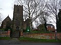 All Saints church, Harborough Magna - geograph.org.uk - 1605207.jpg 640 × 480; 111 KB
-

-

-
 Amusement arcade, Torquay - geograph.org.uk - 1605289.jpg 460 × 640; 88 KB
-
 Another empty development - Bridgend - geograph.org.uk - 1606423.jpg 640 × 480; 75 KB
-

-
 Approach to Cleveley from Enstone - geograph.org.uk - 1610676.jpg 640 × 480; 54 KB
-
 Approaching Foxcote - geograph.org.uk - 1616054.jpg 640 × 480; 72 KB
-
 Approaching the A436 from Salperton - geograph.org.uk - 1610606.jpg 640 × 480; 56 KB
-
 Auchinleck House - Five Ways - geograph.org.uk - 1604847.jpg 640 × 480; 256 KB
-

-
 Bailey bridge over the River Ogmore - geograph.org.uk - 1606373.jpg 640 × 480; 174 KB
-
 BandQ, Hyde - geograph.org.uk - 1604722.jpg 640 × 403; 103 KB
-
 Bandstand, Saltwell Park - geograph.org.uk - 1604650.jpg 640 × 480; 87 KB
-
 Barn in North Cerney - geograph.org.uk - 1610497.jpg 640 × 480; 76 KB
-
 Beauchamp Street - Cardiff - geograph.org.uk - 1605145.jpg 640 × 480; 122 KB
-
 Behold the Star^ - geograph.org.uk - 1604393.jpg 640 × 480; 87 KB
-
 Bend in the Ogmore - Bridgend - geograph.org.uk - 1606514.jpg 640 × 480; 94 KB
-
 Blackwell Scar Darlington - geograph.org.uk - 1604369.jpg 640 × 401; 51 KB
-
 Boats, Torquay harbour - geograph.org.uk - 1605169.jpg 508 × 640; 86 KB
-
 Borders, Market Street - geograph.org.uk - 1604400.jpg 480 × 640; 109 KB
-
 Bottomlands pasture - geograph.org.uk - 1616064.jpg 640 × 480; 72 KB
-
 Bradford Canal Company Offices (former) (4155728122).jpg 3,693 × 2,742; 5.41 MB
-

-
 Brewery Field main stand-geograph-1606369.jpg 640 × 480; 78 KB
-
 Bridge 42 on the Oxford Canal - geograph.org.uk - 1605225.jpg 640 × 480; 78 KB
-
 Bridge at Babeny - geograph.org.uk - 1604310.jpg 640 × 427; 130 KB
-
 Bridge over A4229. - geograph.org.uk - 1654885.jpg 640 × 480; 56 KB
-
 Bridge over the River Taff - Cardiff - geograph.org.uk - 1605554.jpg 640 × 480; 86 KB
-
-
 Bridgend United Methodist Church - geograph.org.uk - 1606445.jpg 640 × 480; 92 KB
-
 Bridleway towards Andoversford - geograph.org.uk - 1616303.jpg 640 × 480; 65 KB
-
 Bristol Street, Newport - geograph.org.uk - 1605428.jpg 640 × 480; 63 KB
-
 Bristol Street, Newport - geograph.org.uk - 1605438.jpg 640 × 498; 65 KB
-
 Brough Golf Club House - geograph.org.uk - 1604544.jpg 640 × 480; 72 KB
-
 Brough Golf Course - geograph.org.uk - 1604603.jpg 640 × 480; 61 KB
-
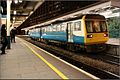
 Brough Railway Station - geograph.org.uk - 1604550.jpg 640 × 480; 53 KB
-
 Brough Roads, River Humber - geograph.org.uk - 1604557.jpg 640 × 480; 41 KB
-
 Bush Street, Burnley - geograph.org.uk - 1607318.jpg 640 × 480; 54 KB
-
 Bush Street, Burnley - geograph.org.uk - 1607324.jpg 640 × 480; 77 KB
-
 Byron Road, Gaer, Newport - geograph.org.uk - 1606510.jpg 640 × 444; 89 KB
-
 Canon Street, Barnardtown, Newport - geograph.org.uk - 1605469.jpg 640 × 423; 61 KB
-

-
 Car park, Omagh Library - geograph.org.uk - 1606551.jpg 640 × 480; 111 KB
-

-
 Caroline Street - Bridgend - geograph.org.uk - 1606502.jpg 640 × 480; 100 KB
-
 Cave Road, Elloughton - geograph.org.uk - 1604538.jpg 640 × 480; 65 KB
-
 Christmas at Marrs - geograph.org.uk - 1604386.jpg 640 × 640; 159 KB
-

-

-
 Christmas Lights in Fitzroy Street - geograph.org.uk - 1605328.jpg 480 × 640; 64 KB
-
 Christmas Lights in Rose Crescent - geograph.org.uk - 1605331.jpg 480 × 640; 74 KB
-
 Christmas lights in Sidney Street - geograph.org.uk - 1604409.jpg 480 × 640; 83 KB
-
 Christmas Lights, John Lewis - geograph.org.uk - 1604375.jpg 640 × 480; 87 KB
-

-
 Church and castle overlooking Bridgend - geograph.org.uk - 1606272.jpg 640 × 480; 102 KB
-
 All Saint's Church, Churchill - geograph.org.uk - 1610657.jpg 480 × 640; 44 KB
-
 Clare Road Chippie - Cardiff - geograph.org.uk - 1605902.jpg 640 × 480; 115 KB
-
-
 Cobalt House (formerly Hagley House) - geograph.org.uk - 1604938.jpg 480 × 640; 232 KB
-
 Cobblers - geograph.org.uk - 1607901.jpg 640 × 426; 60 KB
-
 Cocking Steps Mill, Honley - geograph.org.uk - 1607741.jpg 640 × 466; 120 KB
-
 Coed Poplys - Poplar Trees - geograph.org.uk - 1604398.jpg 508 × 640; 63 KB
-
 Coffee Yard - geograph.org.uk - 1607155.jpg 426 × 640; 79 KB
-
 Colehill Trails - geograph.org.uk - 1604297.jpg 640 × 480; 152 KB
-
 Colehill, bridleway - geograph.org.uk - 1604278.jpg 480 × 640; 137 KB
-
 Colehill, middle school - geograph.org.uk - 1604319.jpg 640 × 480; 102 KB
-
 Colehill, playing fields - geograph.org.uk - 1604345.jpg 640 × 480; 109 KB
-
 Colehill, war memorial - geograph.org.uk - 1604359.jpg 480 × 640; 108 KB
-
 Common Lane - geograph.org.uk - 1604563.jpg 640 × 480; 116 KB
-
 Completed lych gate, Welland - geograph.org.uk - 1606066.jpg 640 × 427; 277 KB
-
 Connections, Torquay - geograph.org.uk - 1604844.jpg 480 × 640; 78 KB
-

-
-

-
 Corridor, Fleet Walk car park - geograph.org.uk - 1605300.jpg 440 × 640; 67 KB
-

-
 Cottages at Foxcote - geograph.org.uk - 1616068.jpg 640 × 480; 125 KB
-
 Covent Garden Market - geograph.org.uk - 1605281.jpg 640 × 428; 71 KB
-
 Crevenagh Road, Omagh - geograph.org.uk - 1606574.jpg 640 × 296; 33 KB
-
 Crosland Factory Lane, South Crosland - geograph.org.uk - 1607840.jpg 640 × 475; 143 KB
-
 Crosland Factory, South Crosland - geograph.org.uk - 1607710.jpg 640 × 480; 109 KB
-
 Crosland Factory, South Crosland - geograph.org.uk - 1607720.jpg 640 × 463; 103 KB
-
 Custom Norton 1 (4155946429).jpg 3,480 × 2,808; 4.66 MB
-
 Custom Norton 2 (4156001073).jpg 3,876 × 2,790; 5.63 MB
-
 Custom V-Twin (4156698430).jpg 3,168 × 4,224; 9.45 MB
-
 Custom V-Twin 2 (4158000729).jpg 2,010 × 2,538; 3.07 MB
-
 Dalmuir sewage works - geograph.org.uk - 1611107.jpg 640 × 480; 76 KB
-
-
 Dean Street, Barnardtown,Newport - geograph.org.uk - 1605483.jpg 640 × 443; 66 KB
-

-
 Dene Lodge, Saltwell Park - geograph.org.uk - 1604622.jpg 640 × 480; 129 KB
-
 Derelict barn, Stainton - geograph.org.uk - 1604070.jpg 640 × 480; 123 KB
-
 Dolly's Cot - geograph.org.uk - 1604411.jpg 640 × 427; 113 KB
-

-
 Down the footpath - geograph.org.uk - 1616418.jpg 640 × 480; 116 KB
-
 Draycote Water visitor centre - geograph.org.uk - 1605236.jpg 640 × 480; 66 KB
-

-
 Drinkwater Close, Gaer, Newport - geograph.org.uk - 1606477.jpg 640 × 526; 81 KB
-
 Drinkwater Gardens, Gaer, Newport - geograph.org.uk - 1606182.jpg 640 × 378; 64 KB
-
 Drinkwater Rise, Gaer, Newport - geograph.org.uk - 1606483.jpg 640 × 431; 67 KB
-
 Drinkwater View, Gaer, Newport - geograph.org.uk - 1606488.jpg 640 × 352; 59 KB
-
 Driveway to Heylens Farm - geograph.org.uk - 1616032.jpg 640 × 480; 81 KB
-
 Dry stone wall at Salperton - geograph.org.uk - 1610590.jpg 640 × 480; 112 KB
-
 Ducati 1098 (4156644836).jpg 3,168 × 4,752; 5.72 MB
-
 Ducati 1098 tail light (4156641262).jpg 3,186 × 2,298; 3.06 MB
-
 Ducati Elite 200cc 1960 (4155855533).jpg 2,615 × 2,637; 4.18 MB
-
 Electricity Pylon - geograph.org.uk - 1604522.jpg 640 × 480; 32 KB
-
 Elloughton Hill Farm - geograph.org.uk - 1604629.jpg 640 × 480; 44 KB
-
 Elloughton Road - geograph.org.uk - 1604607.jpg 640 × 480; 80 KB
-
 Elloughton United Reformed Church - geograph.org.uk - 1604616.jpg 640 × 480; 76 KB
-
 Elm Mill, Burnley - geograph.org.uk - 1607362.jpg 640 × 480; 52 KB
-
 Euston Tower - geograph.org.uk - 1612932.jpg 1,600 × 1,200; 556 KB
-
 Exeter Street, Newport - geograph.org.uk - 1605379.jpg 640 × 480; 63 KB
-
 Factory Row, Torquay - geograph.org.uk - 1604915.jpg 480 × 640; 61 KB
-
 Farm Track near Elloughton - geograph.org.uk - 1604533.jpg 640 × 480; 55 KB
-
 Field barn, Stainton - geograph.org.uk - 1604066.jpg 640 × 450; 140 KB
-
 Field by the B4068 - geograph.org.uk - 1610611.jpg 640 × 480; 106 KB
-

-

-

-

-
-
 Five Ways House - geograph.org.uk - 1607328.jpg 640 × 480; 210 KB
-
 Five Ways Shopping Centre - geograph.org.uk - 1604870.jpg 640 × 480; 282 KB
-
 Flooded culvert - geograph.org.uk - 1606418.jpg 640 × 427; 99 KB
-
 Footbridge in Andoversford - geograph.org.uk - 1615431.jpg 640 × 480; 112 KB
-

-

-
 Footpath in Andoversford - geograph.org.uk - 1615410.jpg 640 × 480; 109 KB
-

-

-

-
 Fountain in Trafalgar Square - geograph.org.uk - 1604970.jpg 3,872 × 2,592; 2.71 MB
-

-
 Fulford House - geograph.org.uk - 1616288.jpg 640 × 480; 134 KB
-
 Full Steam Ahead^ - geograph.org.uk - 1604553.jpg 640 × 480; 74 KB
-

-
 Gated Farm Track, Elloughton Wold - geograph.org.uk - 1604634.jpg 640 × 480; 112 KB
-
-
 Gateway Opposite Buckingham Palace - geograph.org.uk - 1604978.jpg 428 × 640; 74 KB
-
 Gloucestershire Way towards Shipton - geograph.org.uk - 1610597.jpg 640 × 480; 77 KB
-
 Grangetown Railway Bridge - Cardiff - geograph.org.uk - 1605940.jpg 640 × 480; 79 KB
-
 Grape Lane - geograph.org.uk - 1606815.jpg 426 × 640; 85 KB
-
 Green Brook from Green Bridge - geograph.org.uk - 1607347.jpg 480 × 640; 87 KB
-
 Green Brook from Green Bridge - geograph.org.uk - 1607356.jpg 640 × 480; 79 KB
-
 GSXR (4155885373).jpg 2,568 × 3,015; 3.49 MB
-

-
 Hedgerow and Field - geograph.org.uk - 1604518.jpg 640 × 480; 45 KB
-

-
 Hereford Arms, Newport - geograph.org.uk - 1605387.jpg 480 × 640; 77 KB
-
 Hereford Street, Newport - geograph.org.uk - 1605359.jpg 640 × 383; 65 KB
-
 High Road, Elloughton - geograph.org.uk - 1604624.jpg 640 × 480; 61 KB
-
 High Roller (4156691862).jpg 2,936 × 4,480; 7.97 MB
-
 Hoopers' window, Torquay - geograph.org.uk - 1604940.jpg 480 × 640; 89 KB
-
 Hoopers' window, Torquay - geograph.org.uk - 1604948.jpg 640 × 580; 114 KB
-
 Hoopers, Torquay - geograph.org.uk - 1605293.jpg 480 × 640; 80 KB
-
 House and cottages at Foxcote - geograph.org.uk - 1616072.jpg 640 × 480; 100 KB
-
 House with a view at Foxcote - geograph.org.uk - 1616060.jpg 640 × 480; 91 KB
-
 Houses on Humber Crescent - geograph.org.uk - 1604596.jpg 640 × 480; 64 KB
-
 Hunting country - geograph.org.uk - 1616089.jpg 640 × 480; 86 KB
-
 Hyde Telephone Exchange - geograph.org.uk - 1604741.jpg 640 × 480; 115 KB
-
 Indian (4155890909).jpg 2,488 × 2,440; 3.69 MB
-
 Indian V Twin (4156650224).jpg 3,102 × 3,090; 5.83 MB
-
 Inn Sign of the Year Award, The Poplars - geograph.org.uk - 1605020.jpg 480 × 640; 155 KB
-
 Inscription, The Window of Hope - geograph.org.uk - 1606544.jpg 640 × 358; 38 KB
-
 Irishtown Road, Omagh - geograph.org.uk - 1606565.jpg 640 × 480; 61 KB
-
 It's all in the detail - geograph.org.uk - 1605208.jpg 480 × 640; 130 KB
-
 Ivy-clad trees, Meltham - geograph.org.uk - 1608679.jpg 640 × 480; 137 KB
-
 Janus Chairs - geograph.org.uk - 1604532.jpg 640 × 480; 50 KB
-
 Japanese Garden, Saltwell Park - geograph.org.uk - 1604654.jpg 640 × 480; 150 KB
-
 Jubilee Market Hall, Covent Garden - geograph.org.uk - 1605276.jpg 640 × 428; 68 KB
-

-

-
 Kilkeddan Farm - geograph.org.uk - 1604548.jpg 614 × 480; 300 KB
-
 King's Staith - geograph.org.uk - 1606636.jpg 640 × 426; 73 KB
-
 King's Staith - geograph.org.uk - 1606678.jpg 640 × 426; 65 KB
-
 Kingham Station - geograph.org.uk - 1610645.jpg 640 × 480; 69 KB
-
 Lake at Shipton Solers - geograph.org.uk - 1616390.jpg 640 × 480; 101 KB
-

-
 Lansdowne Road, Newport - geograph.org.uk - 1606495.jpg 640 × 438; 68 KB
-

.jpg)


_-_geograph.org.uk_-_1616037.jpg)
_-_geograph.org.uk_-_1616042.jpg)


.jpg)


_(4155728122).jpg)


_-_geograph.org.uk_-_1606426.jpg)
_-_geograph.org.uk_-_1606425.jpg)


_-_geograph.org.uk_-_1604938.jpg)


.jpg)
.jpg)
.jpg)
.jpg)


.jpg)
.jpg)
.jpg)


_-_geograph.org.uk_-_1607685.jpg)


_-_geograph.org.uk_-_1607634.jpg)


.jpg)


.jpg)


.jpg)
.jpg)


