Category:United States photographs taken on 2013-07-27
Jump to navigation
Jump to search
Countries of North America: Canada · Guatemala · Mexico · United States of America‡
‡: partly located in North America
‡: partly located in North America
| ← | 27 July 2013 | → | ||
| ← | July 2013 | → | ||

United States of America photographs taken on 27 July 2013.
Image files should be categorized here automatically using {{taken on}} template. Direct categorisation is also possible, if automatic is impossible.
Media in category "United States photographs taken on 2013-07-27"
The following 200 files are in this category, out of 519 total.
(previous page) (next page)-
 130727-A-AO884-384 (9410266504).jpg 2,032 × 1,349; 352 KB
-
 2013-07-27 Gyromitra californica (W. Phillips) Raitv 353027.jpg 4,716 × 2,596; 9.65 MB
-
 303rd MEB 9th MSC WAREX 2013 Ft McCoy 130727-A-KL525-009.jpg 5,184 × 3,456; 6.73 MB
-
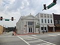
 44 East Mifflin - panoramio.jpg 3,000 × 4,000; 3.49 MB
-
 60 switching cars.JPG 3,072 × 1,728; 2 MB
-
 60th anniversary commemoration of Korean War in DC 130727-D-NI589-171.jpg 4,928 × 3,280; 2.17 MB
-
 60th anniversary of the Korean War armistice signing 130727-A-VS818-408.jpg 1,800 × 1,198; 1.6 MB
-
 A day in Japan 130727-M-YE163-319.jpg 5,616 × 3,744; 8.83 MB
-
 A glacier in the Brooks Range - panoramio.jpg 6,000 × 3,000; 8.89 MB
-

-
-

-

-
 A new breed - Flickr - nosha.jpg 2,448 × 3,264; 2.25 MB
-
 A to Z Rental - panoramio.jpg 4,000 × 2,435; 2.17 MB
-
 A1 Furniture ^ Bedding - panoramio.jpg 4,000 × 3,000; 2.76 MB
-
 AA paint shemes.jpg 3,264 × 2,448; 2.31 MB
-
 Ace® Hardware - panoramio.jpg 4,000 × 3,000; 3.06 MB
-
 Airbus A330-302E.jpg 3,264 × 2,448; 2.26 MB
-
 Aliens in the Corn, Southeastern MN 7-13 (24485433533).jpg 2,000 × 1,772; 1.15 MB
-
 100 Block E Water St, Bainbridge.JPG 4,320 × 3,240; 4.47 MB
-
 108 E Broughton St, Bainbridge.JPG 4,320 × 3,240; 4.39 MB
-
 116 N Broad St, Bainbridge.JPG 4,320 × 3,240; 4.49 MB
-
 121 N West St, Bainbridge.JPG 4,320 × 3,240; 4.45 MB
-
 Alderman's, Bainbridge.JPG 4,320 × 3,240; 4.52 MB
-
 American Legion Memorial, Willis Park.JPG 4,320 × 3,240; 4.53 MB
-
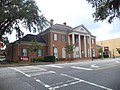
 Bainbridge City Hall.JPG 4,320 × 3,240; 4.48 MB
-
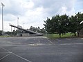
 Bainbridge High School Football Stadium 1.JPG 4,320 × 3,240; 4.48 MB
-
 Bainbridge High School Football Stadium 2.JPG 4,320 × 3,240; 4.48 MB
-
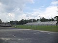 Bainbridge High School Football Stadium 3.JPG 4,320 × 3,240; 4.47 MB
-
 Bainbridge High School Football Stadium 4.JPG 4,320 × 3,240; 4.56 MB
-
 Bainbridge Independents Plaque, Willis Park.JPG 4,320 × 3,240; 4.48 MB
-
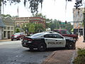 Bainbridge Police Car.JPG 4,320 × 3,240; 4.52 MB
-
 Bainbridge Post Office.JPG 4,320 × 3,240; 4.46 MB
-
 Bainbridge Public Safety Headquarters.JPG 4,320 × 3,240; 4.5 MB
-
 Bank of the Ozarks corner, Bainbridge.JPG 4,320 × 3,240; 4.5 MB
-
 Bank of the Ozarks, Bainbridge.JPG 4,320 × 3,240; 4.53 MB
-
 Callahan Building, Bainbridge.JPG 4,320 × 3,240; 4.57 MB
-
 Camp Recovery Historical Marker, Bainbridge.JPG 4,320 × 3,240; 4.44 MB
-
 Cannon and back of Confederate Monument, Willis Park.JPG 4,320 × 3,240; 4.51 MB
-
 Confederate Monument, Willis Park.JPG 4,320 × 3,240; 4.41 MB
-
 Cox Funeral Home, Bainbridge.JPG 4,320 × 3,240; 4.48 MB
-
 Decatur County Administrative Offices.JPG 4,320 × 3,240; 4.51 MB
-
 Decatur County Board of Education (East face).JPG 4,320 × 3,240; 4.54 MB
-
 Decatur County Board of Education.JPG 4,320 × 3,240; 4.44 MB
-
 Decatur County Courthouse (NW corner).JPG 4,320 × 3,240; 4.49 MB
-
 Decatur County Courthouse (SouthEast face) 2.JPG 4,320 × 3,240; 4.38 MB
-
 Decatur County Courthouse (SouthEast face).JPG 4,320 × 3,240; 4.49 MB
-
 Decatur County Courthouse Annex.JPG 4,320 × 3,240; 4.43 MB
-
 Decatur County Courthouse cornerstone.JPG 4,320 × 3,240; 4.45 MB
-
 Decatur County Historical and Genealogical Society.JPG 4,320 × 3,240; 4.52 MB
-
 Decatur County Historical Marker.JPG 4,320 × 3,240; 4.44 MB
-
 DeSoto Trail Historical Marker, Bainbridge.JPG 4,320 × 3,240; 4.35 MB
-
 E. J. Perry Building, Bainbridge.JPG 4,320 × 3,240; 4.44 MB
-
 El Camino Real Historical Marker, Bainbridge.JPG 4,320 × 3,240; 4.41 MB
-
 Elcan King Elementary School, Bainbridge.JPG 4,320 × 3,240; 4.53 MB
-
 Firehouse Center and Gallery East face.JPG 4,320 × 3,240; 4.52 MB
-
 Firehouse Center and Gallery Renovation 2007 plaque 2.JPG 4,320 × 3,240; 4.48 MB
-
 Firehouse Center and Gallery Renovation 2007 plaque.JPG 4,320 × 3,240; 4.53 MB
-
 Firehouse Center and Gallery South face.JPG 4,320 × 3,240; 4.57 MB
-
 First Presbyterian Church Historical Marker, Bainbridge.JPG 4,320 × 3,240; 4.43 MB
-
 First Presbyterian Church, Bainbridge.JPG 4,320 × 3,240; 4.5 MB
-
 Fleming Building, Bainbridge.JPG 4,320 × 3,240; 4.58 MB
-
 Gilbert H. Gragg Library.JPG 4,320 × 3,240; 4.52 MB
-
 Jacobik Antique Gallery.JPG 4,320 × 3,240; 4.51 MB
-
 Mary Davis Memorial, Willis Park.JPG 4,320 × 3,240; 4.49 MB
-
 Masonic Temple, Bainbridge.JPG 4,320 × 3,240; 4.35 MB
-
 Pond, Willis Park.JPG 4,320 × 3,240; 4.45 MB
-
 Regions Bank, Bainbridge.JPG 4,320 × 3,240; 4.45 MB
-
 Riverpointe, Bainbridge.JPG 4,320 × 3,240; 4.44 MB
-
 Samuel Marvin Griffin Memorial, Willis Park.JPG 4,320 × 3,240; 4.49 MB
-
 Steamboat Bell, Willis Park.JPG 4,320 × 3,240; 4.49 MB
-
 War Memorial, Willis Park.JPG 4,320 × 3,240; 4.43 MB
-
 Willis Park 1904 Marker.JPG 4,320 × 3,240; 4.38 MB
-
 Bat Star & Urchins (9398872328).jpg 3,293 × 2,470; 8.04 MB
-
 Battlefield Forensics 130727-F-AB151-006.jpg 4,256 × 2,832; 2.07 MB
-
 Battlefield Forensics 130727-F-AB151-024.jpg 4,256 × 2,832; 1.76 MB
-
 Bell's Roadside-Skipper (9380189117).jpg 1,920 × 1,080; 163 KB
-
 Bell's Roadside-Skipper butterfly (9382974716).jpg 1,920 × 1,080; 146 KB
-
 Bethany Evangelical Free Church - panoramio.jpg 3,964 × 2,590; 2.22 MB
-
 Big Horn Herd (19984006651).jpg 4,752 × 3,168; 4 MB
-
 BLM Firefighting near Roseburg, Oregon (14184071382).jpg 2,592 × 1,944; 1.23 MB
-
 Blooming Grove Town Hall - panoramio.jpg 3,954 × 2,389; 1.71 MB
-
 Boeing 747 (Delta) at JFK.jpg 2,448 × 3,264; 2.33 MB
-
 Bottomland (9384900397).jpg 3,456 × 5,184; 14.25 MB
-
 Bridge in Central Park NY.JPG 800 × 600; 172 KB
-
 BridgesJohnson1.JPG 4,272 × 2,848; 8.6 MB
-
 Bridgeton Township, PA 18972, USA - panoramio (1).jpg 1,944 × 2,592; 2.14 MB
-
 Bridgeton Township, PA 18972, USA - panoramio (10).jpg 2,592 × 1,944; 1.87 MB
-
 Bridgeton Township, PA 18972, USA - panoramio (11).jpg 2,592 × 1,944; 2.29 MB
-
 Bridgeton Township, PA 18972, USA - panoramio (12).jpg 2,592 × 1,944; 2.27 MB
-
 Bridgeton Township, PA 18972, USA - panoramio (13).jpg 2,592 × 1,944; 2.26 MB
-
 Bridgeton Township, PA 18972, USA - panoramio (14).jpg 2,592 × 1,944; 2.33 MB
-
 Bridgeton Township, PA 18972, USA - panoramio (15).jpg 1,944 × 2,592; 2.02 MB
-
 Bridgeton Township, PA 18972, USA - panoramio (16).jpg 3,783 × 1,630; 1.96 MB
-
 Bridgeton Township, PA 18972, USA - panoramio (18).jpg 5,307 × 1,030; 2.13 MB
-
 Bridgeton Township, PA 18972, USA - panoramio (2).jpg 1,944 × 2,592; 2.28 MB
-
 Bridgeton Township, PA 18972, USA - panoramio (3).jpg 2,592 × 1,944; 1.79 MB
-
 Bridgeton Township, PA 18972, USA - panoramio (4).jpg 1,944 × 2,592; 1.66 MB
-
 Bridgeton Township, PA 18972, USA - panoramio (5).jpg 2,592 × 1,944; 1.85 MB
-
 Bridgeton Township, PA 18972, USA - panoramio (6).jpg 2,592 × 1,944; 1.99 MB
-
 Bridgeton Township, PA 18972, USA - panoramio (7).jpg 2,592 × 1,944; 2.25 MB
-
 Bridgeton Township, PA 18972, USA - panoramio (8).jpg 1,944 × 2,592; 1.72 MB
-
 Bridgeton Township, PA 18972, USA - panoramio (9).jpg 2,592 × 1,944; 1.84 MB
-
 Bridgeton Township, PA 18972, USA - panoramio.jpg 1,944 × 2,592; 1.58 MB
-
 Brinson Municipal Building & Fire Department.JPG 4,320 × 3,240; 4.4 MB
-
 Brinson Post Office.JPG 4,320 × 3,240; 4.49 MB
-
 Brinson Town Hall.JPG 4,320 × 3,240; 4.55 MB
-
 Clifford St, Brinson RR Crossing.JPG 4,320 × 3,240; 4.43 MB
-
 Clifford St, Brinson RR NorthWest bound.JPG 4,320 × 3,240; 4.45 MB
-
 Clifford St, Brinson RR SouthEast bound.JPG 4,320 × 3,240; 4.52 MB
-
 Cairo Airport Hangar 1.JPG 4,320 × 3,240; 4.4 MB
-
 Cairo Airport Hangar 2.JPG 4,320 × 3,240; 4.52 MB
-
 Cairo Airport Precision Aviation.JPG 4,320 × 3,240; 4.5 MB
-
 Cairo Airport sign.JPG 4,320 × 3,240; 4.44 MB
-
 Cairo Airport terminal (East face).JPG 4,320 × 3,240; 4.5 MB
-
 Cairo Airport terminal (NorthEast face).JPG 4,320 × 3,240; 4.52 MB
-
 Cairo Airport, lane to turn onto Runway 13.JPG 4,320 × 3,240; 4.43 MB
-
 Cairo Airport, Runway 13.JPG 4,320 × 3,240; 4.55 MB
-
 Eastside School playground 2, Cairo.JPG 4,320 × 3,240; 4.51 MB
-
 Eastside School playground, Cairo.JPG 4,320 × 3,240; 4.54 MB
-
 Eastside School, Cairo.JPG 4,320 × 3,240; 4.53 MB
-
 Northside Elementary School, Cairo.JPG 4,320 × 3,240; 4.53 MB
-
 Carolina Morning - Flickr - Don McCullough.jpg 5,760 × 3,840; 17.08 MB
-
 Catocala epione - Epione Underwing moth (9382957680).jpg 1,920 × 1,080; 180 KB
-
 Cell Tower - panoramio (8).jpg 3,000 × 4,000; 2.16 MB
-
 CFI Lecture Hall 2.jpg 5,184 × 3,456; 5.81 MB
-
 Charlie Company, Officer Candidate School 2013 130727-M-BE127-008.jpg 3,284 × 2,627; 4.69 MB
-
 Chicago z samolotu.jpg 2,816 × 1,384; 3.36 MB
-
 Christ the King Chapel (Davenport, Iowa) entrance 01.JPG 3,456 × 4,608; 2.07 MB
-
 Civil Affairs goes Hollywood 130727-A-DI144-530.jpg 3,494 × 2,329; 1.08 MB
-
 Civil Affairs goes Hollywood 130727-A-DI144-567.jpg 4,005 × 2,670; 1.15 MB
-
 Climax City Hall.JPG 4,320 × 3,240; 4.5 MB
-
 Climax City sign.JPG 4,320 × 3,240; 4.52 MB
-
 Climax Consolidated School Cornerstone.JPG 4,320 × 3,240; 4.45 MB
-
 Climax Consolidated School Head Start.JPG 4,320 × 3,240; 4.47 MB
-
 Climax Fire Department.jpg 4,320 × 3,240; 4.58 MB
-
 Climax Historical Marker.JPG 4,320 × 3,240; 4.55 MB
-
 Climax Time Capsule.JPG 4,320 × 3,240; 4.51 MB
-
 Climax United Methodist Church Flagpoles.JPG 4,320 × 3,240; 4.41 MB
-
 Climax United Methodist Church Plaque.JPG 4,320 × 3,240; 4.49 MB
-
 Climax United Methodist Church.JPG 4,320 × 3,240; 4.53 MB
-
 Climax Water Tower.jpg 4,320 × 3,240; 4.52 MB
-
 Decatur County Recycling Center in Climax.JPG 4,320 × 3,240; 4.47 MB
-
 Decatur County Veterans Memorial, Climax.JPG 4,320 × 3,240; 4.43 MB
-
 Decatur Grady Head Start Center sign.JPG 4,320 × 3,240; 4.53 MB
-
 Flagpole in Parker Memorial Park.JPG 4,320 × 3,240; 4.51 MB
-
 Former Climax Post Office.JPG 4,320 × 3,240; 4.42 MB
-
 Parker Memorial Park Plaque.JPG 4,320 × 3,240; 4.44 MB
-
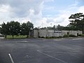
 Parker Memorial Park, Entrance and Picnic Shelter.JPG 4,320 × 3,240; 4.46 MB
-
 Coast Guard Cutter Sea Otter conducts boarding 130727-G-ZZ999-001.jpg 2,113 × 1,578; 2.14 MB
-
 Colonial Bakery - panoramio.jpg 4,000 × 3,000; 3.48 MB
-
 American Legion Post Plaque at Miller County Courthouse.JPG 4,320 × 3,240; 4.6 MB
-
 Colquitt City Hall.JPG 4,320 × 3,240; 4.25 MB
-
 Colquitt Fire Station.JPG 4,320 × 3,240; 4.49 MB
-
 Colquitt Miller Arts Council plaque on Colquitt-Miller County Emergency Services Center.JPG 4,320 × 3,240; 4.43 MB
-
 Colquitt Police Department.JPG 4,320 × 3,240; 4.23 MB
-
 Colquitt Post Office.JPG 4,320 × 3,240; 4.62 MB
-
 Colquitt Sign.JPG 4,320 × 3,240; 4.5 MB
-
 Colquitt Street Clock.JPG 4,320 × 3,240; 4.38 MB
-
 Colquitt Theater.JPG 4,320 × 3,240; 4.59 MB
-
 Colquitt Veterans Park.JPG 4,320 × 3,240; 4.48 MB
-
 Colquitt-Miller County Emergency Services Center (South face).JPG 4,320 × 3,240; 4.58 MB
-
 Colquitt-Miller County Emergency Services Center (West face).JPG 4,320 × 3,240; 4.4 MB
-
 Colquitt-Miller County Emergency Services Center Plaque.JPG 4,320 × 3,240; 4.47 MB
-
 Confederate Soldiers Monument at Colquitt County Courthouse.JPG 4,320 × 3,240; 4.4 MB
-
 Miller County Courthouse.JPG 4,320 × 3,240; 4.47 MB
-
 Miller County Historical Marker.JPG 4,320 × 3,240; 4.33 MB
-
 Miller County Veterans of War Wall.JPG 4,320 × 3,240; 4.57 MB
-
 People's South Bank, Colquitt.JPG 4,320 × 3,240; 4.42 MB
-
 Spring Creek Recreation Park Baseball Field.JPG 4,320 × 3,240; 4.55 MB
-
 Spring Creek Recreation Park Plaque.JPG 4,320 × 3,240; 4.42 MB
-
 Spring Creek Recreation Park Sign.JPG 4,320 × 3,240; 4.45 MB
-
 Tarrer Inn, Colquitt.JPG 4,320 × 3,240; 4.55 MB
-
 Combat camera soldiers helocast into Tampa Bay 130727-A-XL659-236.jpg 1,500 × 798; 886 KB
-
 Come Back In - panoramio.jpg 3,945 × 2,526; 2.04 MB
-
 Corn Stalks at Wayside Rest - Gibbon, MN - panoramio.jpg 2,448 × 1,746; 1.18 MB
-
 Cottage Grove Road Electrical Substation - panoramio.jpg 4,000 × 3,000; 2.28 MB
-
 Dairyland Family Restaurant - panoramio.jpg 3,973 × 2,571; 2.68 MB
-
 Days Inn® Madison South - panoramio.jpg 3,964 × 2,380; 1.88 MB
-
 Dean Clinic - East - panoramio.jpg 4,000 × 3,000; 2.33 MB
-
 Decatur County Veterans Memorial Benches, Climax.JPG 4,320 × 3,240; 4.5 MB
-
 Denali National Park 6.jpg 3,072 × 2,048; 4.06 MB
-
 Denali National Park 7.jpg 3,072 × 2,048; 4.58 MB
-
 Devils Tower - 5.jpg 3,600 × 2,400; 5.07 MB
-
 American Legion Monument, Donalsonville.JPG 4,320 × 3,240; 4.41 MB
-
 Commercial State Bank, Donalsonville.JPG 4,320 × 3,240; 4.52 MB
-
 Donalsonville City Hall.JPG 4,320 × 3,240; 4.43 MB
-
 Donalsonville Fire Station.JPG 4,320 × 3,240; 4.5 MB
-
 Donalsonville Police Department.JPG 4,320 × 3,240; 4.51 MB
-
 Donalsonville Post Office.JPG 4,320 × 3,240; 4.45 MB
-
 Donalsonville Seal on City Hall Annex.JPG 4,320 × 3,240; 4.47 MB
-
 Friendship United Methodist Church, Donalsonville.JPG 4,320 × 3,240; 4.55 MB
-
 Georgia Power, Donalsonville.JPG 4,320 × 3,240; 4.55 MB
-
 Lions Hall, Donalsonville.JPG 4,320 × 3,240; 4.44 MB
-
 Mike Bowen Monument, Donalsonville.JPG 4,320 × 3,240; 4.52 MB
-
 Municipal Building plaque on Donalsonville Post Office.JPG 4,320 × 3,240; 4.54 MB
-
 Post Office Plaque, Donalsonville.JPG 4,320 × 3,240; 4.35 MB
-
 Seminole County Courthouse (from 2nd St).JPG 4,320 × 3,240; 4.43 MB
-
 Seminole County Courthouse from parking lot.JPG 4,320 × 3,240; 4.46 MB
.jpg)
_Raitv_353027.jpg)


.jpg)


.JPG)

.JPG)
_2.JPG)
.JPG)


.jpg)


.jpg)
.jpg)

.jpg)
.jpg)

_at_JFK.jpg)
.jpg)


.jpg)
.jpg)
.jpg)
.jpg)
.jpg)
.jpg)
.jpg)
.jpg)
.jpg)
.jpg)
.jpg)
.jpg)
.jpg)
.jpg)
.jpg)
.jpg)


.JPG)
.JPG)


.jpg)
.jpg)


_entrance_01.JPG)


.JPG)
.JPG)


.JPG)

.jpg)