Category:Upplands runinskrifter 1018
Jump to navigation
Jump to search
| Object location | | View all coordinates using: OpenStreetMap |
|---|
 | |||||
| Upload media | |||||
| Instance of | |||||
|---|---|---|---|---|---|
| Location | Q10726032, Norunda hundred | ||||
| Heritage designation |
| ||||
 | |||||
|
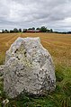
This is a category about an archaeological site or a monument in Sweden, number 10030000010001 in the RAÄ Fornsök database. |
Media in category "Upplands runinskrifter 1018"
The following 4 files are in this category, out of 4 total.
-
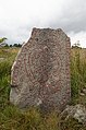 U1018 Kolje - KMB - 16001000202524.jpg 522 × 787; 101 KB
-
 U1018 Kolje - KMB - 16001000202804.jpg 787 × 522; 61 KB
-
 U1018 Kolje - KMB - 16001000202824.jpg 522 × 787; 87 KB
-
 U1018 Kolje - KMB - 16001000202844.jpg 787 × 522; 95 KB


