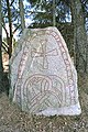
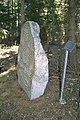
Category:Upplands runinskrifter 1053
Jump to navigation
Jump to search
| Object location | | View all coordinates using: OpenStreetMap |
|---|
 | |||||
| Upload media | |||||
| Instance of | |||||
|---|---|---|---|---|---|
| Location | Q10430588, Norunda hundred | ||||
| Heritage designation |
| ||||
 | |||||
|
This is a category about an archaeological site or a monument in Sweden, number fd4977a8-0fd0-4f3c-a39e-6417654b6051 in the RAÄ Fornsök database. |
Media in category "Upplands runinskrifter 1053"
The following 5 files are in this category, out of 5 total.
-
 U1053 Hammarby - KMB - 16000300026444.jpg 512 × 768; 215 KB
-
 U1053 Hammarby - KMB - 16000300026445.jpg 512 × 768; 128 KB
-
 U1053 Hammarby - KMB - 16000300026446.jpg 768 × 512; 153 KB
-
 U1053 Hammarby - KMB - 16000300026447.jpg 768 × 512; 168 KB
-
 U1053 Hammarby - KMB - 16000300026448.jpg 512 × 768; 158 KB


