Category:Upplands runinskrifter 1059
Jump to navigation
Jump to search
| Object location | | View all coordinates using: OpenStreetMap |
|---|
 | |||||
| Upload media | |||||
| Instance of | |||||
|---|---|---|---|---|---|
| Location | Q10430588, Norunda hundred | ||||
| Heritage designation |
| ||||
 | |||||
|
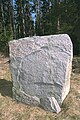
This is a category about an archaeological site or a monument in Sweden, number 10020702180001 in the RAÄ Fornsök database. |
Media in category "Upplands runinskrifter 1059"
The following 6 files are in this category, out of 6 total.
-
 U1059 Möboda - KMB - 16000300026424.jpg 512 × 768; 190 KB
-
 U1059 Möboda - KMB - 16000300026425.jpg 768 × 512; 220 KB
-
 U1059 Möboda - KMB - 16000300026426.jpg 512 × 768; 180 KB
-
 U1059 Möboda - KMB - 16000300026427.jpg 512 × 768; 198 KB
-
 U1059 Möboda - KMB - 16000300026429.jpg 768 × 512; 185 KB
-
 U1059 Möboda - KMB - 16000300026430.jpg 512 × 768; 211 KB


