Category:Upsall
Jump to navigation
Jump to search
village and civil parish near Thirsk, North Yorkshire, United Kingdom  | |||||
| Upload media | |||||
| Instance of | |||||
|---|---|---|---|---|---|
| Location | Hambleton, North Yorkshire, Yorkshire and the Humber, England | ||||
| Population |
| ||||
| Area |
| ||||
 | |||||
Media in category "Upsall"
The following 63 files are in this category, out of 63 total.
-
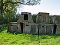 Animal Shelters - geograph.org.uk - 419762.jpg 640 × 480; 139 KB
-
 Approaching North Farm - geograph.org.uk - 5670259.jpg 5,152 × 3,864; 6.16 MB
-
 Beside Ella Carr - geograph.org.uk - 5668965.jpg 5,152 × 3,864; 6.82 MB
-
 Bridleway heading towards Felixkirk - geograph.org.uk - 5671283.jpg 5,152 × 3,864; 6.52 MB
-
 Bridleway to Felixkirk - geograph.org.uk - 2996028.jpg 4,000 × 3,000; 2.49 MB
-
 Countryside SW of Upsall - geograph.org.uk - 420589.jpg 640 × 480; 107 KB
-
 Ella Carr - geograph.org.uk - 5668968.jpg 5,152 × 3,864; 6.29 MB
-
 Field gate to access footpath to Fanny Lane in Knayton - geograph.org.uk - 2901767.jpg 3,648 × 2,736; 2.72 MB
-
 Field of cows near Upsall - geograph.org.uk - 3598076.jpg 3,872 × 2,592; 3.85 MB
-
 Footpath leading South from Turton Beckstead - geograph.org.uk - 5669690.jpg 5,152 × 3,864; 7.21 MB
-
 Footpath near Kilton Hill - geograph.org.uk - 5331167.jpg 640 × 426; 473 KB
-
 Harvested field near Knayton - geograph.org.uk - 3623365.jpg 3,872 × 2,592; 4.56 MB
-
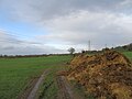
 Heavy clouds over Upsall Road - geograph.org.uk - 3598056.jpg 3,872 × 2,592; 5.13 MB
-
 Horseshoe arch - geograph.org.uk - 419926.jpg 466 × 640; 115 KB
-
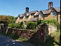 Houses at Upsall.jpg 640 × 480; 112 KB
-
 Kilton Hill - geograph.org.uk - 5331150.jpg 640 × 426; 531 KB
-
 Lane to South Kilvington - geograph.org.uk - 1912050.jpg 2,448 × 3,264; 2.37 MB
-
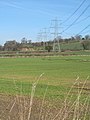
 Line of pylons crossing Upsall Road - geograph.org.uk - 3598022.jpg 3,872 × 2,592; 3.84 MB
-
 Line of pylons on a wet day - geograph.org.uk - 3623374.jpg 3,872 × 2,592; 2.92 MB
-
 Church at Upsall - geograph.org.uk - 419906.jpg 640 × 436; 94 KB
-
 Methodist Chapel, Upsall - geograph.org.uk - 3623351.jpg 3,872 × 2,592; 3.11 MB
-
 Mixed farming near Spital Bridge - geograph.org.uk - 3597933.jpg 3,872 × 2,592; 5.29 MB
-
 Near Knayton - geograph.org.uk - 5981010.jpg 2,048 × 1,536; 806 KB
-
 Near Upsall - geograph.org.uk - 5980997.jpg 2,048 × 1,536; 852 KB
-
 New Lodge - geograph.org.uk - 3598043.jpg 3,872 × 2,592; 6.06 MB
-
 Paled Dike (1) - geograph.org.uk - 5668956.jpg 5,152 × 3,864; 7.1 MB
-
 Paled Dike (2) - geograph.org.uk - 5668959.jpg 5,152 × 3,864; 7.45 MB
-
 Paled Dike - geograph.org.uk - 5331165.jpg 640 × 426; 583 KB
-
 Park House Lodge - geograph.org.uk - 3597960.jpg 3,872 × 2,592; 6.24 MB
-
 Part of Upsall Castle - geograph.org.uk - 5670271.jpg 5,152 × 3,864; 6.77 MB
-
 Poppies and pylons - geograph.org.uk - 5810189.jpg 4,320 × 3,240; 2.98 MB
-
 Pylons - geograph.org.uk - 5331146.jpg 640 × 426; 446 KB
-
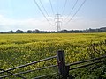
 Pylons across a field of ripe cereal - geograph.org.uk - 3597988.jpg 3,872 × 2,592; 5.79 MB
-
 Pylons in the landscape - geograph.org.uk - 3886226.jpg 3,240 × 4,320; 3.36 MB
-
 Pylons on the hillside - geograph.org.uk - 2797162.jpg 3,264 × 2,448; 1.77 MB
-
 Sheep near Knayton - geograph.org.uk - 3623368.jpg 3,872 × 2,592; 4.91 MB
-
 The entrance to Basset Hall - geograph.org.uk - 3597969.jpg 3,872 × 2,592; 5.99 MB
-
 The Old Forge, Upsall - geograph.org.uk - 5670255.jpg 5,152 × 3,864; 5.9 MB
-
 The Old Methodist Church - geograph.org.uk - 5331157.jpg 640 × 427; 440 KB
-
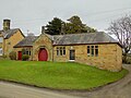
 The Town Hall, Upsall - geograph.org.uk - 5669928.jpg 5,152 × 3,864; 6.21 MB
-
 Town Farm, Upsall - geograph.org.uk - 3623339.jpg 3,872 × 2,592; 3.79 MB
-
 Town Hall, Upsall - geograph.org.uk - 3623330.jpg 3,872 × 2,592; 4.8 MB
-
 Tree Stump near Spital Bridge - geograph.org.uk - 5671028.jpg 5,152 × 3,864; 7.06 MB
-
 Upsal Castle Farm - geograph.org.uk - 5839679.jpg 5,472 × 3,648; 2.26 MB
-
 Upsall Hall Gate Lodge - geograph.org.uk - 4180933.jpg 641 × 430; 57 KB
-
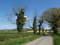 Upsall Lane - geograph.org.uk - 419967.jpg 640 × 480; 136 KB
-
 Upsall Road - geograph.org.uk - 3886222.jpg 3,240 × 4,320; 6.16 MB
-
 Upsall Road - geograph.org.uk - 3886227.jpg 3,240 × 4,320; 5.15 MB
-
 Upsall Town, formerly a forge - geograph.org.uk - 2900466.jpg 3,648 × 2,736; 3.13 MB
-
 Upsall view - geograph.org.uk - 5981003.jpg 2,048 × 1,536; 738 KB
-
 Upsall. The Old Town Hall - geograph.org.uk - 420581.jpg 640 × 480; 111 KB
-
 View from Upsall Road - geograph.org.uk - 5980992.jpg 2,048 × 1,536; 910 KB
-
 View to Branket Wood - geograph.org.uk - 2797166.jpg 3,260 × 1,632; 1.22 MB
-
 Winter landscape, Upsall - geograph.org.uk - 2797160.jpg 3,264 × 2,448; 2 MB
-
 Blackhill Beck - geograph.org.uk - 419755.jpg 640 × 480; 121 KB
-
 Farmland north of Kilvington Hall - geograph.org.uk - 419753.jpg 640 × 480; 113 KB
-
 Footpath to Grizzle Field House - geograph.org.uk - 310978.jpg 640 × 426; 94 KB
-
 Kilvington Hall - geograph.org.uk - 419738.jpg 640 × 393; 120 KB
-
 Low Crake Bank Plantation - geograph.org.uk - 419736.jpg 640 × 480; 131 KB
-
 New Lodge - geograph.org.uk - 420012.jpg 640 × 480; 124 KB
-
 Park House Lodge - geograph.org.uk - 419952.jpg 640 × 480; 139 KB
-
 Tranmission Towers Near Felixkirk - geograph.org.uk - 310986.jpg 640 × 426; 37 KB
-
 Upsall - geograph.org.uk - 127594.jpg 640 × 480; 54 KB


_-_geograph.org.uk_-_5668956.jpg)
_-_geograph.org.uk_-_5668959.jpg)


