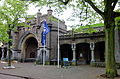
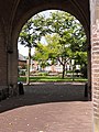
Category:Utrechtse Poort (Naarden)
Jump to navigation
Jump to search
| Object location | | View all coordinates using: OpenStreetMap |
|---|
 | |||||
| Upload media | |||||
| Instance of |
| ||||
|---|---|---|---|---|---|
| Part of | |||||
| Location | Naarden, Gooise Meren, North Holland, Netherlands | ||||
| Street address |
| ||||
| Architect | |||||
| Heritage designation |
| ||||
| Inception |
| ||||
 | |||||
Stadspoort en wachtgebouw
|
This is a category about rijksmonument number 338773
|
| Address |
|
Media in category "Utrechtse Poort (Naarden)"
The following 21 files are in this category, out of 21 total.
-
 De Bilt, foto 3 Jacob Olie (max res).jpg 4,961 × 3,792; 5.82 MB
-

-
 Gate (10961711693).jpg 4,288 × 3,216; 4.61 MB
-
 Naarden - Utrechtsepoort -338773 - 1.jpg 1,024 × 683; 795 KB
-
 Naarden - Utrechtsepoort -338773 - 2.jpg 1,024 × 683; 749 KB
-
 Naarden DSCF9983.JPG 2,816 × 1,864; 1.3 MB
-
 Naarden Vesting Utrechtse Poort.jpg 3,515 × 2,671; 3.81 MB
-
 Naarden vestingpoort.jpg 2,346 × 1,760; 1.03 MB
-
 Naarden, Netherlands - panoramio (3).jpg 5,184 × 3,456; 7.67 MB
-
 Naarden, Netherlands - panoramio (4).jpg 3,456 × 5,184; 9.32 MB
-
 Naarden, stadspoort - panoramio.jpg 5,745 × 1,870; 3.07 MB
-

-
 Utrechtse poort (H) courtine bastion oranje en Promers - Naarden - 20161734 - RCE.jpg 1,191 × 1,200; 422 KB
-
 Utrechtse Poort 01.jpg 1,536 × 2,048; 1.39 MB
-
 Utrechtse Poort 02.jpg 1,536 × 2,048; 1.55 MB
-
 Utrechtse Poort 03.jpg 1,373 × 464; 90 KB
-
 Utrechtse Poort 04.jpg 2,048 × 1,536; 1.44 MB
-
 Utrechtse Poort 05.jpg 2,048 × 1,536; 1.43 MB
-
 Utrechtse Poort 06.jpg 2,048 × 1,536; 1.44 MB
-
 Utrechtse poort1 Naarden.jpg 2,736 × 2,051; 620 KB
-
 Utrechtse poort2 Naarden.jpg 2,683 × 3,577; 955 KB
.jpg)

.jpg)


.jpg)
.jpg)

_courtine_bastion_oranje_en_Promers_-_Naarden_-_20161734_-_RCE.jpg)


