Category:Veensgarth
Jump to navigation
Jump to search
English: Veensgarth (, Viking farm, or Vingarðr, Meadow Farm), is a village in the Tingwall valley west of Lerwick in Shetland. It includes the Vallafield housing estate.
Polski: Veensgarth ( norw. Vikingsgardr = Vikińska farma, lub Vingardr = Farma z zielonym polem) – miejscowość położona w dolinie Tingwall, na zachód od Lerwicku, na Szetlandach.
village in the Shetland Islands, Scotland, UK  | |||||
| Upload media | |||||
| Instance of | |||||
|---|---|---|---|---|---|
| Location |
| ||||
 | |||||
Media in category "Veensgarth"
The following 30 files are in this category, out of 30 total.
-
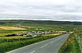
 A970 above Dales Voe - geograph.org.uk - 955613.jpg 640 × 480; 62 KB
-
 First view of Veensgarth - geograph.org.uk - 972745.jpg 640 × 480; 71 KB
-
 Griesta, Tingwall - geograph.org.uk - 594945.jpg 640 × 426; 146 KB
-
 Hill of Herrislee, Tingwall - geograph.org.uk - 595002.jpg 640 × 426; 149 KB
-

-
 Houses on branch road west of Strand - geograph.org.uk - 637074.jpg 640 × 288; 24 KB
-
 Loch of Vatster - geograph.org.uk - 148887.jpg 640 × 480; 83 KB
-
 Looking away from Veensgarth - geograph.org.uk - 972756.jpg 640 × 480; 75 KB
-
 Newly ploughed field at Veensgarth - geograph.org.uk - 1744801.jpg 800 × 410; 129 KB
-
 Strand Loch - geograph.org.uk - 633345.jpg 640 × 480; 55 KB
-
 Strand Loch, Tingwall - geograph.org.uk - 416152.jpg 640 × 426; 38 KB
-
 Vatster Burnt Mound - geograph.org.uk - 445535.jpg 640 × 393; 63 KB
-
 Veensgarth - geograph.org.uk - 1744811.jpg 800 × 533; 92 KB
-
 Veensgarth - geograph.org.uk - 2066568.jpg 2,560 × 1,920; 1.89 MB
-
 Veensgarth - geograph.org.uk - 51334.jpg 640 × 421; 95 KB
-
 Veensgarth and Tingwall airport - geograph.org.uk - 53425.jpg 640 × 417; 77 KB
-
 Veensgarth Below Hill of Herrislee - geograph.org.uk - 2092620.jpg 2,560 × 1,920; 1.86 MB
-
 Veensgarth crossroads - geograph.org.uk - 634255.jpg 640 × 477; 34 KB
-
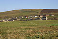
 Veensgarth from Hill of Burradale - geograph.org.uk - 1907000.jpg 800 × 533; 122 KB
-
 Veensgarth from Hill of Burradale - geograph.org.uk - 1907007.jpg 800 × 534; 131 KB
-
 Veensgarth from the South-west - geograph.org.uk - 2092628.jpg 2,560 × 1,920; 1.89 MB
-
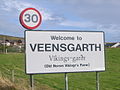 Veensgarth village sign - geograph.org.uk - 972730.jpg 640 × 480; 63 KB
-
 Veensgarth, postbox № ZE2 6 - geograph.org.uk - 2756224.jpg 480 × 640; 77 KB
-
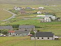
 Veensgarth, Tingwall - geograph.org.uk - 1042984.jpg 640 × 426; 71 KB
-
 Veensgarth, Tingwall - geograph.org.uk - 2066588.jpg 2,560 × 1,920; 1.57 MB
-
 Veensgarth, Tingwall - geograph.org.uk - 594994.jpg 640 × 426; 130 KB
-

-
 Muckle Ayre, Dales Voe, Shetland - geograph.org.uk - 142145.jpg 640 × 480; 59 KB
-
 Pier at Gremista road end - geograph.org.uk - 535108.jpg 640 × 480; 74 KB
-
 Tingwall, Shetland - geograph.org.uk - 141316.jpg 640 × 480; 83 KB


