Category:Via Verde Varesina
Jump to navigation
Jump to search
|
Via Verde Varesina has an entry on OpenStreetMap (show). |
hiking trail in the province of Varese | |||||
| Upload media | |||||
| Instance of |
| ||||
|---|---|---|---|---|---|
| Location | Province of Varese, Lombardy, Italy | ||||
| official website | |||||
| |||||
Subcategories
This category has the following 24 subcategories, out of 24 total.
C
D
F
M
S
V
Media in category "Via Verde Varesina"
The following 63 files are in this category, out of 63 total.
-
 Arrival at parking of Monte San Martino of the path from Val Alta.jpg 3,228 × 2,232; 5.07 MB
-
 Beginning in San Michele of Strada militare San Michele - Vallalta (on the left side).jpg 3,648 × 2,736; 6.88 MB
-
 Branching of Sterata del Fontanone from Strada militare San Michele - Vallalta.jpg 3,214 × 2,424; 5.64 MB
-
 Branching of Strada dei Moianchi from the military road San Michele - Vallalta 01.jpg 3,648 × 2,736; 6.9 MB
-

-

-
 End in San Michele of Strada militare San Michele - Vallalta.jpg 3,648 × 2,736; 6.9 MB
-
 End of path from Monte San Martino towards Val Alta.jpg 3,648 × 2,736; 7.08 MB
-
 End of Strada comunale San Martino - Sant'Antonio towards Via San Martino.jpg 3,648 × 2,736; 7.4 MB
-

-
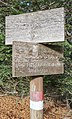
 Guidepost along Strada dei Moianchi.jpg 991 × 1,131; 767 KB
-
 Guidepost at branching of Trekking Insubres from Strada militare San Michele - Vallalta.jpg 1,820 × 2,228; 2.09 MB
-
 Guidepost at Forte di Vallalta, along the military road.jpg 1,686 × 2,246; 2.11 MB
-

-
 Guidepost in Val Alta, direction to Monte San Martino.jpg 2,602 × 1,740; 2.33 MB
-
 Guidepost in Via Gianfilippo Usellini (Arcumeggia).jpg 1,467 × 1,482; 1.21 MB
-
 Guidepost of 3V along Strada comunale San Martino - Sant'Antonio.jpg 2,670 × 2,356; 4.4 MB
-
 Guidepost of 3V along Via San Martino.jpg 1,442 × 1,940; 1.78 MB
-

-

-
 Guidepost of Via Verde Varesina at parking of Monte San Martino.jpg 1,484 × 2,452; 2.24 MB
-
 Guidepost of Via Verde Varesina at Rifugio San Martino (1090).jpg 1,134 × 1,988; 1.53 MB
-
 Guidepost of Via Verde Varesina in Val Alta, on the background of the Madonna statue.jpg 3,476 × 4,228; 4.05 MB
-
 Guidepost of Via Verde Varesina in Val Alta.jpg 2,669 × 2,427; 3.29 MB
-
 Guidepost San Michele 822 m.jpg 1,400 × 2,168; 1.46 MB
-
 Guidepost to observation post "Buco del Diavolo".jpg 2,358 × 1,694; 1.35 MB
-
 Guideposts and route markers along Strada comunale San Martino - Sant'Antonio.jpg 2,811 × 2,494; 3.2 MB
-
 Guideposts at crossing of military roads from San Michele, Mesenzana, Vallalta 01.jpg 2,276 × 2,676; 4.16 MB
-
 Guideposts at crossing of military roads from San Michele, Mesenzana, Vallalta 02.jpg 2,296 × 2,320; 3.39 MB
-
 Guideposts in San Michele, at the beginning of Strada militare San Michele - Vallalta.jpg 3,648 × 2,736; 6.75 MB
-
 Military road aside of Forte di Vallalta, direction NW.jpg 5,112 × 2,851; 9.3 MB
-
 Military road aside of Forte di Vallalta, direction SE.jpg 3,622 × 1,980; 5.79 MB
-

-
 Military road from Vallalta, approaching the branch towards Mesenzana or San Michele.jpg 3,356 × 2,216; 5.66 MB
-
 Military road in Vallalta, direction NW.jpg 3,648 × 2,736; 6.18 MB
-

-
 No access to vehicle on Strada militare San Michele - Vallalta in Porto Valtravaglia 01.jpg 3,648 × 2,736; 9.47 MB
-
 No access to vehicle on Strada militare San Michele - Vallalta in Porto Valtravaglia 02.jpg 3,184 × 1,942; 3.96 MB
-
 No access to vehicle on Strada militare San Michele - Vallalta in San Michele.jpg 3,648 × 2,736; 7.12 MB
-
 Path from Monte San Martino towards Val Alta.jpg 2,146 × 2,358; 3.64 MB
-
 Path from parking of Monte San Martino towards Val Alta.jpg 3,648 × 2,736; 6.93 MB
-
 Path to Cassano Valcuvia departs on the left from the military road in Vallalta.jpg 3,648 × 2,736; 6.96 MB
-
 Path to from Val Alta towards Monte San Martino.jpg 3,648 × 2,736; 7.41 MB
-
 Path to Sacrario dei Caduti di San Martino 01.jpg 3,648 × 2,736; 6.46 MB
-
 Path to Sacrario dei Caduti di San Martino 02.jpg 3,648 × 2,736; 6.06 MB
-
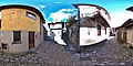
 Photosphere at the beginning of Via Virgilio Cerini (Arcumeggia).jpg 5,376 × 2,688; 4.93 MB
-
 Photosphere in Arcumeggia at crossing of Via Perimo and Via Gianfilippo Usellini.jpg 5,322 × 2,661; 4.95 MB
-
 Photosphere in Arcumeggia at crossing of Via Sant'Antonio, Beretta, Usellini.jpg 5,376 × 2,688; 4.62 MB
-
 Photosphere in front of Forte di Vallalta.jpg 5,322 × 2,661; 6.33 MB
-
 Photosphere in Via Virgilio Cerini (Arcumeggia).jpg 5,322 × 2,661; 5.94 MB
-
 Road sign to Muceno and Pian Cuvinicc.jpg 1,198 × 1,816; 1.41 MB
-
 Route marker I STRA DI CAVER along strada militare San Michele - Vallalta.jpg 3,648 × 2,736; 2.56 MB
-
 Settlement border sign San Martino.jpg 3,041 × 1,846; 3.16 MB
-
 Sign to Sterata del Fontanone.jpg 3,004 × 1,196; 3.51 MB
-
 Start of Strada comunale San Martino - Sant'Antonio from Via San Martino.jpg 3,648 × 2,736; 7.62 MB
-
 Strada comunale San Martino - Sant'Antonio - beginning from Via San Martino.jpg 3,648 × 2,736; 8.15 MB
-
 Strada comunale San Martino - Sant'Antonio after the intersection with route 229.jpg 3,648 × 2,736; 8.27 MB
-

-
 The path from Val Alta approaching the parking of Monte San Martino.jpg 3,648 × 2,736; 6.87 MB
-
 Via Gianfilippo Usellini, end towards Via Sant'Antonio and Via Mario Beretta.jpg 1,485 × 2,388; 1.57 MB
-
 Via Mario Beretta towards the beginning of Via Giuseppe Cerini.jpg 2,192 × 3,091; 3.13 MB
-
 Via San Martino, approaching the service road to the parking place.jpg 3,648 × 2,736; 6.6 MB
-
 Via Virgilio Cerini (Arcumeggia).jpg 2,487 × 3,667; 4.15 MB

.jpg)


.jpg)


.jpg)


.jpg)


.jpg)


.jpg)