Category:Village signs in Lincolnshire
Jump to navigation
Jump to search
Ceremonial counties of England: Bedfordshire · Berkshire · Buckinghamshire · Cambridgeshire · Cheshire · Cornwall · Cumbria · Derbyshire · Devon · Dorset · Durham · East Riding of Yorkshire · East Sussex · Essex · Gloucestershire · Greater London · Hampshire · Herefordshire · Hertfordshire · Kent · Lancashire · Leicestershire · Lincolnshire · Merseyside · Norfolk · North Yorkshire · Northamptonshire · Northumberland · Nottinghamshire · Oxfordshire · Rutland · Shropshire · Somerset · South Yorkshire · Staffordshire · Suffolk · Surrey · West Sussex · West Yorkshire · Wiltshire · Worcestershire
City-counties:
Former historic counties:
Other former counties:
City-counties:
Former historic counties:
Other former counties:
Subcategories
This category has the following 12 subcategories, out of 12 total.
B
- Bardney Village Sign (2 F)
- Barrowby Village Sign (3 F)
- Baston village sign (8 F)
C
- Carlby Village Sign (3 F)
- Castle Bytham Village Sign (4 F)
F
- Friskney Village Sign (3 F)
H
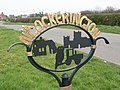
- Heckington village sign (2 F)
L
- Langtoft village sign (5 F)
V
Media in category "Village signs in Lincolnshire"
The following 62 files are in this category, out of 62 total.
-
 Alkborough village sign on Walcot Road.JPG 2,924 × 2,204; 1.98 MB
-
 Walcot village sign on Walcot Road.JPG 3,065 × 1,998; 1.71 MB
-
 Almost there - geograph.org.uk - 1279695.jpg 640 × 480; 99 KB
-
 Binbrook - geograph.org.uk - 696450.jpg 640 × 427; 60 KB
-
 UK Bourne.jpg 595 × 1,603; 184 KB
-
 UK Branston (Lincolnshire) (SideA).jpg 673 × 1,793; 259 KB
-
 UK Branston (Lincolnshire) (SideB).jpg 685 × 1,933; 338 KB
-
 Corby Glen village sign - geograph.org.uk - 886335.jpg 427 × 640; 90 KB
-
 UK CorbyGlen.jpg 586 × 1,355; 225 KB
-
 'Cubbit' - geograph.org.uk - 593759.jpg 640 × 427; 69 KB
-
 Cowbit village sign - geograph.org.uk - 132944.jpg 640 × 480; 276 KB
-
 Croft - geograph.org.uk - 266243.jpg 427 × 640; 91 KB
-
 Crowle village sign - geograph.org.uk - 1013892.jpg 640 × 480; 93 KB
-
 Tourist Info' - geograph.org.uk - 414846.jpg 640 × 598; 95 KB
-
 UK Dyke Lincolnshire.jpg 652 × 1,780; 353 KB
-
 UK Edenham.jpg 478 × 1,339; 159 KB
-
 Entering Humberston from the north - geograph.org.uk - 4224036.jpg 3,455 × 2,677; 1.81 MB
-
 Village Sign - geograph.org.uk - 93231.jpg 300 × 212; 14 KB
-
 Great Gonerby village sign - geograph.org.uk - 280381.jpg 640 × 480; 126 KB
-
 UK GreatGonerby.jpg 605 × 1,811; 225 KB
-
 UK Greatford.jpg 496 × 1,471; 190 KB
-
 Village signposts Grimoldby and Manby - geograph.org.uk - 1804138.jpg 1,600 × 1,200; 638 KB
-
 UK Grimsthorpe.jpg 507 × 685; 79 KB
-
 Habrough village sign - geograph.org.uk - 1538541.jpg 426 × 640; 47 KB
-
 Village sign, west of Hagworthingham - geograph.org.uk - 919752.jpg 640 × 480; 63 KB
-
 UK Holbeach (SideA).jpg 850 × 1,767; 261 KB
-
 UK Holbeach (SideB).jpg 782 × 1,571; 225 KB
-
 Huttoft.jpg 2,592 × 1,944; 2.12 MB
-
 Louth from the South - geograph.org.uk - 233243.jpg 640 × 480; 107 KB
-
 Town sign - geograph.org.uk - 386095.jpg 640 × 480; 138 KB
-
 Welcome To Luddington - geograph.org.uk - 58998.jpg 640 × 480; 144 KB
-
 Moulton - geograph.org.uk - 571786.jpg 427 × 640; 78 KB
-
 Moulton Chapel - geograph.org.uk - 592438.jpg 427 × 640; 120 KB
-
 New York - geograph.org.uk - 166511.jpg 640 × 427; 85 KB
-
 Village centre - geograph.org.uk - 664290.jpg 427 × 640; 66 KB
-
-
 UK NorthRauceby.jpg 941 × 982; 192 KB
-
 AA sign - geograph.org.uk - 828516.jpg 640 × 427; 100 KB
-
 UK Northorpe and Thurlby.jpg 741 × 1,637; 175 KB
-
 UK Pinchbeck.jpg 609 × 1,545; 162 KB
-
 Rippingale Village Sign - geograph.org.uk - 693673.jpg 480 × 640; 108 KB
-
 UK Rippingale.jpg 535 × 1,552; 195 KB
-
 UK Scottlethorpe.jpg 557 × 1,429; 179 KB
-
 Signed entry - geograph.org.uk - 373659.jpg 640 × 422; 54 KB
-
 Skellingthorpe village sign.jpg 1,920 × 2,560; 1.57 MB
-
 Skidbrooke cum Saltfleet - geograph.org.uk - 432043.jpg 640 × 427; 60 KB
-
 UK Sleaford cropped.jpg 591 × 663; 75 KB
-
 UK Sleaford.jpg 689 × 1,817; 267 KB
-
 UK SuttonBridge (Sign2).jpg 709 × 1,769; 367 KB
-
 Entrance to Swayfield - geograph.org.uk - 289489.jpg 640 × 480; 90 KB
-
 Tattershall Village Sign - geograph.org.uk - 702577.jpg 427 × 640; 58 KB
-
 The village sign at Stow (geograph 5932300 cropped).jpg 2,510 × 2,673; 4.17 MB
-
 The village sign at Stow (geograph 5932300).jpg 4,000 × 3,000; 5.03 MB
-
 Theddlethorpe village signpost - geograph.org.uk - 1804117.jpg 2,472 × 3,296; 1.91 MB
-
 Thorpe on the Hill - geograph.org.uk - 361330.jpg 640 × 427; 98 KB
-
 Thorpe on the Hill - geograph.org.uk - 684503.jpg 640 × 480; 106 KB
-
 UK Uffington (Lincolnshire).jpg 772 × 1,609; 312 KB
-
 Village sign - geograph.org.uk - 1400609.jpg 426 × 640; 72 KB
-
 UK Washingborough.jpg 1,001 × 1,429; 288 KB
-
 UK Welby.jpg 644 × 1,777; 369 KB
-
 Westborough (Lincolnshire).jpg 978 × 1,237; 374 KB
-
 Approaching Wootton on the A1077 - geograph.org.uk - 1610703.jpg 640 × 480; 279 KB


.jpg)
.jpg)


.jpg)
.jpg)


.jpg)


.jpg)

_(SideA).jpg)
_(SideB).jpg)
.jpg)