Category:Volcano monitoring in Iceland
Jump to navigation
Jump to search
Subcategories
This category has the following 3 subcategories, out of 3 total.
H
S
V
Media in category "Volcano monitoring in Iceland"
The following 11 files are in this category, out of 11 total.
-
 Dem eya hires.jpg 1,640 × 1,139; 2.21 MB
-
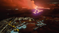 Eruption near Grindavík on March 16, 2024.png 768 × 432; 166 KB
-
 Eyjafjallajökull after eruption on 2010-03-20 seen by TerraSAR-X.jpg 2,673 × 2,005; 6.75 MB
-
 Fimmvörðuháls 03.jpg 640 × 480; 110 KB
-
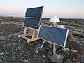 GPS station in Iceland.jpg 4,032 × 3,024; 4.27 MB
-
 GPS station in Stafanes 2024.jpg 3,024 × 4,032; 7.12 MB
-
 GPS station in Stafnes.jpg 4,032 × 3,024; 2.89 MB
-
 Jarðskjálftamælir.jpg 4,032 × 3,024; 6.34 MB
-
 N-Atlantic-grav.png 504 × 339; 301 KB
-
 Seismometer-iceland.JPG 3,072 × 2,304; 1.28 MB
-
 View from the Eldfell towards the Helgafell.jpg 4,752 × 3,168; 7.22 MB


