Category:Voorstraat 31, Bad Nieuweschans
Jump to navigation
Jump to search
| Object location | | View all coordinates using: OpenStreetMap |
|---|
building in Oldambt, Netherlands  | |||||
| Upload media | |||||
| Instance of | |||||
|---|---|---|---|---|---|
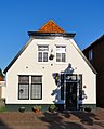
| Location | Bad Nieuweschans, Oldambt, Groningen, Netherlands | ||||
| Street address |
| ||||
| Heritage designation |
| ||||
 | |||||
|
This is a category about rijksmonument number 30468
|
| Address |
|
Media in category "Voorstraat 31, Bad Nieuweschans"
The following 5 files are in this category, out of 5 total.
-
 Overzicht - Nieuweschans - 20164907 - RCE.jpg 1,200 × 800; 286 KB
-
 Overzicht - Nieuweschans - 20164908 - RCE.jpg 1,200 × 807; 329 KB
-
 Overzicht - Nieuweschans - 20164938 - RCE.jpg 1,200 × 812; 319 KB
-
 Voorgevel - Nieuweschans - 20164944 - RCE.jpg 1,200 × 1,191; 253 KB
-
 Voorstraat31 Nieuweschans.jpg 2,400 × 2,984; 908 KB


