Category:Voorstraat 489, Dordrecht
Jump to navigation
Jump to search
| Object location | | View all coordinates using: OpenStreetMap |
|---|
building in Dordrecht, Netherlands  | |||||
| Upload media | |||||
| Instance of | |||||
|---|---|---|---|---|---|
| Location | Dordrecht, South Holland, Netherlands | ||||
| Street address |
| ||||
| Heritage designation |
| ||||
 | |||||
|
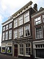
This is a category about rijksmonument number 13845
|
| Address |
|
Media in category "Voorstraat 489, Dordrecht"
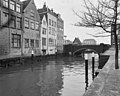
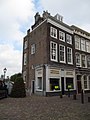
The following 8 files are in this category, out of 8 total.
-
 Overzicht - Dordrecht - 20063002 - RCE.jpg 955 × 1,200; 192 KB
-
 Overzicht - Dordrecht - 20063003 - RCE.jpg 953 × 1,200; 262 KB
-
 Overzicht - Dordrecht - 20063004 - RCE.jpg 954 × 1,200; 231 KB
-
 Overzicht - Dordrecht - 20063005 - RCE.jpg 965 × 1,200; 249 KB
-
 Overzicht - Dordrecht - 20063006 - RCE.jpg 1,200 × 957; 273 KB
-
 RM13844 Dordrecht - Voorstraat 487.jpg 2,448 × 3,264; 1.75 MB
-
 RM13845 Dordrecht - Voorstraat 489.jpg 2,448 × 3,264; 1.84 MB
-
 Voorgevels - Dordrecht - 20063001 - RCE.jpg 804 × 1,200; 196 KB


