Category:Voorstraat 73, Dordrecht
Jump to navigation
Jump to search
| Object location | | View all coordinates using: OpenStreetMap |
|---|
 | |||||
| Upload media | |||||
| Instance of |
| ||||
|---|---|---|---|---|---|
| Location | Dordrecht, South Holland, Netherlands | ||||
| Street address |
| ||||
| Heritage designation |
| ||||
 | |||||
|
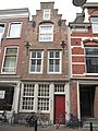
This is a category about rijksmonument number 13745
|
| Address |
|
Media in category "Voorstraat 73, Dordrecht"
The following 4 files are in this category, out of 4 total.
-
 Dordrecht - Voorstraat 73.JPG 3,056 × 4,592; 4.49 MB
-
 Overzicht - Dordrecht - 20062779 - RCE.jpg 1,200 × 967; 236 KB
-
 RM13745 Dordrecht - Voorstraat 73.jpg 1,944 × 2,592; 1.47 MB
-
 Voorgevels - Dordrecht - 20062780 - RCE.jpg 953 × 1,200; 244 KB


