Category:Voorstraat 8, Middelharnis
Jump to navigation
Jump to search
| Object location | | View all coordinates using: OpenStreetMap |
|---|
building in Goeree-Overflakkee, Netherlands  | |||||
| Upload media | |||||
| Instance of | |||||
|---|---|---|---|---|---|
| Location | Middelharnis, South Holland, Netherlands | ||||
| Street address |
| ||||
| Located on street |
| ||||
| Heritage designation |
| ||||
 | |||||
|
This is a category about rijksmonument number 29783
|
| Address |
|
Media in category "Voorstraat 8, Middelharnis"
The following 6 files are in this category, out of 6 total.
-
 En hoger, overzicht - Middelharnis - 20158614 - RCE.jpg 1,200 × 947; 223 KB
-
 Overzicht naar het noorden - Middelharnis - 20158612 - RCE.jpg 1,200 × 795; 205 KB
-
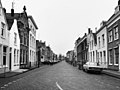 Overzicht Voorstraat - Middelharnis - 20158482 - RCE.jpg 1,200 × 898; 203 KB
-
 RM29783 Middelharnis - Voorstraat 8.jpg 1,944 × 2,592; 1.43 MB
-
 Voor- en zijgevel - Middelharnis - 20158617 - RCE.jpg 1,200 × 794; 233 KB
-
 Voorgevels - Middelharnis - 20158618 - RCE.jpg 1,200 × 812; 218 KB


