Category:Vorderrhein
Jump to navigation
Jump to search
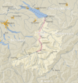
Deutsch: Der Vorderrhein ist einer der beiden Quellflüsse des Rheins im Kanton Graubünden in der Schweiz.
Français : Le Rhin Antérieur est un des 2 cours du Rhin en amont de Reichenau, canton des Grisons en Suisse.
Русский: Передний Рейн — одна из двух рек, при слиянии которых образуется Рейн в кантоне Граубюнден в Швейцарии.
river in Switzerland   | |||||
| Upload media | |||||
| Pronunciation audio | |||||
|---|---|---|---|---|---|
| Instance of | |||||
| Location | Grisons, Switzerland | ||||
| Length |
| ||||
| Elevation above sea level |
| ||||
| Mouth of the watercourse | |||||
| Drainage basin | |||||
| Tributary |
| ||||
 | |||||
Subcategories
This category has the following 13 subcategories, out of 13 total.
A
- Anterior Rhine in art (1 P, 11 F)
B
F
- Flims Rockslide (78 F)
R
- Rein da Maighels (11 F)
- Rein da Tuma (17 F)
- Rheinbrücke Tavanasa (1905) (20 F)
- Rheinbrücke Tavanasa (2016) (4 F)
T
- Tomasee (42 F)
V
- Vorderrhein valley (1 F)
Media in category "Vorderrhein"
The following 80 files are in this category, out of 80 total.
-
De-Vorderrhein.ogg 1.8 s; 18 KB
-
 20171030 Vorderrhein near Disentis.jpg 5,312 × 2,988; 2.97 MB
-
 Anterior Rhine Valley Sumvitg 865.jpg 1,280 × 835; 945 KB
-
 Aua Russein Flussmündung in den Vorderrhein, Cumpadials GR – Disentis GR 20160910-jag9889.jpg 4,642 × 3,714; 16.49 MB
-
 Auengebiet Cahuons, Sumvitg GR 20160910-jag9889.jpg 5,152 × 2,898; 11.36 MB
-
 Auengebiet Cauma, Schluein GR– Castrisch GR 20190814-jag9889.jpg 4,608 × 2,592; 8.32 MB
-
 Auengebiet Disla– Pardomat, Sumvitg GR 20160910-jag9889.jpg 4,642 × 3,714; 16.96 MB
-
 Auengebiet Fontanivas-Sonduritg, Disentis GR 20160910-jag9889.jpg 5,152 × 3,864; 14.85 MB
-
 Black Hole, Rhin Anteriur, CH.jpg 1,024 × 768; 186 KB
-
 Blick von Ladir ins Rheintal (EOS5000208).jpg 3,214 × 2,142; 2.75 MB
-
 Bonaduz und Reichenau Tamins.JPG 2,048 × 1,536; 707 KB
-
 Bridge Over the Vorderrhein near Rueras - panoramio.jpg 3,888 × 2,348; 2.33 MB
-
 Brücke Tavanasa 1928.jpg 3,456 × 2,304; 5.14 MB
-
 Brücke Tavanasa.jpg 3,971 × 2,412; 4.27 MB
-
 Danis.JPG 4,000 × 3,000; 6.84 MB
-
 Einzugsgebiet Alpenrhein.png 2,255 × 2,385; 2.94 MB
-
 ETH-BIB-Cumpadials (Sumvitg)-LBS H1-019701.tif 6,773 × 4,777; 92.65 MB
-
 ETH-BIB-Cumpadials (Sumvitg)-LBS H1-019702.tif 6,813 × 4,777; 93.19 MB
-
 ETH-BIB-Ilanz. Glennermündung v. N. aus 600 m-Inlandflüge-LBS MH01-003918.tif 6,231 × 4,297; 76.7 MB
-

-
 ETH-BIB-Surselva, Blick Nordosten Chur-LBS H1-018204.tif 6,775 × 4,707; 91.4 MB
-

-
 ETH-BIB-Vorderrheintal-Inlandflüge-LBS MH01-007648.tif 2,723 × 2,017; 15.88 MB
-
 ETH-BIB-Vorderrheintal-Inlandflüge-LBS MH05-50-07.tif 3,508 × 2,358; 23.72 MB
-
 ETH-BIB-Vorderrheintal-Inlandflüge-LBS MH05-50-08.tif 3,508 × 2,360; 23.73 MB
-
 Flutwarnung Vorderrhein.jpg 2,156 × 3,236; 1.33 MB
-
 FR Ge 4-4 II 615 Trin 210715 5232 Ilanz-Landquart.jpg 2,048 × 1,365; 3.5 MB
-
 Glacier Express in der Vorderrheinschlucht.jpg 3,304 × 2,233; 2.68 MB
-
 Glenner Flussmündung in den Vorderrhein, Ilanz GR 20190814-jag9889.jpg 4,608 × 3,456; 11.03 MB
-
 GLS Quellgebiet Vorderrhein.png 825 × 1,557; 577 KB
-
 Grisones 1995 01.jpg 1,074 × 713; 707 KB
-
 Gruob Juni 18.jpg 4,032 × 3,024; 3.81 MB
-
 Gruob.jpg 1,079 × 719; 165 KB
-
 ISS022-E-5798 - View of Switzerland.jpg 4,288 × 2,848; 1.54 MB
-
 Madernal TWW.jpg 4,000 × 6,000; 10.5 MB
-
 Noordflank van de Vorderrhein 15-09-2022. (d.j.b) 01.jpg 5,184 × 1,759; 4.61 MB
-
 Noordflank van de Vorderrhein 15-09-2022. (d.j.b) 02.jpg 5,184 × 3,456; 11.03 MB
-
 Noordflank van de Vorderrhein 15-09-2022. (d.j.b) 03.jpg 5,183 × 2,436; 7.22 MB
-
 Noordflank van de Vorderrhein 15-09-2022. (d.j.b) 04.jpg 5,184 × 2,603; 5.43 MB
-
 Rabiusa Mündung.jpeg 4,032 × 3,024; 5.02 MB
-
 Rafting to Versam.jpg 3,771 × 2,694; 5.68 MB
-
 Reichenau GR Bild Peter Birmann 1805.jpg 7,386 × 5,098; 3.34 MB
-
 Rein da Nalps Flussmündung in den Vorderrhein, Sedrun GR 20160910-jag9889.jpg 4,830 × 3,864; 17.25 MB
-
 RhB-Zug gegenüber Rne Wackenau.JPG 3,968 × 2,232; 770 KB
-
 Rhine source.JPG 1,600 × 1,200; 916 KB
-
 Ruinaulta from Versamerstrasse road.jpg 2,997 × 2,248; 3.23 MB
-
 Ruinaulta from Zault Observation Deck.jpg 3,597 × 2,248; 5.81 MB
-
 Ruinaulta Valendas1.jpg 4,608 × 3,456; 6.22 MB
-
 Ruinaulta Valendas2.jpg 4,608 × 3,456; 6.35 MB
-
 Sedrun Portal and Bridge.jpg 4,000 × 2,667; 7.69 MB
-
 Traditionele boerenschuur bij Waltensburg. 18-09-2022. (d.j.b) 01.jpg 5,184 × 3,240; 18.25 MB
-
 Traditionele boerenschuur bij Waltensburg. 18-09-2022. (d.j.b) 02.jpg 5,184 × 3,456; 18.83 MB
-
 Versam, Switzerland - panoramio (4).jpg 3,056 × 4,592; 2.72 MB
-
 View from Islabord bus stop in Versam.jpg 4,000 × 2,857; 8.37 MB
-
-
 Vorderrhein from the Vorderrheinbrücke. 22-09-2022. (actm.) 02.jpg 4,347 × 2,445; 10.67 MB
-
 Vorderrhein from the Vorderrheinbrücke. 22-09-2022. (actm.) 03.jpg 4,116 × 2,744; 12.84 MB
-
 Vorderrhein from the Vorderrheinbrücke. 22-09-2022. (actm.) 04.jpg 5,184 × 2,230; 15.66 MB
-
 Vorderrhein from the Vorderrheinbrücke. 22-09-2022. (actm.) 05.jpg 4,869 × 2,739; 13.74 MB
-
 Vorderrhein from the Vorderrheinbrücke. 22-09-2022. (actm.) 06.jpg 2,675 × 3,456; 12.33 MB
-
 Vorderrhein from the Vorderrheinbrücke. 22-09-2022. (d.j.b) 03.jpg 5,184 × 3,456; 14.48 MB
-
 Vorderrhein Hochwasserstand 25.9.1927 18.7.1987.jpg 1,824 × 1,368; 916 KB
-
 Vorderrhein Ilanz GR.JPG 4,032 × 3,024; 4.08 MB
-
 Vorderrhein Mundaun.JPG 3,451 × 2,161; 2.51 MB
-
 Vorderrhein Sagogn.JPG 3,456 × 2,304; 3.86 MB
-
 Vorderrhein unterhalb Ilanz.jpg 3,449 × 4,670; 3.25 MB
-
 VorderrheinSagogn1.JPG 3,456 × 2,304; 3.96 MB
-
 Waltensburg-Vuorz railway station en omgeving (Vorderrhein). 22-09-2022. (actm.) 01.jpg 5,129 × 2,885; 17.66 MB
-
 Waltensburg-Vuorz, railway station 22-09-2022. (d.j.b) 01.jpg 4,561 × 3,421; 11.92 MB
-
 Waltensburg-Vuorz, railway station 22-09-2022. (d.j.b) 02.jpg 5,184 × 3,456; 14.65 MB
-
 Waltensburg-Vuorz, railway station 22-09-2022. (d.j.b) 05.jpg 5,145 × 2,894; 8.51 MB
-
 Zermatt Tour 05.jpg 3,200 × 1,800; 3.45 MB
-
 Zuidflank van de Vorderrhein 18-09-2022. (d.j.b) 01.jpg 4,846 × 3,231; 12.59 MB
-
 Zuidflank van de Vorderrhein 18-09-2022. (d.j.b) 02.jpg 4,984 × 2,691; 8.94 MB
-
 Zuidflank van de Vorderrhein 18-09-2022. (d.j.b) 03.jpg 4,685 × 3,123; 9.6 MB
-
 Zuidflank van de Vorderrhein 18-09-2022. (d.j.b) 04.jpg 4,968 × 2,910; 12.43 MB
-
 Zuidflank van de Vorderrhein 18-09-2022. 18-09-2022. (actm.) 01.jpg 5,042 × 3,151; 13.24 MB
-
 Zuidflank van de Vorderrhein 18-09-2022. 18-09-2022. (actm.) 02.jpg 4,866 × 2,426; 11.66 MB
-
 Zusammenfluss Glenner Vorderrhein1.jpg 5,184 × 3,456; 4.09 MB
-
 Zusammenfluss Glenner Vorderrhein2.jpg 4,280 × 2,852; 2.8 MB


.jpg)


_02.jpg)
_03.jpg)
_04.jpg)


_01.jpg)
_02.jpg)
.jpg)

_04.jpg)
_02.jpg)
_03.jpg)
_04.jpg)
_05.jpg)
_06.jpg)
_03.jpg)


._22-09-2022._(actm.)_01.jpg)
_01.jpg)
_02.jpg)
_05.jpg)

_01.jpg)
_02.jpg)
_03.jpg)
_04.jpg)
_01.jpg)
_02.jpg)


_01.jpg)