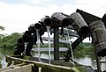
Category:Wässerwiesenrad (Möhrendorf)
Jump to navigation
Jump to search
| Object location | | View all coordinates using: OpenStreetMap |
|---|
Media in category "Wässerwiesenrad (Möhrendorf)"
The following 4 files are in this category, out of 4 total.
-
 Möhrendorf Wässerwiesenrad 001.JPG 3,660 × 2,416; 3.16 MB
-
 Möhrendorf Wässerwiesenrad 002.JPG 3,496 × 2,428; 2.51 MB
-
 Möhrendorf Wässerwiesenrad 003.JPG 3,586 × 2,443; 2.31 MB
-
 Möhrendorf Wässerwiesenrad 004.JPG 3,804 × 2,508; 2.67 MB


