Category:Wachgebäude (Munitionsdepot Dülmen-Visbeck)
Jump to navigation
Jump to search
| | View all coordinates using: OpenStreetMap |
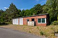
Deutsch: Wachgebäude im Munitionsdepot Dülmen-Visbeck
Media in category "Wachgebäude (Munitionsdepot Dülmen-Visbeck)"
The following 3 files are in this category, out of 3 total.
-
 Dülmen, Kirchspiel, ehem. Munitionslager Visbeck -- 2020 -- 7531.jpg 6,720 × 4,480; 23.29 MB
-
 Dülmen, Kirchspiel, ehem. Sondermunitionslager Visbeck, Wachhaus -- 2019 -- 6416.jpg 6,720 × 4,480; 20.98 MB
-
 Dülmen, Kirchspiel, ehem. Sondermunitionslager Visbeck, Wachhaus -- 2019 -- 6417.jpg 6,720 × 4,480; 19.6 MB


