Category:Wallowa County, Oregon
Vai alla navigazione
Vai alla ricerca
Counties of Oregon: Baker · Benton · Clackamas · Clatsop · Columbia · Coos · Crook · Curry · Deschutes · Douglas · Gilliam · Grant · Harney · Hood River · Jackson · Jefferson · Josephine · Klamath · Lake · Lane · Lincoln · Linn · Malheur · Marion · Morrow · Multnomah · Polk · Sherman · Tillamook · Umatilla · Union · Wallowa · Wasco · Washington · Wheeler · Yamhill
contea statunitense   | |||||
| Carica un file multimediale | |||||
| Istanza di | |||||
|---|---|---|---|---|---|
| Luogo | Oregon, Stati Uniti d'America | ||||
| Capitale | |||||
| Data di fondazione o creazione |
| ||||
| Popolazione |
| ||||
| Superficie |
| ||||
| sito web ufficiale | |||||
 | |||||
Sottocategorie
Questa categoria contiene le 29 sottocategorie indicate di seguito, su un totale di 29.
B
C
E
F
- Flora, Oregon (10 F)
G
H
- Hells Canyon Dam (9 F)
I
- Imnaha River (7 F)
J
- Joseph Canyon (15 F)
L
- Lostine, Oregon (6 F)
M
- Maxwell Lake (Wallowa County) (14 F)
N
O
- Oregon Route 3 (9 F)
P
S
U
W
- Wallowa Lake, Oregon (30 F)
- Wallowa River (49 F)
- Wallowa, Oregon (65 F)
File nella categoria "Wallowa County, Oregon"
Questa categoria contiene 59 file, indicati di seguito, su un totale di 59.
-
 130413 Wen odfw (16674010473).jpg 2 100 × 1 500; 1,31 MB
-
 160921-Wenaha odfw (33132132114).jpg 1 274 × 962; 1,55 MB
-
 170220 Wenaha Brown odfw (39753387540).jpg 1 555 × 1 236; 1,16 MB
-
 171225 Middle Fork Brown odfw (39753387370).jpg 1 535 × 1 035; 1,13 MB
-

-
 200930-Wenaha juveniles (51144474882).jpg 2 100 × 1 500; 2,44 MB
-
 210207 MIddle Fork wolf odfw 3.5x2.5 (52014798322).jpg 1 050 × 750; 689 KB
-
 210612 bear creek wolf pack odfw 3.5x4.5 (52016079614).jpg 1 350 × 1 050; 1,23 MB
-
 5758 zumwalt prairie swart odfw (26928232100).jpg 2 100 × 1 500; 3,7 MB
-
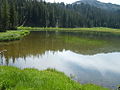
 Aneroidlake.JPG 1 024 × 768; 175 KB
-
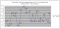 AneroidTemp.gif 704 × 343; 9 KB
-
 Bighorn Ram Lostine 6 myatt odfw.JPG 2 100 × 1 500; 1,54 MB
-
 Bonny lake west.jpg 500 × 375; 45 KB
-
 Bonny lakes.jpg 640 × 480; 90 KB
-
 Canyon Overlook near Grand Ronde River (10776292164).jpg 1 536 × 1 024; 438 KB
-
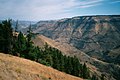 Canyon Overlook near Grand Ronde River 2001. (10776182115).jpg 1 536 × 1 024; 473 KB
-
 Chinese Massacre Cove.jpg 1 024 × 768; 338 KB
-
 DSCN1029 collared wolf odfw (17086810627).jpg 2 100 × 1 500; 3,47 MB
-
 Ferguson ridge ski area.jpg 2 592 × 1 944; 2,28 MB
-

-
-
 Hurricane Creek Grange - Wallowa County Oregon.jpg 3 982 × 2 186; 3,38 MB
-
 Hurricane Creek.jpg 1 200 × 1 600; 784 KB
-
 Image5 imnaha pup 2012 odfw (17106501298).jpg 480 × 270; 168 KB
-
 Imnaha River aerial.jpg 4 288 × 2 848; 3,53 MB
-
 Imnaha Valley at Sunset (543564859).jpg 1 280 × 800; 176 KB
-
 Minam River near confluence with Wallowa River IMG 4501.jpg 3 888 × 2 592; 5,62 MB
-
 Minam State Recreation Area.jpg 4 288 × 2 848; 9,14 MB
-
 Mount Howard, Oregon.jpg 3 212 × 2 265; 1,27 MB
-
 Mules and rider, Peter Murphy (5352568320).jpg 1 100 × 823; 701 KB
-
 Near Enterprise, Oregon.JPG 3 456 × 2 304; 3,09 MB
-
 North east of Enterprise, OR. (10488995376).jpg 2 048 × 1 536; 823 KB
-
 North east of Enterprise, OR. (10488997964).jpg 2 048 × 1 536; 934 KB
-
 North east of Enterprise, OR. (10488999624).jpg 2 048 × 1 536; 1,01 MB
-
 North east of Enterprise, OR. (10489001494).jpg 2 048 × 1 536; 1 019 KB
-
 North east of Enterprise, OR. (10489002595).jpg 2 048 × 1 536; 808 KB
-
 North east of Enterprise, OR. (10489008326).jpg 2 048 × 1 536; 1 001 KB
-
 ODFW 181206 Wenaha female (49786374796).jpg 1 807 × 1 262; 917 KB
-
 ODFW 190624 OR30 wolf-1 (49785834893).jpg 2 048 × 1 420; 496 KB
-

-
 Pond at Iwetemlaykin State Heritage Site.jpg 4 254 × 2 778; 6,74 MB
-
 Power line outside Enterprise, OR. (10776449113).jpg 1 536 × 1 024; 409 KB
-
 Road north of Enterprise, OR. (10776216696).jpg 1 536 × 1 024; 555 KB
-
 Travelling N along Hwys 39 & 3 in NE Oregon - (28652554381).jpg 4 617 × 3 078; 10,42 MB
-
 Travelling N along Hwys 39 & 3 in NE Oregon - Larkspur spp - (28697492236).jpg 989 × 1 483; 1,17 MB
-

-

-
 Travelling N along Hwys 39 & 3 in NE Oregon - Water droplets on leaves - (28729691725).jpg 3 966 × 2 644; 6,79 MB
-
 Troy Oregon IMG 4545.jpg 3 888 × 2 592; 5,27 MB
-

-
 USA Wallowa, Oregon age pyramid.svg 520 × 600; 8 KB
-
 Wallowa County Livestock club member (5834181014).jpg 3 725 × 2 487; 663 KB
-
 Wallowa River Rest Area.jpg 4 288 × 2 848; 10,57 MB
-
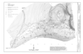
 Wallowa-Whitman National Forest map.gif 600 × 617; 38 KB
-
 Wenaha River, USFS.jpg 1 536 × 2 048; 1,01 MB
-
 Wild horse run (5988550463).jpg 796 × 600; 103 KB
-
 Zumwalt overview.jpg 5 100 × 3 300; 10,46 MB
-
 Zumwalt overviewsmall.jpg 2 100 × 1 500; 1,86 MB
-
 Zumwalt prairie 2007.jpg 1 152 × 864; 192 KB
.jpg)
.jpg)
.jpg)
.jpg)
.jpg)
.jpg)
.jpg)
.jpg)
.jpg)


.jpg)
.jpg)

.jpg)


.png)


.jpg)

.jpg)


.jpg)

.jpg)
.jpg)
.jpg)
.jpg)
.jpg)
.jpg)
.jpg)
.jpg)
.gif)

.jpg)
.jpg)
.jpg)
.jpg)
.jpg)
.jpg)
.jpg)


.jpg)


.jpg)


