Category:Wansdyke
ancient trackway   | |||||
| Carica un file multimediale | |||||
| Istanza di |
| ||||
|---|---|---|---|---|---|
| Luogo |
| ||||
| |||||
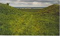
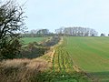
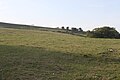
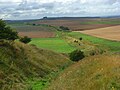
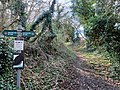
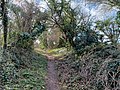
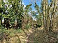
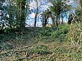
The Wansdyke (from Woden's Dyke) is a series of early medieval defensive linear earthworks in the West Country of England, consisting of a ditch and a running embankment from the ditch spoil, with the ditching facing north. There are two main parts: an eastern dyke which runs between Savernake Forest and Morgan's Hill in Wiltshire, and a western dyke which runs from Monkton Combe to the ancient hill fort of Maes Knoll in historic Somerset. Between these two dykes there is a middle section formed by the remains of the London to Bath Roman road. There is also some evidence in charters that it extended west from Maes Knoll to the coast of the Severn Estuary but this is uncertain. It may possibly define a post-Roman boundary.
File nella categoria "Wansdyke"
Questa categoria contiene 64 file, indicati di seguito, su un totale di 64.
-
-
-
 Farmland and Wansdyke, Cadley - geograph.org.uk - 419352.jpg 640 × 480; 136 KB
-
 Footpath, Combe Down - geograph.org.uk - 1561674.jpg 640 × 480; 188 KB
-
 Path along the Wansdyke bank, east of Burnt House.JPG 3 264 × 2 448; 3,4 MB
-
 Sign and stone in Englishcombe churchyard - geograph.org.uk - 700197.jpg 480 × 640; 232 KB
-
 Stile on the Wansdyke (geograph 3331740).jpg 2 785 × 3 679; 5,98 MB
-
 The springers explore Wansdyke (geograph 2705555).jpg 1 600 × 1 200; 421 KB
-
 The Wansdyke on Tan Hill. - geograph.org.uk - 185604.jpg 640 × 441; 113 KB
-
 The Wansdyke on Tan Hill. - geograph.org.uk - 187162.jpg 640 × 437; 97 KB
-
 The Wansdyke on Tan Hill.jpg 640 × 480; 103 KB
-
 The Wansdyke Path (geograph 4589594).jpg 640 × 480; 95 KB
-
 The Wansdyke, East of Tan Hill. - geograph.org.uk - 185572.jpg 640 × 370; 101 KB
-
 The Wansdyke, Looking East to Milk Hill. - geograph.org.uk - 187168.jpg 640 × 435; 106 KB
-
 The Wansdyke, North of Milk Hill. - geograph.org.uk - 185562.jpg 640 × 438; 135 KB
-
 The Wansdyke, North-west of Tan Hill. - geograph.org.uk - 185617.jpg 640 × 518; 119 KB
-

-
 View on the downs at Bishops Cannings - geograph.org.uk - 928987.jpg 640 × 480; 98 KB
-
 Wansdyke 01.JPG 3 456 × 2 304; 1,63 MB
-
 Wansdyke 02.JPG 3 456 × 2 304; 1,37 MB
-
 Wansdyke 03.JPG 3 456 × 2 304; 1,38 MB
-
 Wansdyke 04.JPG 3 456 × 2 304; 2,07 MB
-
 Wansdyke 05.JPG 3 456 × 2 304; 1,58 MB
-
 Wansdyke 06.JPG 3 456 × 2 304; 1,52 MB
-
 Wansdyke 07.JPG 3 456 × 2 304; 1,76 MB
-
 Wansdyke 08.JPG 3 456 × 2 304; 2,19 MB
-
 Wansdyke 09.JPG 3 456 × 2 304; 1,59 MB
-
 Wansdyke 10.JPG 3 456 × 2 304; 1,7 MB
-
 Wansdyke at Morgan's Hill - geograph.org.uk - 298298.jpg 640 × 480; 76 KB
-
 Wansdyke Ditch. - geograph.org.uk - 187150.jpg 640 × 433; 156 KB
-
 Wansdyke earthworks, Englishcombe, November 2014.JPG 3 264 × 2 448; 2,81 MB
-
 Wansdyke Englishcombe.jpg 2 288 × 1 712; 827 KB
-
 Wansdyke in a Somerset Orchard (geograph 2137028).jpg 1 600 × 1 068; 909 KB
-
 Wansdyke near Bishops Cannings - geograph.org.uk - 928989.jpg 640 × 480; 128 KB
-
 Wansdyke near Bishops Cannings - geograph.org.uk - 928990.jpg 640 × 480; 108 KB
-
 Wansdyke near Bishops Cannings - geograph.org.uk - 928991.jpg 640 × 480; 149 KB
-
 Wansdyke near Bishops Cannings - geograph.org.uk - 928992.jpg 640 × 480; 133 KB
-
 Wansdyke sign (geograph 2378892).jpg 1 704 × 2 304; 2,08 MB
-
 Wansdyke, Bishops Cannings - geograph.org.uk - 1564995.jpg 640 × 480; 158 KB
-
 Wansdyke, near East Kennett - geograph.org.uk - 834729.jpg 640 × 480; 150 KB
-
 Wansdyke, near East Kennett - geograph.org.uk - 834730.jpg 640 × 479; 137 KB
-
 Wansdyke, off A361, Wiltshire - geograph.org.uk - 299961.jpg 640 × 480; 116 KB
-
 Wansdyke, Old Dyke Lane, Inkpen 01.jpg 4 000 × 3 000; 5,58 MB
-
 Wansdyke, Old Dyke Lane, Inkpen 02.jpg 4 000 × 3 000; 5,57 MB
-
 Wansdyke, Old Dyke Lane, Inkpen 03.jpg 4 000 × 3 000; 6,34 MB
-
 Wansdyke, Old Dyke Lane, Inkpen 04.jpg 4 000 × 3 000; 6,4 MB
-
 Wansdyke, Old Dyke Lane, Inkpen 05.jpg 4 000 × 3 000; 6,44 MB
-
 Wansdyke, Old Dyke Lane, Inkpen 06.jpg 4 000 × 3 000; 5,35 MB
-
 Wansdyke, Old Dyke Lane, Inkpen 07.jpg 4 000 × 3 000; 6,75 MB
-
 Wansdyke, Old Dyke Lane, Inkpen 08.jpg 4 000 × 3 000; 5,34 MB
-
 Wansdyke, Old Dyke Lane, Inkpen 09.jpg 4 000 × 3 000; 6,11 MB
-
 Wansdyke, Old Dyke Lane, Inkpen 10.jpg 4 000 × 3 000; 6,45 MB
-
 Wansdyke, Old Dyke Lane, Inkpen 11.jpg 4 000 × 3 000; 6,25 MB
-
 Wansdyke, Old Dyke Lane, Inkpen 12.jpg 4 000 × 3 000; 6,44 MB
-
 Wansdyke, Old Dyke Lane, Inkpen 13.jpg 4 000 × 3 000; 7,08 MB
-
 Wansdyke, Old Dyke Lane, Inkpen 14.jpg 4 000 × 3 000; 7 MB
-
 Wansdyke, Old Dyke Lane, Inkpen 15.jpg 4 000 × 3 000; 5,4 MB
-

-

-
 View over Wansdyke towards Long Hill - geograph.org.uk - 427686.jpg 640 × 480; 48 KB
-
 Wansdyke - geograph.org.uk - 392443.jpg 640 × 480; 91 KB
-

-

-
 Wansdyke, West Woods, near Marlborough - geograph.org.uk - 409328.jpg 640 × 480; 210 KB


.jpg)
.jpg)


.jpg)


.jpg)


.jpg)


_-_geograph.org.uk_-_409337.jpg)
_-_geograph.org.uk_-_409354.jpg)
