Category:Wansford, East Riding of Yorkshire
Jump to navigation
Jump to search
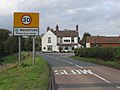
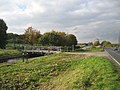
English: Wansford is a village in the East Riding of Yorkshire, England, it forms part of the civil parish of Skerne and Wansford. It is situated on the B1249 road and just to the north of the River Hull and the Driffield Canal. It is approximately 2.5 miles (4 km) south east of Driffield and 3 miles (4.8 km) north west of North Frodingham.
village in East Riding of Yorkshire, UK  | |||||
| Upload media | |||||
| Instance of |
| ||||
|---|---|---|---|---|---|
| Location | Skerne and Wansford, East Riding of Yorkshire, Yorkshire and the Humber, England | ||||
 | |||||
Subcategories
This category has the following 4 subcategories, out of 4 total.
S
- Snakeholme Lock (3 F)
W
- Wansford Lock (22 F)
Media in category "Wansford, East Riding of Yorkshire"
The following 84 files are in this category, out of 84 total.
-
 An Ivy Covered Bridge - geograph.org.uk - 659411.jpg 640 × 480; 87 KB
-
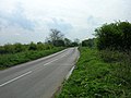
 B1249 leaving Wansford - geograph.org.uk - 4286526.jpg 640 × 480; 97 KB
-
 B1249 through Wansford - geograph.org.uk - 4277625.jpg 640 × 480; 91 KB
-
 B1249 Towards North Frodingham - geograph.org.uk - 1280758.jpg 640 × 480; 72 KB
-
 B1249 Towards North Frodingham - geograph.org.uk - 1280772.jpg 640 × 480; 56 KB
-
 Beware of farm vehicles - geograph.org.uk - 4278937.jpg 640 × 433; 71 KB
-
-
 Bus shelter, Wansford - geograph.org.uk - 4277616.jpg 640 × 480; 68 KB
-
 Canal at Wansford, near Driffield - geograph.org.uk - 2371767.jpg 482 × 640; 185 KB
-
 Canalside Building at Wansford - geograph.org.uk - 1318057.jpg 536 × 640; 218 KB
-
 Carr Lane, Wansford - geograph.org.uk - 4277589.jpg 640 × 480; 65 KB
-
 Chalk walling at Wansford - geograph.org.uk - 4234197.jpg 1,024 × 768; 284 KB
-
 Chapel Lane, Wansford - geograph.org.uk - 2140139.jpg 800 × 600; 370 KB
-
 Converted Chapel, Wansford - geograph.org.uk - 1280724.jpg 640 × 480; 73 KB
-
 Copper Hall - geograph.org.uk - 263520.jpg 640 × 457; 97 KB
-
 Crop field south west of Wansford - geograph.org.uk - 4278941.jpg 640 × 480; 110 KB
-
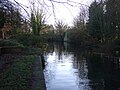
 Driffield Canal - geograph.org.uk - 1280749.jpg 640 × 480; 88 KB
-
 Driffield Canal, Wansford - geograph.org.uk - 4277621.jpg 640 × 480; 93 KB
-
 Driffield Canal, Wansford - geograph.org.uk - 4277633.jpg 640 × 480; 131 KB
-
 Driffield Canal, Wansford - geograph.org.uk - 4277643.jpg 640 × 480; 85 KB
-
 East of Wansford - geograph.org.uk - 106646.jpg 640 × 480; 150 KB
-
 Entering Wansford - geograph.org.uk - 2115712.jpg 800 × 600; 305 KB
-
 Entering Wansford - geograph.org.uk - 4278921.jpg 640 × 362; 66 KB
-

-
 Farm buildings, Wansford - geograph.org.uk - 4277574.jpg 640 × 480; 57 KB
-
 Farm buildings, Wansford - geograph.org.uk - 4277576.jpg 640 × 480; 54 KB
-
 Farmland and hedgerow, Wansford - geograph.org.uk - 4279938.jpg 640 × 480; 102 KB
-

-
 Farmland south of Wansford - geograph.org.uk - 4278936.jpg 640 × 480; 86 KB
-
 Field entrance south of Wansford - geograph.org.uk - 4278939.jpg 640 × 480; 100 KB
-
 Field entrance west of Wansford - geograph.org.uk - 4287436.jpg 640 × 480; 67 KB
-
 Field track - geograph.org.uk - 121944.jpg 640 × 480; 90 KB
-
 Footpath by Nafferton Beck - geograph.org.uk - 659457.jpg 480 × 640; 106 KB
-
 Footpath by Nafferton Beck - geograph.org.uk - 768813.jpg 640 × 480; 211 KB
-
 Gauging station near Wansford Bridge - geograph.org.uk - 4243413.jpg 1,024 × 768; 274 KB
-
 Grazing near Golden Hill Farm - geograph.org.uk - 4278946.jpg 640 × 480; 73 KB
-
 Heading towards Wansford - geograph.org.uk - 4277561.jpg 640 × 473; 44 KB
-
 Heading west towards Wansford - geograph.org.uk - 4286505.jpg 640 × 480; 88 KB
-
 House in Wansford - geograph.org.uk - 4277623.jpg 640 × 480; 82 KB
-
 House on the B1249, Wansford - geograph.org.uk - 4286525.jpg 640 × 482; 52 KB
-
 Landing stage for the River Hull at Wansford - geograph.org.uk - 2411555.jpg 3,648 × 2,736; 2.62 MB
-
 Main Drain near Wansford - geograph.org.uk - 4278931.jpg 640 × 480; 93 KB
-
 Main Drain near Wansford - geograph.org.uk - 4278932.jpg 640 × 480; 86 KB
-
 Mill Farm, Wansford - geograph.org.uk - 4243422.jpg 1,024 × 768; 268 KB
-
 Mill pond, Wansford - geograph.org.uk - 4277631.jpg 640 × 480; 116 KB
-
 Minor Road out of Wansford - geograph.org.uk - 1280736.jpg 640 × 480; 56 KB
-
 Minor Road Towards Wansford - geograph.org.uk - 1302207.jpg 640 × 480; 91 KB
-
 Minor road towards Wansford - geograph.org.uk - 4279918.jpg 640 × 480; 67 KB
-
 Nafferton Beck - geograph.org.uk - 785366.jpg 496 × 640; 113 KB
-
 Nafferton Road, Wansford - geograph.org.uk - 4277606.jpg 640 × 480; 48 KB
-
 Nafferton Road, Wansford - geograph.org.uk - 4277613.jpg 640 × 480; 59 KB
-
 Near Golden Hill Farm - geograph.org.uk - 82287.jpg 640 × 480; 147 KB
-
 North of Brigham - geograph.org.uk - 252317.jpg 640 × 480; 119 KB
-
 Pleasant Wood Farm - geograph.org.uk - 1280730.jpg 640 × 480; 53 KB
-

-
-
 Pond near Wansford Bridge - geograph.org.uk - 4228050.jpg 1,024 × 768; 244 KB
-
 River Hull below Wansford - geograph.org.uk - 1354731.jpg 476 × 640; 421 KB
-
 River Hull, Wansford - geograph.org.uk - 2371531.jpg 640 × 450; 209 KB
-
 River Hull, Wansford - geograph.org.uk - 4278922.jpg 640 × 480; 122 KB
-
 Stubble field north of Wansford - geograph.org.uk - 4286510.jpg 640 × 427; 51 KB
-
 The Driffield Canal at Wansford - geograph.org.uk - 2883534.jpg 3,508 × 2,736; 2.2 MB
-
 The Driffield Canal near Wansford - geograph.org.uk - 4286529.jpg 640 × 480; 94 KB
-
 The Driffield Canal near Wansford - geograph.org.uk - 4286534.jpg 892 × 955; 269 KB
-

-
 The Driffield Canal, Wansford - geograph.org.uk - 4286523.jpg 640 × 480; 96 KB
-
 The Driffield Canal, Wansford - geograph.org.uk - 659474.jpg 640 × 480; 117 KB
-
 The Driffield Canal, Wansford - geograph.org.uk - 785348.jpg 640 × 467; 101 KB
-
 The Finishing Post, Wansford - geograph.org.uk - 785363.jpg 640 × 463; 68 KB
-
 The fish ponds near Wansford - geograph.org.uk - 2139542.jpg 800 × 600; 326 KB
-
 The Grange, Near Wansford - geograph.org.uk - 1280766.jpg 640 × 480; 127 KB
-
 The Grange, Wansford - geograph.org.uk - 785345.jpg 474 × 640; 138 KB
-
 The River Hull at Wansford - geograph.org.uk - 2140154.jpg 800 × 600; 308 KB
-
 The road to Wansford - geograph.org.uk - 121942.jpg 640 × 349; 74 KB
-
 The Square, Wansford - geograph.org.uk - 4277605.jpg 640 × 480; 81 KB
-
 Track to Golden Hill Farm - geograph.org.uk - 4278945.jpg 640 × 354; 54 KB
-
 Wansford - geograph.org.uk - 73587.jpg 640 × 480; 79 KB
-
 Wansford Bridge - geograph.org.uk - 4232981.jpg 1,024 × 768; 305 KB
-
 Wansford Bridge - geograph.org.uk - 785353.jpg 640 × 453; 138 KB
-
 Wansford Bridge, near Driffield, E Yorks (geograph 2371056).jpg 640 × 459; 199 KB
-
 Wansford Trout Farm - geograph.org.uk - 4287507.jpg 640 × 480; 53 KB
-
 Wansford Village Hall - geograph.org.uk - 4277609.jpg 640 × 480; 71 KB
-
 West Beck, Wansford - geograph.org.uk - 697188.jpg 640 × 462; 81 KB
-
 Whinhill Lock - geograph.org.uk - 73831.jpg 640 × 480; 115 KB


.jpg)


