Category:Warbstow
Jump to navigation
Jump to search
village and civil parish in Cornwall  Eglwys Sant Werburgh, Warbstow | |||||
| Upload media | |||||
| Instance of | |||||
|---|---|---|---|---|---|
| Location | Cornwall, South West England, England | ||||
 | |||||
Subcategories
This category has the following 6 subcategories, out of 6 total.
C
- Canworthy Water (7 F)
D
- Downinney (1 F)
F
- Fonston (1 F)
S
T
- Trengune (3 F)
W
- Warbstow War Memorial (2 F)
Media in category "Warbstow"
The following 73 files are in this category, out of 73 total.
-
 Approaching Hendra - geograph.org.uk - 4398400.jpg 1,920 × 1,194; 530 KB
-
 Barn, Tredarrup - geograph.org.uk - 4398232.jpg 3,748 × 2,682; 1.8 MB
-
 Farm lane to Witheven - geograph.org.uk - 4397200.jpg 1,920 × 1,397; 852 KB
-
 Farmland near Canworthy - geograph.org.uk - 4390352.jpg 1,920 × 1,302; 840 KB
-
 Farmland near Trengune - geograph.org.uk - 5184079.jpg 3,056 × 1,774; 1.18 MB
-
 Farmland near Trengune - geograph.org.uk - 5184156.jpg 3,060 × 1,824; 1.26 MB
-
 Farmland near Trengune - geograph.org.uk - 5184174.jpg 3,065 × 1,650; 1.61 MB
-
 Farmland, Hendra - geograph.org.uk - 4390797.jpg 1,860 × 1,230; 464 KB
-
 Field by Burrow Cottage - geograph.org.uk - 4398382.jpg 1,920 × 1,221; 569 KB
-
 Field entrance east of Canworthy Water - geograph.org.uk - 4397168.jpg 1,920 × 1,537; 740 KB
-
 Field near Trevillian Cottage - geograph.org.uk - 715460.jpg 640 × 441; 63 KB
-
 Field, Fonston - geograph.org.uk - 4390383.jpg 4,000 × 3,000; 2.61 MB
-
 Fields near Penwenham - geograph.org.uk - 3548973.jpg 640 × 480; 84 KB
-
 Fields northwest of Trengune - geograph.org.uk - 5184184.jpg 3,068 × 1,922; 1.42 MB
-
 Footpath near Hendra - geograph.org.uk - 4398417.jpg 1,920 × 1,477; 574 KB
-
 Ford at Trengune - geograph.org.uk - 5139151.jpg 6,000 × 4,000; 7.01 MB
-
 Hedge Side view at Warbstow Triangulation Pillar - geograph.org.uk - 4724371.jpg 4,000 × 3,000; 4.06 MB
-
 Higher and Lower Youlton Farms - geograph.org.uk - 380683.jpg 640 × 480; 85 KB
-
 Junction on A39 - geograph.org.uk - 5184194.jpg 3,064 × 1,883; 1.16 MB
-
 Lane from Trengune - geograph.org.uk - 5183822.jpg 3,072 × 2,048; 1.53 MB
-
 Lane near Reddyford Mill - geograph.org.uk - 4390561.jpg 1,920 × 1,379; 1.04 MB
-
 Lane to Broad Langdon - geograph.org.uk - 4398389.jpg 1,920 × 1,352; 469 KB
-
 Lane to Broad Langdon - geograph.org.uk - 4398520.jpg 1,920 × 1,430; 795 KB
-
 Lane to Canworthy - geograph.org.uk - 4397197.jpg 1,920 × 2,560; 1.36 MB
-
 Lane to Downinney - geograph.org.uk - 4397611.jpg 2,389 × 3,032; 1.39 MB
-
 Lane to Langdon - geograph.org.uk - 4390779.jpg 1,920 × 1,440; 933 KB
-
 Lane to the Canworthy Water valley - geograph.org.uk - 4397822.jpg 1,920 × 1,440; 448 KB
-
 Lane to Tredarrup Cross - geograph.org.uk - 4390547.jpg 1,920 × 1,440; 772 KB
-
 Lane to Tredarrup Cross - geograph.org.uk - 4398342.jpg 3,102 × 2,457; 1.22 MB
-
 Lane to Trelash - geograph.org.uk - 4398235.jpg 1,920 × 1,440; 869 KB
-
 Lane to Trengune - geograph.org.uk - 4976968.jpg 1,920 × 1,304; 978 KB
-
 Lane to Trengune - geograph.org.uk - 4976998.jpg 1,920 × 1,280; 750 KB
-
 Lane to Trengune - geograph.org.uk - 5184066.jpg 3,072 × 2,048; 1.5 MB
-
 Lane to Treswen - geograph.org.uk - 4390517.jpg 1,920 × 1,344; 665 KB
-
 Lane to Treswen - geograph.org.uk - 4397506.jpg 1,920 × 2,560; 1.1 MB
-
 Lane to Warbstow Cross - geograph.org.uk - 4397565.jpg 1,920 × 1,440; 933 KB
-
 Ramp to field near Warbstow - geograph.org.uk - 4397657.jpg 1,920 × 1,440; 680 KB
-
 River Ottery - geograph.org.uk - 212774.jpg 640 × 480; 163 KB
-
 Road east of Canworthy Water - geograph.org.uk - 4397152.jpg 1,920 × 1,443; 729 KB
-
 Road through Canworthy Water - geograph.org.uk - 3433763.jpg 657 × 492; 110 KB
-
 Road to Canworthy Water - geograph.org.uk - 4397230.jpg 1,920 × 1,316; 538 KB
-
 Road to the Ottery - geograph.org.uk - 4390863.jpg 1,920 × 1,294; 724 KB
-
 Road to Warbstow church - geograph.org.uk - 3433779.jpg 783 × 587; 116 KB
-
 Road, Fonston - geograph.org.uk - 4397240.jpg 1,920 × 1,440; 1.07 MB
-
 Sheds near Canworthy Water - geograph.org.uk - 4397223.jpg 1,920 × 1,194; 481 KB
-
 Sheep above the Ottery valley - geograph.org.uk - 4398528.jpg 1,920 × 1,145; 590 KB
-
 Stream near Reddyford Mill - geograph.org.uk - 4397831.jpg 1,920 × 2,560; 1.85 MB
-
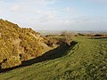
 The Giant's Grave, Warbstow Bury - geograph.org.uk - 712295.jpg 640 × 479; 187 KB
-
 Towards the Canworthy Water valley - geograph.org.uk - 4397666.jpg 1,920 × 1,296; 787 KB
-
 Track, Tredarrup - geograph.org.uk - 4398246.jpg 3,734 × 2,659; 1.61 MB
-
 Tredarrup Cross - geograph.org.uk - 4390750.jpg 1,920 × 1,440; 669 KB
-
 Tree by Hendra Cottage - geograph.org.uk - 4390770.jpg 1,920 × 1,413; 700 KB
-
 Trees by the lane to Hendra Farm - geograph.org.uk - 4398517.jpg 1,920 × 1,440; 951 KB
-
 Trelash - geograph.org.uk - 1891792.jpg 640 × 437; 72 KB
-
 Trelash - geograph.org.uk - 1891798.jpg 640 × 404; 67 KB
-
 Trelash - geograph.org.uk - 4398225.jpg 1,920 × 1,382; 748 KB
-
 Trengune - geograph.org.uk - 210786.jpg 640 × 480; 153 KB
-
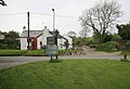
 Village street, Warbstow Cross - geograph.org.uk - 4397525.jpg 3,989 × 2,767; 1.58 MB
-
 Warbstow Bury - geograph.org.uk - 712235.jpg 640 × 480; 223 KB
-
 Warbstow Cross - geograph.org.uk - 846958.jpg 640 × 446; 177 KB
-
 Warbstow Cross houses from Warbstow Bury - geograph.org.uk - 712297.jpg 640 × 480; 168 KB
-
 Warbstow, north towards Trelash - geograph.org.uk - 90478.jpg 640 × 433; 130 KB
-
 Wind turbine near Tredarrup - geograph.org.uk - 4398264.jpg 1,920 × 2,421; 814 KB
-
 Wind-shaped tree, Burrow Cottage - geograph.org.uk - 4398363.jpg 1,920 × 1,395; 755 KB
-
 Broadlands Farm - geograph.org.uk - 708434.jpg 640 × 480; 218 KB
-
 Field by the lane to Canworthy Water - geograph.org.uk - 714224.jpg 640 × 436; 90 KB
-
 Field gate into Warbstow Bury - geograph.org.uk - 712303.jpg 640 × 480; 253 KB
-
 Fields by Warbstow Bury - geograph.org.uk - 708388.jpg 640 × 480; 217 KB
-
 Hendra Farm - geograph.org.uk - 210812.jpg 640 × 480; 88 KB
-
 House at Higher Langdon - geograph.org.uk - 713457.jpg 640 × 480; 285 KB
-
 Laneside trees at Trenannick - geograph.org.uk - 715476.jpg 640 × 480; 130 KB
-
 Langdon Outbuildings - geograph.org.uk - 212745.jpg 640 × 480; 137 KB
-


