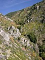
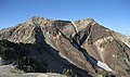
Category:Wasatch Range
Vai alla navigazione
Vai alla ricerca
mountain range in northern Utah, United States   | |||||
| Carica un file multimediale | |||||
| Istanza di | |||||
|---|---|---|---|---|---|
| Luogo | |||||
| Lunghezza |
| ||||
| Catena montuosa | |||||
| Punto più alto | |||||
| Altezza sul mare |
| ||||
| Distinto da | |||||
 | |||||
English: Media related to the Wasatch Range, a mountain range in northern Utah, United States, that has a subrange that extends into southeastern idaho.
Sottocategorie
Questa categoria contiene le 59 sottocategorie indicate di seguito, su un totale di 59.
A
B
- Big East Dam (1 F)
- Brighton Ski Resort (16 F)
C
- Chad's Gap (3 F)
D
- Done Ridge (1 F)
E
- Emigration Canyon, Utah (16 F)
G
H
L
M
- McClellan Lake Dam (Utah) (1 F)
- Mineral Basin (Utah) (5 F)
- Mutual Dell Organization Camp (empty)
N
O
P
- Pinecrest, Utah (empty)
R
- Round Valley (Morgan County, Utah) (empty)
S
- Sundance Resort (9 F)
T
U
- Upper Bells Canyon Reservoir (1 F)
W
Pagine nella categoria "Wasatch Range"
Questa categoria contiene un'unica pagina, indicata di seguito.
File nella categoria "Wasatch Range"
Questa categoria contiene 200 file, indicati di seguito, su un totale di 354.
(pagina precedente) (pagina successiva)-

-

-
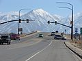
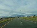
 2013-09-23 18 27 35 View north along Interstate 15 in Utah near milepost 206.JPG 3 264 × 2 448; 2,07 MB
-

-
-
-
 20190707-FS-UWC NF-NL-Squaw Peak Narrow-01 (48937232428).jpg 6 000 × 4 000; 11,47 MB
-

-
-
-

-
 26 to 84 east (45164454442).jpg 4 032 × 3 024; 2,06 MB
-
 388ogroup-f-16s-1.jpg 375 × 283; 51 KB
-
 Above the Y - panoramio.jpg 2 128 × 2 800; 1,42 MB
-
 Across South State Street at Lone Peak Hospital, Draper, Utah, Jun 16.jpg 2 592 × 1 944; 2,35 MB
-

-
-

-
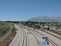
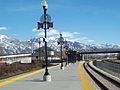
 American Fork Station passenger platform west end.JPG 2 816 × 2 112; 2,52 MB
-
 American Fork Twin Peaks.jpg 2 560 × 1 664; 1,11 MB
-
 American Forks Twin Peaks.jpg 2 772 × 1 629; 1,25 MB
-
 American Forks Twins.jpg 2 302 × 1 503; 994 KB
-
 Antelope Island Causeway 2005.JPG 1 280 × 960; 507 KB
-
 Autumn mountain trail.jpg 3 008 × 2 000; 5,53 MB
-
 Baled hay in Utah Valley.jpg 3 521 × 2 315; 4,65 MB
-
 Bear River Valley 2016-10-14 2668.jpg 4 608 × 3 072; 2,67 MB
-
 Bicycle lockers and rack at South Jordan Parkway station, Apr 16.jpg 2 592 × 1 944; 2,45 MB
-
 Newbraska Wasatch Mountains.jpg 1 000 × 692; 229 KB
-
 Big Cottonwood Canyon winter.jpg 8 064 × 6 048; 29,77 MB
-
 Bountiful Peak.jpg 2 091 × 1 125; 944 KB
-
 Broads Fork Twins.jpg 3 530 × 2 345; 4,33 MB
-
 Bus stands at Midvale Center station, Jan 15.jpg 2 816 × 2 112; 2,48 MB
-
 BYU Motion Picture Studio, ca. 1959.png 1 056 × 848; 962 KB
-
 Cache Mtn (Summit Pass) 2016-10-14 2671.jpg 4 608 × 3 072; 2,92 MB
-
 Cache Mtn 2016-10-14 2675.jpg 4 608 × 3 072; 2,8 MB
-
 Cache Mtn 2016-10-14 2678.jpg 4 608 × 3 072; 2,67 MB
-
 Caldera Systems offices in Orem Utah January 2001.jpg 1 163 × 783; 210 KB
-
 Canyon View Park parking lot, Spanish For, Utah, Jul 15.jpg 2 816 × 2 112; 2,27 MB
-
 Capitol Hill, Salt Lake City, UT, USA - panoramio (4).jpg 3 264 × 2 448; 2,9 MB
-
 Cardiff Boundary arete.jpg 892 × 586; 223 KB
-
 Cascade, near Ogden, Weber County, Utah - NARA - 516747.jpg 2 397 × 3 000; 2,38 MB
-
 Catherine Pass Trail.jpg 2 700 × 1 800; 2,02 MB
-
 Cattle guard, Road 115 Uinta National Forest, Jul 16.jpg 2 592 × 1 944; 2,19 MB
-
 Central Morgan Valley, Sep 09.jpg 3 296 × 2 472; 1,22 MB
-
 Chevron station north Provo, Utah.JPG 2 816 × 2 112; 2,37 MB
-
 Chuck-A-Rama restaurant in south Provo, Utah, Aug 16.jpg 2 592 × 1 944; 2,37 MB
-
 Collier's 1921 Salt Lake City - Main Street.jpg 2 436 × 1 375; 1 013 KB
-
 Combat ready (10477868563).jpg 2 618 × 1 452; 532 KB
-
 Constructing a building on the site of a new steel mill 1a34850v.jpg 1 024 × 826; 322 KB
-
 Crescent View pedestrian safety barriers.JPG 2 816 × 2 112; 2,63 MB
-
 Crescent View Station NE across Park and Ride.JPG 2 816 × 2 112; 2,59 MB
-
 Crown Burgers Restaurant.jpeg 2 560 × 1 920; 1,01 MB
-
 Daily morning operations 121031-F-US032-259.jpg 3 622 × 2 542; 4,16 MB
-
 Daybreak Community Utah 2011-06-20.JPG 5 184 × 3 456; 3,49 MB
-
 Deer at Forest Lake - panoramio.jpg 4 288 × 3 216; 7,14 MB
-
 East (north side) along tracks from 1940 West North Temple station, Aug 15.jpg 2 816 × 2 112; 2,35 MB
-
 East (south side) along tracks from 1940 West North Temple station, Aug 15.jpg 2 816 × 2 112; 2,51 MB
-
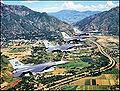
 East across American Fork at Wasatch Range on southbound FrontRunner, Jul 16.jpg 2 592 × 1 944; 2,34 MB
-
 East across Layton station Park and Ride, Jan 16.jpg 2 816 × 2 112; 2,48 MB
-
 East along SR-194 in Lehi, Utah, Jul 16.jpg 2 592 × 1 944; 2,34 MB
-
 East along SR-201 from I-80 interchange, Mar 16.jpg 2 592 × 1 944; 2,41 MB
-
 East along tracks from Power station, Aug 15.jpg 2 816 × 2 112; 2,37 MB
-
 East along W 750 S in Provo, Utah, Apr 17.jpg 2 592 × 1 944; 2,36 MB
-
 East at 2230 North station site, Aug 16.jpg 2 592 × 1 944; 2,41 MB
-
 East at 2700 W Sugar Factory Rd passenger platform, Apr 16.jpg 2 592 × 1 944; 2,44 MB
-
 East at a South Jordan Parkway station passenger shelter, Apr 16.jpg 2 592 × 1 944; 2,38 MB
-
 East at Dividend Road (about mm 0.5) in Utah County, Utah, May 16.jpg 2 592 × 1 944; 2,41 MB
-
 East at Emergency Vehicle Operations Range on Camp Williams, Oct 16.jpg 2 592 × 1 944; 2,38 MB
-
 East at Exit 362 interchange, !-15 & I-84, Feb 17.jpg 2 592 × 1 944; 2,38 MB
-
 East at former SR-68 & SR-140 junction, Bluffdale, Utah, Sep 16.jpg 2 592 × 1 944; 2,31 MB
-
 East at I-15 & SR-114 interchange, Provo, Utah, May 16.jpg 2 592 × 1 944; 2,33 MB
-
 East at I-15 & SR-92 interchange, Apr 16.jpg 2 592 × 1 944; 2,39 MB
-
 East at I-15, US-189, & Lakeview Pkwy interchange, Oct 16.jpg 2 592 × 1 944; 2,4 MB
-
 East at Palmyra Dr & W 4400 S intersection Palmyra, Utah, May 16.jpg 2 592 × 1 944; 2,36 MB
-
 East at US-6 & Dividend Rd intersection from Dividend Rd, May 16.jpg 2 592 × 1 944; 2,36 MB
-
 East at US-6 & Dividend Rd intersection from US-6, May 16.jpg 2 592 × 1 944; 2,36 MB
-
 East at US-89 & US-189, Provo, Utah, Jan 17.jpg 2 592 × 1 944; 2,42 MB
-
 East at Vineyard Connector Road railroad overpass, Nov 15.jpg 2 816 × 2 112; 2,38 MB
-
 East down tracks from N 2400 West on W North Temple, Aug 15.jpg 2 816 × 2 112; 2,58 MB
-
 East from Dividend Road (about mm 1.2) in Utah County, Utah, May 16.jpg 2 592 × 1 944; 2,34 MB
-
 East from South Jordan Parkway station, Apr 16.jpg 2 592 × 1 944; 2,39 MB
-
 East in Provo Yard toward FrontRunner end of line, Mar 15.jpg 2 816 × 2 112; 2,73 MB
-
 East Layton 5.png 4 032 × 3 024; 17,36 MB
-
 East on Center St at Geneva Rd, Provo, Utah, Oct 16.jpg 2 592 × 1 944; 2,4 MB
-
 East on Center St from 100 E, Provo, UT, Feb 17.jpg 2 592 × 1 944; 2,26 MB
-
 East on Center St from 700 E, Provo, UT, Feb 17.jpg 2 592 × 1 944; 2,17 MB
-
 East on Dividend Road (about mm 0.4) in Utah County, Utah, May 16.jpg 2 592 × 1 944; 2,38 MB
-
 East on E Canyon Crest Rd, Alpine, Utah, Jun 16.jpg 2 592 × 1 944; 2,4 MB
-
 East on Lakeview Pkwy at 620 W, Oct 16.jpg 2 592 × 1 944; 2,35 MB
-
 East on N 2100 W in Utah County, Utah, Oct 16.jpg 2 592 × 1 944; 2,34 MB
-
 East on SR-265 in Provo, Aug 16.jpg 2 592 × 1 944; 2,39 MB
-
 East on SR-71 in Riverton, Utah, Jun 16.jpg 2 592 × 1 944; 2,31 MB
-
 East on SR-77 at N 2600 W & S 400 W intersection in Springville, Utah, May 16.jpg 2 592 × 1 944; 2,42 MB
-
 East on US-89 at 200 E, Provo, Utah, Jan 17.jpg 2 592 × 1 944; 2,39 MB
-
 East southeast past Pioneer Rd from Draper Town Center station, Jan 15.jpg 2 816 × 2 112; 2,75 MB
-
 East SR-172 & SR-173 junction, May 17.jpg 2 592 × 1 944; 2,35 MB
-
 East through The Shops at Riverwoods, Apr 16.jpg 2 592 × 1 944; 2,39 MB
-
 East toward I-15 & SR-178 interchange.jpg 2 816 × 2 112; 2,42 MB
-
 East toward I-15 and SR-75 interchange, Feb 16.jpg 2 816 × 2 112; 2,18 MB
-
 East toward junction of SR-178 & SR-198, Feb 16.jpg 2 816 × 2 112; 2,45 MB
-
 East toward State Street, Jan 16.jpg 2 816 × 2 112; 2,59 MB
-
 East-southeast on SR-265 in Provo, Jul 16.jpg 2 592 × 1 944; 2,37 MB
-
 Elk by Highway 224 in Snyderville Basin JW 2021-12-30.jpg 9 469 × 3 823; 13,19 MB
-
 Farmington bay to wastach mountains (15334133759).jpg 4 288 × 2 848; 10,92 MB
-
 Flickr - …trialsanderrors - The Wasatch Range from the Valley of the Jordan, Utah, 1900.jpg 6 530 × 2 708; 5,84 MB
-
 Franklin, Idaho.jpg 1 600 × 1 200; 248 KB
-
 Free creative commons Rural Stop Landscape, Antelope Island, Utah (4594258122).jpg 5 616 × 3 744; 15,22 MB
-

-
 FrontRunner train at Provo Station, March 2015.JPG 2 816 × 2 112; 2,58 MB
-
 Future sight of Spanish Fork Hospital, Mar 17.jpg 2 592 × 1 944; 2,37 MB
-
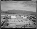
 Geneva Steel Mill 1942 by Andreas Feininger.jpg 7 264 × 5 640; 10,17 MB
-
 Great Salt Lake.jpg 640 × 480; 62 KB
-
 Gunnison, Gunnison Valley Wasatch Mountains in distance, Utah 1872 - NARA - 519737.jpg 3 000 × 1 918; 1,54 MB
-
 GWR 75 SLC May 9 1969x1x4RP (12004010574).jpg 1 008 × 643; 617 KB
-
-
 Here by Norie Sato 13, Oct 16.jpg 2 592 × 1 944; 2,17 MB
-
 Higher view of Ogden Intermodal Transit Center's bus stands.JPG 2 816 × 2 112; 2,38 MB
-
 Higher view of Ogden Intermodal Transit Center's passenger platform.JPG 2 816 × 2 112; 2,5 MB
-
 Higher view of Ogden Intermodal Transit Center.JPG 2 816 × 2 112; 2,4 MB
-
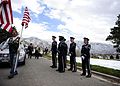 Hill Air Force Base Honor Guard funeral detail 121116-F-RN544-619.jpg 3 882 × 2 773; 4,98 MB
-
 Holme's Cabin - panoramio.jpg 4 000 × 3 000; 3,82 MB
-
 Holmes Cabin view - panoramio (1).jpg 4 000 × 3 000; 3,82 MB
-
 Holmes Cabin view - panoramio.jpg 4 000 × 3 000; 3,91 MB
-
 Honor Flight return Hill AFB, Oct 07 (2).jpg 1 280 × 960; 312 KB
-
 I 15 salt lake city.jpg 1 000 × 750; 99 KB
-
 Iceberg resturant Orem, Utah.JPG 2 816 × 2 112; 1,97 MB
-
 Industrial Pkwy (30275845357).jpg 4 032 × 3 024; 1,37 MB
-
 Interstate 15 from FrontRunner, Salt Lake County, Utah, Jun 16.jpg 2 592 × 1 944; 2,3 MB
-
 Iss007e07360.jpg 3 032 × 2 008; 1,89 MB
-
 Jan 14 06 eastern Salt Lake County UT USA.JPG 2 048 × 1 536; 1,4 MB
-
 Layton Station with old depot.JPG 3 296 × 2 472; 1,01 MB
-
 LDS Church in Orem against winter mountain background.jpg 2 304 × 1 536; 533 KB
-
 Light pillar in winter.jpg 3 024 × 4 032; 6,17 MB
-
 Light pillar.jpg 3 024 × 4 032; 5,32 MB
-

-
 Lone Peak from FrontRunner, Jul 16.jpg 2 592 × 1 944; 2,38 MB
-
 Lone Peak Hospital sign, Draper, Utah, Jun 16.jpg 2 592 × 1 944; 2,38 MB
-
 Looking down on east Mapleton, Utah, Jun 04.jpg 1 280 × 960; 313 KB
-
 Looking down on Ether Peak, Jun 04.jpg 1 280 × 960; 307 KB
-
 Looking down on west Mapleton, Utah, Jun 04.jpg 1 280 × 960; 305 KB
-
 Looking east from Historic Gardner.JPG 2 816 × 2 112; 2,48 MB
-
 Looking east-northeast from West Jordan City Center Station.JPG 2 816 × 2 112; 2,82 MB
-
 Looking north along TRAX tracks from Murray Central Station.JPG 2 816 × 2 112; 2,51 MB
-
 Looking south from American Fork Station.JPG 2 816 × 2 112; 2,49 MB
-
 Lower upper Right Fork Hobble Creek, Jul 16.jpg 2 592 × 1 944; 2,27 MB
-
 Macey's store in Provo, Utah.JPG 2 816 × 2 112; 2,46 MB
-
 Macey's store in Spanish Fork, Utah.JPG 2 816 × 2 112; 2,23 MB
-
 Mario Capecchi Dr (The University of Utah) - panoramio.jpg 2 592 × 1 621; 1,29 MB
-
 Miami to Seattle flight - over Brigham City, Utah, looking N to Box Elder Peak (15955401619).jpg 5 130 × 3 420; 12,87 MB
-
 Mine of Utah Bit and Mine at Bingham Junction.JPG 2 816 × 2 112; 2,65 MB
-
 MississippianMarbleUT.JPG 1 500 × 1 125; 994 KB
-
 Misty Sunset over Wasatch Mountains, U.S. Route 6, Santaquin, Utah 2.jpg 4 000 × 3 000; 3,12 MB
-
 Misty Sunset over Wasatch Mountains, U.S. Route 6, Santaquin, Utah.jpg 4 000 × 3 000; 3,32 MB
-
 Mount Ben Lomond in Ogden Utah.jpg 1 624 × 820; 337 KB
-
 Mount Nebo and Utah Lake aerial.jpg 2 688 × 1 512; 898 KB
-
 Mount Raymond and Gobblers Knob.jpg 3 136 × 2 291; 1,17 MB
-
 Mount Raymond.jpg 1 925 × 1 474; 747 KB
-
 Mount Superior Winter.jpg 3 024 × 4 032; 4,01 MB
-
 Mount Superior.jpg 2 277 × 3 034; 4,41 MB
-
 Mountain around Salt Lake City Utah - panoramio.jpg 2 304 × 1 728; 1,51 MB
-
 Mountain meadow near Pumphouse Hill, July 16.jpg 2 592 × 1 944; 2,4 MB
-
 Murray station parking lot looking north.jpg 2 816 × 2 112; 1,88 MB
-
 Near Lake Blanche Utah.jpg 1 080 × 1 350; 211 KB
-
 Nebo School District Bus Facility, Springville, Utah May 16.jpg 2 592 × 1 944; 2,3 MB
-
 North & down from Right Fork Hobble Creek Rd, Jul 16.jpg 2 592 × 1 944; 2,13 MB
-
 North across Spanish Fork River Bottoms, Jul 15.jpg 2 816 × 2 112; 2,4 MB
-
 North at I-15 & SR-178 interchange, May 16.jpg 2 592 × 1 944; 2,31 MB
-
 North at intersection of SR-51 & Expressway Ln, Apr 16.jpg 2 592 × 1 944; 2,43 MB
-
 North at Spanish Fork Pkwy & SR-51, Spanish Fork, Utah, Apr 16.jpg 2 592 × 1 944; 2,37 MB
-
 North on S 2050 W at Center St, Provo, Utah, Oct 16.jpg 2 592 × 1 944; 2,34 MB
-
 North on US-89, Springville-Mapleton, Jul 15.jpg 2 816 × 2 112; 2,64 MB
-
 North-northwest across Spanish Fork River Bottoms, Jul 15.jpg 2 816 × 2 112; 2,32 MB
-
 Northeast across the Utah Valley Convention Center terrace, Jan 16.jpg 2 816 × 2 112; 2,54 MB
-
 Northeast across Utah Valley from West Mountain, Utah, Jun 16.jpg 2 592 × 1 944; 2,23 MB
-
 Northeast at 1940 West North Temple station, Aug 15.jpg 2 816 × 2 112; 2,21 MB
-
 Northeast at E 1860 S & Novell Pl in Provo, Mar 15.jpg 2 816 × 2 112; 2,59 MB
-
 Northeast at Jackson-Euclid station, Aug 15.jpg 2 816 × 2 112; 2,55 MB
-
 Northeast at Park & Ride lot at 4800 W Old Bingham Highway station, Apr 16.jpg 2 592 × 1 944; 2,31 MB
-
 Northeast at Power station, Aug 15.jpg 2 816 × 2 112; 2,42 MB
-
 Northeast from Jordan Valley station, Apr 16.jpg 2 592 × 1 944; 2,43 MB
-
 Northeast on track from S 1300 E, Draper, Utah, Apr 15.jpg 2 816 × 2 112; 2,79 MB
-
 Northern Morgan Valley, Sep 09.jpg 3 296 × 2 472; 1,11 MB
-
 Northwest at Towne Centre Blvd & W 1200 S in Provo, Mar 15.jpg 2 816 × 2 112; 2,45 MB
-
 Northwest at US-40 & US-189 junction, Apr 16.jpg 2 592 × 1 944; 2,28 MB
-
 Northwest on Emma Park Road at county line, May 17.jpg 2 592 × 1 944; 2,41 MB
-
 Novell Brainshare letters display 1995.jpg 1 149 × 633; 129 KB
-
 Novell BrainShare letters display forward 1995.jpg 927 × 495; 91 KB
-
 Novell HQ Provo April 2008.jpg 2 335 × 1 557; 745 KB
-
 Main Street, Salt Lake City, Utah (NYPL b12647398-73982).tiff 2 360 × 1 539; 10,4 MB
-
 Ogden Utah satellite map.jpg 582 × 847; 71 KB
-
 Ogden-Hinckley Airport Runway 3 short final PC 12 photo Don Ramey Logan.jpg 3 968 × 2 232; 4,22 MB
-
 Open Field Near Provo River - 1 - panoramio.jpg 3 264 × 2 448; 2,09 MB
-
 Oquirrh Lake at sunrise.jpg 1 600 × 1 063; 119 KB
-
 Orem Station Park and Ride lot.JPG 3 296 × 2 472; 1 018 KB
-
 Partly finished open hearth furnaces and stacks for a steel mill 1a34846v.jpg 1 024 × 829; 351 KB
-
 Passenger platform at Historic Gardner from northwest.JPG 2 816 × 2 112; 2,38 MB
-

-

-
 Pedestrian level crossing at 4800 W Old Bingham Hwy station, Apr 15.jpg 2 592 × 1 944; 2,35 MB
-
 Plate 33 Comparative Map of Great Salt Lake.jpg 1 338 × 1 973; 406 KB


.jpg)


.jpg)


_2016-10-14_2671.jpg)


.jpg)


.jpg)


_along_tracks_from_1940_West_North_Temple_station,_Aug_15.jpg)
_along_tracks_from_1940_West_North_Temple_station,_Aug_15.jpg)


_in_Utah_County,_Utah,_May_16.jpg)


_in_Utah_County,_Utah,_May_16.jpg)


_in_Utah_County,_Utah,_May_16.jpg)


.jpg)


.jpg)
.jpg)


.jpg)


.jpg)

.jpg)


.jpg)


_-_panoramio.jpg)
.jpg)


Categorie:
- Mountain ranges of Utah
- Mountain ranges of Idaho
- Ranges of the Rocky Mountains
- Landforms of Box Elder County, Utah
- Landforms of Davis County, Utah
- Landforms of Juab County, Utah
- Landforms of Morgan County, Utah
- Landforms of Rich County, Utah
- Landforms of Utah County, Utah
- Landforms of Wasatch County, Utah
- Landforms of Weber County, Utah
- Mountain ranges of the Great Basin (USA) in Utah
- Regions of Utah
- Basin and Range Province
- Uinta National Forest
- Wasatch-Cache National Forest
- Locations along Interstate 80 in Salt Lake County, Utah
- Locations along Interstate 80 in Summit County, Utah
- Locations along Interstate 80N in Box Elder County, Utah
- Locations along Interstate 80N in Morgan County, Utah
- Locations along Interstate 80N in Weber County, Utah
- Locations along Interstate 84 in Box Elder County, Utah
- Locations along Interstate 84 in Morgan County, Utah
- Locations along Interstate 84 in Weber County, Utah
- Locations along U.S. Route 6 in Utah County, Utah
- Locations along U.S. Route 30S (Idaho–Utah–Wyoming) in Box Elder County, Utah
- Locations along U.S. Route 30S (Idaho–Utah–Wyoming) in Weber County, Utah
- Locations along U.S. Route 30S (Idaho–Utah–Wyoming) in Davis County, Utah
- Locations along U.S. Route 30S (Idaho–Utah–Wyoming) in Morgan County, Utah
- Locations along U.S. Route 40 in Summit County, Utah
- Locations along U.S. Route 50 in Utah (1926-1953) in Salt Lake County, Utah
- Locations along U.S. Route 50 in Utah (1926-1953) in Utah County, Utah
- Locations along U.S. Route 50 Alternate in Salt Lake County, Utah
- Locations along U.S. Route 50 Alternate in Utah County, Utah
- Locations along U.S. Route 89 in Box Elder County, Utah
- Locations along U.S. Route 89 in Cache County, Utah
- Locations along U.S. Route 89 in Davis County, Utah
- Locations along U.S. Route 89 in Rich County, Utah
- Locations along U.S. Route 89 in Salt Lake County, Utah
- Locations along U.S. Route 89 in Utah County, Utah
- Locations along U.S. Route 89 in Weber County, Utah
- Locations along U.S. Route 91 in Box Elder County, Utah
- Locations along U.S. Route 91 in Cache County, Utah
- Locations along U.S. Route 91 in Utah (1926-1974) in Box Elder County, Utah
- Locations along U.S. Route 91 in Utah (1926-1974) in Cache County, Utah
- Locations along U.S. Route 91 in Utah (1926-1974) in Salt Lake County, Utah
- Locations along U.S. Route 91 in Utah (1926-1974) in Davis County, Utah
- Locations along U.S. Route 91 in Utah (1926-1974) in Weber County, Utah
- Locations along U.S. Route 91 in Utah (1926-1974) in Utah County, Utah
- Locations along U.S. Route 189 in Summit County, Utah
- Locations along U.S. Route 189 in Utah County, Utah
- Locations along U.S. Route 189 in Wasatch County, Utah
- Locations along Utah State Route 4 (1910-1962) in Salt Lake County, Utah
- Locations along Utah State Route 4 (1910-1962) in Summit County, Utah
- Locations along Utah State Route 30 in Box Elder County, Utah
- Locations along Utah State Route 30 in Cache County, Utah
- Locations along Utah State Route 39 in Weber County, Utah
- Locations along Utah State Route 66
- Locations along Utah State Route 85 (1962-1977) in Box Elder County, Utah
- Locations along Utah State Route 85 (1962-1977) in Cache County, Utah
- Locations along Utah State Route 92
- Locations along Utah State Route 190
- Locations along Utah State Route 210
- Locations along Utah State Route 220 (1966-1990)