Category:Waskerley
Jump to navigation
Jump to search
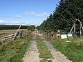
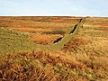
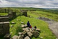
English: Waskerley is a village in County Durham, in England. It is situated a few miles to the southwest of Consett.
village in County Durham, United Kingdom  | |||||
| Upload media | |||||
| Instance of | |||||
|---|---|---|---|---|---|
| Location | Muggleswick, County Durham, North East England, England | ||||
 | |||||
Subcategories
This category has the following 6 subcategories, out of 6 total.
M
- Moorcock Inn, County Durham (10 F)
O
- Oxen Law (4 F)
S
- Skaylock Hill (7 F)
- Smiddy Shaw Reservoir (11 F)
T
- Tunstall Reservoir (33 F)
W
- Waskerley Reservoir (8 F)
Media in category "Waskerley"
The following 54 files are in this category, out of 54 total.
-
 "Are we nearly there yet" - geograph.org.uk - 357631.jpg 640 × 480; 73 KB
-
 Barn - geograph.org.uk - 549720.jpg 640 × 480; 66 KB
-

-
 Burnhill Junction - geograph.org.uk - 550299.jpg 640 × 359; 72 KB
-
 How far from Waskerley to Rowley^ - geograph.org.uk - 1505964.jpg 640 × 480; 146 KB
-
 Narrow bridge - geograph.org.uk - 1505581.jpg 640 × 480; 120 KB
-
 Park Head - geograph.org.uk - 550298.jpg 640 × 411; 92 KB
-
 Parkhead Plantation - geograph.org.uk - 297838.jpg 640 × 480; 124 KB
-
 Saltersgate Ammunition Depot - geograph.org.uk - 550147.jpg 640 × 480; 107 KB
-
 Sheep's breakfast, Waskerley village - geograph.org.uk - 297840.jpg 640 × 480; 78 KB
-
 Wartime fence near Greenfield Farm - geograph.org.uk - 357626.jpg 640 × 480; 83 KB
-
 Waskerley - geograph.org.uk - 550101.jpg 640 × 480; 82 KB
-
 Waskerley - geograph.org.uk - 550108.jpg 640 × 480; 121 KB
-
 Waskerley Village - geograph.org.uk - 32044.jpg 640 × 378; 289 KB
-
 A secure building - geograph.org.uk - 343971.jpg 640 × 480; 119 KB
-
-
 Barn - geograph.org.uk - 550186.jpg 640 × 480; 103 KB
-
 Bee Cottage Guesthouse - geograph.org.uk - 357604.jpg 640 × 480; 60 KB
-
 Boggy moorland above Waskerley Beck - geograph.org.uk - 297836.jpg 640 × 480; 57 KB
-
 Cat Beck - geograph.org.uk - 297835.jpg 640 × 480; 90 KB
-
 Catchwater Channel - geograph.org.uk - 194214.jpg 640 × 480; 69 KB
-
 Cattle Grid - geograph.org.uk - 456144.jpg 640 × 480; 70 KB
-
-
 Down the dam steps - geograph.org.uk - 344070.jpg 640 × 480; 123 KB
-
 Drypry and Park Head Plantations - geograph.org.uk - 536864.jpg 640 × 480; 94 KB
-

-
 Farmland at Bees Cottage - geograph.org.uk - 150893.jpg 640 × 480; 167 KB
-
 Felltop road - geograph.org.uk - 517007.jpg 640 × 396; 82 KB
-
 Goldhill Farm - geograph.org.uk - 542540.jpg 640 × 480; 63 KB
-
 Greenfield Farm - geograph.org.uk - 357627.jpg 640 × 480; 74 KB
-
 Greenfield Farm - geograph.org.uk - 550137.jpg 640 × 413; 108 KB
-
 Head of the Browney valley - geograph.org.uk - 357634.jpg 640 × 480; 66 KB
-
 Heather Lea - geograph.org.uk - 550291.jpg 640 × 480; 73 KB
-

-
 HorseShoe Bridge - geograph.org.uk - 31492.jpg 640 × 451; 425 KB
-

-
 Moorland near Catchwater Plantation - geograph.org.uk - 297825.jpg 640 × 480; 68 KB
-

-

-
 Mud^ - geograph.org.uk - 357628.jpg 640 × 480; 74 KB
-
 Near Salters Gate - geograph.org.uk - 33348.jpg 640 × 405; 338 KB
-
 Nearly There^ - geograph.org.uk - 456089.jpg 640 × 480; 71 KB
-
 Old quarry - geograph.org.uk - 260459.jpg 640 × 480; 127 KB
-
 Parallel walls, Saltersgate Lane - geograph.org.uk - 357610.jpg 640 × 480; 77 KB
-
 River Browney - geograph.org.uk - 550132.jpg 480 × 640; 102 KB
-
 Road to Waskerley Reservoir - geograph.org.uk - 297730.jpg 640 × 480; 51 KB
-
 Ruins of Waskerleypark House - geograph.org.uk - 297636.jpg 640 × 480; 87 KB
-
 Salter's Gate - geograph.org.uk - 357615.jpg 640 × 480; 78 KB
-
 Saltersgate Ammunition Depot - geograph.org.uk - 550152.jpg 640 × 455; 79 KB
-
 Valley of the Waskerley Beck - geograph.org.uk - 297830.jpg 640 × 480; 80 KB
-
 Wall and stockade - geograph.org.uk - 357635.jpg 640 × 480; 95 KB
-
 Winter sunshine over Waskerley Way - geograph.org.uk - 97984.jpg 640 × 500; 82 KB
-
 Woodland near Salter's Gate - geograph.org.uk - 357616.jpg 640 × 480; 88 KB
-
 World War II bunkers at Burn Hill - geograph.org.uk - 357621.jpg 640 × 480; 73 KB


